Geospatial and emissions modeling
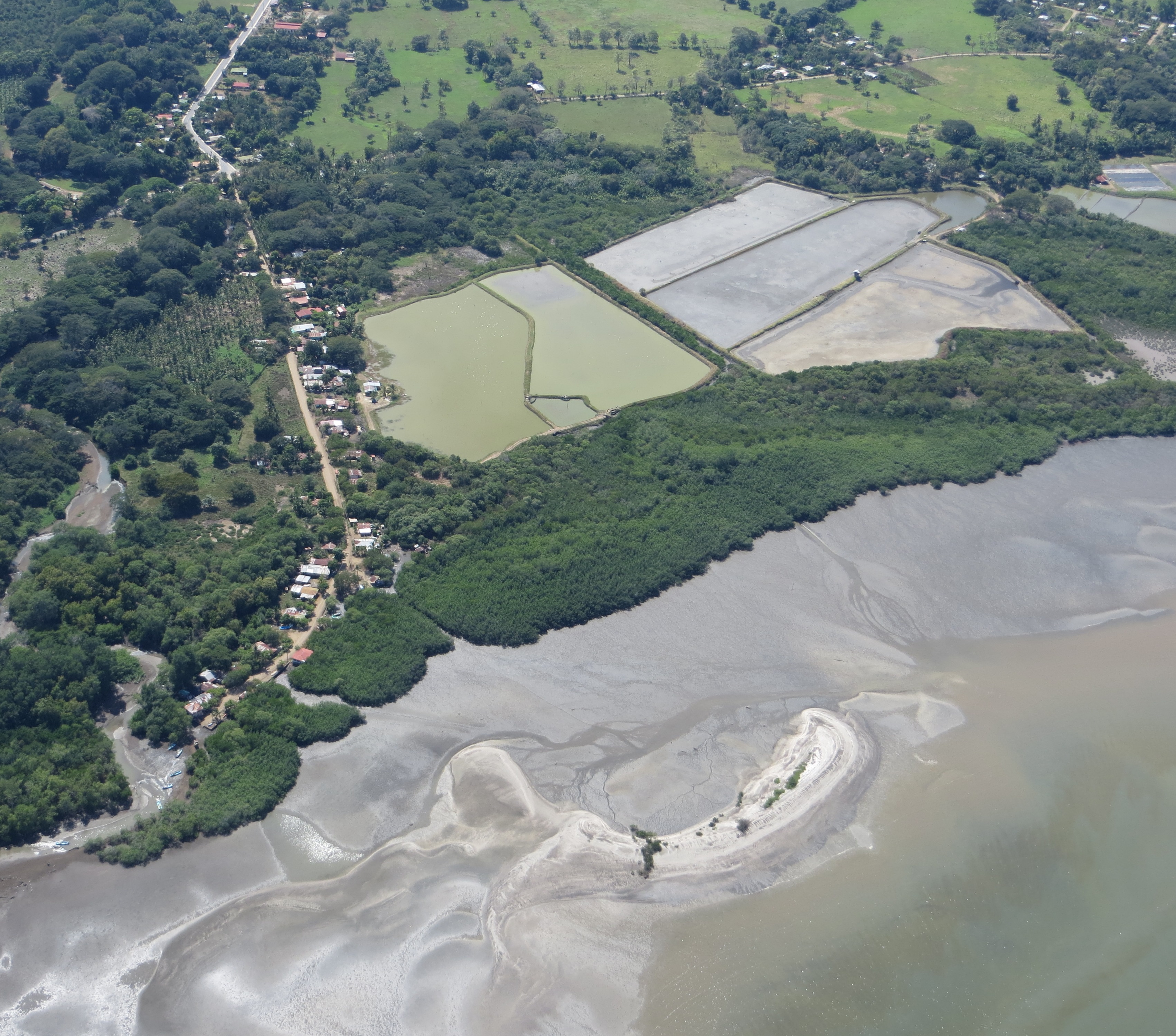
The assessment of historical land use dynamics of coastal areas relies on geospatial analysis of a sequence of satellite images. It classifies land use categories and how their area changes over time. Using these dynamics, the quantification of carbon emissions associated with the conversion of mangrove forests to other land uses can be estimated through modeling. This provides both an assessment of carbon stocks lost as well as an identification of areas suitable for restoration. This can also be tied to estimates of natural capital lost over time.
The main requirement is the availability of a consistent series of satellite images that is free of cloud cover and offers enough spatial resolution to differentiate mangrove stands (and types), surrounding agriculture and other human uses of the landscape. Local or national capacities for remote sensing processing and advanced GIS analyses of coastal features is also important. Emissions modeling is a challenge, which needs to be resolved through enhanced capacities.
Although GIS facilities and trained personnel are readily available, capacities to properly classify different types of mangroves within a stand are still lacking in the GIS/remote sensing field, especially when higher resolution images are used. We have been exploring the application of innovative image processing and classification techniques with good results. However, the process cannot be fully automated and the analyses require time and expert judgement to complete. Access to a consistently cloud-free series of images across different dates is a challenge. This is coupled with the malfunctioning of a well-known satellite, which further limits the availability of images suitable for analyses. Scaling-up analyses from local to subnational to regional scales presents additional challenges of spatial resolution, data volume for analyses and time required.
International Sustainability Certification

In 2015 the Bejuco snapper fishery underwent a full assessment by the Marine Stewardship Council (MSC). The certification process was discontinued, however, in 2016 due to serious national governance shortcomings. Because of the difficulty for many small-scale fisheries to satisfy the rigorous requirements of the MSC, Fair Trade USA has developed a Capture Fisheries Program that combines the MSC's environmental standards with robust social requirements. The certification process is gradual and allows fisheries to develop the tools necessary to comply with the standard's requirements over a 6 year period rather than all at once at the time of assessment like the MSC requires. The Fair Trade process better addresses the social and management realities within which the majority of artisanal fisheries operate. Because of this, fishers and value chain stakeholders have begun an initial Fair Trade pre-evaluation of the fishery. This solution's certification building block has undergone many changes throughout the years, but project members feel they are making headway towards viable, long-term socio-economic improvements which have, since the beginning of the MSC process, been the driving force behind the certification initiative.

All project stakeholders must understand the Fair Trade process including the responsibilities pertaining to its price premium. Fishers must see it as a unique and useful tool to better develop the fishery in the face of an uncertain future. Project stakeholders must also be capable of fundraising a considerable amount of money finance the assessment process.

Not all project stakeholders will immediately see the benefits of a certification. Constant communication with key fishery members is essential to keep the process moving forward. Years have passed since the Bejuco bottom longline fishery went through the failed MSC process  and a lot of money has had to be raised to continue on the path to a potential future certification. Strong project administration is essential to maintaining these efforts.

Global fishery certifications are an evolving entity. Given the social and environmental complexities of the world's fisheries, there can be on one silver bullet certification. Slowly, certification systems have realized this and begun to adapt to the specific needs of small-scale fisheries. The Bejuco snapper fishery has lived this process since 2011 and has accumulated a long list of lessons learned too long to fully detail on this webpage!!

Catch Composition Data Collection and Analysis

In order to develop and manage an environmentally sustainable fishery, a number of performance indicators need to be established for its target species, common bycatch species, environmental factors, and management regimes. Examples of these for the Bejuco artisanal bottom longline snapper fishery include the stock's status, bycatch and discard rates, endangered and/or protected species catch rates, gear impacts to the seafloor and associated benthic organisms, local management plan, and national fisheries management capacity. Since 2007, the catch composition of the Bejuco bottom longline fishery has been continuously monitored by dock side observers and researchers who accompany fishers on their nightly trips. This information, along with the collection of fisher ecological knowledge, has allowed researchers to identify many of these indicators. In close collaboration with the national government, protected area and management plan development initiatives are also taking shape.

Collaboration between researchers (NGO collaborators and university students) and the local fishers needs to exist. A certain level of trust must be established between both parties in order to create this type of environment. Project researchers and other associated NGO members were invited into the fishing communities by fishers themselves, thus facilitating this process.


Data collection expenses have been primarily shouldered by international NGOs (grants) and research students (institutions).

A relationship based on mutual trust must be established if long term data collection efforts are to be successful. Fishers must know that researchers will not use catch information against them to further compromise their industry, and researchers need to be assured that they have full fisher support and open access to their operations. Data must also be recorded throughout the entire year (or fishing season) and not just “when the fishing is good”. There are months when this fishery produces almost no snapper. This data is valuable. Researchers ran into a statistical analysis problem because they stopped taking data when the catch per unit of effort dropped. This created a bias in their analysis.

To facilitate the long term collection of data, researchers are working with the government to train fishers to record their own catch and determine the reproductive states of certain species. A smartphone App is also being developed to facilitate the data collection process by fishers.

Situation Analysis and Vulnerability Assessment

Participatory rural appraisals help to draw a picture of both the socio-economic and environmental situation and the major concerns. Geographical assessments and the use of geographical information systems help to identify the project area and risk zones that are affected most by climate change impacts like sea level rise and salinity.

Conditions for adoption elsewhere:

  • Information on current and predicted mean sea levels
  • Modelled impacts from sea level rise on the coastal area and community targeted
  • No conflicts between hamlets in the target area
  • Willingness of the community, and support for a sustained participatory process

A combination of participatory and scientific tools such as GIS is very useful in bring out the real issues faced by the people.