Contribution to local and regional development

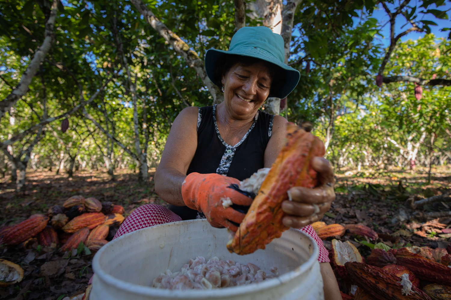
In the ARPA and the associated landscape of the PNRA, which are located within the Buffer Zone of the RBGP, the population works in agriculture, tourism and gold mining that operates legally. The management of the PNRA has promoted sustainable economic activities in this area based on local resources such as organic cocoa, beekeeping and fish farming, and REDD+ projects that revalue natural ecosystems, with the participation of men's and women's organizations.

Public institutions, campesino communities, authorities, NGOs and companies working within the PNRA have shown their willingness to participate in the management of the PNRA and the RBGP. A crucial element has been the willingness of the campesino communities to organize and assume ownership of concessions for conservation and ecotourism. As well as the willingness of regional and local governments to develop sustainable development projects and the support of NGOs for such initiatives and REDD+ projects.

The participation of the local population and the articulation with different public entities, organizations and private companies, represented in the PNRA's Management Committee, allowed the construction of local development spaces, with the improvement in the production of agricultural products such as potatoes and cocoa, the mining activity operating with environmental and social responsibility standards and the REDD+ projects that value ecosystem services, providing benefits to the population.

Research for the safeguarding of natural and cultural heritage

Research is one of the main pillars of PNRA's management. The rediscovery of the yellow-tailed choro monkey(Lagothrix flavicauda) was the basis for its establishment and the discovery of archeological sites such as Gran Pajatén and Los Pinchudos allowed the park to be declared a National and World Heritage Site. The actors involved in the management of the PNRA participate in and finance research that the park prioritizes and that contribute to the knowledge of the RBGP's values.

There is leadership from the PNRA in identifying priority research for natural and cultural values and promoting the participation of allied institutions. On the other hand, there is a willingness on the part of NGOs and companies within the scope of the PNRA to support these initiatives technically and financially.

The PNRA is the first PNA to use LIDAR technology to corroborate the state of conservation of the forest and archeological sites. In addition, with the participation of the Ministry of Culture, 12 archeological sites were registered in Peru's Archeological Geographic Information System. The results of the research strengthen the identity of local stakeholders living in the area.

Participatory landscape conservation

The PNRA is the Core Zone of the Gran Pajatén Biosphere Reserve. For its conservation, the PNRA is building a participatory landscape management model that promotes conservation modalities in its Buffer Zone and associated landscape, which are located in the reserve's Buffer Zone. Thus, the Boshumi RCA was created and works in coordination with 25 rural communities and at least 19 adjacent productive associations.

Because it is a mixed heritage site, SERNANP and the Ministry of Culture lead the management of the PNRA with an integrated vision. In addition, local governments, Amazonian and Andean farming communities, and scientists are willing to strengthen the management of surveillance and control, biological monitoring, sustainable resource management, and the benefit of the ecosystem services provided by the PNRA in its Buffer Zone (ZA). The private sector assumes its responsibility with good environmental practices and research.

The effective management and safeguarding of World Heritage is consolidated through the participation of public and private institutions, rural communities and organizations surrounding the PNRA in the protection and sustainable use of resources and the benefit of the Gran Pajaten Biosphere Reserve's ecosystem services.

One result of the management is the recognition of forest governance through the Rio Huayabamba Abiseo Model Forest (Havana 2015) and through the REDD+ Project "Sacred Martin Biocorridor".

Community outreach

With poaching being a huge threat to saiga, especially given the demand for saiga horn in the illegal wildlife trade, outreach plays a very important role. ACBK holds every year in May the “Saiga Day” together with the Saiga Conservation Alliance, in which members of the steppe clubs participate in games, crafts, competitions and other educational and entertainment programs. 

Participating communities and schools.

The outreach creates support for saiga conservation in neighbouring communities. Led by ACBK, the partnership is working to educate the local population about the threats to nature and the necessity of its conservation. A special monitoring group that was created regularly conducts outreach campaigns about the illegality of the saiga horn trade among the rural population. They are raising awareness of the youth living in key settlements located in the area of each saiga population to gain deeper knowledge about this species, and mobilise them around the 10 formed clubs of “Saiga Friends” in Kazakhstan. Unemployment forces many local people to poach. The clubs teach the children the important role of each species and the consequences that poaching of wildlife may have on the whole ecosystem.

Using a flagship species to catalyze policy changes

In this case, the saiga is used to catalyze this incredible protection initiative which also aims to re-establish self-sustaining populations of other original large steppe grazing herbivores - Przewalski’s horse, kulan and goitered gazelle as well as understand the role of the ‘steppe’ wolf in maintaining healthy populations of saiga antelopes and to ensure that all these areas, their rich wildlife and local communities can be sustained economically in the long term.

The key enabling factor for this is a tremendous partnership between multiple conservation organizations and the Government of Kazakhstan, which has always viewed this project as a long-term process.


The initiative is implemented by the ACBK with the support of the Committee of Forestry and Wildlife of the Ministry of Agriculture of Kazakhstan, Fauna & Flora International, Frankfurt Zoological Society, and the Royal Society for the Protection of Birds, and it complements the work of the national authorities. 

The saiga experienced a massive die-off in 2015. Climatic conditions transformed a usually harmless bacterial infection into a dangerous outbreak that killed more than 60% of the saiga antelope. More than 200,000 saiga antelope died of a virulent infection over a 3-week period. A bacterium (Pasteurella multocida) was identified as the cause which caused extensive internal bleeding. The bacterium does not typically harm healthy saiga, which suggested that an environmental factor might have made the microbe more dangerous. The team analysed weather data from 1979 to the mid-2010s, a period that included three mass die-offs of saiga — in 1981, 1988 and 2015. They found that the outbreaks were linked to relatively high daily temperatures and humidity levels.


Careful management is needed to protect the remaining populations of this critically endangered species, especially in the face of climate change

Inclusive approach to transnational cooperation

The purpose is to have a good transboundary understanding of the national nature conservation systems and how the people and organisations involved work together on a trilateral level. This deep understanding supports the improvement of the implementation of coordinated management and the linking of national to trilateral (and vice-versa) policies, plans, and activities.

In the Trilateral Governmental Cooperation, each country has its own political culture and priorities. This has an influence on the governmental and civil society structures and thus on decision-making processes, which in turn influences nature conservation and management.

The national nature conservation structures clarify which are the different public organisations and the different geopolitical levels that are responsible for planning, policy-making, and implementing nature conservation activities on the ground. Also required was a definition of nature conservation site managers, their roles, and competences per country. These elements are key to consider while developing a transnational integrated management plan (SIMP).

All the groups with competences in nature conservation are represented in the trilateral governance structure. Some at the decision-making body the Wadden Sea Board, and others in the different working groups.

It is in the interest of governmental organisations involved in nature conservation to express and clarify their roles and competences at the national level. This helps to manage and adjust expectations as well as for designing a trilateral structure including the relevant non-governmental organisations and groups.
  • It is not always easy to understand the management structures and processes because of the different political cultures in the three countries. It is good to have people that can “translate” structures into a “common language”.
  • Good to have the correct, clear, and complete structures to make sure that in the process of developing the single integrated management plan we are involving the right organisations at the right stages in the transnational iterative and participatory process (see BB1).
  • Understanding the structures also supports the understanding of the process of policy making, management plans related to EU Directives, and the update of national strategies and agendas, easing the spotting of important moments to consider nationally trilateral policies, strategies, and plans with the TWSC members help.
  • Understanding the national nature conservation structures and processes also helps to improve the understanding of how other national and regional commitments (a.o. EU Directives and Strategies) are being implemented in each country.
Iterative and participatory nature conservation planning process (site management and policy levels)

The purpose is to achieve a successful transboundary management plan integrating the levels needed for effective management. An exercise to imagine what would make the SIMP a success was useful to manage expectations, and guide and adapt the process.

  1. Preparatory phase: the trilateral Task Group World Heritage, overseeing the SIMP development, agreed on the purpose to improve management coordination at the trilateral level. Considering the suggestions from site management and policy levels and the Operational Guidelines for the implementation of the World Heritage Convention, a roadmap and content were agreed upon.
  2. The content development in the TWSC: draws upon the existing governance of the cooperation. The working groups supported the drafting of the SIMP’s content in regard to climate change effects and adaptation, education, sustainable tourism, research, monitoring, assessment, etc. Preliminary content was iteratively reviewed and enriched by the TWSC groups, the site managers, the trilateral Task Group World Heritage, and the Wadden Sea Board.
  3. Consultation beyond the TWSC: external stakeholders, and members of advisory boards in each of the German Federal States, Denmark, and the Netherlands, reviewed and commented on the draft SIMP.

A similar process is foreseen for assessing the progress and adapting activities.

  • The existing governance structure of the TWSC includes working groups on relevant topics to the Wadden Sea World Heritage and therefore the single integrated management plan (SIMP). The mandate to develop the SIMP (involving site management and policy level) was given in the Trilateral Governmental Declaration as a response to the request of the World Heritage Committee.
  • Existing engagement of the Task Group World Heritage.
  • Resources commitment from the parties and an additional staff member in CWSS as SIMP project officer.
  • Give enough time for participation: take into account that each country has its own participation habits and structures and that each involved group has its own rhythm and processes to follow. Learn about those and integrate these the best as possible.
  • Plan for discussions among the involved parties: some aspects require more time and background information to understand positions and propose solutions. The Trilateral Task Group World Heritage was a great platform with members that are the liaison to the policy and site management level.
  • Effective, easy, tailored communication is key at all levels and all phases in order to convey the key messages. Here we learned along the way and improved but more improvement is possible.
AI-based crack gauge for rockfall

AI-based crack gauge for rockfall is a device that monitors the occurrence of rockfall and the crack displacements in real-time by installing an observation sensor in a rockfall risky area located along the trail. Since 2013, automatic and manual crack gauges have been installed on steep slopes with a high risk of collapse, and 525 units are currently in operation at 174 locations. The rockfall measuring device is divided into risk levels of 'interest, caution, alert, and serious'. In the interest stage, regular and frequent inspections are carried out. In the caution stage where cracks are less than 5 mm and less than 2°, monitoring is strengthened. In the alert stages, precise investigation and action plans for the disaster are prepared. In the serious stage, the adjacent trails are controlled and emergency measures such as rockfall removal are implemented.

Prior to the installation of the AI-based crack gauge, a dedicated investigation team composed of geologists and disaster prevention experts was established in advance to systematically manage rockfalls and steep slopes to investigate areas with risk of rockfall accidents along the trails of national parks. In addition, the safety hazardous areas were graded from A to E according to the degree of risk, steepness, and other geologic characteristics and converted into databases. 

81 rockfall events have occurred in the national park during the last 10 years, resulting in 3 deaths and 6 injuries, damaging properties of about  KRW 2.1 billion. However, since 2018, when the AI-based crack gauge was used, there has been no fatality or injury to visitors due to rockfalls. In addition, it took a lot of time and labor to inspect all the crack gauges installed throughout the national park one by one. With the saved time park rangers can concentrate more on park other management activities, which greatly improved the internal satisfaction.

AI-based intelligent CCTV

AI-based Intelligent CCTV is a scientific safety management system that uses deep learning technology to control emergencies in real-time image analysis. By recognizing and analyzing abnormal behavior patterns, such as intrusion, screaming, wandering, etc., a warning broadcast is immediately sent to the site and delivered to the control system, following the emergency responses.
In addition, in the case of marine/coastal national parks with a high risk of safety accidents due to tides and tides, the broadcast of tide times is automatically issued to the site. Intelligent CCTV was installed in 2020 and is currently being operated in 89 places in 15 national parks.

The most important enabling factor is to select the optimal location where the equipment can be operated effectively. Intelligent CCTV was installed by selecting areas where drowning accidents occurred frequently in the past. Another success factor is having a set of systems to deal with emergencies. When the AI alarm system is activated, the general control center in KNPS HQ checks real-time streaming to quickly grasp the situation and then rescue teams in national parks on the spot to start rescue operations.

AI-based intelligent CCTV is a scientific safety management system using deep learning technology. In order to continuously improve the accuracy of deep learning, experts continue to maintain the software and provide technical support in the field so that it can be managed stably. As data for deep learning is accumulating, it is expected that the operating level of the system will be increased. Based on these achievements and limitations, it is necessary to improve the numerous CCTVs that have been monitored by manpower using this innovative technology gradually in connection with the KNPS safety management system.

Biodiversity Impact Assessment Tool (BiA)

To enable automatic and instant biodiversity impact assessment enquiry, the BiA tool has been developed to facilitate enquiry services for land planners and other interested parties via Azure platform. The BiA tool works by overlaying the enquiry site or region (or existing construction projects) with multiple geographic layers including species distribution and protected area range to investigate if the site or region is within certain distance (e.g., 3 km, 5 km) from and may cause impact on endangered species habitat and/or protected areas. The assessment reports illustrate ecological and environmental risks of construction projects for decision-makers and could hopefully promotes them to take biodiversity into consideration.


A brief timeline of the BiA tool:

  • Apr-Jun 2020: team formation, requirement communication, system development plan
  • Jul-Sept 2020: tool development
  • Oct 2020: trial test, application and dissemination
  • (in preparation) Apr-Sept 2022: system upgrade
  • Years of data collection accumulation and constant thinking of data application approaches.
  • Theoretical & technical basis accumulated from long-term research and conservation practice.
  • Promotion of the BiA tool to its potential users, like governments, investors, and enterprise.
  • Keeping track of tool operation and user feedback to devise further upgrade of the tool.
  • Data application is the foremost step in the whole data workflow, where the data turns into valuable information for stakeholders. Effective data application reports should bear the audience in mind (e.g., being concise and focused).   
  • The complete of development and releasing is not the last step for a tool. Finding potential users and persuading them to use the tool is also very important. A tool has to be used to provide the most value.