Consideration of climate change vulnerability and ecosystem services in Duque de Caxias’ municipal master plan (Brazil)
Full Solution
Data collection
In the process of revising its municipal master plan, the city of Duque de Caxias decided to include both climate change vulnerability and ecosystem services mapping in its diagnosis. This is expected to lay the foundation for incorporating more EbA measures in the master plan. Both assessments used a participative approach, in order to strengthen capacities and complete missing quantitative data.
Photo and video gallery
Context
Challenges addressed
The main challenge has been missing dialogue between stakeholders at municipal level, as well as the lack of quantitative climate, biophysical and socioeconomic data. In addition, the lack of personnel and time constraints from municipal employees proved to be a major challenge. Finally, an additional challenge is high-level political back-up to include the technical recommendations with regard to climate change and ecosystem services risks in the final document of the municipal master plan.
Beneficiaries
All sectors in the municipality, with a special focus on vulnerable population.
Location
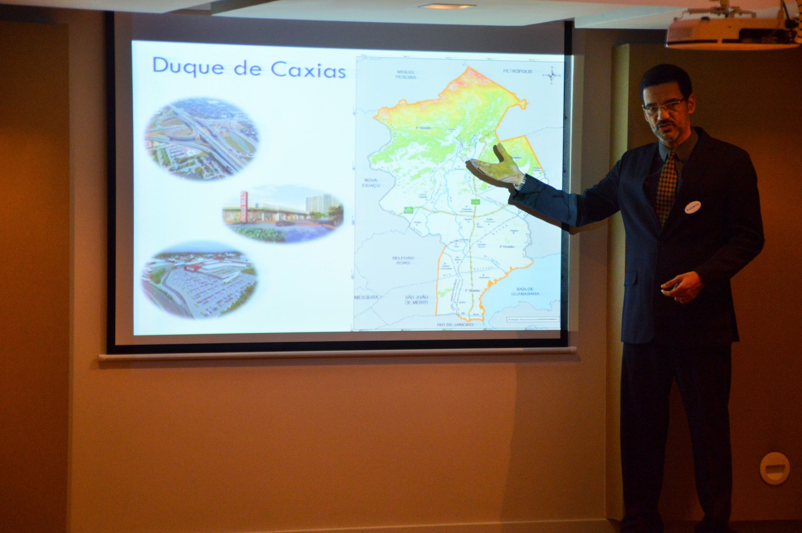
Duque de Caxias - State of Rio de Janeiro, Brazil
South America
Process
Summary of the process
The three building blocks complement and mutually reinforce each other. Building block three (Stakeholder engagement and capacity development “on the run”) can be considered cross-cutting. It creates the conditions for a successful process in terms of participation, decision-making, human and institutional capacities and resources. Building blocks one (Participatory vulnerability assessment) and two (Mapping of key ecosystem services) deliver key technical information and findings and subsequently build the basis for decision-making on (ecosystem-based) adaptation.
Building Blocks
Participative Vulnerability Assessments
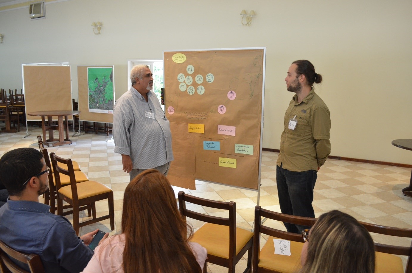
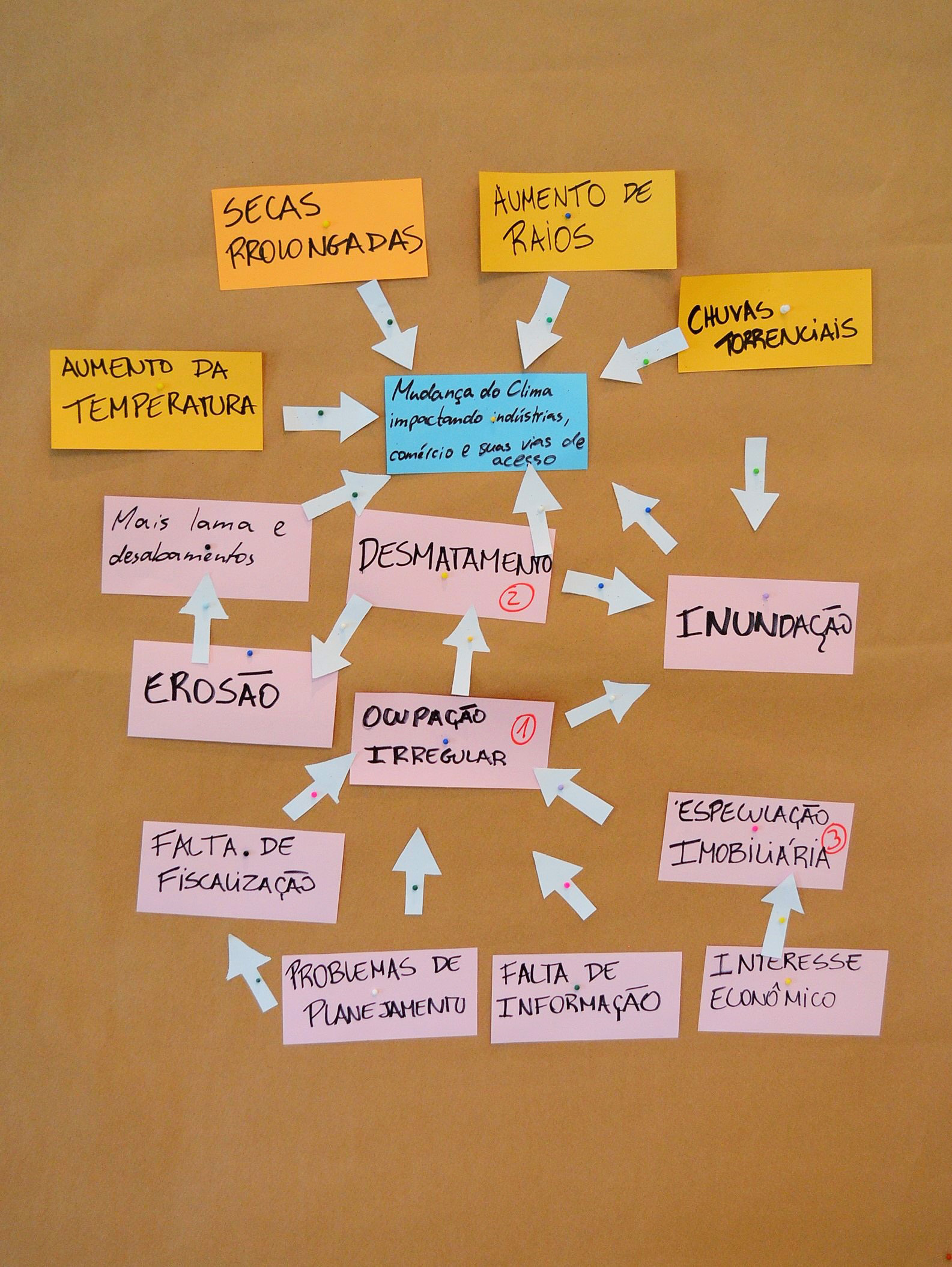
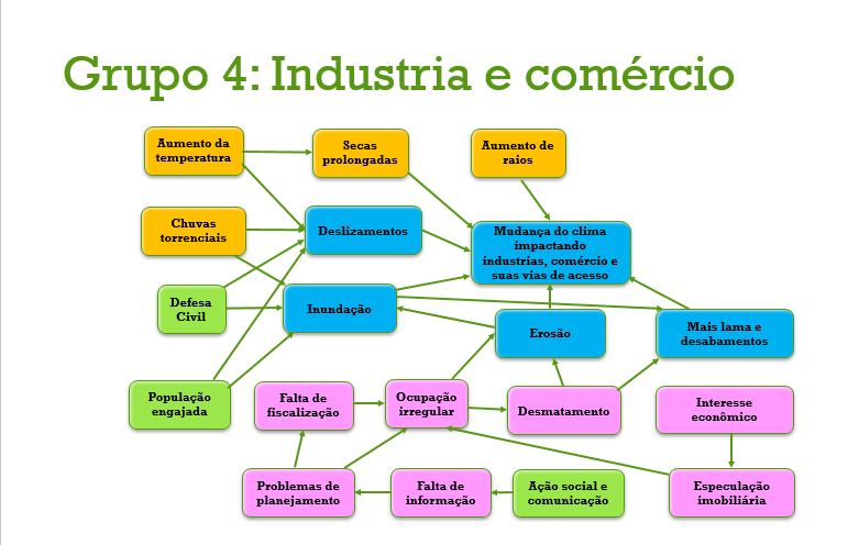
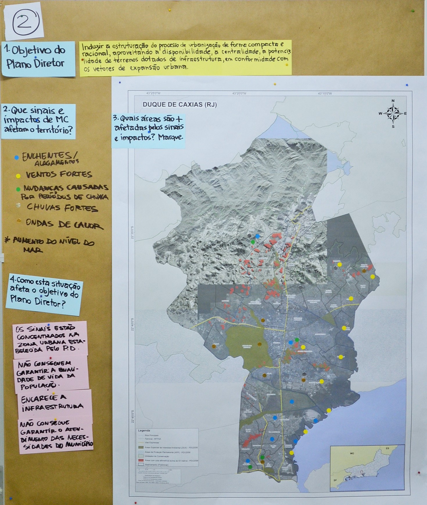
Vulnerability assessments are key for identifying drivers of climate change induced vulnerability. Following IPCC’s AR4 terminology, vulnerability assessments explore exposure to climate change, drivers for sensitivity and current adaptation capacity. By assessing the causes of vulnerability, decision makers are able to identify potential adaptation measures that may contribute to reduce this vulnerability.
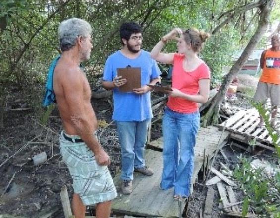
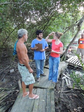
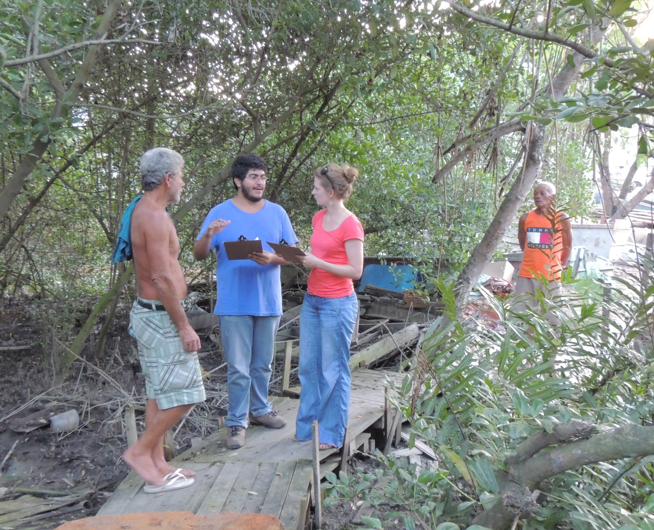
Given the limited availability of sound quantitative data on climate change impacts, the focus was placed on a participatory process and the use of qualitative data. Basically, the vulnerability assessment was performed in two workshops (one for the entire municipality, another one for an especially vulnerable district) and focused on previously identified key systems of interest.
The combination of Metaplan and other participatory methods during the workshops helped to engage stakeholders and to mobilize their knowledge. As one of the key outcomes, an impact model that visualizes drivers of exposure, sensitivity and adaptive capacity, served to identify (ecosystem-based) adaptation measures to be considered in the Duque de Caxias city master plan.
Enabling factors
- Stakeholder mobilization and engagement, including the incorporation and valuation of their knowledge.
- Measures directed at establishing a common level of understanding among all participants in the beginning helped to better define future tasks.
- A well-thought and well-managed schedule allows for a good monitoring.
- The identification and participation of relevant stakeholders in order to obtain realistic information and validate the results is a decisive factor in gaining credible results.
Lesson learned
- Ludic methodologies aimed at focusing on people’s experiences in order to determine climate change vulnerability, linked with capacity-building elements, revealed insights that quantitative desk-studies would not have produced.
- A clear and user-friendly presentation of outcomes (maps, impact chains) is important to get attention and acceptance of key stakeholders for the main study and workshop results.
- The participatory approach used to perform the vulnerability assessment resulted in increased acceptance and involvement.
- Nevertheless, the availability of high-quality quantitative data, including climate modelling, is needed to increase the acceptance of the results among decision makers, technicians, and the population.
Mapping of key ecosystem services
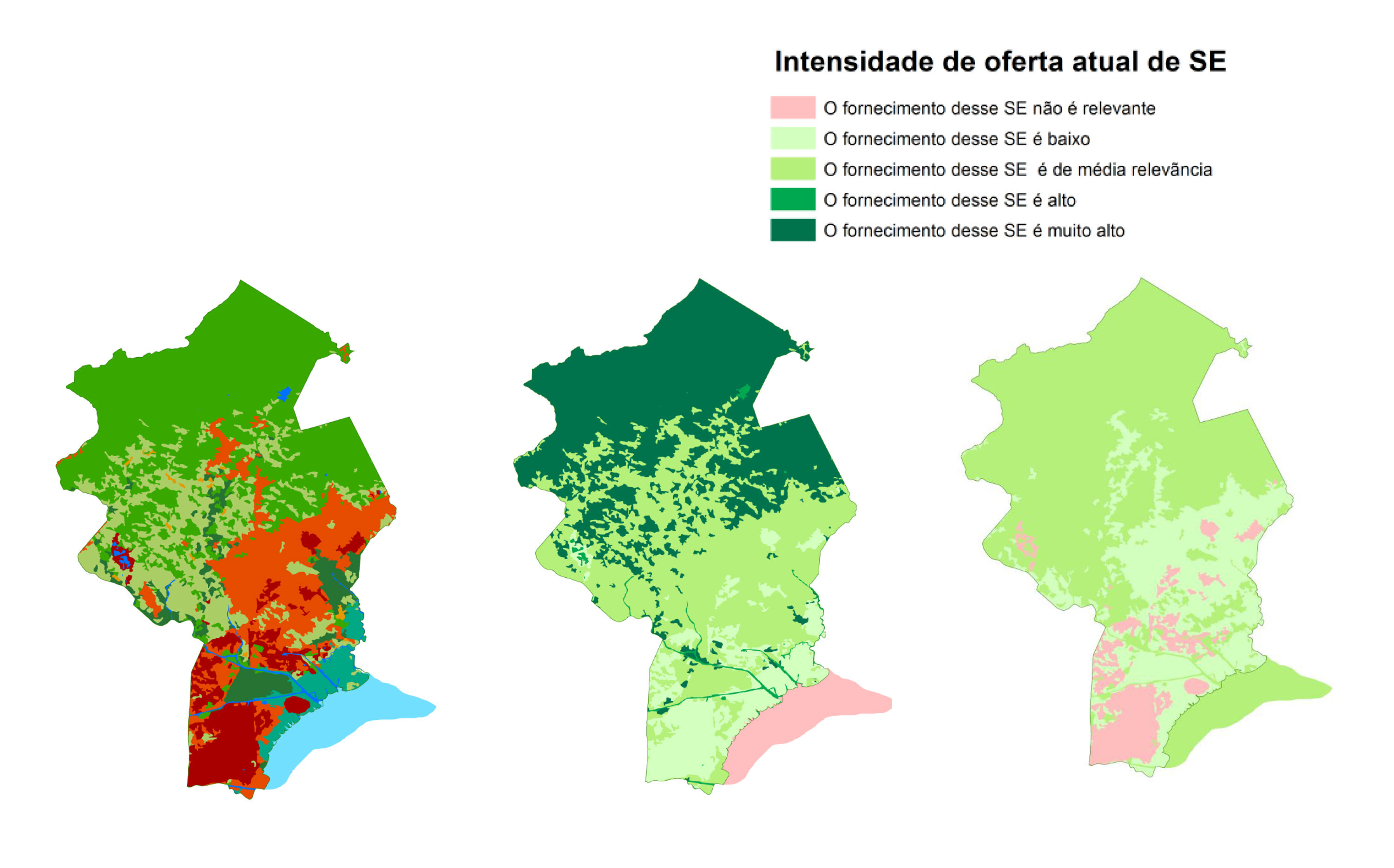
The aim of this step was the mapping and evaluation of ecosystem services (ES) provided by the region’s ecosystems, using the IES approach (Integrating Ecosystem Services into Development Planning).
The first step of the workshop was a participative selection of the most relevant ES, so that they can be considered in spatial planning processes. In a second step, using the Matrix Method, the following activities where undertaken for the mapping of the ES:
- Creation of a database (current land-use, present and future conditions of ES), design of interview guidelines.
- Mapping of relevant interviewees (specialists, decision makers and community representatives), carrying out of the interviews.
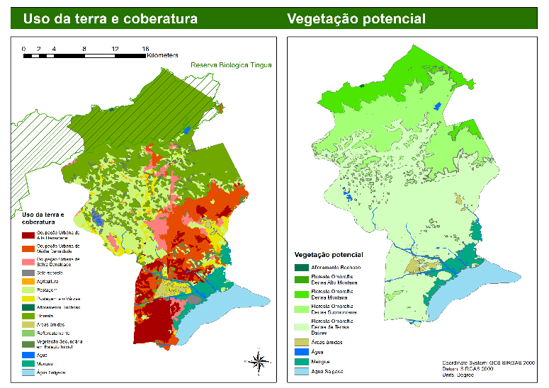
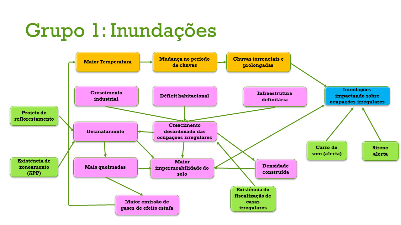
- Creation of the ES Maps using GIS/QGIS. The maps show the location and intensity of the ES and the main drivers leading to degradation of ecosystems.
The analysis identified conflicts between zones of the current master plan and some of the landscapes that provide important ES. Additionally, several patches of native vegetation inside urban areas have been identified as suppliers of ES, which provided new information for urban planning. The mapping also generated data with explicit information regarding cultural services for the first time.
Enabling factors
- Municipal technicians’ recognition of both, the importance of ES for the population’s well-being, and the fundamental significance of the protection of ecosystems for the municipality is key for this step.
- Based on this enabling factor, they facilitated as many resources as possible for a smooth implementation of the work. As a result, the ecosystem services mapping played a key role for a solid diagnosis that allows considering ecosystem services in territorial planning.
Lesson learned
- The ES assessment was an opportunity to: (1) increase public participation in territorial planning; (2) systematize and make use of local knowledge; (3) increase general acceptance of the future zoning proposal; (4) clarify and explicit land use conflicts and uses/dependencies of ecosystems; and (5) add valuable information to the territorial diagnostic in a language that allows for a good understanding of all sectors of the government regarding the importance of each ecosystem.
- Including key stakeholders in the mapping is vital, both to increase legitimization of the data and its acceptance and to ensure the stakeholders’ advocacy for the results. Validating each step with stakeholders is crucial both to ensure ownership of the results and to enable them to understand and advocate for the results.
- Necessity of carrying out a detailed stakeholder mapping to identify all key stakeholder as well as of spending more time on this preliminary selection and interview process.
Stakeholder engagement and capacity development “on the run”
A shared understanding, engagement and commitment of key stakeholders and the availability of capacities and resources are key. Right from the start, climate change and the ecosystem services proved to be excellent topics to bring together expert opinions and different perspectives from stakeholders, enabling them to work together on common challenges.
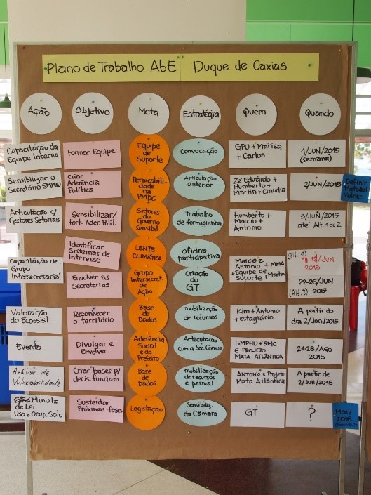
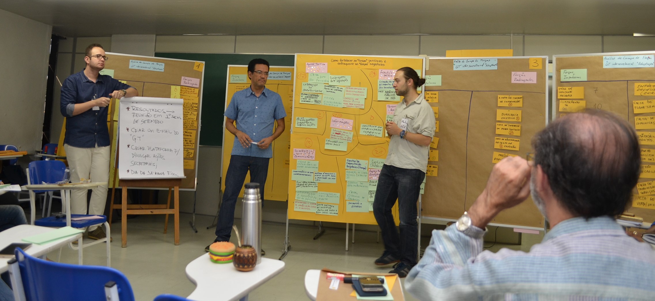
An inter-secretarial workshop brought together representatives from different departments of the municipal government of Duque de Caxias. This (first) opportunity to exchange on these issues helped them to discuss the importance of considering climate change related risks in their municipal planning instruments. The participatory identification of climate change impacts fostered a common understanding of climate change as a crosscutting issue affecting all municipal sectors. The mix of inputs, discussions as well as working on the concrete case strengthened the spirit of cooperation and the search of synergies in preparing for (ecosystem-based) adaptation to climate change in the region of Duque de Caxias.
The final outcome was the creation of an inter-departmental working group on climate change, which seeks for coordination and cooperation in order to enhance adaptation success.
Enabling factors
- Strong ownership of the process on the part of the municipality.
- Awareness of the need to improve the planning procedure and willingness to implement the necessary steps.
- Reduction of frontal input during workshops to a minimum, giving to participants as much ownership of the process as possible, and therefore enabling them to discuss and learn “by doing”.
Lesson learned
- Climate change and the ecosystem services approach proved to be excellent topics to bring together experts and stakeholders with different visions, enabling them to collaborate on common challenges.
- Introducing vulnerability to climate change and ecosystem services as crosscutting issues, rather than separate topics, increased the likelihood for them to be considered a topic of high-value.
- The combination of workshops with capacity development elements helped to sensitize representatives from different sectors for the need to cooperate and coordinate in order to reduce specific risks.
- The joint development of starting points and concrete steps to consider vulnerability to climate change and ecosystem services in planning processes lowers the stress of local planning teams.
Impacts
Vulnerability to climate change and the flow of ecosystem services have been considered during the revision process. It is expected that more ecosystem-based adaptation measures will be included in the plan. Possible measures include more efforts to conserve the Atlantic Forest, wetlands, and mangroves in order to, e.g., enhance the provision of drinking water and reduce coastal erosion due to sea-level rise. Forest restoration and conservation on mountain slopes shall act as a natural barrier to reduce increasing landslide risk.
The process of discussing climate change vulnerability and ecosystem services also proved to be the first topic in years to gather participants from different municipal secretariats: as climate change is impacting different sectors, and knowledge about how to deal with this issue is not existent, a climate change working group of different secretariats was established, pursuing to plan common action.
Sustainable Development Goals
SDG 6 – Clean water and sanitation
SDG 11 – Sustainable cities and communities
SDG 13 – Climate action
SDG 15 – Life on land
Story
The city of Duque de Caxias is suffering from a series of climate and non-climate related pressures, such as floods, coastal erosion, salt-water intrusion, extreme heat and a chronic lack of drinking water.
The upcoming revision process of the municipal master plan was therefore seen as an opportunity to better address the risks from current and future pressures associated with climate change and ecosystem services. Subsequently, appropriate approaches and tools were necessary to incorporate these new features systematically in the planning procedure. In order to do so, the city’s municipal administration was assisted by two international cooperation projects, implemented by the Brazilian Ministry of Environment and GIZ (via IKI/BMUB).
Initially, technicians of the municipality participated in a training on EbA and land-use planning, as well as in the concepts of ecosystem services (ES) and how to use the Integration of Ecosystem Services (ISE) approach in the planning process. Subsequently, the Municipal Department of Planning invited several stakeholders (incl. eight other municipal secretariats) to be trained on climate change adaptation and to design an action plan for the following steps:
- An ecosystem services mapping applying the matrix model, which is a social valuation of ecosystem services that collects both expert and local knowledge through an expert elicitation within a defined region. This method was combined with participative mappings, done within the same interview. The resulting maps highlight areas relevant for the provision of 9 different ecosystem services, as well as drivers for the decrease of ecosystem service provision. Results of ES mapping offer new perceptions regarding ES and their values as well as expected tendencies in the future and respond to the need of local decision-makers for spatial explicit information.
- A participative climate change vulnerability assessment. While only very little quantitative data was available, the team decided for a mainly qualitative approach that included a strong capacity development momentum. An introductory workshop served to sensitize participants about the importance of considering climate change into planning and related terminology. On that basis, a vulnerability assessment on local level was conducted. The results include information on vulnerability and risks, a mapping of sensitive areas, and potential (ecosystem-based) adaptation measures.