Stakeholder identification and analysis/site profile analysis.
Participatory Assessment
Use of data for decision-making and planning.
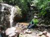
Photo 1 (Njal Njock Simon, Utilisation de l’Outil IMET pour l’identification des priorités d’aménagement de la forêt intercommunale de Ngog-Mapubi Dibang /STGA-CA-1831, Photo de famille atelier de remplissage à Ngog-Mapubi, Janvier 2022 )
Conduct good site investigation and flood modeling
Increase the flood mitigation capacity and resiliency
Preserve wetland and reduce the impact of urban development
Improve water access and maximize social benefits
Intercambio de experiencias entre juntas administradoras de agua en la microcuenca Las Balanzas, en la Reserva Biológica Güisayote, área protegida de la Reserva de Biosfera Transfronteriza Trifinio Fraternidad.


")