Connecting a coastal Reserve with its Surroundings
Full Solution

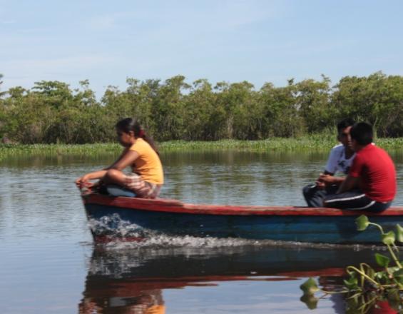
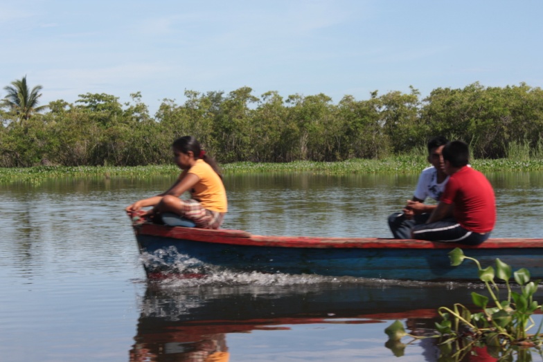
Monterrico 1
(© CECON)
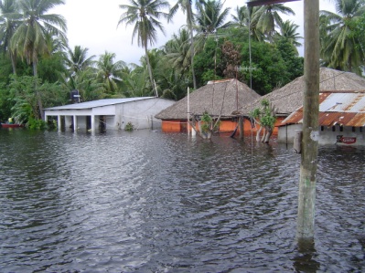
“Connecting a coastal Reserve with its Surroundings” is a process that is addressing the problem of floods inside Monterrico Multiple Use Natural Reserve for the benefit of Reserve’s inhabitants, through the engagement and inclusion of new stakeholders, broadening the scope management and a setting a new scale of actions.
Last update: 02 Oct 2020
6572 Views
Photo and video gallery

Context
Challenges addressed
The challenges the solution seeks to address are:
- Negative effects of floods on ecosystems and human settlements inside the Reserve.
- Alterations in watersheds and their effects on coastal wetlands.
- Narrow scope management that overlooks connections between the Reserve and its surroundings.
Location
Monterrico, Guatemala
Central America
Process
Summary of the process
The first step is to understand the relationships between the Protected Area and its surroundings and to comprehend the scale in which ecosystems, processes, drivers of change and stressors take place inside and outside of the protected area (Conceptual Ecological Model). Based on this understanding, it is possible that the protected area’s scale of actions and management scope are not enough to assure its long term viability. If this is the case, a new scale and broader scope of management for the protected area is needed. Secondly, once adopted a new scale and broader scope of management actions, it is also needed to determine all the stakeholders involved on it, and engage them in a permanent process of participation. Finally, the new management scale, broaden management scope and new stakeholder setting need to be formally recognised into the protected area management, meaning this, to be included in its highest level of planning (its management plan).
Building Blocks
Monterrico Reserve Conceptual Ecological Model
The Reserve’s Conceptual Ecological Model (CEM) was created through a participatory approach aiming to understand the interactions between the Reserve and its surroundings, specifically the processes that link ecosystems, species and conservation values inside the Reserve, and to recognize the conditions under which those processes could change and affect conservation values inside the Reserve.
Enabling factors
• Availability of information.
Lesson learned
• During the elaboration of the CEM and with the results that came out during this phase, was evident that the current scale of actions taking place only inside the Reserve will not be enough to address flood issues in the area.
Permanent Stakeholder Engagement Process
Realizing the importance of involving all main stakeholders, a permanent stakeholder engagement process was established aiming to engage stakeholders who are currently not involved in the Reserve’s management and should be included to meet the new scale of actions suggested by the Reserve's CEM. Those stakeholders include amongst others, sugarcane mills, the General Secretariat for Planning, and local governments inside the watersheds.
Enabling factors
The enabling factors have been:
- The effective scale of management for the protected area is known.
- Stakeholders affecting the area are identified.
- Willingness of protected area managers to engage stakeholders.
- Ability of the institution in charge of the protected area management to generate widespread interest amongst different stakeholders.
- Stakeholders are committed to participate actively in the process.
-
High public awareness regarding the Reserve’s values (economic and non-economic).
Lesson learned
Important stakeholders affecting the Reserve were left behind in the current governance scheme; therefore, the inclusion of new actors to match the new scale of actions is needed.
Updating the Reserve’s Master Plan
The triggering factor that started the updating process of the Reserve’s master plan, were the inhabitants’ concerns about floods affecting them. In response to this, CECON is leading a process of gathering, updating and analysing information to propose management actions and strategies to be included in the updated master plan. Additionally, final discussions with stakeholders and elaboration of the final version of the updated master plan to be presented and approved by CONAP are ongoing.
Enabling factors
• Availability of information.
• Ability of the institution in charge of the protected area management to generate widespread interest amongst different stakeholders.
• Stakeholders are committed to participate actively in the process.
Lesson learned
• The Reserve by itself will not be able to control the risk of floods inside its territory, without interventions outside of its limits.
• Updating a management plan is not just a specific event in time, but a powerful process to establish permanent stakeholder engagement, and to link a protected area with its surroundings.
Impacts
During this ongoing process, intermediate results have been achieved for the management of the Reserve: a) new scale of management actions; b) broader governance arrangements; and c) wider scope of management. Additionally, some initial impacts of this process are: a) Reserve’s managers and inhabitants have gained better understanding of the magnitude and scale of the flood problem inside the Reserve. b) The process highlighted the necessity to carry out conservation actions outside the Reserve to maintain ecosystem integrity and control floods happening inside the protected area.
Beneficiaries
The main beneficiaries of this solution are:
- Inhabitants of Monterrico Reserve
- People depending on economic activities taking place in the area, mainly tourism and fishery.
Sustainable Development Goals
SDG 14 – Life below water
SDG 15 – Life on land
Story
Monterrico’s inhabitants continuously affected by floods, have perceived an increase on their intensity and frequency; considering this, as a consequence of alterations of the watershed made by sugarcane mills. In search of a way to face this problem, inhabitants asked the University of San Carlos of Guatemala (USAC) to intermediate in this issue and try to find a shared solution; this, due to the University through the Centre for Conservation Studies (CECON) is the institution in charge of the Reserve’s management and because of it is a public institution highly known at national level. For doing so, CECON organised a series of field trips along the entire watersheds in which important stakeholders participated to understand the causes behind the flood problems, as an important element in the process of constructing a Conceptual Ecological Model, aiming to make clear all those key interlinks between the Reserve and its surroundings. The realisation of these interlinks, led also to understand that working only inside the Reserve won’t be enough to deal effectively with flood problems. Thus, a bigger working area was considered; however, a bigger area also meant that it would be necessary to coordinate and work together with other stakeholders, not taken into account in the current management of the Reserve. In the same way, it was considered during this process that all those insights gained must be mainstreamed into the Reserve’s management, and the best way to do that would be including them into the Reserve’s highest planning tool, its Master Plan. Hence, the updating process of the current Master Plan began and is still ongoing, and aims to establish a new scale of actions, broader scope of management and new governance scheme, which acknowledge its surroundings.
Connect with contributors

Other contributors
Francisco Castaneda Moya
Centre for Conservation Studies, University of San Carlos of Guatemala
Mercedes Barrios
Centre for Conservation Studies, University of San Carlos of Guatemala