Smart Conservation Platform-Driven Sustainable Development: A Case Study of the Bogda Component, Xinjiang Tianshan World Natural

The Bogda Component of Xinjiang Tianshan World Natural Heritage Site exemplifies representative geomorphological features and ecosystems of Xinjiang Tianshan. As a quintessential arid landscape in Eurasia’s hinterland, it showcases remarkably distinct and complete vertical zonation of mountain natural landscapes within minimal distances. This includes: snow-capped peaks and glaciers, pristine forests and meadows, crystal-clear rivers and lakes, expansive deserts. It achieves a remarkable convergence of stark contrasts: heat and cold, aridity and humidity, desolation and beauty, grandeur and delicacy. To realize win-win protection and development, the site is steadily advancing its smart conservation management platform, providing foundational support for sustainable development.
Contexte
Challenges addressed
Challenges
Facing increasing tourist volumes and escalating ecological conservation pressures, traditional protection methods reveal multiple deficiencies in management, conservation, and monitoring, with urgent issues requiring resolution.
Implementation
Steadily advancing the Data-Driven Ecological Conservation Platform, over 40 million yuan has been invested to establish ecological resource management and IT infrastructure, laying a solid foundation. Leveraging Internet+ technologies—including 5G, smart sensor networks, cloud computing, IoT, GIS, satellite remote sensing, big data, and data visualization—the platform centers on an ecological resource management system. This has:
- Significantly enhanced ecological monitoring and disaster control (e.g., forest fire prevention)
- Effectively protected biodiversity habitats
- Strengthened ecosystem stability and sustainability
- Provided robust ecological safeguarding for long-term heritage site development.
Emplacement
Traiter
Summary of the process
By integrating environmental monitoring equipment, geological monitoring instruments, infrared cameras, and video surveillance systems, and leveraging technologies such as 5G, the Internet of Things (IoT), and Geographic Information Systems (GIS), a smart sensory network covering the entire area has been established. This network enables holistic dynamic monitoring of the ecological environment, emergency safety, and operational status, achieving real-time visual dispatching of resources, personnel, and events.
Building on the technical strengths of the smart ecological management platform, a tripartite digital operational system integrating "Ecological Protection – Comprehensive Management – Marketing Services" has been developed.
Building Blocks
Integrated Forestry Spatial Platform
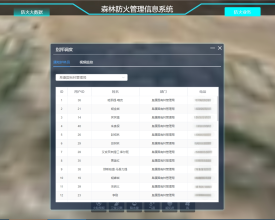
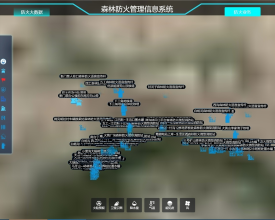
Integrating historical forest resource surveys, monitoring data, and thematic research, a Smart Forestry Management Cloud Platform was developed. Through intelligent spatial data analysis, resource retrieval, rapid thematic mapping, customized reporting, and multi-temporal high-resolution imagery comparisons, it established six core modules:
- Project Information Management
- Collaborative Daily Operations
- Dynamic Personnel Dispatch
- Forest Conservation & Cultivation
- Non-Commercial Forest Development
- Full-Cycle Fund Oversight
achieving unified "One Map" forestry resource governance.
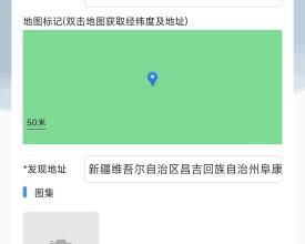
The Mobile Patrol App centrally manages rangers' patrol routes, attendance records, and field logs. It enables reporting, processing, and early warnings for 10 types of incidents, including:
- Geological hazards
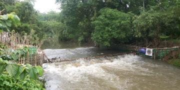
- Flood risks
- Fire threats
- Illegal logging/mining
- Poaching
This achieves comprehensive oversight of:
✓ Ranger information management
✓ End-to-end patrol process monitoring
✓ Real-time conservation status tracking
Enabling factors
IoT Application: Deployed environmental/geological sensors with "3S + IoT" tech for real-time tracking of temperature, humidity, wind, rainfall, noise, PM2.5/10, ions, and ground displacement. Enables live ecological data collection. Combines satellite phones/field gear with patrols to monitor forests and illegal encroachment via human-device networks.
Remote Sensing: Integrated satellites/drones for "air-space-ground" monitoring. Quantifies fires, vegetation, biomass. Acquires high-res imagery for dynamic tracking and post-disaster evaluation.
Lesson learned
During heritage site conservation management, regulating uncivilized tourist behaviors—such as trampling vegetation or climbing barriers for photos—requires multifaceted awareness campaigns and strategic interventions to ensure a safe and rewarding visitor experience.
environmental monitoring devices
25 environmental monitoring devices and 21 geological hazard warning systems were deployed, integrating 3S technology (GIS/GPS/RS) and IoT to enable real-time monitoring, data visualization, intelligent analysis, and early warnings for:
- Environmental factors: temperature, humidity, wind speed, rainfall, noise, PM2.5, PM10, negative oxygen ions
- Geological risks: slope displacement and inclination
providing critical support for conservation and emergency management.
400 high-definition surveillance feeds were installed to:
- Monitor and statistically analyze tourist capacity in real-time
- Issue frontline alerts
- Capture uncivilized tourist behaviors
Integrated systems include:
- 9 dual-spectrum PTZ cameras
- 10 fire lookout towers
- 25 facial recognition audio warning poles
- 10 drones (equipped per ranger station)
- 50 4G patrol terminals
Establishing a "Thermal Imaging + IoT Sensing + 3D Patrol" monitoring network achieving full-coverage fire surveillance.
Enabling factors
Data Visualization: Uses 3S tech and smart analytics to visualize environmental trends, resource distribution, and wildlife data, enabling intuitive ecological assessment and science-based decisions.
Decision Support System: Analyzes big data to auto-trigger threshold alerts from field devices, generating protocols for fire warnings and pest control. Provides end-to-end digital support from monitoring to emergency response.
Fire Surveillance: Integrates drones, cameras, and satellite data for 24/7 fire/illegal act monitoring. Instantly alerts personnel, enabling smart-enabled early detection, rapid response, and scientific firefighting.
Lesson learned
During heritage site conservation management, regulating uncivilized tourist behaviors—such as trampling vegetation or climbing barriers for photos—requires multifaceted awareness campaigns and strategic interventions to ensure a safe and rewarding visitor experience.
Impacts
Management: By integrating environmental monitoring equipment, geological sensors, infrared cameras, and video surveillance with 5G, IoT, and GIS technologies, a smart sensory network covering the entire area has been established. This enables holistic, dynamic monitoring of the ecological environment, emergency safety, and operational status, achieving real-time visual dispatching of resources, personnel, and events.
Protection: Observation towers, satellite monitoring, ecological patrol systems, and a patrol app form an integrated "sky-ground-human" monitoring network. This provides quantitative data for ecological conservation and restoration, enhancing the accuracy and completeness of monitoring data.
Monitoring: Multi-dimensional data collection (environmental factors, geological displacement, infrared cameras, etc.) enables early warning and integrated control of wildfires, geological hazards, forest pests, illegal land use, and unauthorized cultivation. This gradually enables comprehensive smart conservation.
This achieves a profound transformation:
- Ecological management: from "reliance on manual experience" to "data-driven"
- Conservation: from "reactive response" to "proactive prevention"
- Monitoring: from "single-mode" to "multi-source integration"
Leveraging the smart ecological management platform, a tripartite digital operational system integrating "Ecological Protection – Comprehensive Management – Mark
Beneficiaries
Stakeholders and rights-holders, including tourists, heritage site managers, surrounding businesses, and community residents.
