Ecosystem-based flood and drought management in river basins
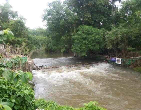
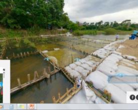
Technical and capacity development measures are applied in watersheds threatened by climate change. Relevant professionals are supported in vulnerability assessments. Inclusion of population is ensured through the involvement in stakeholder platforms. Innovative EbA approaches like the “living weir” approach are based on local knowledge and initiatives and are implemented for demonstration purposes. Innovative technical methods, such as drones, were used to evaluate and monitor the project area before, during and after the activities. This approach recently received the International Drone Pioneer Award 2017 for visionary drone applications with global impact. Based on the experiences, EbA approaches are fed into the national level and education format.
Context
Challenges addressed
- Increasing floods and droughts cause damage and water scarcity.
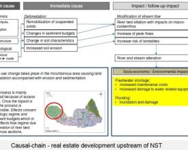
- Land use activities in river basins (rice, rubber, sugar cane) support land degradation causing soil and river bank erosion, sedimentation of grey infrastructure, increased risk of landslides, loss of biodiversity and water retention capacity.
- Local water management institutions lack technical capacity and concepts to address such extreme events.
- The population faces economic losses due to crop failure and loss of production in the fisheries sector. They are lacking water availability during dry season and face damages to their homes and fields in the rainy season.
- Policy conflicts between different sectors and the absence of formal rules for urban planning are exacerbating the challenges.
Location
Process
Summary of the process
Assessing vulnerabilities and identifying different EbA measures to tackle the vulnerabilities (building block 1) is a precondition for implementing the most feasible EbA measure, for example, living weirs (building block 2). This measure utilizes local knowledge (building block 3) in combination with state of the art adaptation approaches. Knowledge exchange between decision makers and practitioners (building block 4) together with capacity building in water monitoring, modeling and economic valuation methods (building block 5) allows a further upscaling of the approach.
Building Blocks
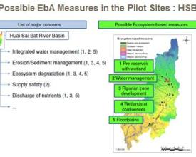
Vulnerability analysis and identification of EbA measures
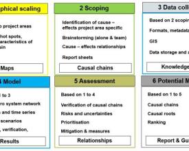
The vulnerability assessment approach allows to find the biggest problems in river basins. For this assessment the approach was based on GIWA (Global International Water Assessment Methodology) & HSAP (Hydropower Sustainability Assessment Protocol) and follows a 6 step approach including the following: 1) geographical scaling (mapping of hot spots) defines the geographic boundaries of the pilot areas to be analysed; sub-regions are identified within each project area and major hydro system features and economic activities are mapped out; 2) scoping by assessing environmental and socio-economic impacts and establishing priorities among the major concerns and issues as well as tracing the root causative factors behind the selected concerns and issues; 3) data collection; 4) modeling for verification and quantification of root-cause relationships with either physically deterministic or conceptual models covering a) hydrologic modeling with TalsimNG software, b) erosion and sedimentation modeling with Modified Uniform Soil Loss Equation (MUSLE), c) water quality modeling with GISMO software; 5) assessment to identify risks and uncertainties and to prioritize vulnerabilities; 6) Identification and ranking of potential EbA measures.
Enabling factors
Available datasets (e.g. GIS) on digital elevation models and time series for water discharge, precipitation, temperature, humidity, evapotranspiration. Cooperation of local stakeholders to ensure that they are part of the decisions making processes and that their prioritized problems are tackled.
Lesson learned
- Different data, discharge, evaporation, humidity, temperature, etc., is owned by different institutions. Some of them do not share their data as they consider it a loss of power. This needs to be considered as early as possible. The project used drones for collect additional data on the river discharge. - Datasets were partly incomplete. The missing information does not allow to analyze and quantify certain effects, therefore the results of the assessments still include uncertainties.
EbA Measure: Living weirs as flood buffers
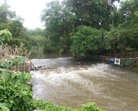
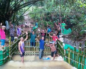
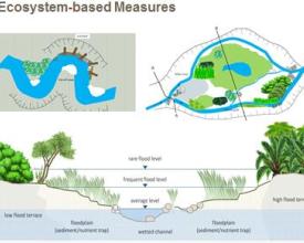
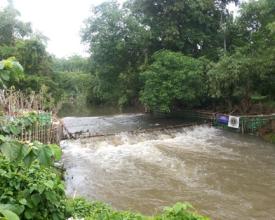
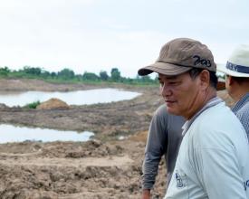
The living weir concept is an EbA Measure, which is based on the knowledge of the local communities in the river basin and in line with the King of Thailand’s Sufficiency Economy Philosophy to apply technologies based on local resources and know-how. In a first stage a bamboo grid construction is constructed in the river providing structure for degradable sand bags containing a mixture of sand, coconut coir and manure. Along the riverbanks a combination of Banyan trees (Ficus bengalensis) and other leguminous plants is planted to stabilize soils. The wide rooting banyan trees are planted on both side of the weir, The roots that they are forming will nurture from the manure and will penetrate in the bamboo construction over the next decades to form a “living weir”. This technology entails several benefits such as improving ground water recharge, which can increase the crop yields, increasing biodiversity, such as increasing in fish habitat, variety of plants etc. and strengthen unity among related stakeholders. Terraces also allow fish to move upstream. Maintenance costs and efforts for this methodology are low and can be easily conducted by the local communities.
Enabling factors
• Local acceptance & ownership • clarity on land tenure on construction site • stakeholder involvement, such as local people, (ideally with support from government and private sector) • natural materials that are available in the area such as bamboo, sandbags, tree seedlings etc. • working on voluntary basis, budget and material support by community at the first stage, support from the government and/or private sector at a later stage
Lesson learned
- Being seen as a local wisdom, these measures have the full support from the local community and are financed and implemented by local stakeholders. This has gained them a lot of attention and interests from Thai government institutions. - However, there is a lack of scientific backup. This leads to construction without proper planning and without coordination with the local water management institutions. In the past newly constructed weirs were built in wrong locations at the wrong time, underestimating the river flow during an early flood season , which caused damage or even destruction of the incomplete structures - Raising awareness on physical and socioeconomic impacts of climate change has increased the acceptance of EbA measures by local stakeholders. However, further knowledge is needed to erase belief on false effects of EbA measures and to convey to stakeholders in which locations EbA measures are feasible.
Utilization of local knowledge and ownership through river basin committees
The set-up of river basin committees, representing the population within a river basin as well as academia, government and others is crucial for the success of river management. The connection between the local population and the water resources, especially in the Tha Di river basin, is very strong. Within the local communities knowledge on changes in climate and natural disasters (flood and drought events) has been passed down from generation to generation without much written documentation. The concept of flood protection via living weirs originated from the local riparian communities and strong leaders with innovative ideas and the willingness to experiment different approaches for flood and drought protection. Combining this strong ownership with hydrological data from local universities and the administrative capacity from the regional governing institutions allows for a holistic water management approach. All these actors are represented within the river basin committees.
Enabling factors
• strong community partnership and ownership • innovative ideas and willingness to experiment • willingness to contribute with resources (time, manpower, local material) • river basin committees are the bridge between local stakeholders and water management institutions of the government
Lesson learned
The river basin committees (RBCs) in different river basins were at very different stages at the beginning of the project. Some were fully established, which allowed easier communication with the local population as well as cooperation between local stakeholders, public sector and academia. Other RBCs had not held their first meeting when the project started. Here local stakeholders took strong ownership over their water recourses, which allowed the project to progress while the RBC was still in the process of being established.
Knowledge exchange visits at local and national level
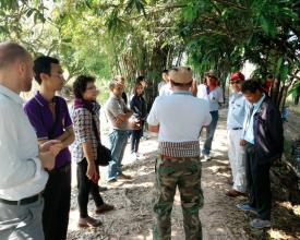
The set-up of site visits and exchange of stakeholders and decision makers between the three different pilot river basins was a great method to foster exchange and mutual learning on potential EbA measures across river basins and across institutions. This exchange triggered important exchange on the feasibility of measures, their application in different locations and the possibilities for upscaling. Further, on one hand a friendly competitive spirit could be sensed in regards to which river basin would have the better ecosystem-based water management sooner. On the other hand, institutions which are in competition to each other came together and started cooperating.
Enabling factors
• Exchange of local lessons learned • Cooperation across river basins • GIZ project as neutral framework allowed non-cooperative institutions to come together
Lesson learned
- Tangible examples and good practices on EbA measures help relevant stakeholders to get a better understanding on EbA concepts and its benefits. - At the same time, EbA measures cannot simple be copied to other river basins and relevant people need to be made aware of the need for river basin-specific vulnerability assessments.
Building technical capacities on water monitoring, modeling and economic valuation methods
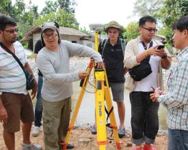
Key capacities for setting-up a sustainable river management, namely hydrological modeling, vulnerability assessments on future floods and droughts and economic valuation methods for identifying suitable ecosystem-based adaptation measures were built on the local and national level. The project introduced drone technology for monitoring the watershed and to improve modeling of future flood risks. A series of trainings, developed together with German research institutes and practitioners, was conducted, containing both theoretical background and practical application in the river basins.
Enabling factors
• Sufficient technical and financial capacities of local research institutions • Motivation of single persons, that act as agents of change within their own institution and follow-up on the trainings/ implement the newly gained knowledge into their daily work.
Lesson learned
International institutions/ experts need to be aware about the knowledge management as well as learning structures of the local institutions and be willing to adapt their own approach accordingly.
Impacts
1) Environmental
- Damages from floods and droughts to local communities, economy and ecology are reduced.
- Sediments and nutrients are kept in agricultural relevant areas.
- Water quality is improved.
- Decentral and new habitats function as valuable biodiversity conservation areas, especially during dry season.
2) Social
- Communities are more resilient to flashfloods during the rainy season.
- The water from floods, which is retained in the landscape, increases water storage for consumption and irrigation during the dry season.
- More water can be provided to more people and/or for more irrigated land.
- between 780 more people in year and up to 15.000 more people in year 25.
- 1,500 people have been reached directly and 4,500 indirectly by awareness raising and training, 530 officers have been trained in economic evaluation of EbA options.
3) Policies
- DWR and RID as the main warer organizations are prioritizing EbA solutions in their policies and plans with an DWR investment of 535,000 EUR and RID investment of 20 million EUR.
- The current government the National Council of Peace and Order announced upstream forest rehabilitation projects (about 7.520 ha) and soil erosion prevention projects (Vetiver grass will be planted on 1.080 km2)
- Forest rehabilitation and vetiver grass planting will absorb up to 84.000 tons of CO2 per year.
Beneficiaries
The rural population in the river basins benefits from the implementation of flood and drought management measures by reduced vulnerability towards flood and drought impacts.
Sustainable Development Goals
Story

Farmer Wanchart Samdang from Nakhon Si Thammarat like most farmers in South Thailand grows little rice but is specialized in vegetables and fruit cultivation, especially Durian and Mangosteen fruits. Both sell well at local markets. However irrigation is a problem and at the end of the dry season, water is scarce. His reservoir fills up during the rainy season and the water irrigates the fruit trees. During the dry season he has to tap river water, pumping it to the fruit orchards. Since water availability is a common challenge in this area, the farmers of the adjacent villages have joined forces. With help from the government and supported by local universities and GIZ they are building a living weir, slowing the river down. Before they have tried to build with cement but this is “dead” material which gets destroyed by the water and is expensive to build and maintain. That’s why the farmers used bamboo and other natural materials in combination with river vegetation like trees and shrubs, stabilizing the riverbank. They have created a “living weir” which can withstand floods, slows the river down, so more water trickles into the surrounding nature. The local community is strengthened by the joint work. Every one participates and water shortage is rarely a problem. Besides, the yield of fruit trees has increased, allowing Mr Samdang to earn more money with a sustainable irrigation method.
