Madagascar Lemur Portal : Bridging technology and biodiversity conservation
Solution complète

Madagascar Lemur Portal
MLP
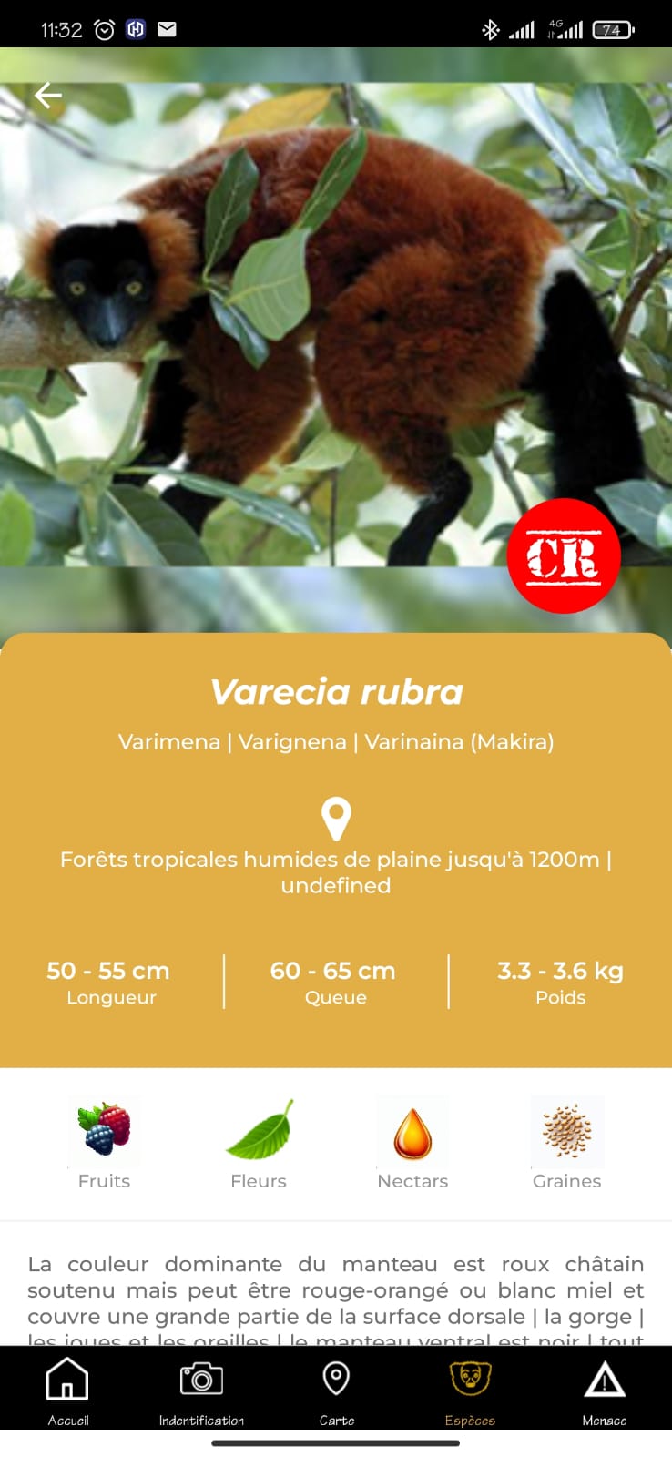
Madagascar Lemur Portal (MLP) serves as a digital hub empowering conservation effort in Madagascar, home to critically endangered lemurs. Combining a website and mobile application, MLP project provides tools for ecological monitoring, data sharing, and community engagement. The platform offers a lemur species database, geospatial mapping of occurrence points, and offline data collection capabilities.
MLP addresses challenges such as limited resources both human and financial at protected area level for ecological monitoring of conservation targets, fragmented field data and weak collaboration between conservation stakeholder communities at all levels, with centralized information not conducive to adaptive results-based management at protected area level. Positive results include improved monitoring of lemurs in protected areas, increased community awareness and conservation planning based on up-to-date data driven conservation planning. This solution demonstrates the value of using technology in biodiversity conservation.
Dernière modification 31 Oct 2025
314 Vues

Contexte
Défis à relever
MLP project was developed in response to key environmental and social challenges affecting lemur conservation in Madagascar: improve data accessibility, promote community of conservation practitioners engagement, and build long-term technical capacity for conservation.
Environmental challenges:
- Habitat Loss: Widespread deforestation and land degradation threaten critical lemur habitats, especially in and around protected areas
- Hunting: Lemurs are frequently targeted for bushmeat or captured for the pet trade, posing a serious threat to their survival
Social challenges:
- Lack of awareness: Many communities and decision-makers lack sufficient knowledge of lemur conservation and its broader importance
- Limited technical capacity: There is a shortage of training and access to digital tools for ecological monitoring, especially in remote areas
- Insufficient monitoring and enforcement: Existing conservation policies often require insufficient human and financial resources for proper implementation
- Scattered effort and lack of communication
Emplacement
Madagascar
Antananarivo, Analamanga, Madagascar
Afrique de l'Est et du Sud
Traiter
Résumé du processus
Madagascar Lemur Portal (MLP) project brings together technology, science, and community engagement to support effective and inclusive conservation. A centralized biodiversity database provides accurate, up-to-date data for decision-making and research. The mobile app and online platform enable real-time data collection and access, linking field users, researchers, and policymakers. Meanwhile, targeted training and outreach foster knowledge sharing and build local capacity. Together, these elements form a feedback loop where data drives action, and local input enriches the system. The solution aligns with the Global Biodiversity Framework by supporting species protection, ecosystem monitoring, equitable participation, and access to biodiversity knowledge. By combining digital tools with local empowerment, MLP creates a sustainable, collaborative approach to conservation that can adapt and grow over time.
Blocs de construction
Robust scientific database
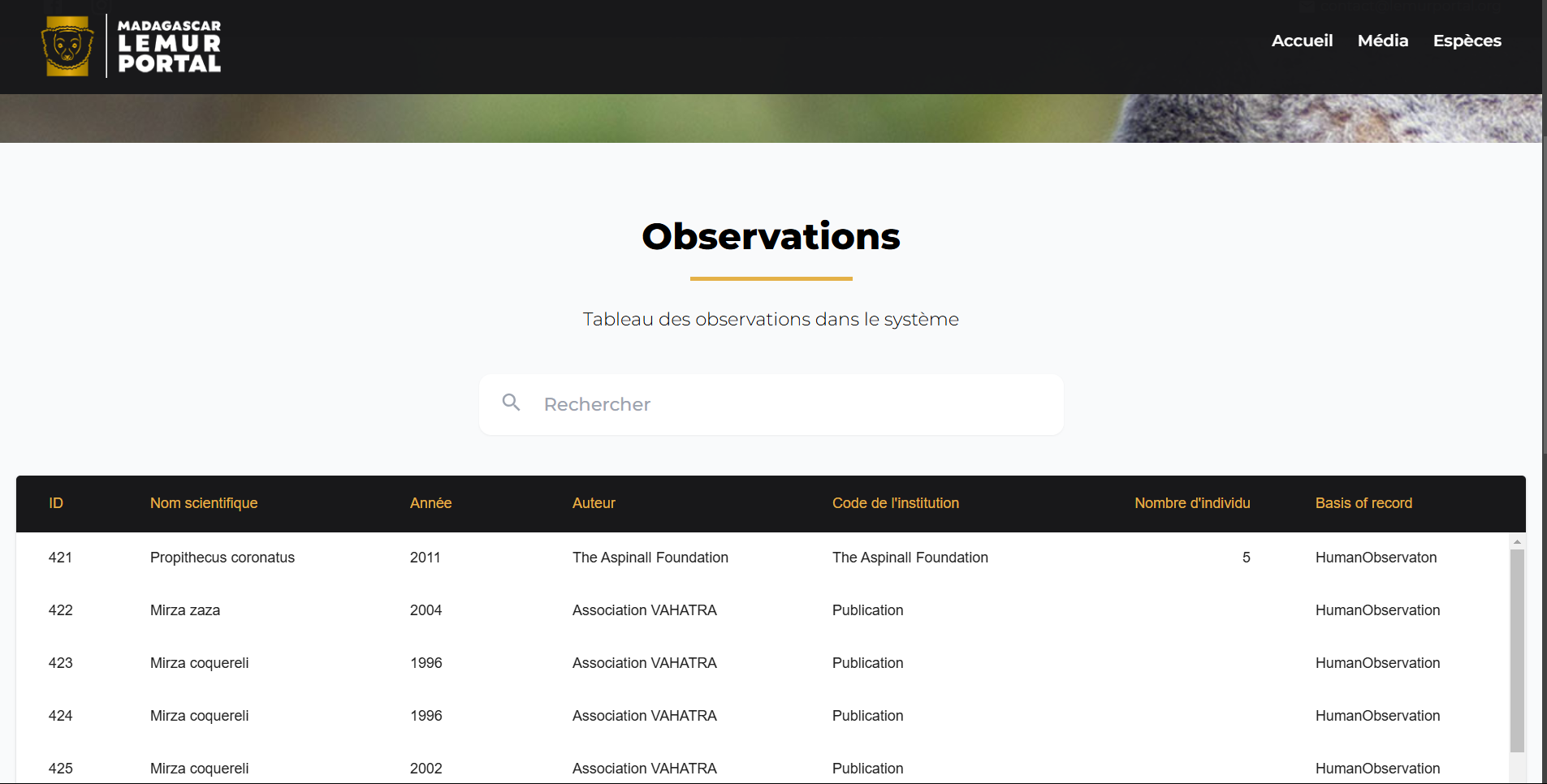
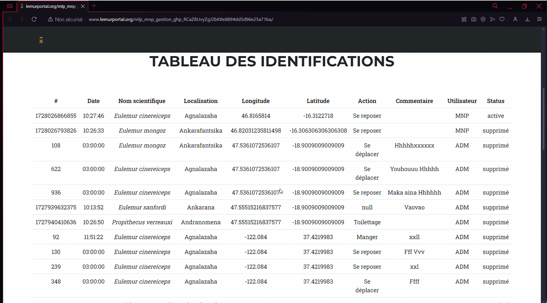
A centralized, open-access database compiles high-quality biodiversity data, including lemur species distributions, habitat conditions, and conservation threats. It provides a reliable foundation for research, policy development, and conservation planning across Madagascar. The database is regularly updated with field observations collected via the mobile app and validated by local experts.
By making biodiversity knowledge accessible, up-to-date, and decision-relevant, this component directly contributes to the GBF Target 4 (halt species extinction) and Target 21 (ensure public access to biodiversity knowledge and data). It enables trend monitoring, supports conservation action, and strengthens coordination between field and policy levels.
Facteurs favorables
- Integration of data from field studies, research institutions, and conservation NGOs.
- Regular updates from mobile and online platforms to ensure current and relevant information.
- Collaboration with local scientific communities to maintain data integrity and to validate and enrich the database
- Inclusion of offline functionality to enable data collection in remote areas with limited connectivity.
Leçon apprise
A database alone has limited value unless it is actively used. Outreach, training, and sustained user engagement are essential to ensure the data is not only accessible, but also well understood and effectively applied by diverse stakeholders—including local communities and conservation practitioners. Additionally, in recent years, many funders have shifted away from supporting standalone data platforms. To secure long-term support, the database must clearly demonstrate its impact on conservation outcomes and its integration into real-world decision-making processes.
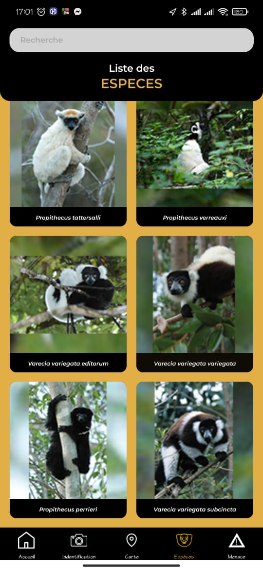
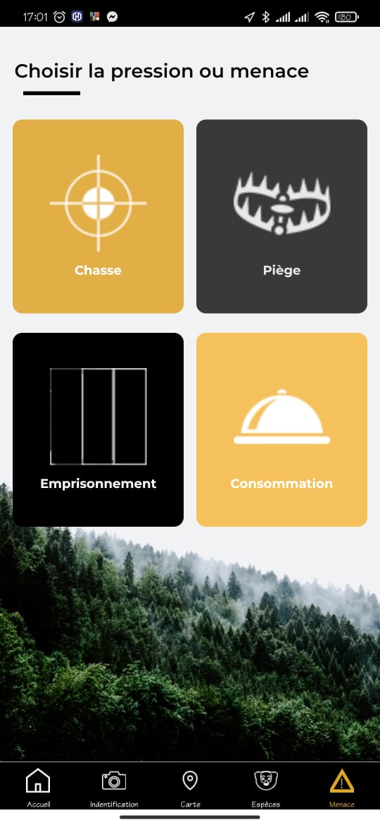
Mobile application and online platform
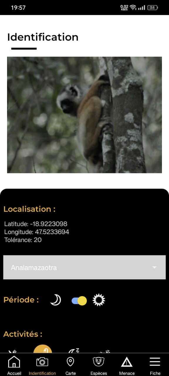
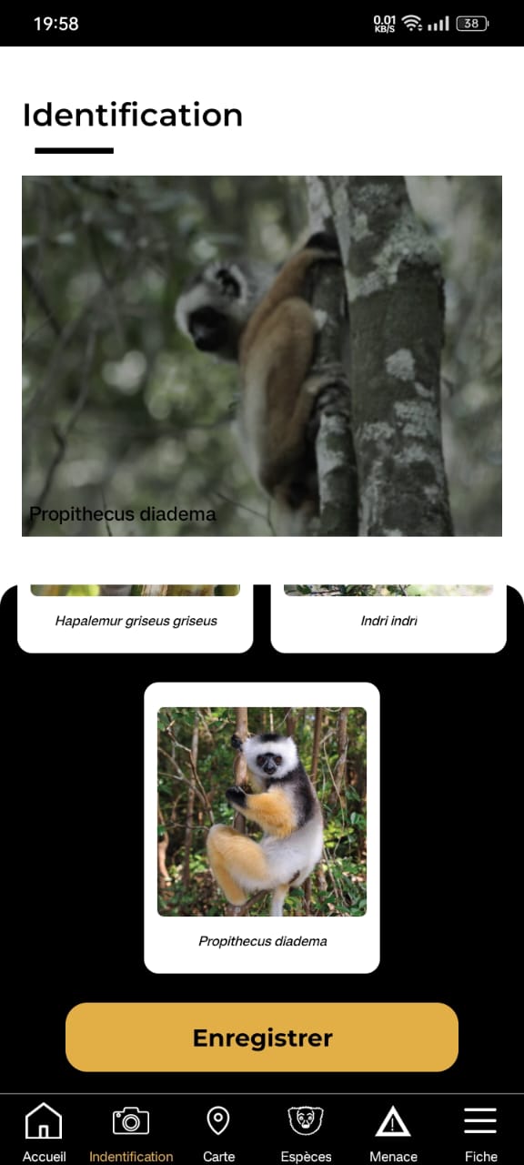
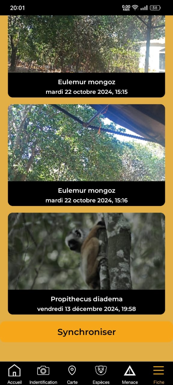
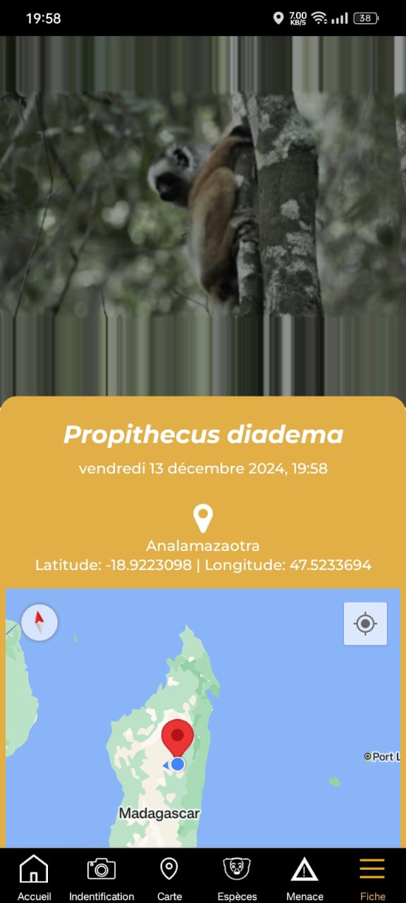
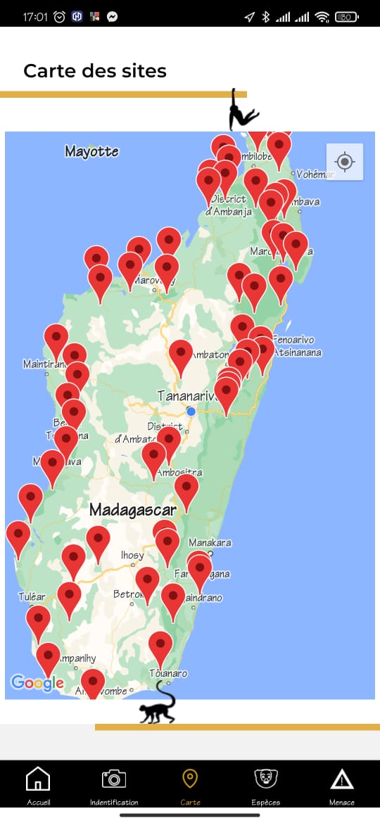
This dual-component system combines a mobile application for real-time data collection with an online platform for data visualization and analysis. The mobile app allows field agents, students, and community members to record species observations, even in remote areas, thanks to offline functionality. Data is automatically synchronized to a central database for visualization and analysis on the web platform.
By enabling spatial tracking of species, improving data flows from protected areas, and involving diverse users in conservation, this component contributes to GBF Target 1 (planning and managing biodiversity areas), Target 3 (strengthening protected areas), Target 4 (preventing species extinction), and Target 22 (ensuring inclusive participation in biodiversity action). These components also form the basis for long-term funding to maintain the project. By collaborating with travel agencies and protected areas, non-intrusive advertisements could be implemented on the website and mobile app to generate revenue and support the website’s activities.
Facteurs favorables
- Intuitive, user-friendly interfaces tailored to a wide range of users with different digital literacy levels.
- Use smartphone Integrated GPS tools to facilitate geotagging of species observations.
- Compatibility with the database for automatic data uploads and access.
- Continuous feedback loops between field users and conservation planners to improve functionality and relevance.
- Active engagement of local communities, youth groups, and university partners through outreach and co-design.
Leçon apprise
While the app has significantly improved data flow and user engagement, many users, especially in rural areas, require hands-on training and ongoing support to build confidence in using digital tools. Additionally, long-term maintenance of the platform demands more resources than initial development, including technical infrastructure and human capacity. Sharing precise geolocation data can also pose risks, particularly for endangered species, highlighting the importance of strict data privacy and ethical protocols. Ensuring long-term success requires strong local ownership, responsive support systems, and sustainable funding strategies that go beyond pilot phases.
Data and knowledge sharing
This component fosters collaboration, transparency, and co-learning among conservation stakeholders by facilitating the open and inclusive exchange of data and insights. By ensuring that conservation strategies are informed by the latest findings, and that communities and researchers work toward shared goals, the platform strengthens collective action for lemur protection. Through targeted communication, training workshops, and education campaigns, it empowers local communities, supports academic engagement, and raises public awareness around biodiversity conservation.
This component directly supports GBF Target 21 (enhancing knowledge sharing and access to data) and Target 22 (inclusive and equitable participation in biodiversity actions), by ensuring that knowledge is not only available, but also usable and co-developed by those closest to the ecosystems in question.
Facteurs favorables
- Open-access policies that allow broad usage of data while respecting ethical boundaries.
- Regular updates and communication between conservation organizations to align efforts.
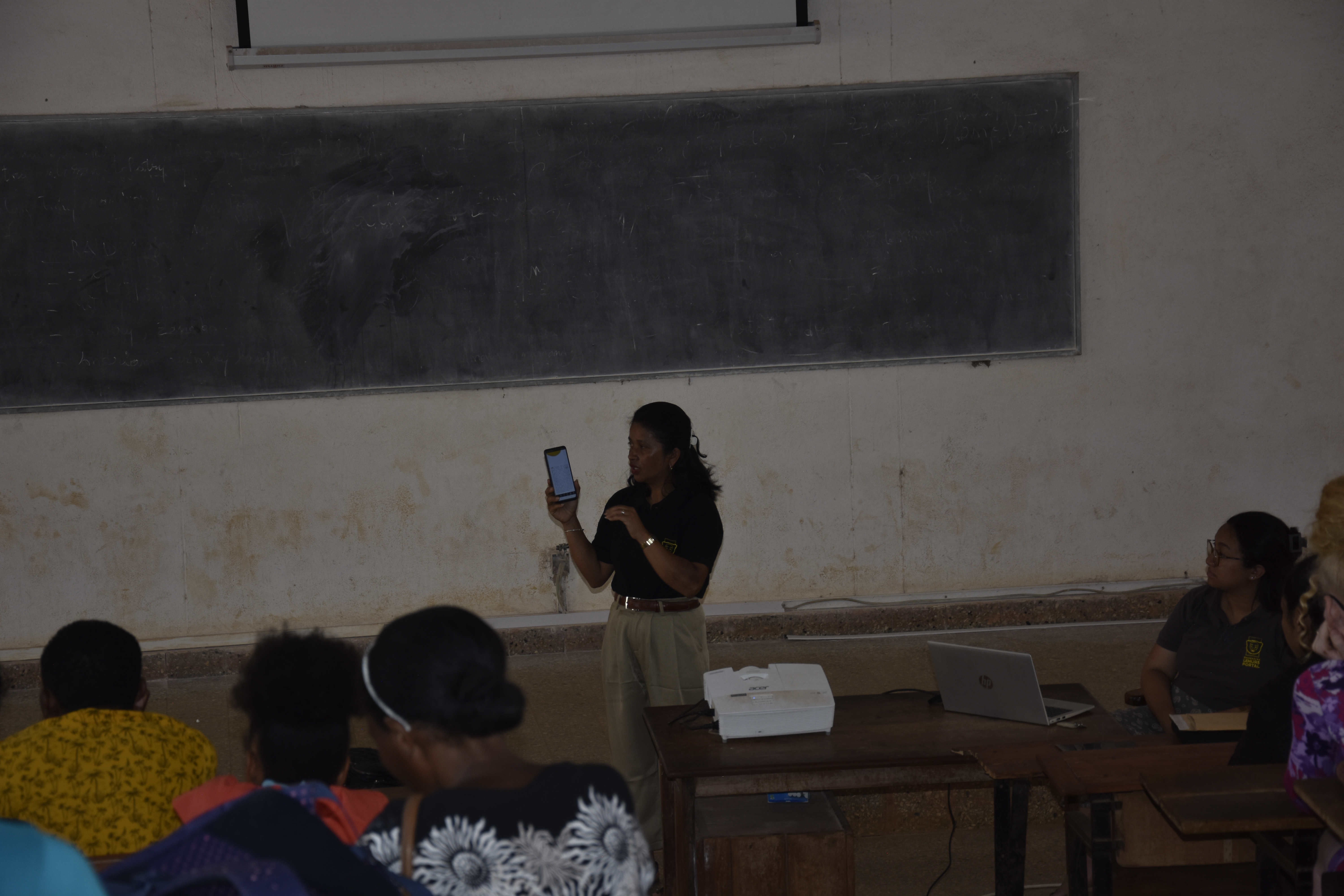
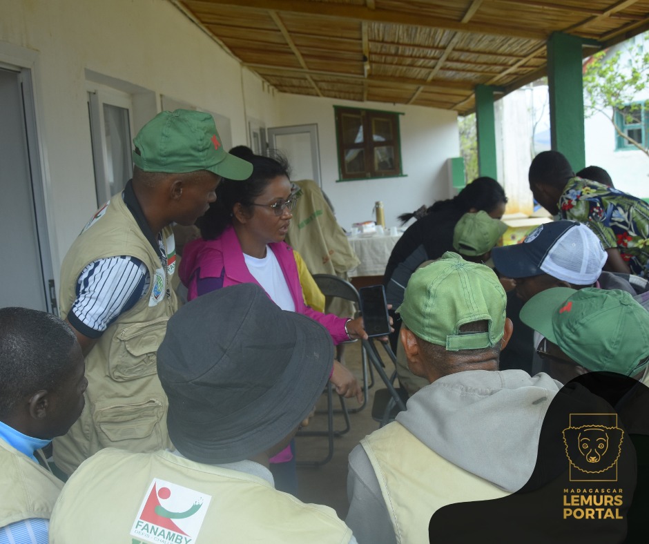
- Training workshops and educational sessions—especially on the use of technology—for local communities, conservation teams, and students, enabling them to contribute to and benefit from the portal.
- Integration of feedback from stakeholders to refine and improve tools and processes.
- Educational outreach to promote conservation literacy and foster shared responsibility for the environment.
Leçon apprise
While data openness is important, some sensitive information such as the exact location of endangered species must remain restricted to protect biodiversity. Additionally, training and outreach efforts must account for technological and language barriers to ensure equitable participation. For example, local dialects and offline alternatives may be needed to reach more remote or marginalized groups. Sustained funding is also essential to maintain these educational and communication activities over time, ensuring they evolve with user needs and remain impactful in the long term.
Impacts
Portal (MLP) generates measurable environmental, social, and economic impacts through the use of inclusive, community-based digital tools.
- Environmental Impacts
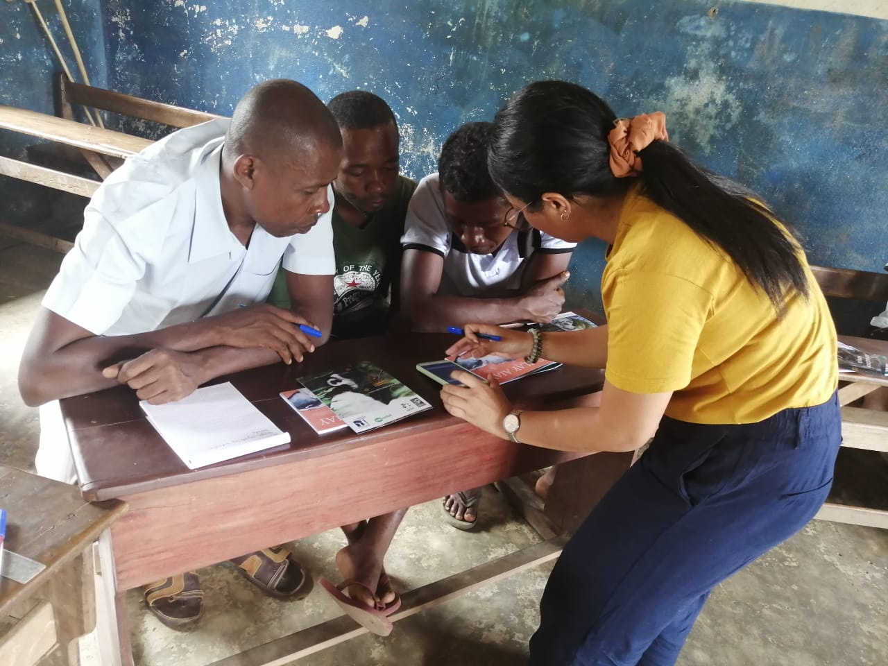
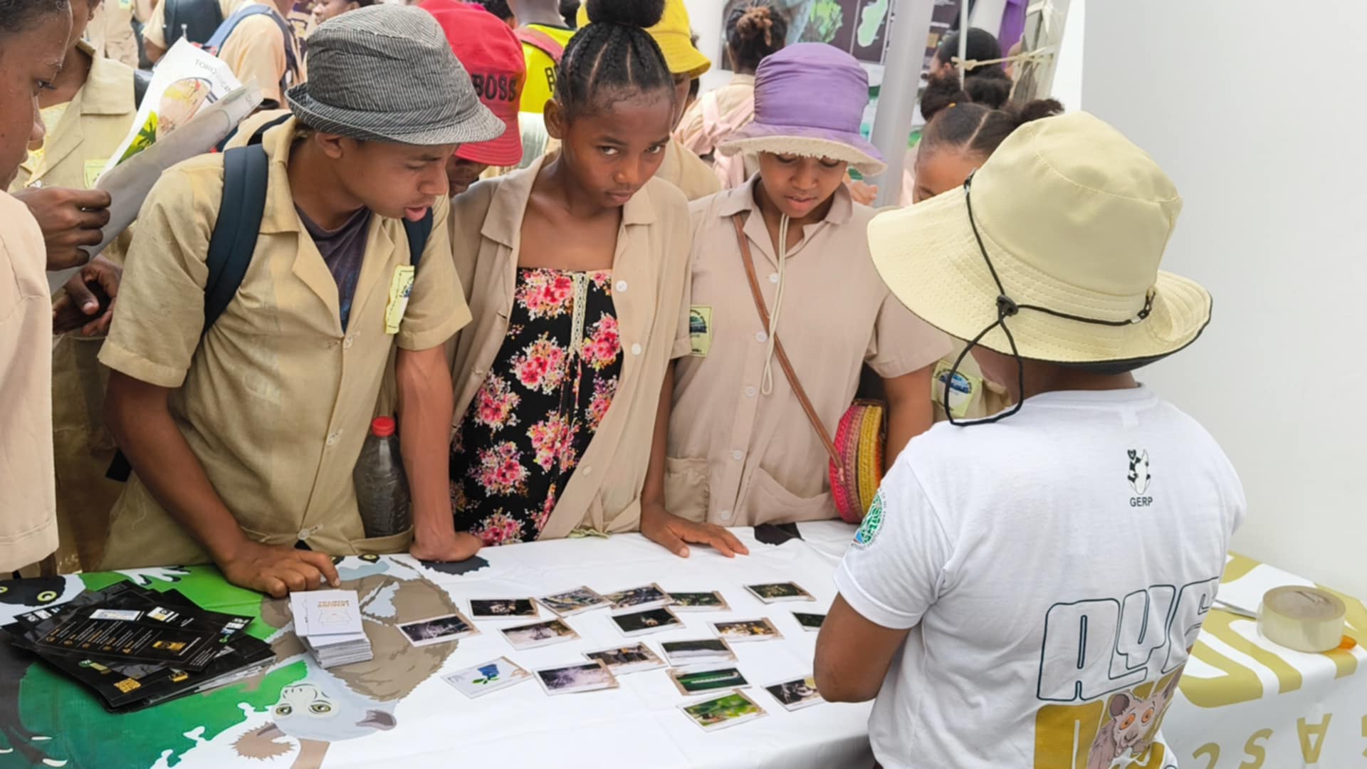
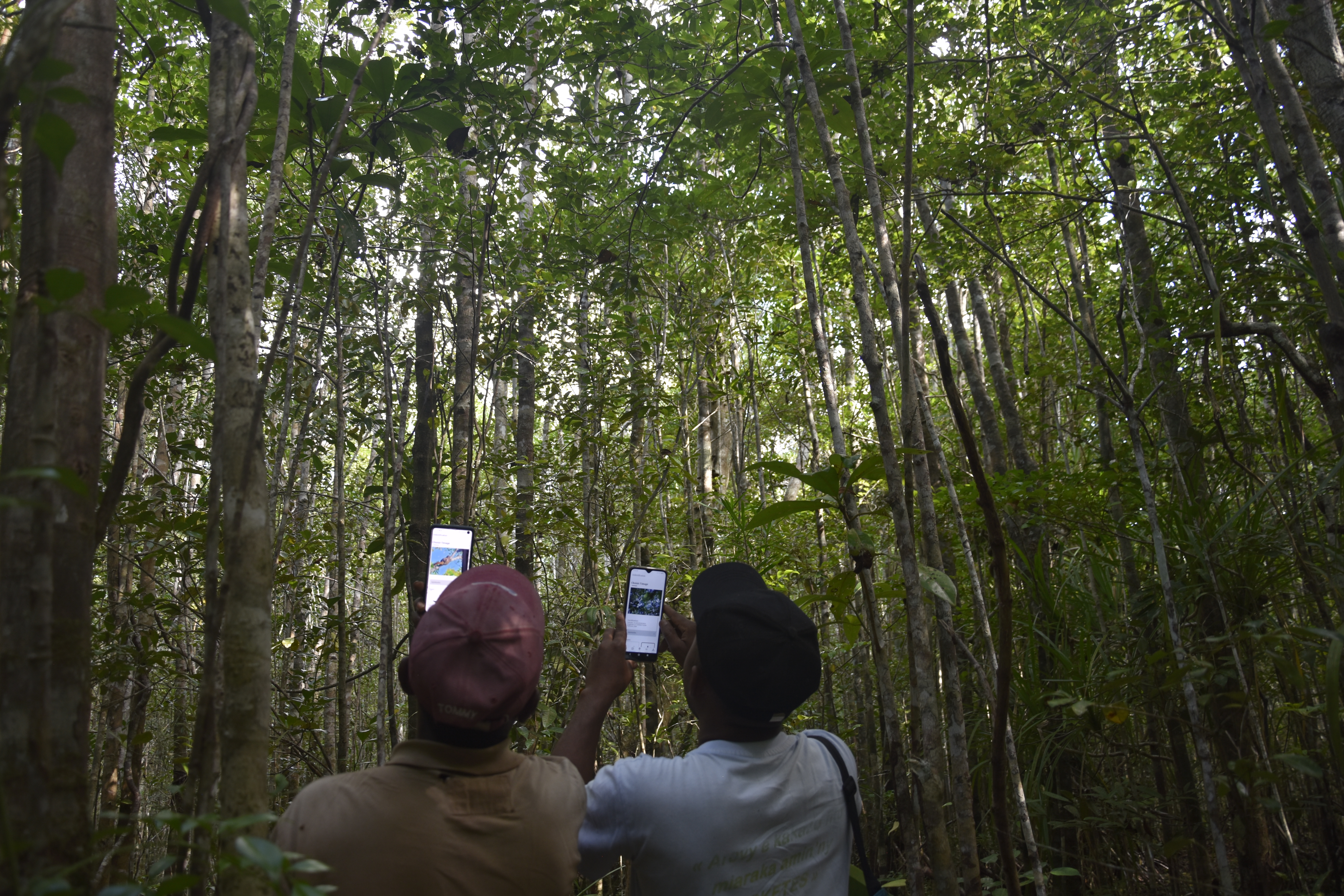
The official launch of the mobile application in 2024 marked a major step in enhancing ecological monitoring. Field agents from Ankarafantsika Madagascar National Parks (MNP) have tested the tool across seven parcels of the protected areas, using its geolocation, offline access, and mapping features. To date, over 2,080 lemur observations have been recorded and are pending validation. These data directly support habitat protection, species monitoring, and evidence-based conservation planning.
- Social Impacts
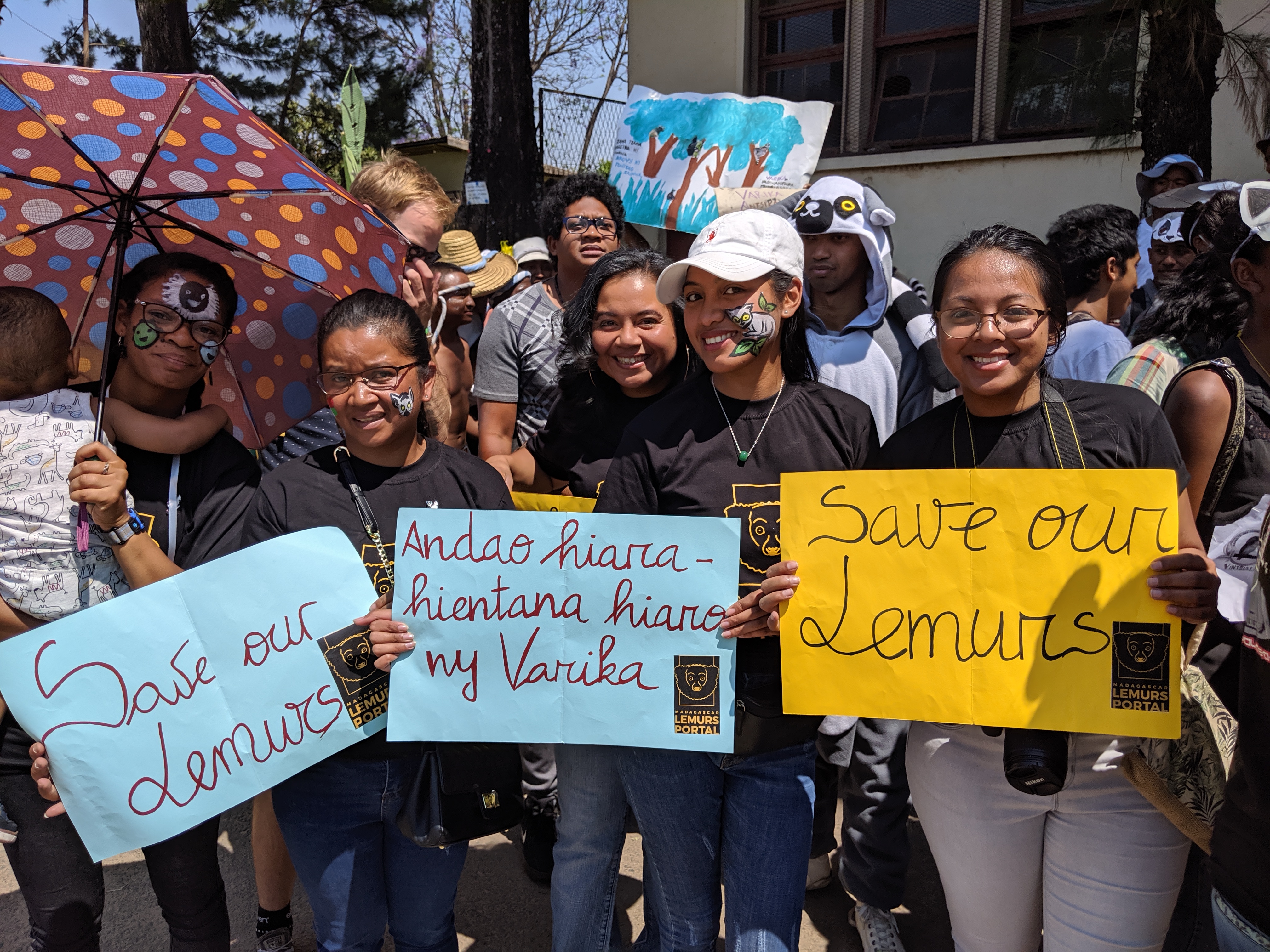
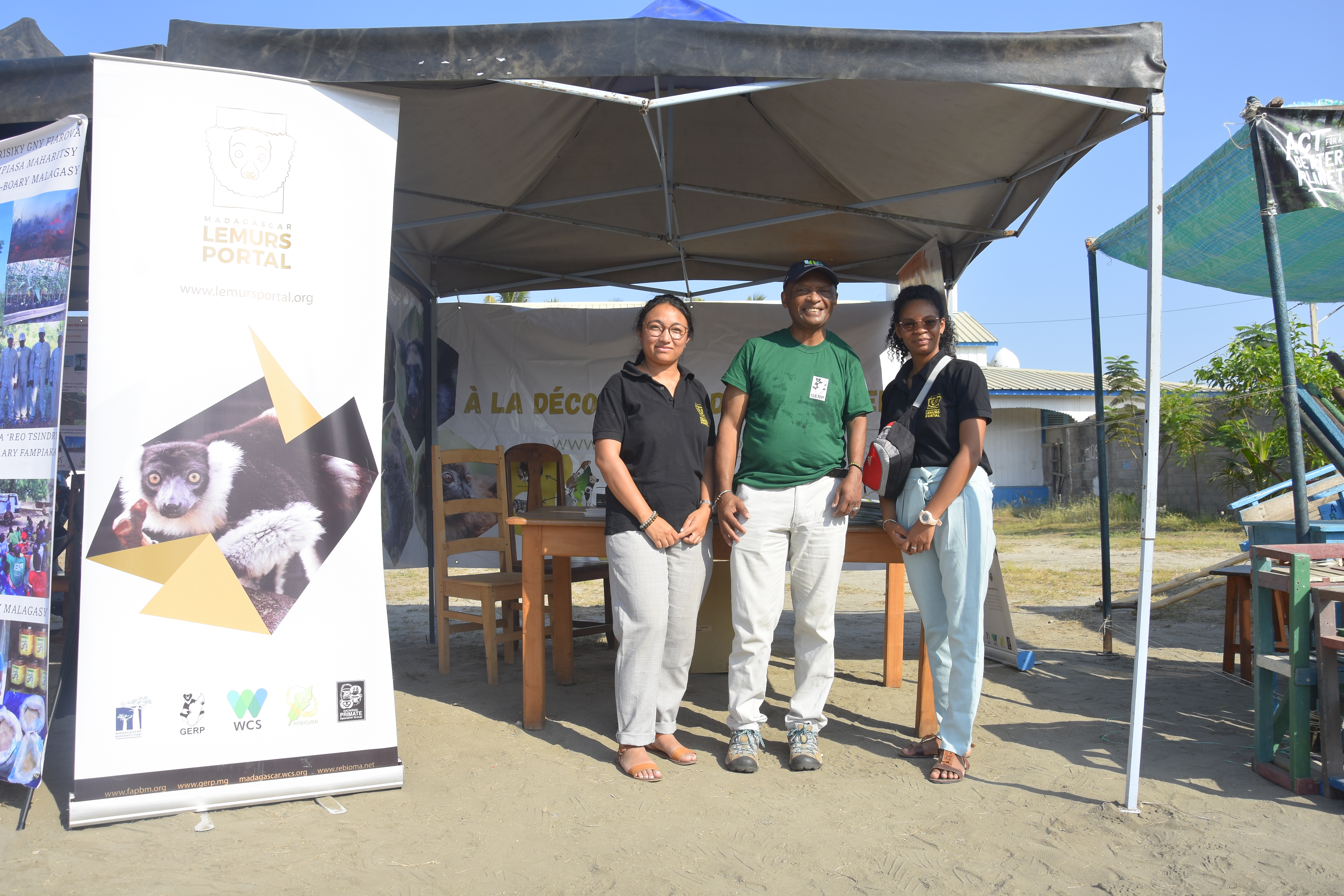
More than 190 stakeholders—including park managers, patrol teams, students, and local communities—have been involved in training and awareness activities. Educational tools such as lemur fact sheets and field demonstrations have increased knowledge of biodiversity conservation and fostered a sense of ownership and engagement in data collection. The solution strengthens local capacity and encourages long-term participation in citizen science.
- Economic Impacts
MLP contributes to sustainable development by integrating digital tools into Madagascar’s ecotourism and conservation sectors. The platform supports local livelihoods by enhancing the visibility of protected areas and promoting responsible wildlife tourism.
Bénéficiaires
MLP supports local communities, park managers, students, researchers, and NGOs with tools for biodiversity monitoring, training, and data sharing. It strengthens conservation efforts, promotes sustainable tourism, and empowers communities through knowledge.
En outre, expliquez le potentiel d'évolutivité de votre solution. Peut-elle être reproduite ou étendue à d'autres régions ou écosystèmes ?
Madagascar Lemur Portal is highly scalable and adaptable to any type of ecoregions or ecosystems. The mobile application and database structure are designed to be flexible, allowing it to adapt to different biodiversity contexts. By modification of the species database and geo-location features, the platform can be extended to the monitoring of other fauna or flora in similar ecological settings. The open-source policy and user-friendly design also allows for replication, enabling local communities, researchers and conservation organizations worldwide to adopt and adapt the technology for effective biodiversity conservation.
MLP’s open-source policy and intuitive, multilingual interface make it accessible to a wide range of users, including those in regions with limited technical infrastructure. The platform’s adaptability allows conservation organizations, researchers, and local communities worldwide to replicate and modify the technology to suit their specific conservation needs.
By combining low-cost digital tools, offline functionality, and participatory data collection, MLP offers a replicable model for inclusive, data-driven biodiversity conservation—especially in areas where access to reliable ecological information is limited.
It is also cost-effective as ecological monitoring of lemurs in Madagascar's 101 terrestrial protected areas costs around 450,000 US dollars per year. By using this mobile application, it would cost less than half of this amount.
Cadre mondial pour la biodiversité (CMB)
Objectif 1 du GBF - Planifier et gérer toutes les zones afin de réduire la perte de biodiversité
Objectif 3 du FBG - Conserver 30 % des terres, des eaux et des mers
Objectif 4 du GBF - Stopper l'extinction des espèces, protéger la diversité génétique et gérer les conflits entre l'homme et la faune sauvage
Objectif 20 du GBF - Renforcer le développement des capacités, le transfert de technologies et la coopération scientifique et technique en faveur de la biodiversité
Objectif 21 du cadre stratégique pour la biodiversité - Veiller à ce que les connaissances soient disponibles et accessibles pour guider l'action en faveur de la biodiversité
Objectif 22 du FBG - Assurer la participation de tous à la prise de décision et l'accès à la justice et à l'information relative à la biodiversité
Objectifs de développement durable
ODD 3 - Bonne santé et bien-être
ODD 4 - Éducation de qualité
ODD 15 - Vie terrestre
ODD 17 - Partenariats pour la réalisation des objectifs
Histoire

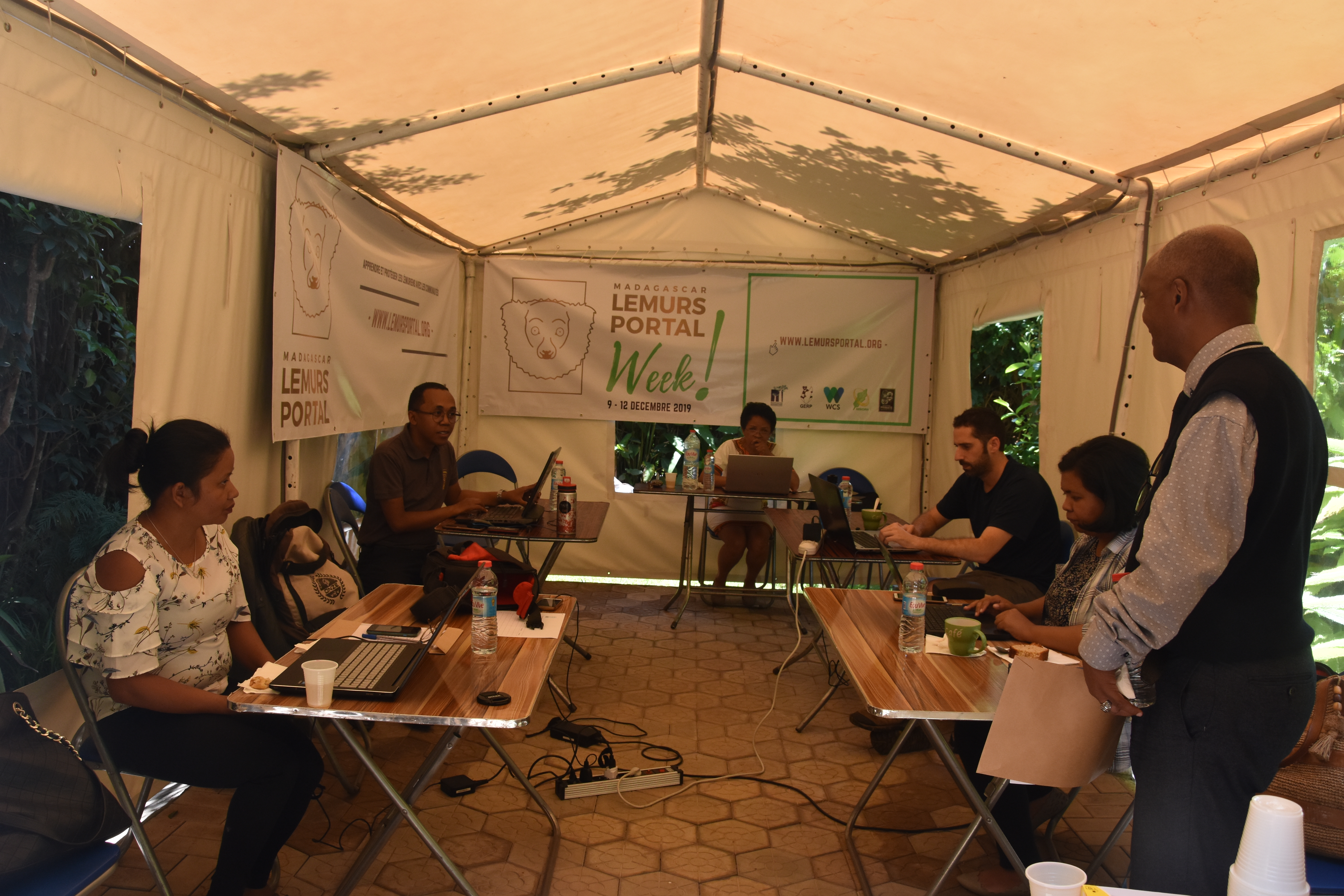
Mobile app testing
MLP
The idea for MLP germinated when a passionate group of conservationists saw a critical challenge in lemur conservation: the lack of centralized data and information about lemur populations across Madagascar. Despite growing global interest in these unique primates, there was a significant gap in resources for real-time collaboration and data sharing among researchers, park managers, and local communities.
In 2016, JRS Foundation, FAPBM, GERP, and WCS came together to create a solution. They realized that to protect lemurs effectively, a digital platform was needed for data collection, information sharing, and collaboration. The goal was simple yet ambitious: create a platform where local communities, researchers, and park managers could all contribute to lemur conservation.
This vision materialized as MLP, combining a user-friendly website with a robust scientific database. By enabling real-time data sharing, the portal bridged the gap between local, national, and global conservation efforts, becoming a vital tool for anyone working to protect Madagascar’s extraordinary biodiversity.
Developing the portal was challenging in that the team faced limited technology access in remote areas, the need for an intuitive platform, and securing funding. Despite these, the team’s commitment to Madagascar's wildlife remained strong.
In 2021, the development of a mobile application became essential to align with technological advancements and improve user experience. The mobile app aimed to make the portal accessible to broader audiences, including for environmental education, ecotourism, and the public. This phase was supported by funding from Re:wild.
By 2024, after rigorous testing and feedback, the mobile application was officially launched. Local guides, park rangers, students, and researchers began using the app to collect and share real-time data on lemurs and their habitats. This immediate access to data facilitated rapid conservation actions and enhanced the management of Madagascar’s protected areas.
Today, MLP project stands as a testimony to the power of collaboration, technology, and innovation. It is not only a platform for scientific research and monitoring—it’s also a tool that empowers local communities, providing them scientific and highly technical resources but yet simple, citizen science oriented, to protect their natural heritage. MLP shows how combining technology with local knowledge and global partnerships can create lasting, transformative change in biodiversity conservation.

