Community-based Mangrove Conservation and Rehabilitation
Full Solution
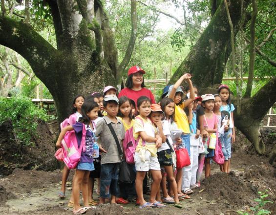
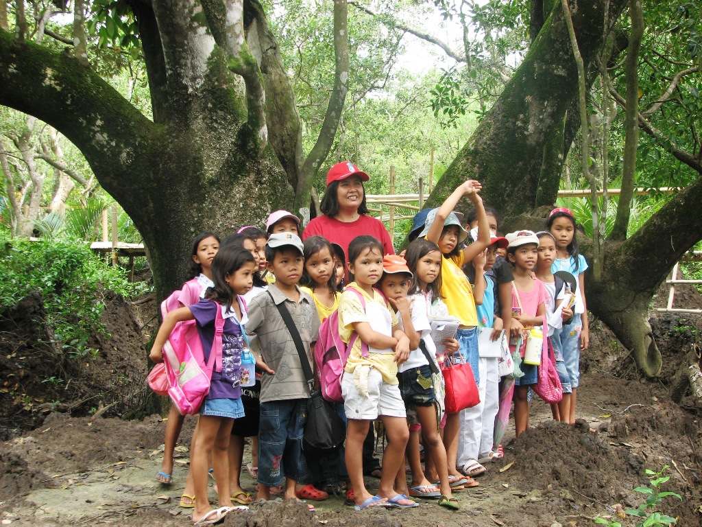
Schoolchildren visiting Ecopark (© ZSL - Lopez)
Mangroves and beach forests provide coastal greenbelts that act as a protective buffer to sea level rise and storms. Moreover, they are particularly effective in mitigating global warming and rising carbon dioxide levels by capturing and storing carbon in both above- and below-ground biomass. On Panay Island, protection of remaining mangroves and rehabilitation of degraded areas is carried out by local communities and supported by local governments.
Last update: 30 Sep 2020
10491 Views
Photo and video gallery

Context
Challenges addressed
- Increasing frequency and intensity of typhoons as impacts of climate change
- Low survival rates of seafront mangrove plantings due to lack of science-based protocols
- At present the mangrove-fishpond ratio is 1:1, which is way below the 4:1 ratio required for ecological sustainability
Location
Panay, Western Visayas, Philippines
Southeast Asia
Process
Summary of the process
Seafront planting
- biophysical considerations (use of seedlings, assisted natural regeneration, site selection, breakwater)
- nurseries
- outplanting
- protection and maintenance
- monitoring protocols
Eco-park development
- engaging local government
- organizing local communities
- mapping
- municipal ordinance
- training park managers
- launching
Pond reversion
- establishing tenure of fishponds
- biophysical reversion to mangroves
Building Blocks
Seafront Mangrove Planting
Local communities are empowered to protect remaining mangrove forests using science-based methods for communities to rehabilitate lost forest sites. To successfully rehabilitate the mangrove belt, it is crucial to use the right species for the respective sites in the upper and middle intertidal. Sites are selected during neap tides and young mangroves are protected by breakwaters to ensure their steady growth. For the plantings, wildlings are used that are either directly transplanted (to nearby sites if plants are big enough) or being reared in nurseries (for distant sites and/or if plants are small).
Enabling factors
- Sufficient scientific knowledge about mangrove processes or a mangrove area
- Translation of such knowledge into science-based protocols
- Organized, empowered local communities
Lesson learned
Mangrove species distribution and growth in a given setting are influenced by tidal elevation and flooding regime, salinity pattern, substrate and other factors. With each species requiring a particular set of environmental conditions, species selection in any restoration effort depends primarily on the species match for the physical characteristics of a given site, and secondarily on the objectives for mangrove restoration. One of the main challenges was therefore to overcome the persistent popularity of convenient, but wrong, mangrove planting practices among local government officials and nongovernmental organizations, and replace them with scientific-based planting practices. Furthermore, empowering local communities in protection and rehabilitation is the key to effective mangrove management.
Mangrove Eco-park
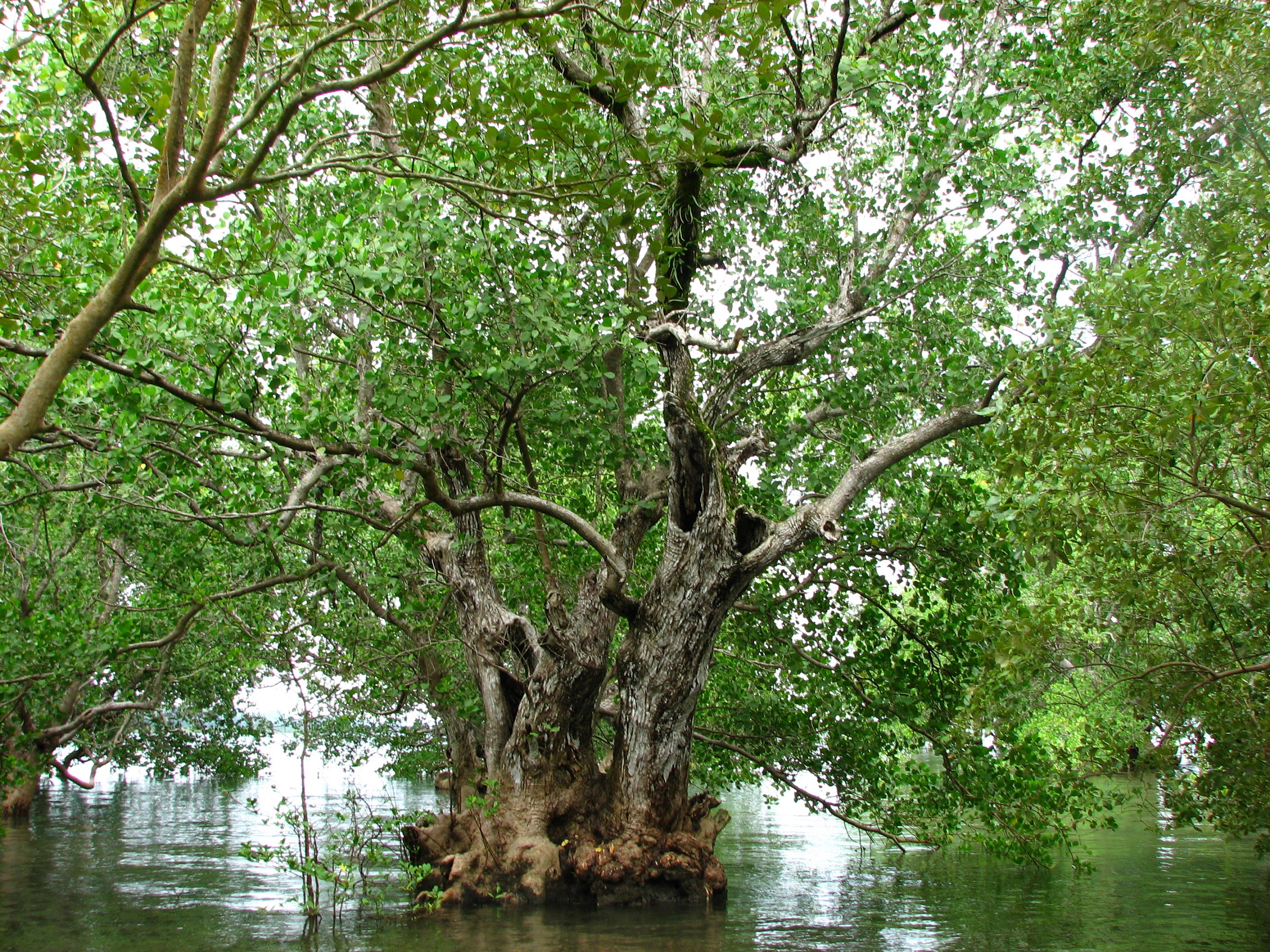
The establishment of the 44-hectare Kantunggan It Ibajay (KII) Eco-Park is part of CMRP's mangrove conservation projects. The eco-park is managed by local community groups (Bugtongbato Fisherfolk Association (BFA) and Naisud Mangrove and Aquatic Organization (NMAO)) and helps raise awareness of the importance of mangroves, while providing valuable additional income for the local communities who manage the park. The eco-park has over 1 km of boardwalks for visitors to explore the mangrove forest and associated wildlife. Entrance fees are used for park maintenance.
Enabling factors
- Empowered and dedicated local communities
- Support of local government
Lesson learned
- Importance of political will (over a 13-year period, the ecopark was established only under the 3rd mayor who was pro-environment, unlike the other two)
- Available scientific data (guided the location of footwalks, etc.)
Reversion of abandoned Ponds to Mangroves
To attain the 4:1 mangrove-pond ratio required for ecological sustainability, there is need to focus on reverting abandoned ponds to mangroves. A pond inventory, based on satellite imagery and technical surveys of all fishponds, is conducted and fed into a central database. After determining tenurial status, policy recommendations are made regarding the ponds’ reversion into mangroves. Combined with the outcome of planting trials, a Mangrove Rehabilitation Plan is drawn up. This plan provides methodologies for physical (restoring of natural hydrology) and biological reversion (active planting of suitable species) of fishponds to mangrove areas.
Enabling factors
- Supportive local government
- Sufficient scientific knowledge about mangrove processes or a mangrove area
- Translation of such knowledge into science-based protocols to guide pond-mangrove reversion
Lesson learned
Planting is only the first step towards restoring mangroves. During the initial 1-2 year period, the plants are vulnerable to various manmade and natural stressors. Therefore maintenance and monitoring are two other major activities in mangrove rehabilitation, aside from bagging seeds or seedlings and planting proper.
Impacts
Socio-economic
- Food security
- Mangrove plantation for domestic consumption
- Higher income for local cooperative members who manage the mangroves
Ecological
- Increase in biodiversity (27 out of 35 mangrove species in the Philippines)
Educational
- Increased awareness of mangrove importance among local communities, out-of-town visitors, and especially schoolchildren and students who use the eco-park as a living laboratory
Beneficiaries
Local communities and governments, students as well as the whole society.
Story
The success story of Vincenzo Sagun town in Zamboanga del Sur is one of mangrove destruction and subsequent rehabilitation by the local community, with the continuing support of various NGOs and LGUs. Large tracts of the 496-ha mangrove area were cleared for pond development in the 1980s-1990s. This negatively impacted livelihoods (from reduced fish catches), compromised food security (no more shellfish gleaning), and threatened safety of fishers (from storms and pirates in offshore waters).
From 1992 through 2010, mangrove reforestation and coastal resource management (CRM) programs were initiated and funded by a series of NGOs – PAMALAKAYA, CoSEED, Lutheran World Service, Christian Aid and Philippine Tropical Forest Conservation Foundation (PTFCF). The latter collaborated with CoSEED on a project which rehabilitated more than 200 ha of mangroves, including 26.5 ha of abandoned ponds. With the PO-NGO-LGU networking efforts, thousands of hectares of mangroves and abandoned ponds have been turned over to the local government and protected by a municipal ordinance that also established a fish sanctuary.
Aside from LGU involvement, enabling factors were the empowerment of the community itself through NGO support, effective IEC (e.g., training courses, billboards), and conversion of poachers and illegal pond operators to mangrove conservationists. The Bgy. Bantay Katunggan Task Force (BBKTF) was integrated into the Municipal Development Plan and deputized to apprehend violators. BBKTF members were provided zero interest loans, free health insurance, patrol equipment and gears, guardhouse and mangrove foot walk. Two decades of mangrove and CRM initiatives have stopped mangrove cutting and illegal fishing; restored fish and wildlife diversity, increased fisheries catches and fishers’ income, and allowed women to harvest shellfish once more and men to fish in the safety of municipal waters.