Integrated Spatial Plan.
A. Damar
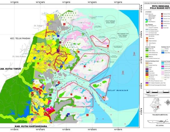
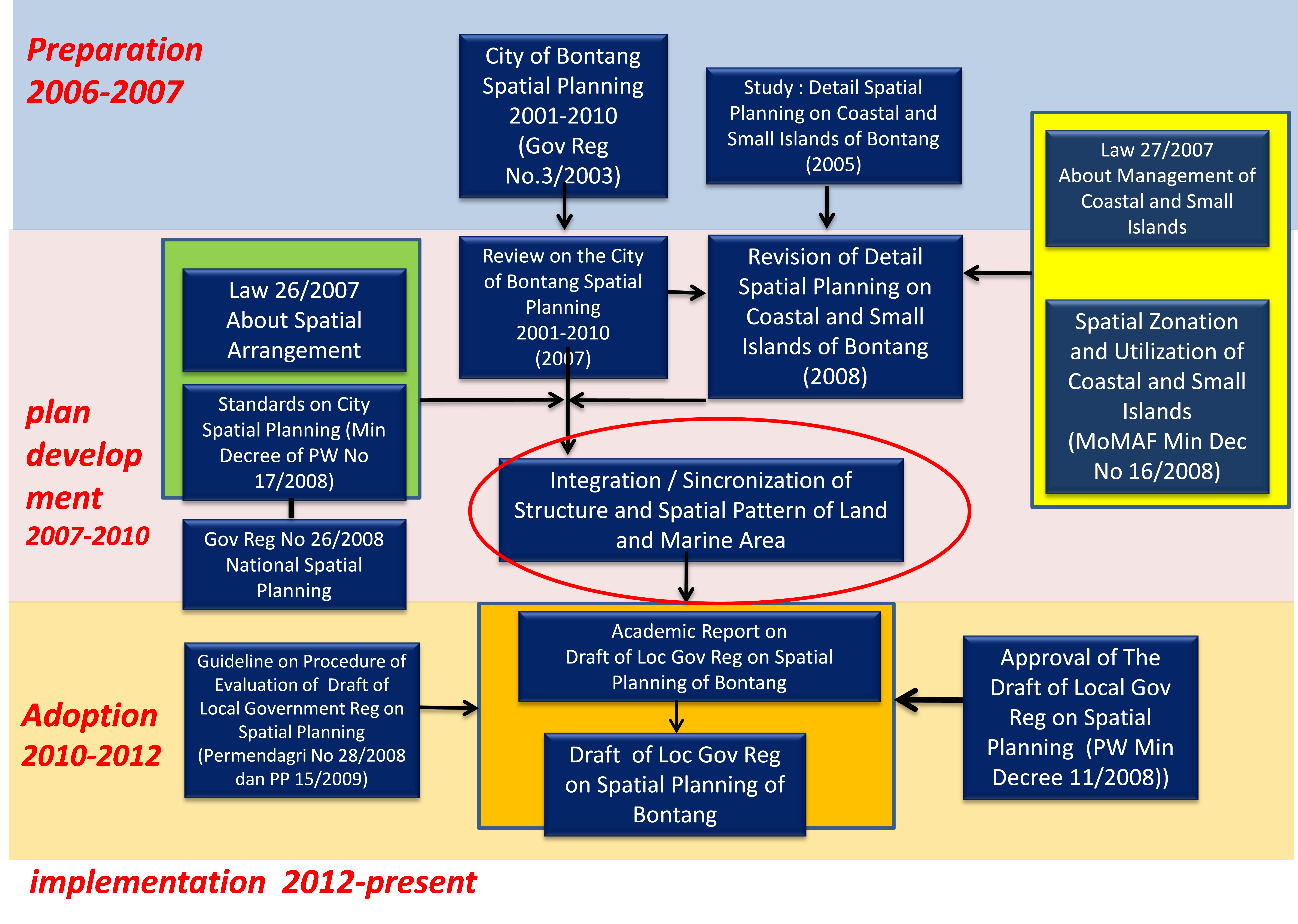
About of 80% of Indonesia’ coastal districts have only land-based spatial planning, with the marine realm being neglected. The ‘solution’ is a novel approach to integrate land, coastal and marine ecosystems into spatial planning. It was started by a group of young and enthusiastic middle level governmental staff of Bontang City who were really keen on Integrated Coastal Zone Management (ICZM), part of them being trained on ICZM at our university. These people were our main human capital and pre-condition for the success of our ‘solution’. We were very lucky to have them. The head of Bontang City Development Board was also supporting this idea and committed to fund the revision of Bontang City Spatial Plan. The ‘old’ Bontang City Spatial Plan only focused on land-based considerations and did not include any marine aspects. After overcoming the administrative obstacles we started designing the study methodology, strategy of data collection and, most importantly, the discussion with various stakeholders of Bontang City. Identifying key persons of each stakeholder group was a really important step. We selected key persons from each stakeholder group who were open minded for new ideas and approaches and willing to cooperate, and held a series of discussions. In parallel, we prepared the spatial analysis of the area. Ecosystem links and functions were analyzed and mapped. Environmental and socio-economic profiles of the area were identified and spatially projected into a map based on each topic. Various experts collected field data and information as well as issues related to each aspect. After environmental and social profiles had been analyzed, we identified the main issues, root problems, spatial conflicts, causes for ecosystem degradation, poverty level, environmental protection efforts, management efforts, etc. The main output of our solution is an integrated Bontang City Land-Coastal-Marine Spatial Plan, presented in a single spatial planning map. In the new integrated spatial plan of Bontang City, coastal and marine entities linked to the spatial allocation of economic functions both in land and marine areas. In 2012, the integrated spatial plan of Bontang City had been adopted by the local parliament and started to be implemented, and may now be adopted in other coastal districts in Indonesia.