Implementing the ArcGIS Protected Area Management Solution for holistic landscape monitoring in the West Lunga ecosystem, Zambia.
Full Solution
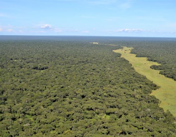
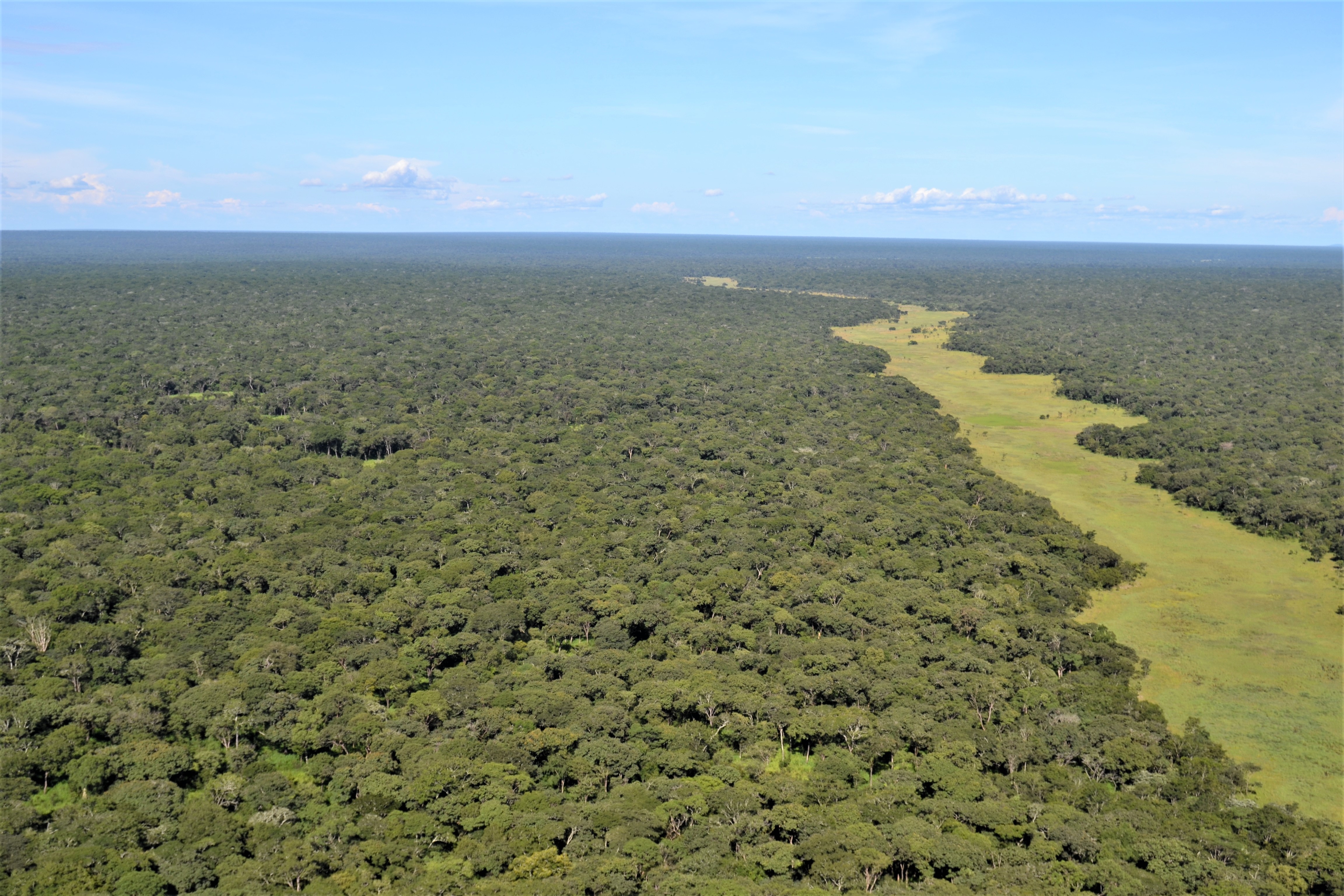
The West Lunga ecosytem
DorianTilbury
Protected areas are faced with numerous ecological, social, and economic challenges both inside and outside their boundaries. Most of these challenges occur over vast spatial scales and are often magnified by a lack of resources to adequately monitor and respond to challenges. The ArcGIS Protected Area Solution (PAM) is an effective way to address these challenges holistically and at scale. PAM allows users to rapidly configure several workflows for effective area management.
M.A.P Scientific Services implemented PAM for the West Lunga Conservation Project (WLCP) in West Lunga National Park, Zambia. The Solution targeted workflows that improve monitoring of the area, these included remote sensing of deforestation and wildfires, law enforcement, wildlife sightings, and community outreach. Outcomes have allowed for improved monitoring and evidence-based management of the protected area that benefits conservation and communities whose livelihoods are intrinsically dependent on the West Lunga ecosystem and its services.
Last update: 26 Sep 2022
1733 Views
Context
Challenges addressed
The West Lunga ecosystem is vast and remote, consisting of West Lunga National Park, surrounding game management areas, and traditional land that covers ~11 754 km squared. The long-term goal for WLCP is to make this landscape ecologically, socially and financially sustainable.
Threats to the ecosystem include the loss of fauna and flora due to human encroachment, unsustainable agricultural practices, poaching, and wildfires. To mitigate these threats, WLCP has supported the Department of National Parks and Wildlife to increase their law enforcement capacity and implements local community initiatives to provide alternative livelihoods to enhance the long-term sustainability of the area. A major challenge was to effectively monitor these interventions at scale to make informed management decisions that take advantage of their limited resources.
This required monitoring of:
- Law enforcement.
- Wildlife sightings.
- Human-wildlife conflict.
- Community outreach initiatives.
- Deforestation and wildfires.
Location
Northwestern, Zambia
East and South Africa
Process
Summary of the process
The Protected Area Management Solutions and workflows require ArcGIS Online. As an organisation working in a protected area, one can apply for ArcGIS Online through the Esri Conservation Program. ArcGIS Online provides a secure and flexible framework to holistically support workflows of data collection, visualisation, and reporting related to protected area initiatives. Pre-configured workflows can be deployed immediately, or new workflows can be designed and deployed on ArcGIS Online. To ensure effective implementation and long-term use of the solution, continues training and support are required throughout the use of the solution.
Building Blocks
ArcGIS Online
The Protected Area Management Solution and workflows are built using ArcGIS Online as the foundation. ArcGIS Online is a cloud-based mapping and analysis solution. It gives users access to workflow-specific apps, maps, and data from around the globe, and tools for being mobile in the field. Users can use it to make maps, analyse data, and to share and collaborate. Your data and maps are stored in a secure and private infrastructure and can be configured to meet your mapping and IT requirements.
Enabling factors
- Organisations can apply for low-cost access to ArcGIS Online through the Esri Conservation Program by filling out the Technology assistance application. Alternatively, licencing can be purchased through a local Esri Distributer.
- ArcGIS Online is software-as-a-service (SaaS) cloud-based offering that requires an internet connection. However, tools are designed to work offline by default. Once surveys are downloaded, captured data will be saved in the device so it can be later synchronized.
Lesson learned
- ArcGIS Online allows you to create a great central destination for all your organisations monitoring data.
- ArcGIS Online can be daunting to configure if you are unfamiliar with GIS.
- There are rich resources for learning about ArcGIS Online, use them, especially the free Esri Training.
- Great Esri Community Forum for ArcGIS Online where you can post questions.
- There are several user types available based on the members’ needs and requirements. The user type determines the privileges that can be granted to the member. It is important to have a good understanding of which and how many user types your organisation needs.
- Organise your members into well defined groups to organise activities and data access.
Designing and Deploying Workflows
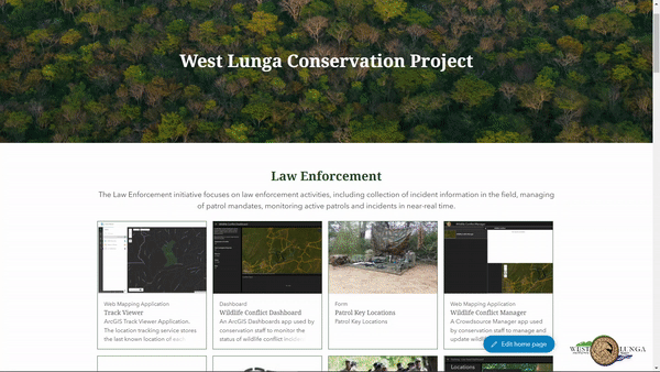
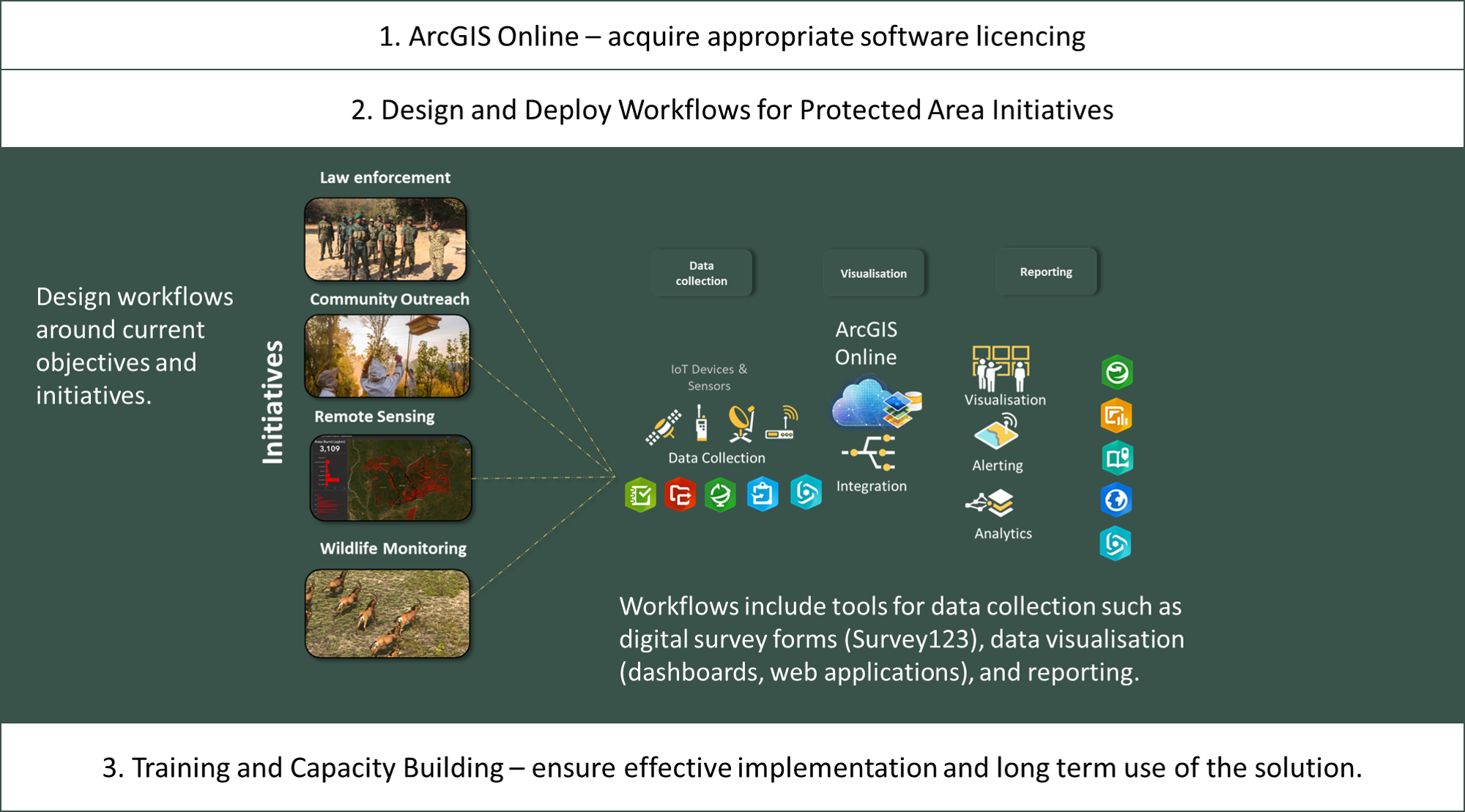
ArcGIS Online provides a secure and flexible framework for both deploying useful applications and integrating other conservation technology to holistically support workflows related to each initiative that is being implemented by a protected area. The foundation of all workflows includes tools for data collection such as mobile survey forms (Survey123), data visualisation (dashboards or web applications), analyses, and reporting. Additionally, the ArcGIS Living Atlas of the World gives you access to the foremost collection of geographic information from around the world to support your workflows, this includes the latest satellite imagery and products such as forest loss.
There are several pre-configured workflows for initiatives that can be unpacked and implemented immediately. These initiatives include:
- Track Illegal Activity.
- Monitor Wildlife.
- Mitigate Wildlife Conflict.
- Maintain Park Infrastructure.
The workflows are configurable and allows users to customise them based on their needs. Alternatively, organisations have access to all the necessary building blocks to develop entirely new workflows for their own initiatives e.g., a community outreach or public participation initiatives.
Enabling factors
- Listen to and work with the frontline practitioners to understand the problem and define the requirements before designing and deploying the workflow.
- There are several configurable applications available on ArcGIS Online, understanding how they work and how they can link with each other is crucial in developing effective workflows.
Lesson learned
- Follow the design, deploy, operate, and review strategy to develop a workflow and maximise its impact.
- Prototype and test before rolling out.
- Establish essential procedures and guidelines.
- Follow the best practices and trends.
- Experience in ArcGIS is hugely beneficial, alternatively use implementation partners to make the process easier and effective.
- Take advantage of the ArcGIS Community and online training resources.
Resources
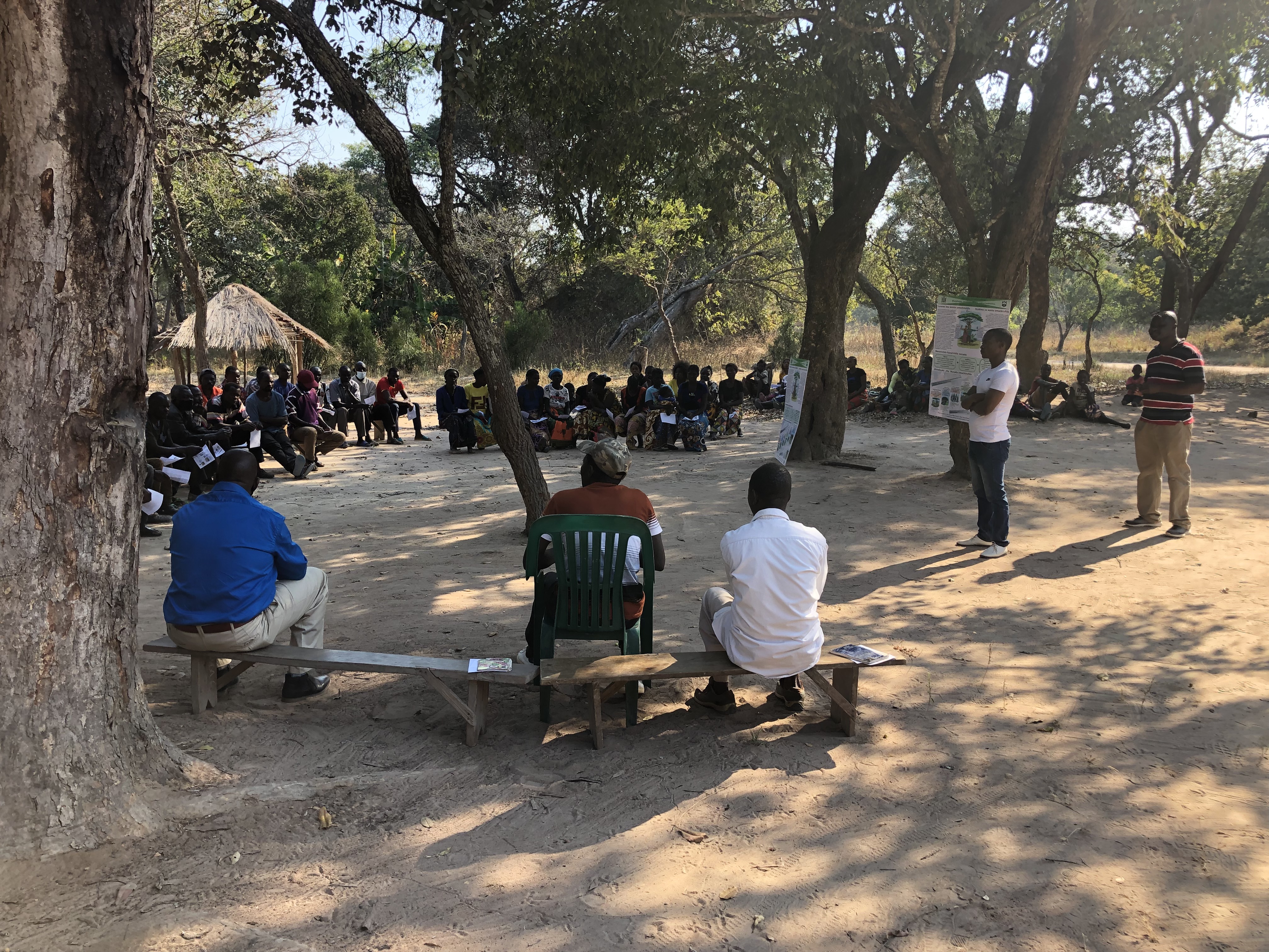
Training and Capacity Building
Training of staff is important to ensure the effective implementation and long-term success of the solution. Prioritise training during the designing and deployment phase, as well as after the deployment to ensure continued use of the solution.
Enabling factors
- Technical officers or champions to drive the training and use on the ground improve the chance of success.
Lesson learned
- Use the organisational reporting tools to track user engagement and usage to pinpoint when and if they are not using the applications as planned. Identify why there may be a problem, and work with them to overcome the problem.
- Language barriers can be an issue and forms need to be simple for effective data collection.
- Training should not be seen as a once-off exercise but rather a continuous process.
- Staff turnover is a reality and organisations need to ensure continuity by always having more than one senior staff member trained on the various workflows and administration of ArcGIS Online.
- Implementation partners can make training and long-term support of the solution more manageable.
Impacts
Eight paper-based workflows were digitised, and a remote sensing workflow was implemented aimed at improving data collection processes, and optimising key initiatives.
To date:
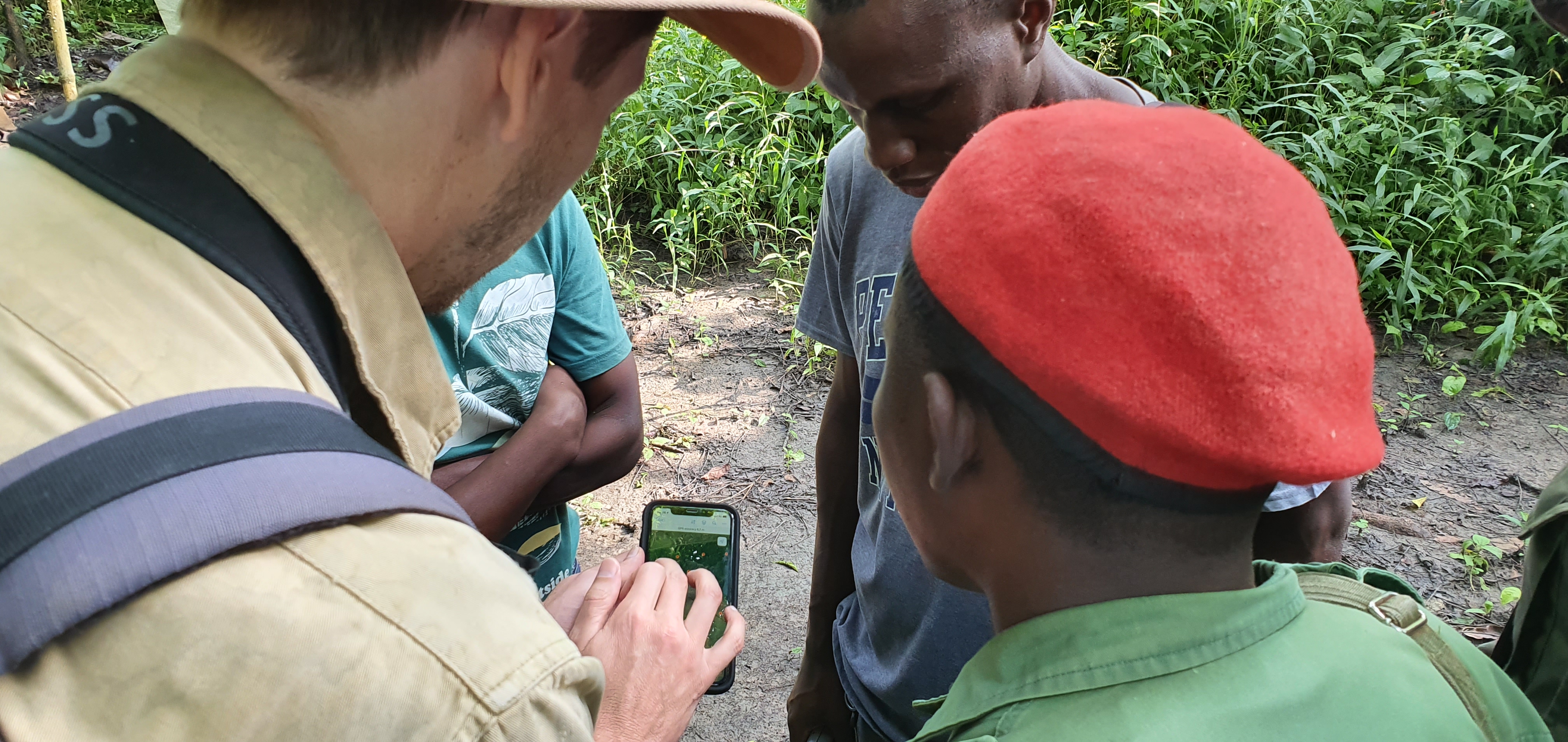
- ~25 users have been trained to use customised mobile applications to record:
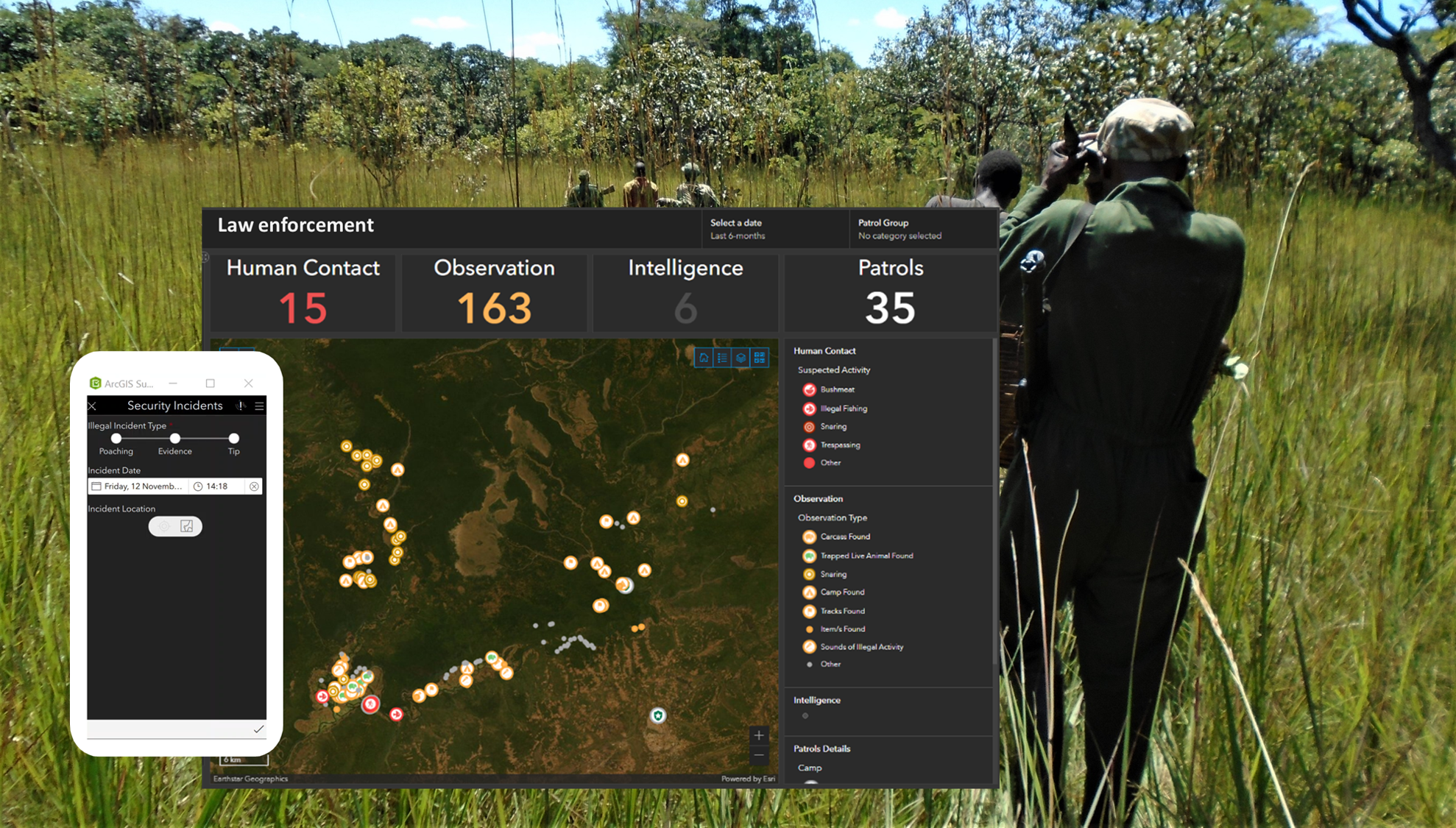
- Details on each law enforcement patrol and any incidents that occur during the patrol e.g., poaching, snaring, logging, or signs of illegal activity.
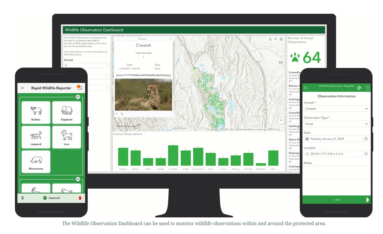
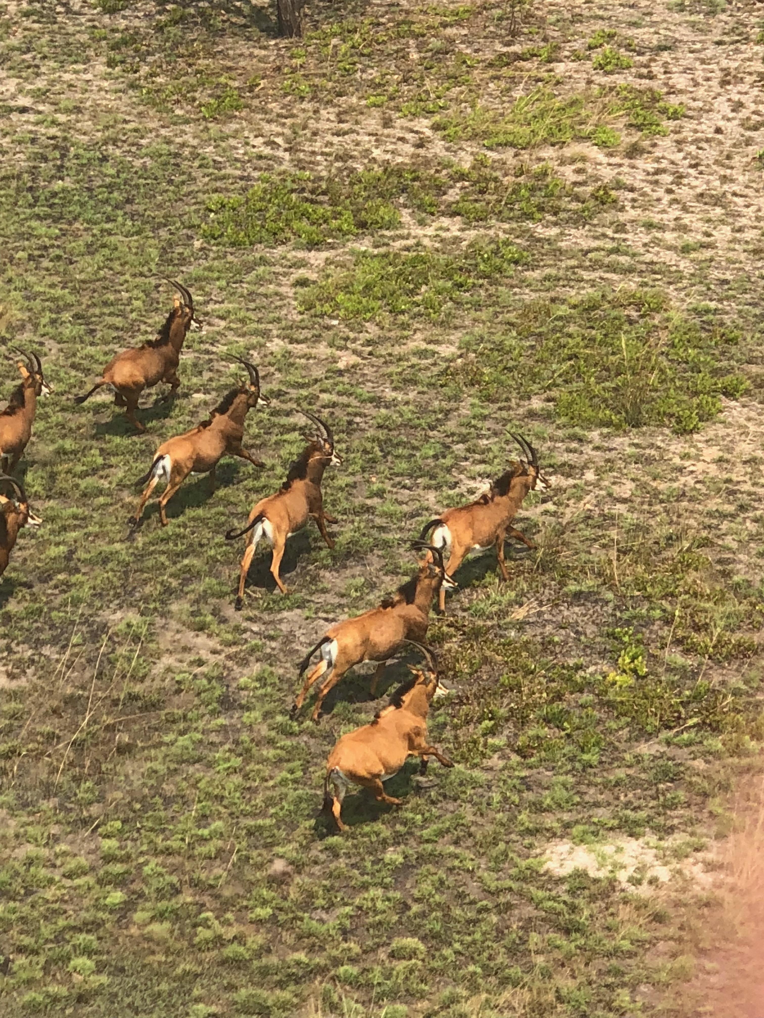
- Wildlife sightings.
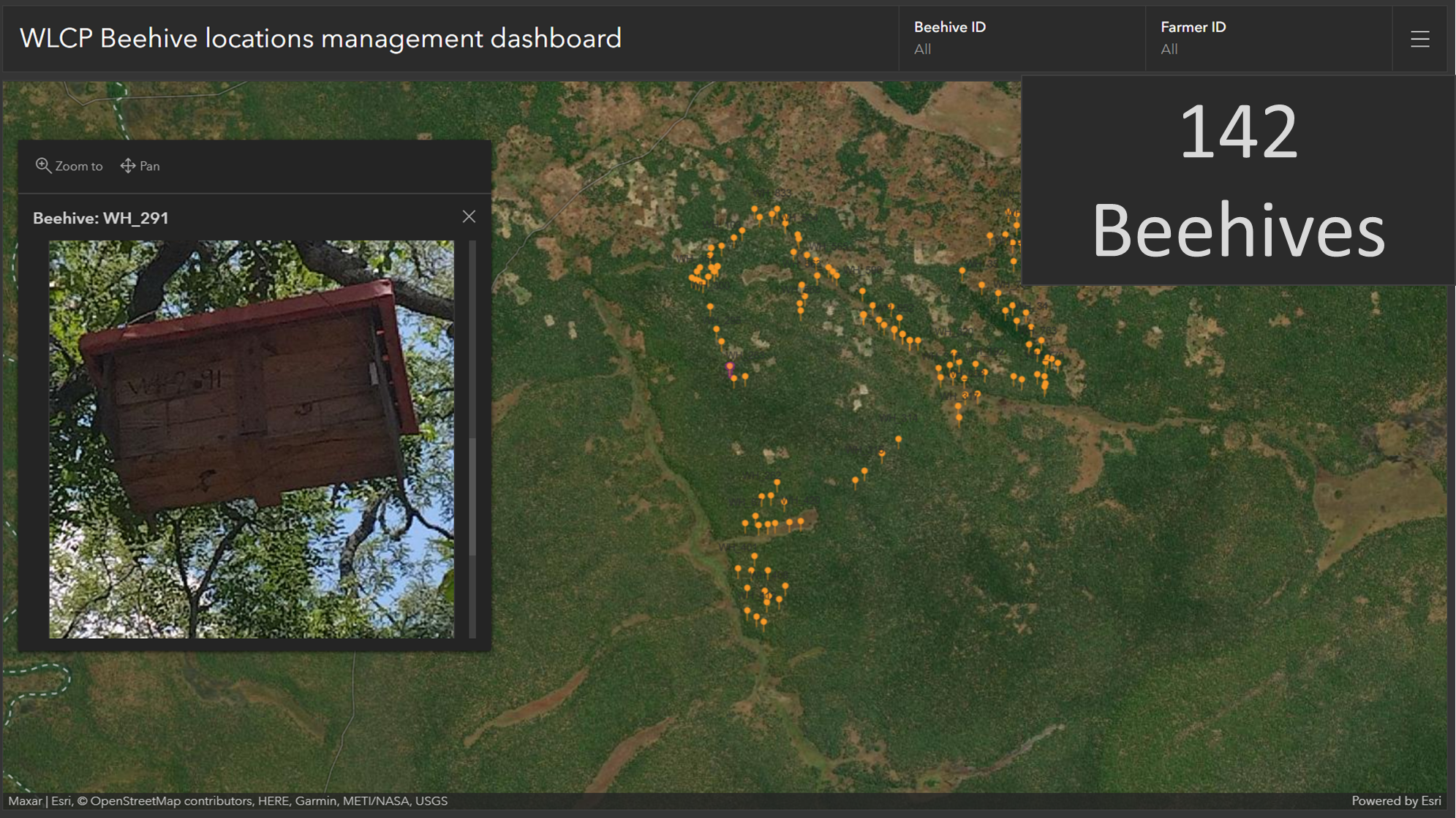
- Community outreach programs e.g., the location of farmers and their beehives to improve the efficiency of community outreach initiatives aimed at alternative methods of livelihood support.
- ~180 patrols have been conducted using the solution
- ~300 patrol incidents have been logged.
- Two full wildlife ground counts have been conducted using the solution.
- ~850 wildlife sightings have been recorded on 40 species.
- The location of ~8 000 beehives have been recorded within the ecosystem.
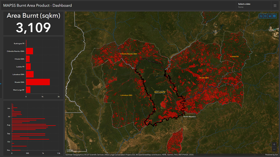
- The location and extent of ~15 000 fires were mapped.
On a single secure platform, park management, staff, and their partners can efficiently track data collection and assess their management initiatives in near real time, gaining evidence-based insights for where incidents are taking place, how wildlife populations are changing, whether community initiatives are successful, and what areas are vulnerable to over exploitation, illegal harvesting, and wildfires.
Beneficiaries
Beneficiaries include the West Lunga ecosystem, staff and managers of the protected area, and communities surrounding and living within the West Lunga ecosystem.
Sustainable Development Goals
SDG 2 – Zero hunger
SDG 12 – Responsible consumption and production
SDG 13 – Climate action
SDG 15 – Life on land
Connect with contributors
Other contributors
Andrew Purdon
M.A.P Scientific Services
Dorian Tilbury
West Lunga Conservation Project
