Integrated technology platform to support conservation – protecting wildlife and people
Full Solution

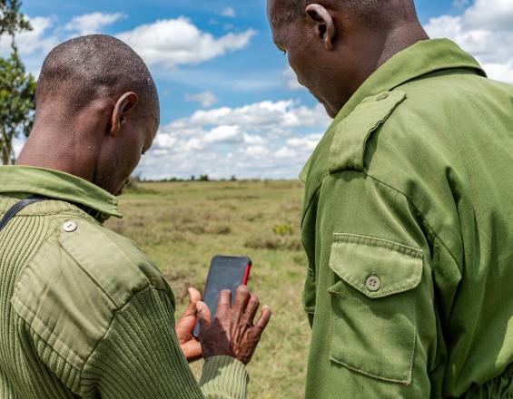
EarthRanger in the field
Ol Pejeta Conservancy
Ol Pejeta is home to the largest population of critically endangered black rhinos in E. Africa. Protecting them and other wildlife is a great responsibility and we utilize technology where it adds value. In 2019 we rolled out EarthRanger (ER), a software platform that collects protected area activity information (the animals and assets being protected, the rangers protecting them, and threats of potential poaching) into a single, integrated, real-time visualized operational platform. It amalgamates data from different sources including animal GPS tracking collars, ranger digital radio systems/vehicle trackers, and ranger recorded observations. ER allows us to see key information in one place, enabling informed and faster conservation-related operational decisions.
ER was developed in collaboration with Vulcan Inc. through our Conservation Tech Lab. The Lab acts as a field-based space for technologists and scientists to test and deploy solutions, but also as a center for collaboration, learning and sharing knowledge.
Last update: 14 Oct 2021
2256 Views
Photo and video gallery
Context
Challenges addressed
The main challenges include:
- Effective protection of endangered wildlife with limited resources and over large areas. The Conservancy covers 110,000 acres and with only 3 field-based teams patrolling at any one time, it is crucial that we can focus our rangers in the right places at the right times. It is also critical to automatically identify areas that are not adequately monitored/patrolled and measures to address this can be put in place
- Current methods of collecting and reporting field data (wildlife monitoring, anti-poaching, fencing) are largely manual and require updating. Digitising this will enable faster transfer of accurate data from the source.
- Navigating data sets and systems and accessing them quickly to inform decisions. We use a range of different technologies and data. Knowing where to look for what information and in full context was a challenge.
Location
Nanyuki, Laikipia, Kenya
East and South Africa
Process
Summary of the process
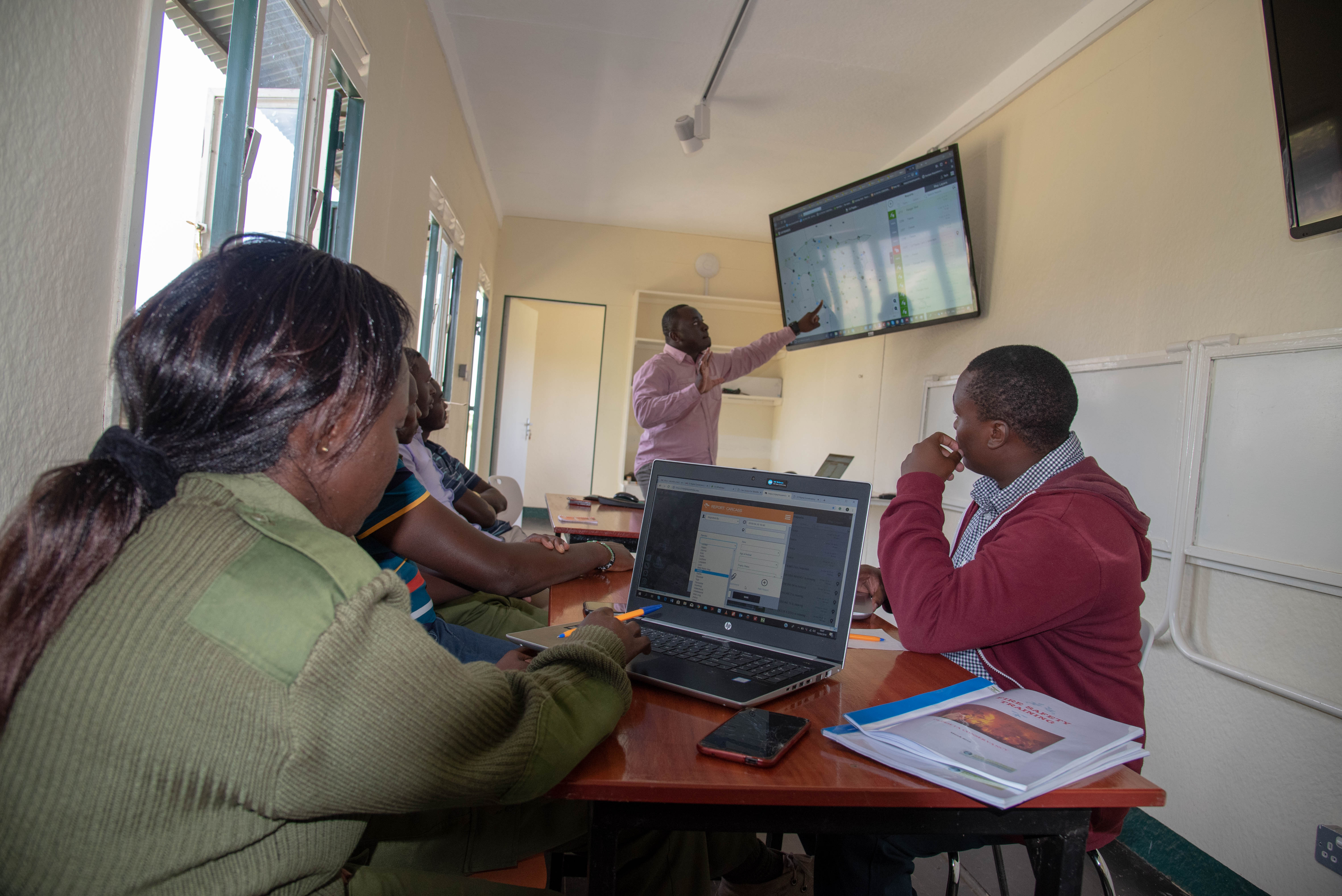
Building block 1 (platform solution design) provides the overall framework for the integration of different data sets. Building block 2 (ranger report design) is one of those data sets and a key source of information that underpins the platform. The platform and data sets work together to provide easy and quick access to the right information in one place to inform effective decision making. Digitisation of ranger reports allows faster transfer of accurate data. The visual display of different data also supports this decision making, allowing effective deployment of patrols in high-risk areas and rapid response to security and human wildlife conflict incidents. This supports effective operations, improving the security and health of wildlife and protecting community livelihoods.
Building Blocks
Integrated (EarthRanger) platform solution design
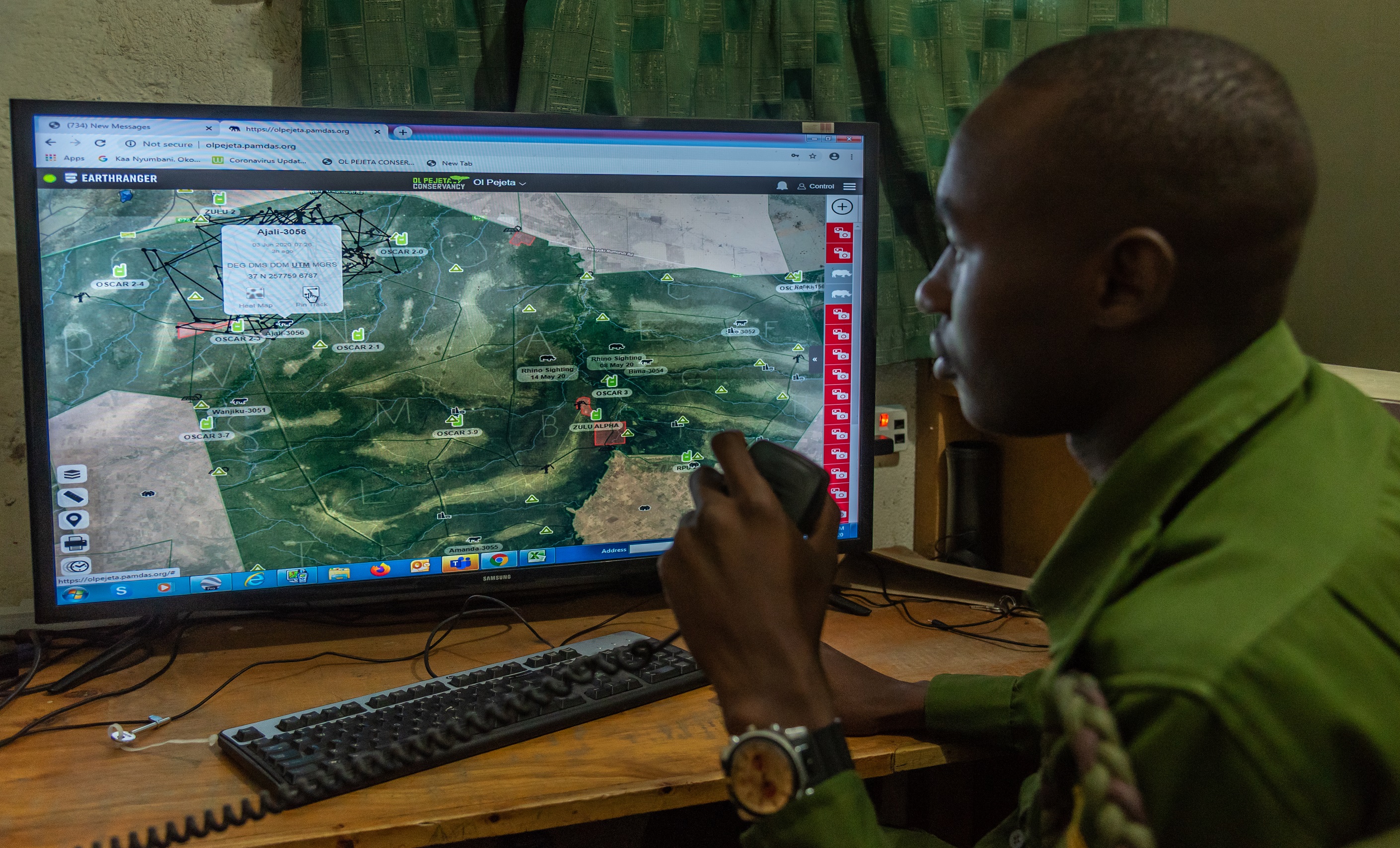
EarthRanger provides the platform for integration but the data sets and information to be integrated needed to be determined. Ol Pejeta therefore designed the platform solution, adapting it meet the conservancy’s needs – evaluating what information would be useful and how it could be integrated. This was partly based on what data was readily available as well as understanding the key factors in supporting critical operations. This included combining data from the field (animal, radio, vehicle tracking) to inform security and ecological monitoring efforts. Cameras that monitor wildlife corridors also provide alerts if vehicles, people, or animals pass by. The Conservancy also operates an integrated livestock and wildlife land management approach. Livestock bomas are mapped and if collared predators are close an alert is sent so teams can respond accordingly.
Enabling factors
- Problem solving – focus on what the needs are and exploring how technology can support rather than being solution led
- Operational focus – grounded in conservation, understanding all areas of operations, important data, and user requirements to inform solution design.
- Supporting infrastructure & systems – source platforms (digital radio, vehicle monitoring, animal tracking) to be in place to enable integration.
- Skills and partnership – technical skills within the team deploying the solution and or partnership with an organisation that can help.
Lesson learned
- Partnership is critical – delivering such a solution requires partnerships to be formed across different parties. The institution providing the platform, the user and deploying organization and solution providers of the different source data platforms. All these parties have to collaborate effectively to deliver a proper working solution.
- User training and buy in is key – the users of the solution have to be properly trained and involved in order to achieve buy in and proper utilization of the solution.
Ranger patrol report design
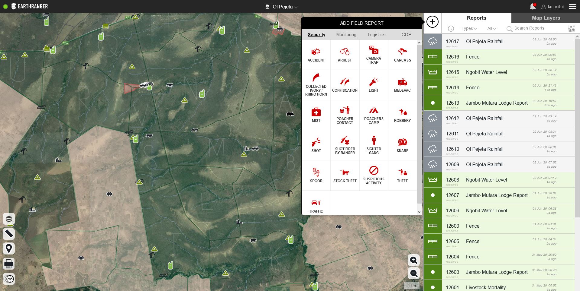
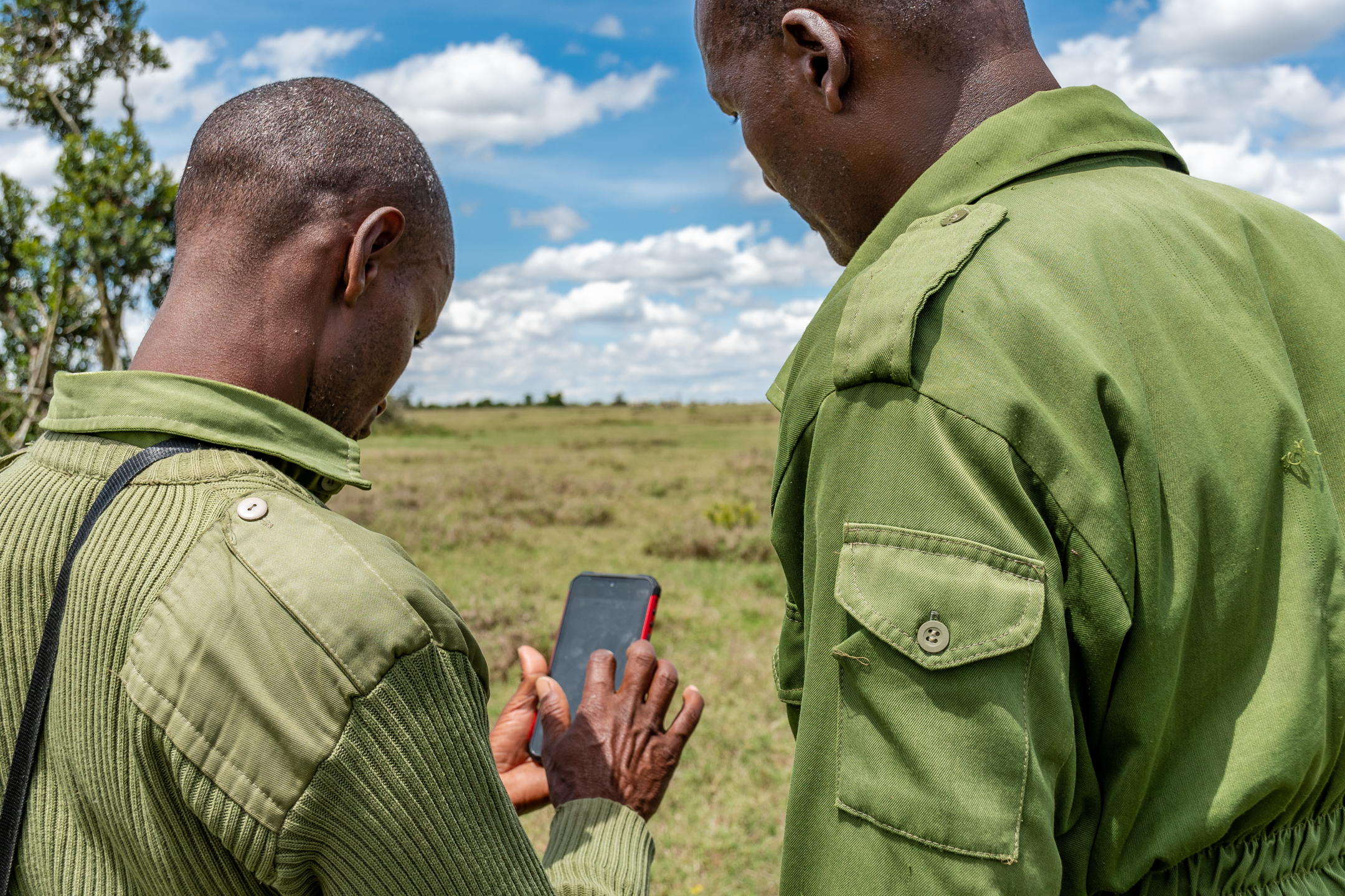
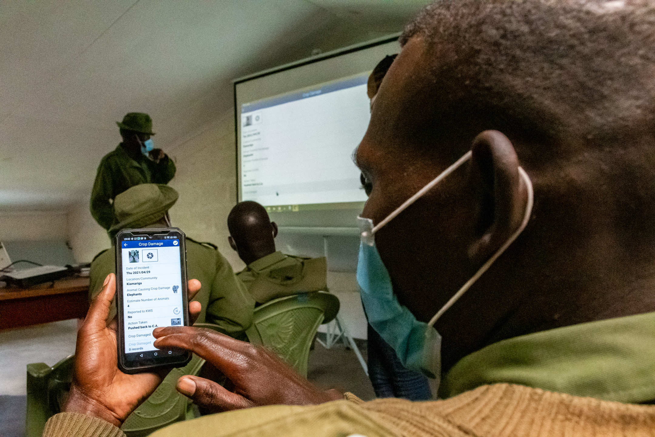
EarthRanger combines different data from different sources. A key aspect of this is reports from the field as rangers carry out their patrols. To ensure robust data is collected and in a format that can be analysed, a ranger patrol report schema was needed. Ol Pejeta designed a set of report types relating to different categories of incidents or issues, such as a wildlife sighting or a security incident. Within each report type, standardized data fields were developed, ensuring data is simple to input and can be compared. Rangers use handheld devices to capture these reports and photos quickly and effectively, building a rich picture of what is happening across the Conservancy. These reports, together with the other data sets integrated in EarthRanger can be used for rapid response to serious incidents, as well as trend analysis to inform longer term strategic conservation planning and management.
Enabling factors
- User focus – working closely with the rangers and ecological monitoring unit as users of the system to understand their needs and ensure the report design meets those needs.
- ‘Minimum Viable Product’ approach – ensuring the report types cover most typical scenarios, achieving a balance of enough variety but not too many different categories so that reporting becomes complex and meaningless.
Lesson learned
- Focus on the challenge, not the technology – the focus should remain the challenge that is being solved, and not the piece of technology being delivered. This ensures that the solution is not cumbersome with unnecessary functions and ties in with the user focus condition which ensures proper uptake of the solution.
Impacts
Environmental:
- Enhanced protection of wildlife. ER has been critical to supporting our security efforts and we have had zero poaching on the conservancy for 3 years. It also forms part of our ecological monitoring efforts which allow us to protect all wildlife.
- Evidence-based conservation management planning. Combining real time and historic data through Tableau analytics has provided richer information to support longer term planning. Appropriate management strategies and approaches are informed by evidence.
Social:
- Safety and security for our patrol staff. Switching from analog comms to digital, and trackers on radios and vehicles ensures we know where our rangers are and can respond quickly in the event of an incident in the field, ultimately saving lives.
- Managing Human Wildlife Conflict to support the 35,000 people living in communities around the conservancy. ER supports us in being able to respond to reported incidents rapidly and effectively. Data analysis enables us to monitor trends and deploy effective mitigation strategies.
Economic:
- Operational efficiency. Effective deployment of 150 field staff ensuring no gaps in ranger patrol coverage.
Beneficiaries
The main beneficiaries are Ol Pejeta’s staff – the rangers, security, Ecological Monitoring Unit, and conservation management team. In addition, the 20 communities (35,000 people) living around the conservancy through enhanced human wildlife conflict response.
Sustainable Development Goals
SDG 15 – Life on land
Story
Our EarthRanger platform integrates data from corridor monitoring cameras, identifying objects and movements, and distinguishing between people, vehicles, and animals. In one situation, the cameras triggered an alert after a vehicle was identified in the corridor – a space usually inaccessible to most. EarthRanger sent an image of the vehicle in real-time, alerting us to suspected potential poachers. The alert meant we were able to respond rapidly in a way we had not before. Security teams were sent immediately to the corridor.
Our fears were unfounded when the vehicle turned out to be lost tourists! Thankful that we were not dealing with a serious security incident, we were able to share with our visitors information on the EarthRanger system, how it works, and the benefits to conservation. This provided us with an unique engagement opportunity and a very different tourism experience for them!