Isar-Plan: Improving flood protection and recreational opportunities by redesigning the Isar
The project group “Isar-Plan” was initiated in 1995 to restore the Isar river in Munich from its artificial canal bed to a more natural shape and function in order to improve flood control, biodiversity and recreational opportunities. Construction started in 2000 and was finished in 2011 having restored 8km of river and costing 35 million euros.
Context
Challenges addressed
Heavy rain events in the Alps in the years of 1999, 2005 and 2013 led to major floods and substantial financial damage in the South of Germany. Such events are likely to increase with climate change. Furthermore, balancing societal and ecological priorities as well as working to remodel the densely populated inner city to implement the river restoration plan was challenging, with disagreements over the design in certain areas as well as what was feasible within the confines of the city.
Location
Process
Summary of the process
Strong partnerships and public engagement (building block 1) are essential for the successful implementation of the solution and a prerequisite to allow for multiple goals to be achieved through balancing trade-offs (building block 2). Finally, “learning by doing” (building block 3) allows for improved solutions.
Building Blocks
Partnerships and public engagement
The project was headed by the State Office of Water Management Munich (Wasserwirtschaftsamt) and includes representatives from the Department of Public Construction (Baureferat), the Department of Urban Planning and Building Regulation (Referat für Stadtplanung und Bauordnung) and the Department of Health and Environment (Referat für Gesundheit und Umwelt). It also partnered with “Isar-Allianz” (an alliance of NGOs). Public participation was ensured through multiple mediums to encourage awareness and participation. Participation was especially encouraged during the landscape design competition for the 1.6 Km urban stretch, which allowed a voice given to the population for the design of the area as well as raising awareness of the issues of renaturalisation and flood protection.
Enabling factors
Diverse mediums were used to engage stakeholders, such as an internet platform, info-brochures, excursions, workshops, TV and press, round tables, info-points, and a service telephone.
Lesson learned
The level of cooperation achieved between all stakeholders involved within the Isar-Plan was excellent and one key success factor for the project. Indeed, stakeholder dialogue and involvement was challenging at times with controversial discussions, and a public quarrel involving strong campaigns. Conflict came about after two nearly opposing designs were awarded 1st and 2nd prize. The main issues in this case is the fact that there are constraints within a crowded urban sector in terms of what is necessary for flood control. A full EbA Solution, i.e. total renaturalisation, was unlikely to afford enough flood protection in this particular 1.6Km compared to the rest of the 8km. This was taken into account by the 1st design, whereas the 2nd promoted more naturalization. The public was split in two behind the two schemes. A clever compromise between the two designs was reached, showing how good mediation and cooperation is necessary.
Resources
Balancing trade-offs between different priorities
The interdisciplinary working group “Isar-Plan” was initiated in 1995, with membership from the Munich City and the State Office of Water Management Munich and the “Isar-Allianz”. The group examined the flooding situation, the need for recreational areas at the riverside and the area’s biodiversity. The study included a comprehensive atlas of fauna and flora, existing public uses and spatial qualities, which later were merged into a conflict and value analysis of all aspects in relation to one another. Based on these findings, development goals were defined. Flood defense measures were chosen that mostly maintained the existing undergrowth on the dykes to conserve ecosystems and have areas for recreation. A sufficient runoff capacity was generated by broadening the main channel bed which simultaneously enables near-natural and flat river bank stabilization.
Enabling factors
Hydrological modelling helps to determine what is needed and what is possible for restoring the river and a suitable flow. Furthermore, while most of the river in that area had been canalized, a part near the city had maintained its character so it could serve as a model function of the river. Finally, good cooperation between stakeholders for balancing priorities between flood protection, nature and recreation was essential.
Lesson learned
The design of rough ramps enhances natural development of the river regime. With their pools, stone rock steps and the downstream gravel banks and gravel stone islands have an important ecological function and contribute towards the overall morphological development of the river bed. They also provide an attractive site for recreation. Dynamically developing banks are a special feature of the natural river, changing and retreating during high water levels and flood runoff. However, to prevent future erosion, rear-defense protection measures were implemented for safety reasons. In the inner city, the Isar Plan had to deal with several restrictions for the river development due to the existing infrastructure, and deal with the controversial public discussions over two competing restoration designs (see above). A clever compromise between the two designs was reached with reinforcements built below ground and covered with vegetation to provide a naturalized appearance.
Resources
“Learning by doing”
The team took into account events during the long implementation (11years for the construction work with 5 years preliminary work) to create a successful EbA solution. In essence, they used adaptive management for their implementation. Indeed, the big flood of 2005, in the middle of their work had a major impact both on the area and on the final implementation of the solution. They also took into account public concerns (see above) towards a final solution that is appreciated by many.
Enabling factors
Having space to allow for natural river morphology development through time.
Lesson learned
The flood revealed that areas without turf sustained erosion damage. The best protection was to be found where the technical bank protection measures were supplemented by the planting willows or turf. Especially the thin willow rods that develop after cutting back every two to three years provide an exceptionally good hold. Furthermore, many of the new structures that developed due to flood “damage” such as pools, dips and gravel banks are connected now to the River Isar, depending on the discharge, and provide habitats for young fish and macroinvertebrates. At the same time, the biotope character of these areas is enhanced by allowing deadwood to remain after flooding. These small biotopes were maintained and protected with turf and willow. On the surfaces exposed by flooding, thin but richly flowering grass communities of high ecological value developed in the following year.
Resources
Impacts
The project successfully improved protection against flooding through developing more of a natural river landscape, which allows space for the river. Indeed, a big flood in 2005 had an effect on the whole catchment area and allowed evidence to show where the restoration had mitigated flood damage. As seen through the impacts of this massive flood in other areas of southern Germany, the restoration of the river Isar has improved flood control and reduced the damage that could have been caused.
The project has also benefited biodiversity through the creation of new habitats for flora and fauna and through allowing fish to move along the river where before they were impeded.
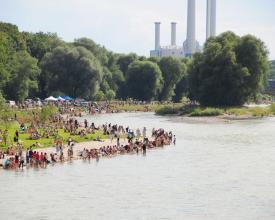
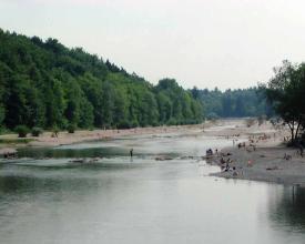
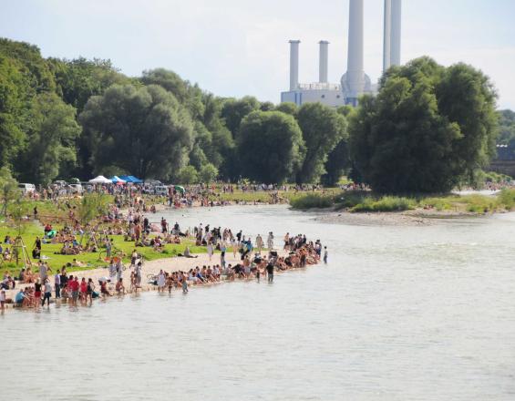
The hydrological status has been also improved to achieve bathing water quality. This means that Munich inhabitants and visitors can swim in the river and benefit from the attractive landscape for many recreational activities.
Beneficiaries
Given the improved flood protection and the quality of nearby recreational spaces, the main beneficiaries are the surrounding infrastructure, citizens and visitors to the area as well as the economy. The restoration also benefits biodiversity.
Sustainable Development Goals
Story
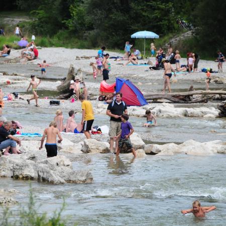
The Isar river restoration along 8 km in the city of Munich is a spectacular achievement in its ability to accommodate both large floods that regularly impact the area and high recreational usage with up to 30,000 people gathering in the area on warm weekends, while improving biodiversity.
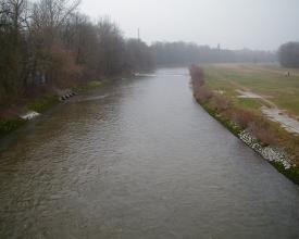
The project group “Isar-Plan” was initiated in 1995 during an investigation of the Munich flood protection systems and amidst an increasing demand for a “closer to nature” urban environment which can offer recreational opportunities. The project was headed by Munich City and the Bavarian Water Board and represents an unparalleled level of interdisciplinary cooperation. After preliminary studies in how to design a project that balanced the aims for flood protection, ecology and recreation, work started in 2000. The main channel was widened from 50m to 90m and a number of measures have been undertaken to restore the natural hydrological function, a near-natural appearance of the river, with ample habitat for flora and fauna and recreation areas, while at the same time ensuring flood protection of the surrounding area.
In 2003 a landscape design completion was launched with public consultation and participation for the last 1.6Km stretch in the heart of the city (that needed to take into account ecological, flood protection and recreational goals). This resulted in controversial discussions and public quarrel because two near opposing projects (an urban functional design vs a total re-naturalised design) were selected as first and second prize. Finally, in 2005, both teams collaborated to provide a compromised design that encompassed the secure flood protection needed within the constraints required by the heavily built up area and a renaturalised appearance.
The restoration finished in 2011.
