Multi-Stakeholder Engagement for Improved Management of the Mvai Forest Reserve in Ntcheu District, Malawi
Full Solution

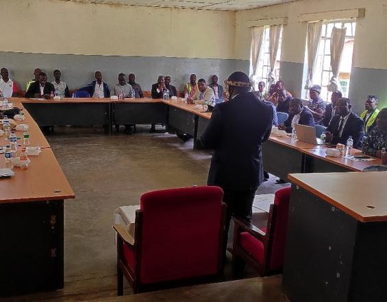
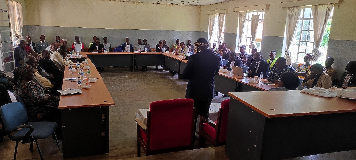
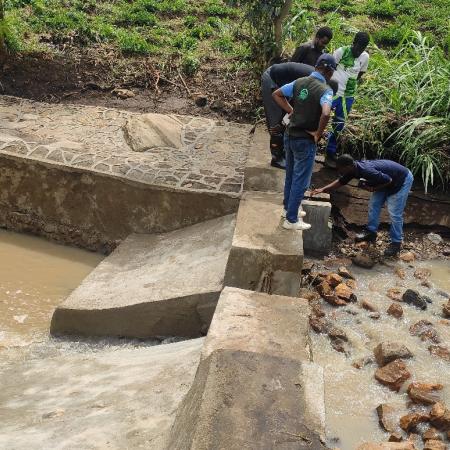
Stakeholder Engagement meeting at the district headquarters to end encroachment in Mvai forest reserve
FAO
The AREECA project addresses severe encroachment and degradation in Mvai Forest Reserve, Malawi, to protect vital natural resources. A multi-stakeholder approach, initatiated by FAO and IUCN, was used to tackle encroachment drivers, including firewood collection, charcoal production, and farming expansion, which threaten Mvai’s ecosystem and the Mpira Dam’s water supply. Key interventions involved degradation mapping to assess impacted areas, the establishment of a Chief’s Forum to coordinate governance, the formulation of stricter by-laws with local enforcement, and demarcation of reserve boundaries with community input.
Additionally, woodlot creation and alternative livelihoods such as banana, pineapple, livestock farming and bee keeping were introduced to reduce pressure on the forest. This collaborative approach, involving local chiefs, government bodies, and surrounding communities, has led to a reduction in encroachment and provided sustainable economic alternatives.
Last update: 22 Aug 2025
269 Views
Context
Challenges addressed
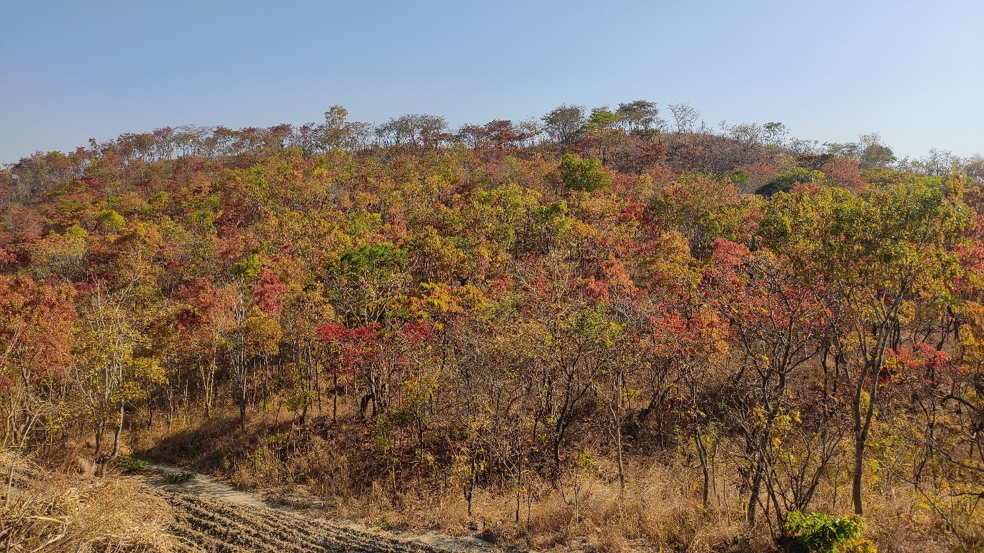
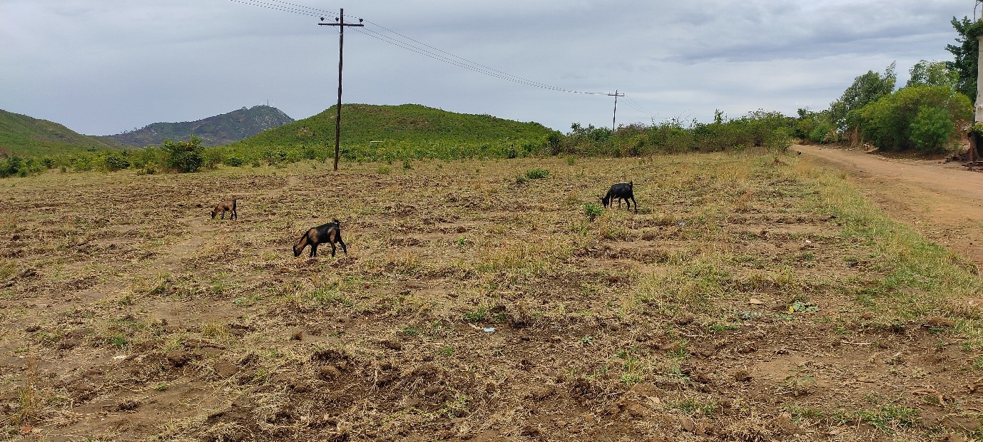
Mvai Forest Reserve experienced extensive encroachment and degradation due to unsustainable activities such as charcoal production, firewood collection, and farming expansion, which threatened the Mpira Dam’s water supply. In 2021, over 450 hectares of the reserve were impacted. This degradation not only threatens the forest ecosystem but also endangers the Mpira Dam, a crucial water source for many communities in Ntcheu District and surrounding southern districts.
The forest plays a vital role as a catchment area, supporting water supply for local agriculture and household needs. Its degradation poses risks to the productivity of nearby farms and the livelihoods of residents who depend on reliable water sources. Weak enforcement measures, limited resources for community patrols, and a lack of organized governance initially hindered efforts to manage these resources effectively.
Cross-border encroachment from Mozambique also compounded the issue, emphasizing the need for a collaborative approach to protect Mvai’s resources.
Location
Mpira, Ntcheu, Malawi
East and South Africa
Process
Summary of the process
Degradation Mapping serves as the starting point, identifying critical areas impacted by encroachment and highlighting jurisdictional differences in degradation levels, which informs targeted interventions. This data enables the Chief’s Forum to develop a unified governance approach across local authorities and to coordinate actions that address specific areas of concern. Through the Community Education and Sensitization efforts led by the Forum, local residents gain an understanding of the ecological importance of the forest and the necessity of sustainable practices, preparing them for compliance with Stricter By-Laws that regulate forest use.
Following sensitization and legal reinforcement, demarcation of Reserve Boundaries with community involvement solidifies the physical limits of the forest, clarifying protected areas and reducing conflicts over land use. Finally, Livelihoods Diversification offers sustainable income alternatives, reducing pressure on forest resources and ensuring that community members have viable economic options. Together, these building blocks create a cohesive strategy, where governance, community buy-in, legal enforcement, and economic support converge to achieve long-term conservation outcomes
Building Blocks
Degradation Mapping and Baseline Survey
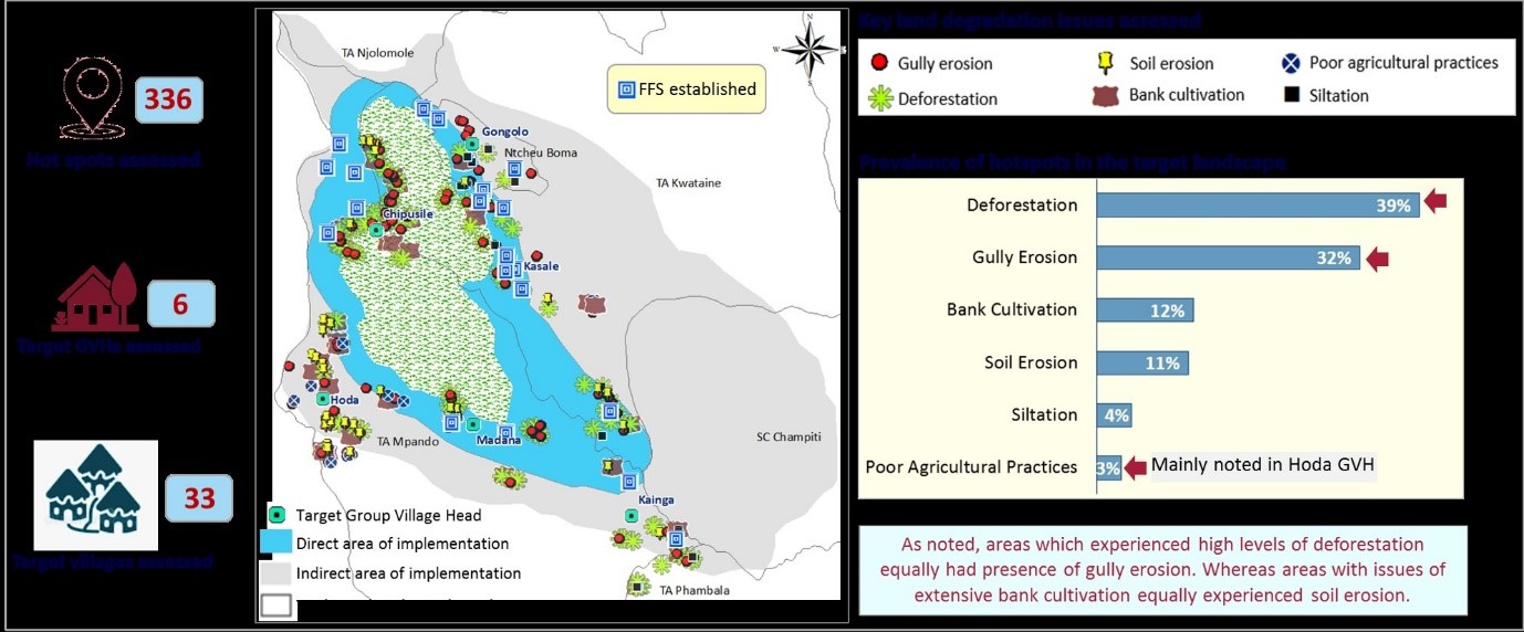
Mapping the degraded areas within Mvai Forest Reserve was an essential first step to identify the extent of encroachment and prioritize restoration efforts. The process involved assessments of the reserve to locate areas impacted by charcoal production, firewood collection, and farming expansion. By 2021, 450 hectares of the forest were confirmed as affected by encroachment activities. This mapping provided a clear view of degradation hotspots and facilitated targeted interventions, forming the foundation for boundary demarcation, enforcement strategies, and community engagement. The mapped data helped the project team and local authorities to understand the scale of degradation and to set measurable targets for restoration and conservation, ensuring that resources and efforts were allocated effectively to the most critical areas.
Enabling factors
- Community Participation: Local knowledge contributed to accurately identifying degraded areas.
- Government Support: Official backing from the Forestry Department enabled systematic mapping.
- Technical Resources: Use of mapping tools helped clearly delineate impacted zones for prioritization.
Lesson learned
Degradation mapping is vital for understanding the extent of encroachment and organizing targeted responses. Engaging local communities in the mapping process enhances accuracy and ownership, as they provide on-the-ground insights into affected areas. The mapping highlighted that the level of forest degradation is closely linked to the role and effectiveness of local authorities, with variation in encroachment levels depending on the jurisdiction. This insight emphasized the importance of unified enforcement across administrative areas to ensure consistent resource protection. Clear identification of degradation zones allows for efficient allocation of resources and focuses restoration efforts where they are most needed, improving the chances of successful rehabilitation.
Establishment of the Chief’s Forum

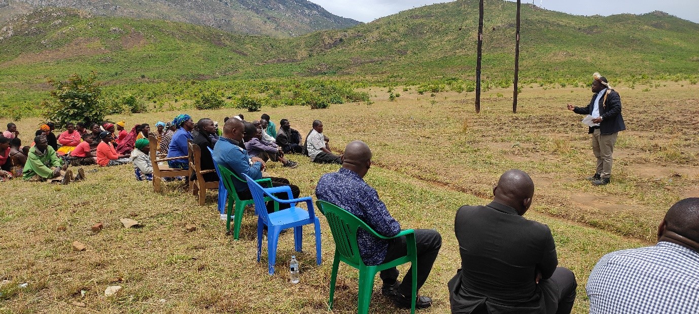
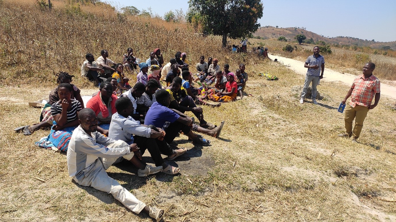
The Chief’s Forum was created to strengthen governance and reduce encroachment by uniting local chiefs, district council officers, and community representatives in a collaborative approach. Formed after extensive consultations in 2022, the Forum established a formalized structure to coordinate natural resource management efforts, aligning with traditional authorities and local government to enforce sustainable practices. Key responsibilities include advocacy for resource management, mobilizing funds, creating and enforcing by-laws, and promoting community sensitization on sustainable land use. The Forum acts as a bridge between the project and local stakeholders, fostering cooperation and accountability. Regular meetings and field visits enable chiefs to observe forest management challenges firsthand and address issues such as grazing and farming within protected areas.
Enabling factors
- Inclusive Representation: Engagement of chiefs, district council members, and community groups promoted balanced decision-making.
- Government and Project Support: Provided resources and legitimacy for Forum activities.
- Community Trust: The traditional authority of chiefs ensured community respect and adherence.
Lesson learned
The Chief’s Forum demonstrates the value of engaging local governance structures in resource management. Including traditional leaders and diverse community groups ensures that policies are respected and tailored to local needs. The Forum’s structure creates accountability and improves communication between stakeholders, fostering a collaborative approach. Regular meetings and field visits provide chiefs with direct insight into conservation challenges, enabling them to make informed decisions and gain community support. Establishing a formalized governance body is essential for sustaining long-term conservation efforts and aligning local practices with national restoration goals.
Community Education and Sensitization

Community education and sensitization were essential components of the project to reduce encroachment and promote sustainable practices in Mvai Forest Reserve. The Chiefs Forum organised field visits to showcase governance challenges and educate participants on the environmental, social, and economic benefits of natural resource management. Local leaders conducted advocacy and awareness sessions to inform communities about the importance of conservation, sustainable land use, and legal regulations on resource use. Sensitization campaigns emphasized the impacts of deforestation and introduced sustainable livelihood alternatives, aiming to shift behaviors away from forest exploitation. These activities have empowered communities to take responsibility for forest protection and reporting illegal activities, significantly reducing encroachment and fostering a conservation mindset among local residents.
Enabling factors
- Local Advocacy: Traditional leaders played an influential role in sensitizing the community and raising awareness.
- Practical Demonstrations: Field visits highlighted real-world governance and conservation challenges.
- Resource Mobilization: Support for materials and logistical needs ensured effective sensitization efforts.
Lesson learned
Community education builds understanding and shifts attitudes towards conservation. When local leaders lead sensitization efforts, community members are more likely to trust and adopt sustainable practices. Field demonstrations of governance challenges provide tangible insights into the importance of resource management, reinforcing the value of conservation. Ongoing sensitization efforts are critical, as changing long-established behaviors takes time and consistency. Engagement must include practical guidance on alternative livelihoods to effectively reduce dependency on forest resources.
Adequate By-Laws and Enforcement Mechanisms
To curb illegal activities in Mvai Forest Reserve, stricter by-laws and enhanced enforcement mechanisms were introduced through the Chief’s Forum in collaboration with local government. These by-laws regulate activities such as charcoal production, farming, and firewood collection within the reserve. Measures include stricter penalties for illegal resource use, community sensitization on legal repercussions, and improved support for local patrol committees. The project provided necessary equipment to community committees for patrolling and monitoring encroachment, while local authorities agreed to expedite legal proceedings for forest-related offenses. This stricter enforcement framework addresses the underlying issues of encroachment, ensuring that illegal activities are deterred effectively. Additionally, community sensitization campaigns, led by traditional authorities, reinforced the importance of compliance with by-laws for sustainable forest management.
Enabling factors
- Local and Traditional Authority Support: Chiefs and government officers endorsed enforcement efforts.
- Community Patrols: Local committees were equipped to monitor forest activities.
- Judiciary Engagement: Legal support expedited the processing of forest offense cases.
Lesson learned
Stricter by-laws are essential for effective resource management. Local enforcement, backed by traditional leaders, improves community adherence and fosters respect for regulations. Providing resources and equipment to community patrols ensures they are well-equipped to monitor forest activities, while judicial support enhances the enforcement of penalties. Community education about legal consequences builds understanding and discourages illegal activities. The Chief’s Forum’s role in sensitization and enforcement bridges the gap between traditional authority and formal governance, making enforcement measures more cohesive and effective.
Demarcation of Reserve Boundaries with Community Involvement
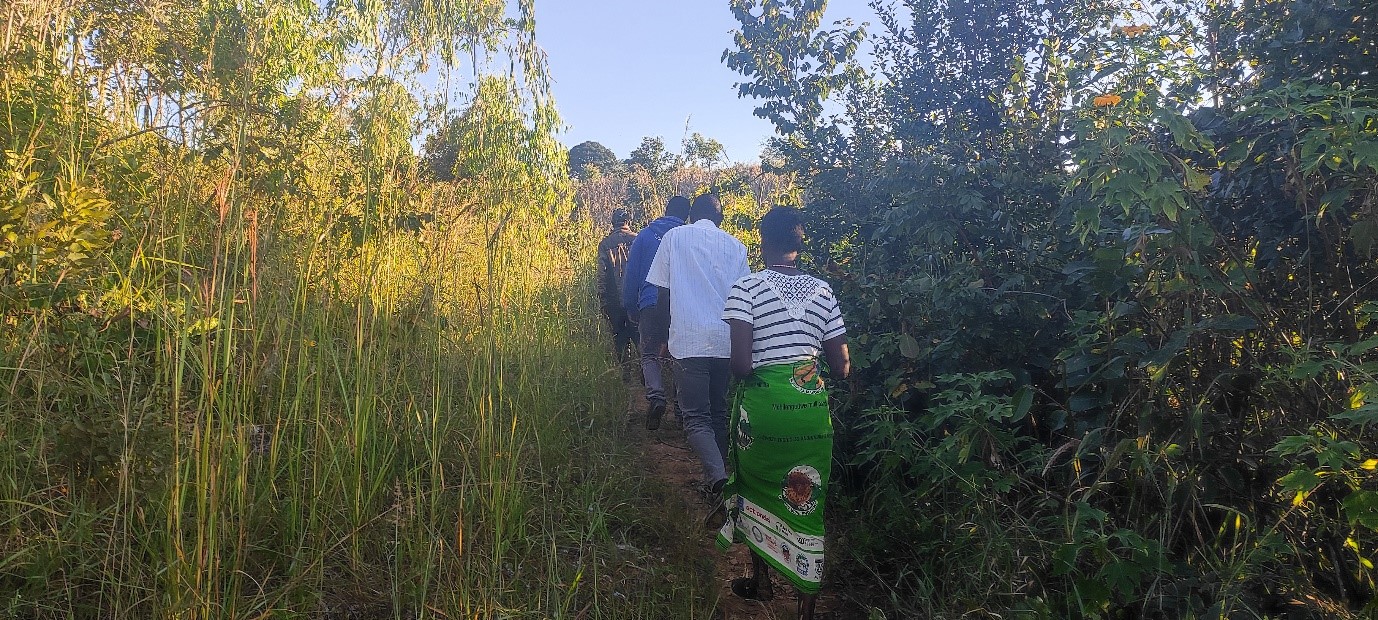
The demarcation of Mvai Forest Reserve’s boundaries was a collaborative effort involving the local community, traditional leaders, and government agencies. Through consultations and field visits, boundaries were marked to clearly delineate protected areas, minimizing conflicts over land use and reducing unauthorized access. Community members participated in the boundary-setting process, reinforcing their understanding and respect for the protected area’s limits. Demarcation included physical markers, providing a visible reminder to the community of the forest’s boundaries, which also helped organize patrols and enforce restricted access. This clear boundary setting allowed the project to manage forest resources systematically, while community participation ensured the demarcation was respected and recognized by all stakeholders. This collaborative demarcation process strengthened the community’s role in conservation and solidified the boundaries as a foundation for sustainable management.
Enabling factors
- Community Participation: Engaged residents in marking boundaries, promoting local respect.
- Government and Traditional Leader Support: Provided legitimacy to boundary setting.
- Physical Markers: Visible indicators reinforced the forest’s protected status.
Lesson learned
Community involvement in boundary demarcation fosters respect and adherence to protected areas. When local residents actively participate in the boundary-setting process, they develop a stronger understanding of and commitment to respecting the forest’s limits. The process also highlighted that visible, physical markers are essential for maintaining clear boundaries, reducing misunderstandings and preventing unauthorized access. Additionally, engaging community leaders and traditional authorities in demarcation efforts enhances local accountability, as these respected figures can advocate for adherence within their communities. The exercise showed that boundary demarcation is most effective when supported by education on the ecological importance of the reserve, helping the community see the demarcation as a shared responsibility to protect resources that support local water supply, agriculture, and livelihoods.
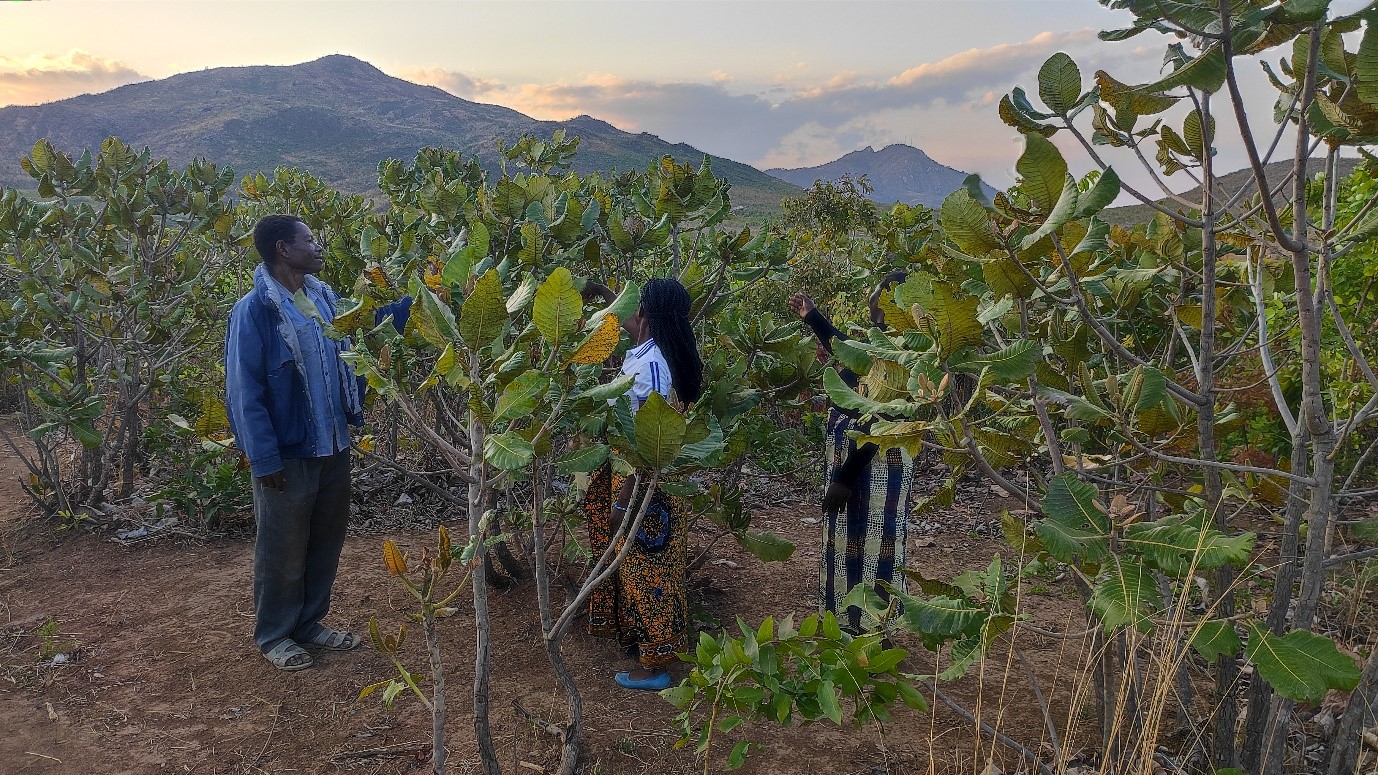
Livelihood Diversification for Conservation


To reduce community reliance on deforestation activities, the project introduced livelihood diversification options, including irrigation farming, beekeeping, banana and pineapple production, goat and chicken rearing, and mushroom cultivation. These activities provide sustainable income alternatives that align with the conservation goals of Mvai Forest Reserve. Local farmers are trained in small-scale irrigation and sustainable agriculture techniques to improve productivity without expanding farmland and so far four irrigation schemes have been developed to enable crop production three times a year. The diversification of livelihoods aims to create a sustainable income base for the community, reducing the need for charcoal production and forest exploitation. These initiatives are at varying stages of implementation, with some fully operational, such as banana and pineapple farming, while others, like mushroom production and fish farming will be operational by March 2025.
Enabling factors
- Training and Resources: Provided communities with skills and tools for alternative livelihoods.
- Economic Motivation: Sustainable income options made conservation efforts more appealing.
- Local Adaptation: Activities were chosen based on suitability for the local environment and community needs.
Lesson learned
Providing alternative livelihoods reduces pressure on forest resources and supports long-term conservation goals. Economic incentives are effective motivators for communities to embrace sustainable practices. Tailoring livelihood activities to local conditions and community needs increases their likelihood of success and adoption. Consistent training and resources are essential to maintain productivity and interest in these alternatives.
Impacts
The project has led to reduced encroachment, increased community engagement, and sustainable livelihood options. Environmentally, the mapping and demarcation of Mvai Forest Reserve boundaries helped curtail unauthorized access, while stricter by-laws and enforcement improved compliance. The establishment of woodlots and introduction of alternative livelihoods for surrounding communities, including, irrigation development, livestock production, small-scale banana, pineapple farming and bee keeping, have provided sustainable income sources, reducing reliance on deforestation activities. Socially, the formation of the Chief’s Forum has fostered a collaborative approach to forest management, uniting traditional authorities, government officials, and community members in protecting Mvai’s resources. Early results show a decrease in the number of illegal charcoal furnaces and a reduction in the encroached area from 450 to less than 100 hectares, demonstrating the effectiveness of combining governance and livelihood support for sustainable forest conservation.
Beneficiaries
- 45,000 people in the Mpira catchment area
- Community chiefs and local committees, surrounding village residents who participate in livelihood programs,
- Traditional authorities involved in forest governance.
- Over 200,000 people in Balaka and Machinga Districts
Sustainable Development Goals
SDG 5 – Gender equality
SDG 10 – Reduced inequalities
SDG 13 – Climate action
SDG 15 – Life on land
SDG 17 – Partnerships for the goals
Story
Rehabilitated Mpamadzi Iriigation Scheme for multiple cropping in Kasale area
FAO
Group Village Head (GVH) Kasale is a traditional leader under Traditional Authority Kwataine in Mpira Catchment, Ntcheu District. Her jurisdiction adjoins Mvai Forest Reserve and she is in charge of Kasale Blcok, a portion of the five demarcated blocks. Below her, are over 10 Village Heads.
This visionary chief is an icon of FLR interventions in Ntcheu District because of her zeal to mobilise her subjects to conserve the forests within Mvai and outside. She remembers the days the area was in full tree cover and she witnessed the destructive practices. Now she is standing tall as she has taken steps to address the problems. Within her area, she redemarcated the area into three portions for easy monitoring and coordination of the activities. She assisted in the formulation of the by-laws for the precious natural resources (forests) in the area.
GVH Kasale was one of the leaders who promised to work towards intensification of FLR at the formation of the Chiefs Forum on Restoration in 2022. To date she has demonstrated utmost activeness in achieving the promise. Over 100 ha have been restored in her area. She attributes this to the plans that the community set up. The groups have work plan detaining specific activities according to time. The GVH recalls ‘When we re starting it seemed an impossible mission but we have restored over 100 ha, brought back lost wild fruits and some animals, farming has reduced’.
She appeals to the government offices to ensure they provide support like occasional patrols and working gear for the communities. The government through AREECA is in the process of proving working gear for the communities.
GVH Kasale also appreciated AREECA’s effort in providing social economic support of pineapples, apiary kits, chickens, goats, rehabilitation of Mpamadzi Irrigation Scheme among others. According to the Chief, the combined package of restoration work and livelihood initiatives are a game changer to achieve meaningful restoration.
Connect with contributors


Other contributors
Harrington Nyirenda
Food and Agriculture Organization of the United Nations (FAO)
Donnex Mtambo
Departement of Forestry Malawu; Ntcheu District Council
