Nigg Bay Coastal Realignment
RSPB
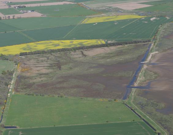
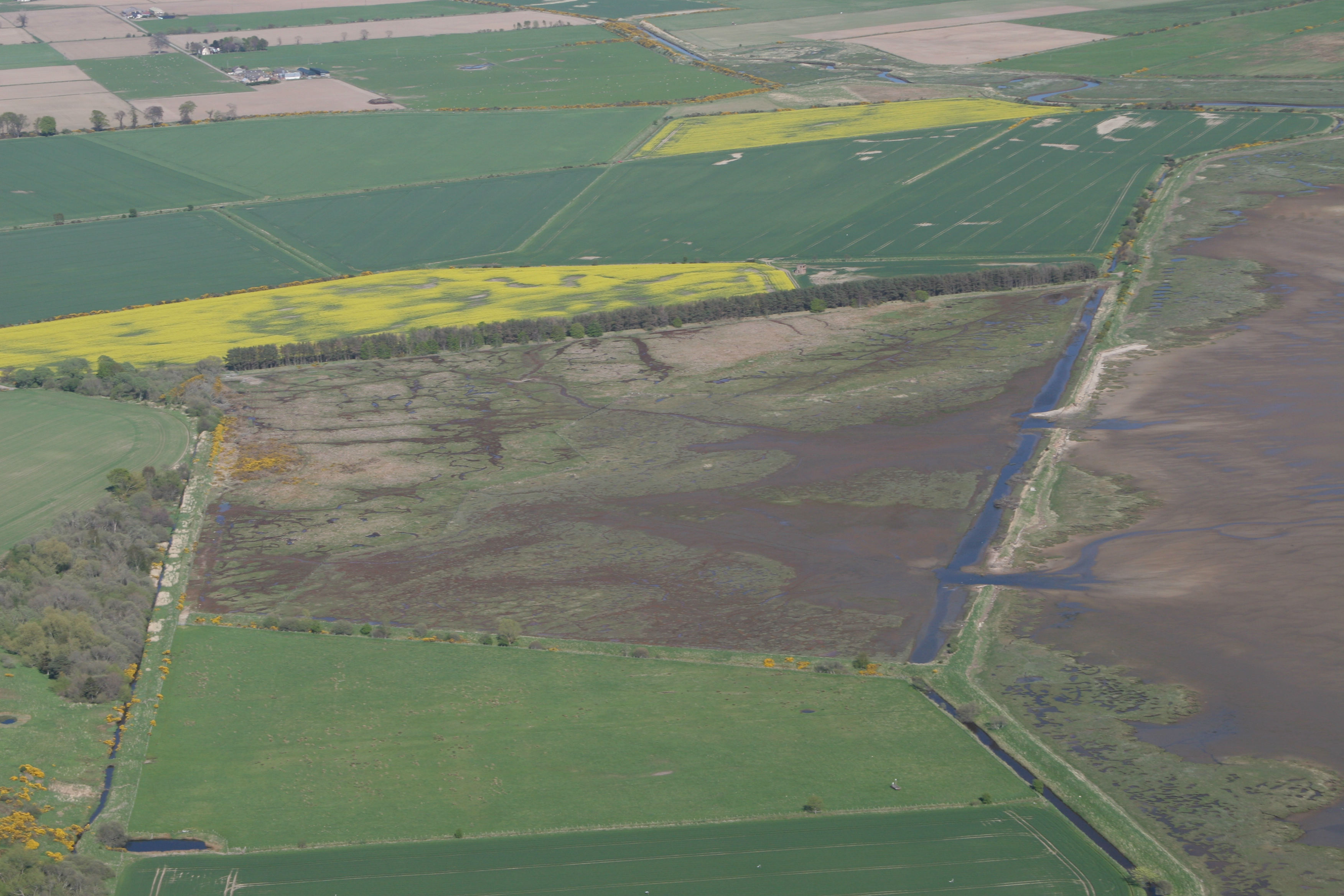
In 2003, two 20 metre breaches were created in an existing eroded sea wall to allow for the tide to re-enter a 25ha field, known as “Meddat Marsh”, on the edge of Nigg Bay. This allowed this area to be reconnected to the sea for the first time since the 1950s and intertidal habitat to be created. A second sea wall behind the field was already in existence and was raised and strengthened.
The coastal realignment was a success, with salt marsh habitat and wintering water birds colonizing the area, as well as improving coastal flooding protection.
Last update: 03 Nov 2021
7209 Views
Photo and video gallery

Context
Challenges addressed
The main questions for this scheme were whether intertidal habitats would develop in the area after breach of the sea wall, how best to breach, and whether there would be any impacts to the surrounding environment. A further challenge was what authorisations were required, because while coastal realignment had been successful in England, it was the first time to be undertaken in Scotland.
Location
Nigg Bay, Cromarty Firth, Scotland
West and South Europe
Process
Summary of the process
To understand how to implement and the potential results of the coastal realignment scheme (building block 2), a design and impacts study (building block 1) was undertaken. Monitoring (building block 3) enabled evaluation of the scheme as well as establishing what further management, if any, is required.
Building Blocks
Design and Impacts Study
The design and impacts study look at the feasibility of the project in terms of potential impact, design of intervention and potential results.
Potential Impact: flooding of the site under various tidal conditions was modelled, and showed that the project would have a negligible effect on the tidal regime and coastal processes of Nigg Bay and the Cromarty Firth.
Design: different engineering options were considered - a single breach, two breaches, completely removing the sea wall or not doing anything. Hydraulic modelling informed the decision that two 20m breaches, lining up with the relic drainage channels, was the preferred design. It also specified some further engineering work.
Potential Results: the likely zonation of saltmarsh communities within the coastal realignment site was modelled, using the elevations of the site. This showed that there was sufficient topographical variation for a full zonation of saltmarsh communities to be restored without further engineering works.
Enabling factors
A full environmental impact assessment was not required by authorities, so a design and impacts study was commissioned instead.
Lesson learned
The design and impacts study provided useful information for the design of the coastal realignment intervention and contributed to the success of the scheme.
Coastal Realignment
Two 20m breaches in the sea wall were created over two days to allow the tides to come into the area. The secondary sea wall behind the field was raised to 1 in 50 year predicted storm surge height, before the breaches were dug. Other required engineering works, specifically the blocking of culverts to a drainage channel behind the sea wall were also undertaken from the recommendations of the “design and impacts study”.
Enabling factors
Prior to the 1950s when the sea wall (that was breached in 2003) was built, the area encompassing “Meddat Marsh Field” was a coastal wetland area. Indeed an Ordnance Survey map form 1872 showed that there appeared to have been some mudflat as well as saltmarsh (shown as ‘liable to floods’ on the map) in that field. Furthermore, prior to the scheme, the field was hard to keep dry and as it had not been ploughed, much of the topography (including relict saltmarsh creeks) was still present.
Lesson learned
The Nigg Bay project was the first of its kind in Scotland and therefore there was no experience of the consents required, or the processes required for securing those consents, under the Scottish system. Consequently, the RSPB drew up a long list of potential regulations affected and the relevant agencies were consulted.
Monitoring regeneration of ecosystem
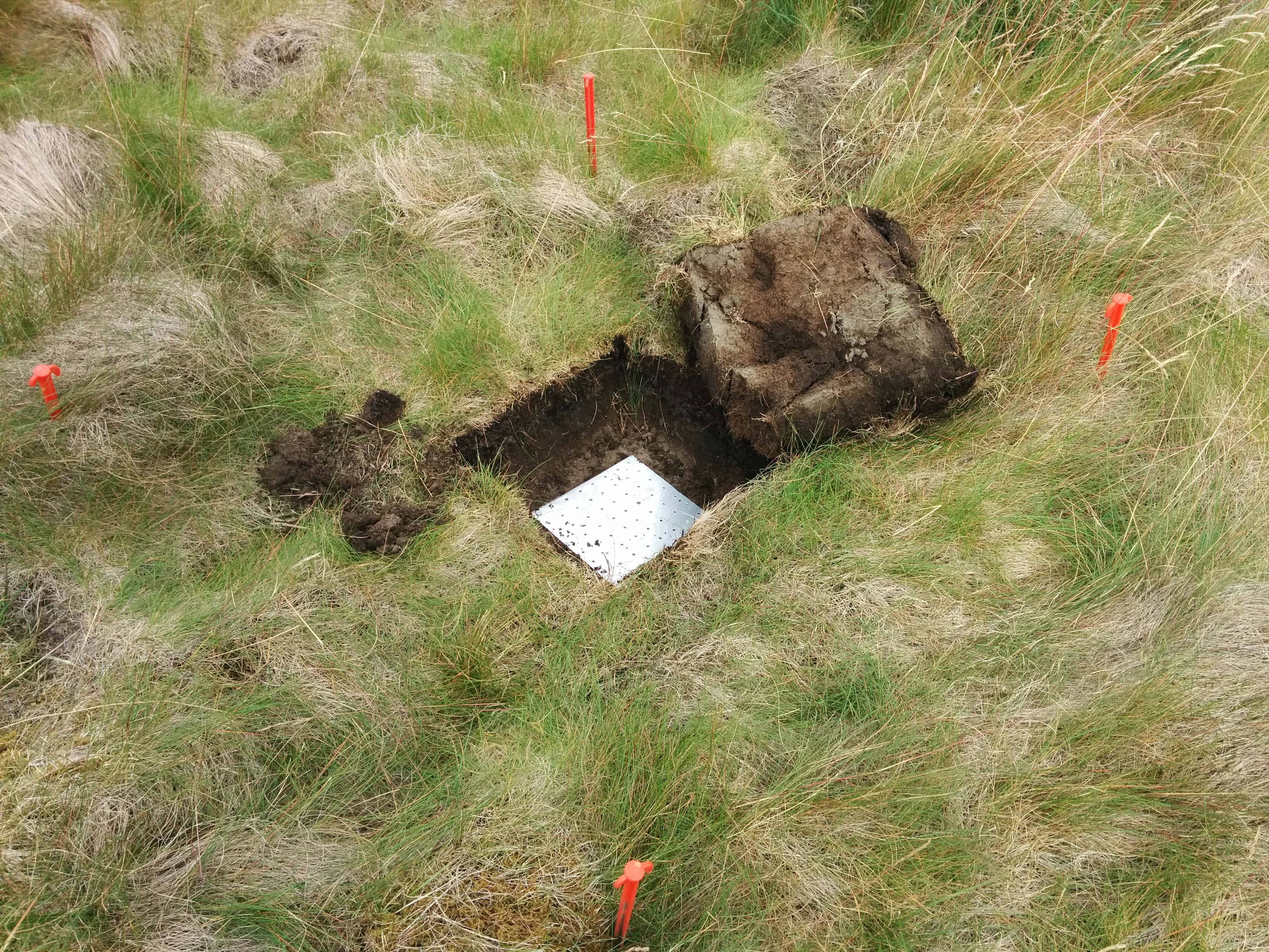
Monitoring was undertaken in four main areas:
- Vegetation: the colonisation by saltmarsh plants, and development of saltmarsh communities
- Benthic invertebrates: particularly of species important as food sources to wintering waterbirds
- Use by wintering waterbirds
- Sedimentation & geomorphology
It was undertaken pre-breach and post breach annually for 4 years (until 2007), as a PhD study. After that monitoring was completed in 2009, 2011 and 2014.
Enabling factors
University programmes such as PhDs and Masters courses, as well as volunteer organisms provide reduced cost monitoring. A PhD study and a few Masters projects provided monitoring data. A contract ecologist and an apprenticeship partnership also provided data. Formal bird monitoring has been supplemented by regular monitoring of wintering waterbirds via the Wetland Bird Survey (WeBS) scheme and ad-hoc informal monitoring by reserves staff (e.g. collecting records during site visits).
Lesson learned
After an initial intensive period of monitoring (from PhD), the frequency of monitoring was reduced due to lack of resources and requirement. Working with student projects, and other means for continual monitoring is essential because it produces evidence required on the effectiveness of the scheme.
Furthermore, continual observation of a site helps indicate management thereof. For instance, a fence used to bisect the site, but is was removed in 2015 after observation that it impeded bird usage of the other side of the fence.
Impacts
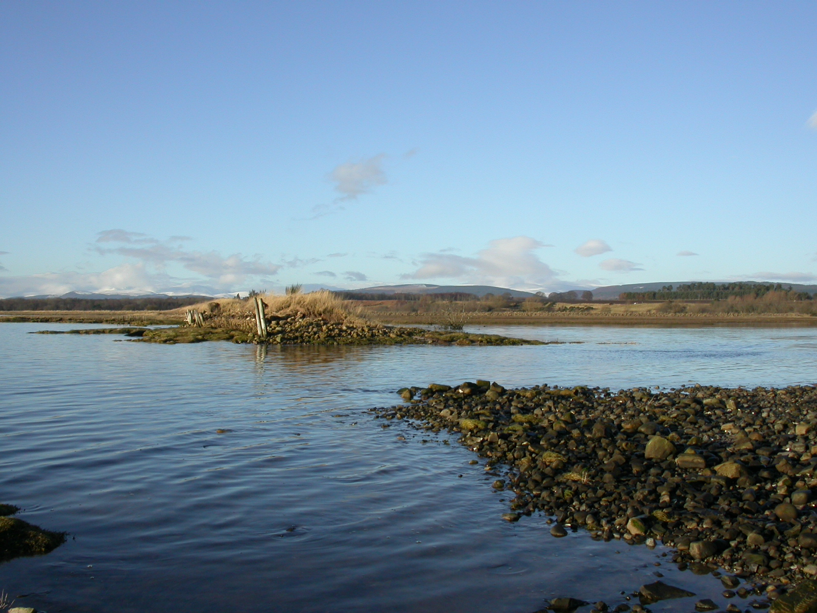
Salt marsh has colonized the area reclaimed and thus increased the area of salt marsh by 23% in Nigg Bay. It has also added nearly a km of new saltmarsh edge and 5 hectares of intertidal mudflat – all very important for foraging birds. Indeed 25 species of water birds now use the newly created area.
Over the 10 years there has been 20-30cm of sedimentation in some parts of the site and saltmarsh creek systems have developed. The new sea defence around the site remains strong and the whole area provides greater protection from coastal flooding to inland areas than the original sea wall.
Beneficiaries
The local population gain a stronger flood protection in the area and, as a nature reserve, the wider area provides educational and recreational benefits. Water birds , as well as saltmarsh and intertidal species are benefitting from this habitat.
Sustainable Development Goals
SDG 11 – Sustainable cities and communities
SDG 13 – Climate action
SDG 15 – Life on land
Story

Coastal Realignment in “Meddat Marsh” field in Nigg Bay
RSPB
Salt marshes and other intertidal habitats are highly important ecosystems, both in terms of biodiversity and ecosystem services (e.g. coastal flood protection), that have been lost in many places due to coastal squeeze. For this reason, a coastal realignment scheme was planned at Nigg Bay with the purchase of “Meddat Marsh” field in 2001. Consultations with local communities and statutory bodies were undertaken, as was a “design and impacts” study. This study aimed to determine the best way to breach the existing sea wall, if intertidal habitats were predicted to develop and check if this work would have any impacts on the surrounding environment. A full environmental impact assessment was not required by the authorities in this instance.
The breach of the sea wall took place in 2003. A second sea wall behind this was already in existence and was raised and strengthened. Quite quickly intertidal species colonized the area resulting in the salt marsh vegetation surveyed in 2015 having the same composition as surrounding areas. In the first winter after the breach, 3 waterbird species used the site but this jumped to 19 species in the second winter and now stands at 25 species, the area providing a haven since it is one of the last areas in Nigg Bay to become covered by sea water with the incoming tide.
The project has increased the area of saltmarsh habitat in Nigg Bay by 23%. It has also added nearly a km of new saltmarsh edge and 5 hectares of intertidal mudflat – all very important for foraging birds.
Over the 10 years there has been 20-30cm of sedimentation in some parts of the site and saltmarsh creek systems have developed. The scheme has improved coastal flooding protection, as evidenced by the improvement in the state of the main sea wall. The previous sea wall (now breached) was eroded and would have required more regular maintenance due to the pressure of the incoming tide. Indeed the two 20 meter breach in 2003, have become more than 50 meters wide by 2015. The current sea wall behind the salt marsh remains in good condition.