From paddock to park: removal of licensed grazing in Warby-Ovens National Park
Full Solution
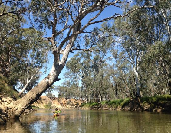
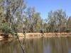
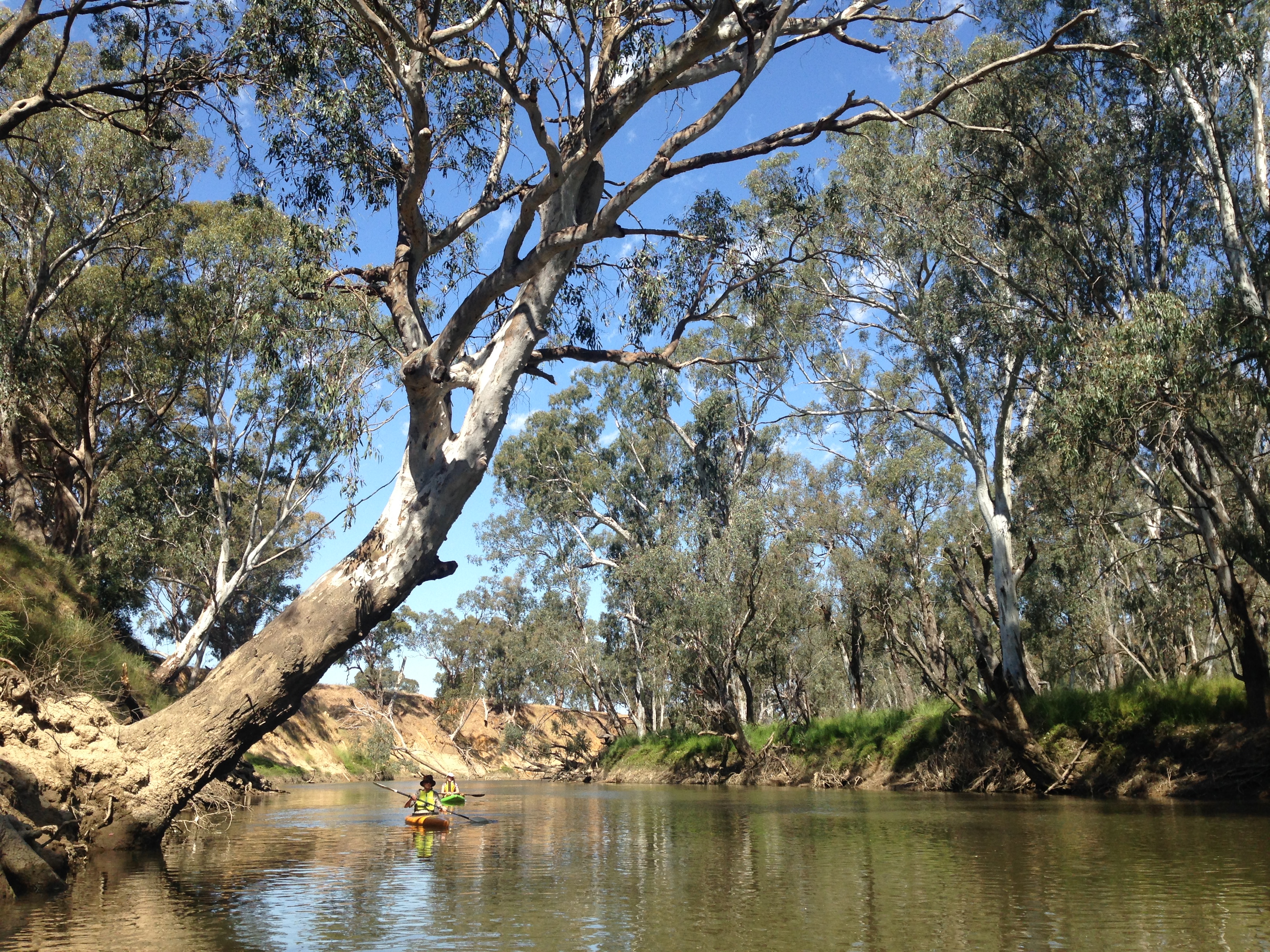
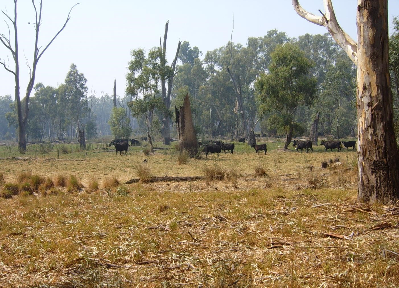
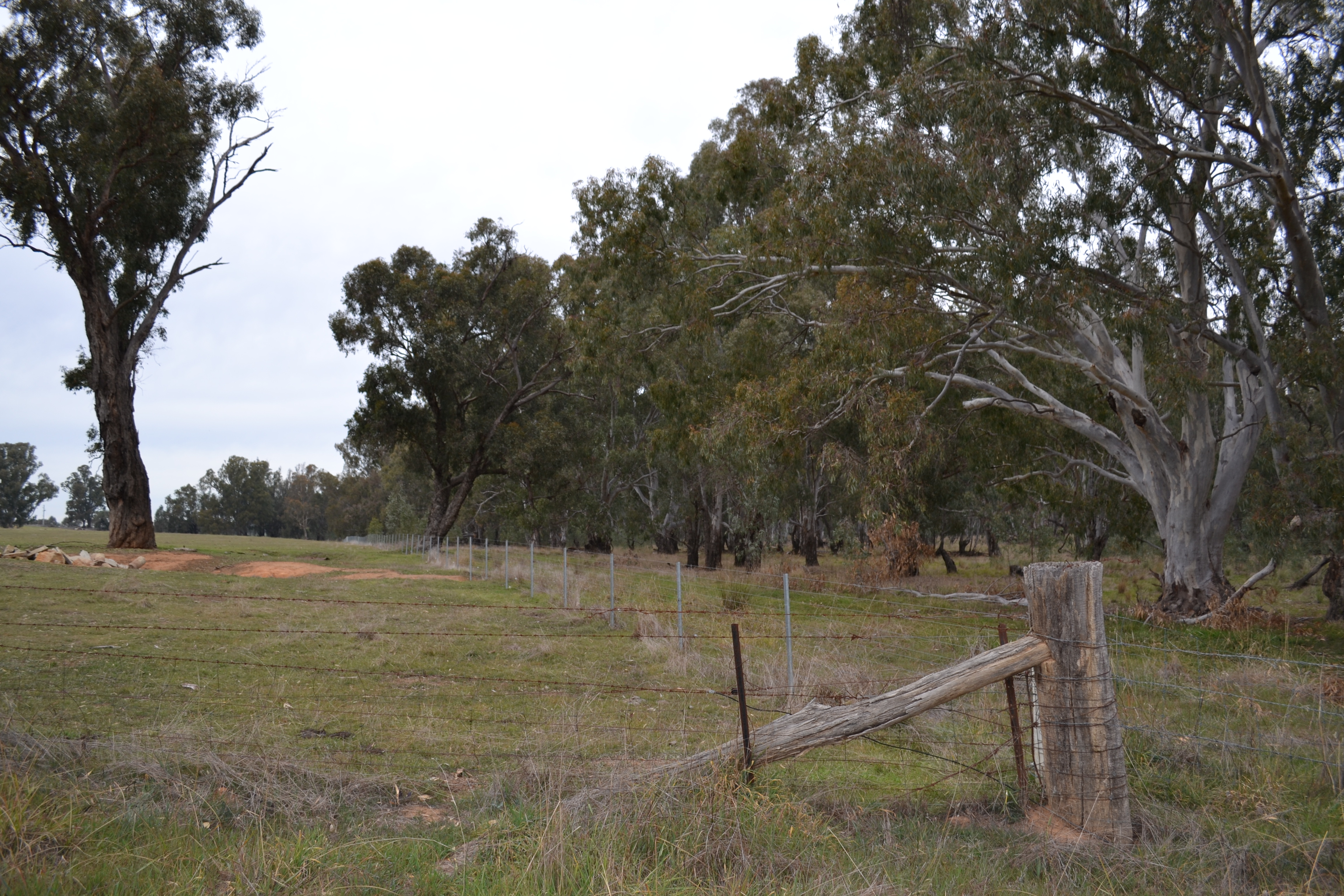
The Ovens River, Warby-Ovens National Park. The natural flow regime of the unregulated river (illustrated by the flood line on the tree in the foreground) helps to maintain the healthy riverine ecosystems within the park.
C. Pascoe
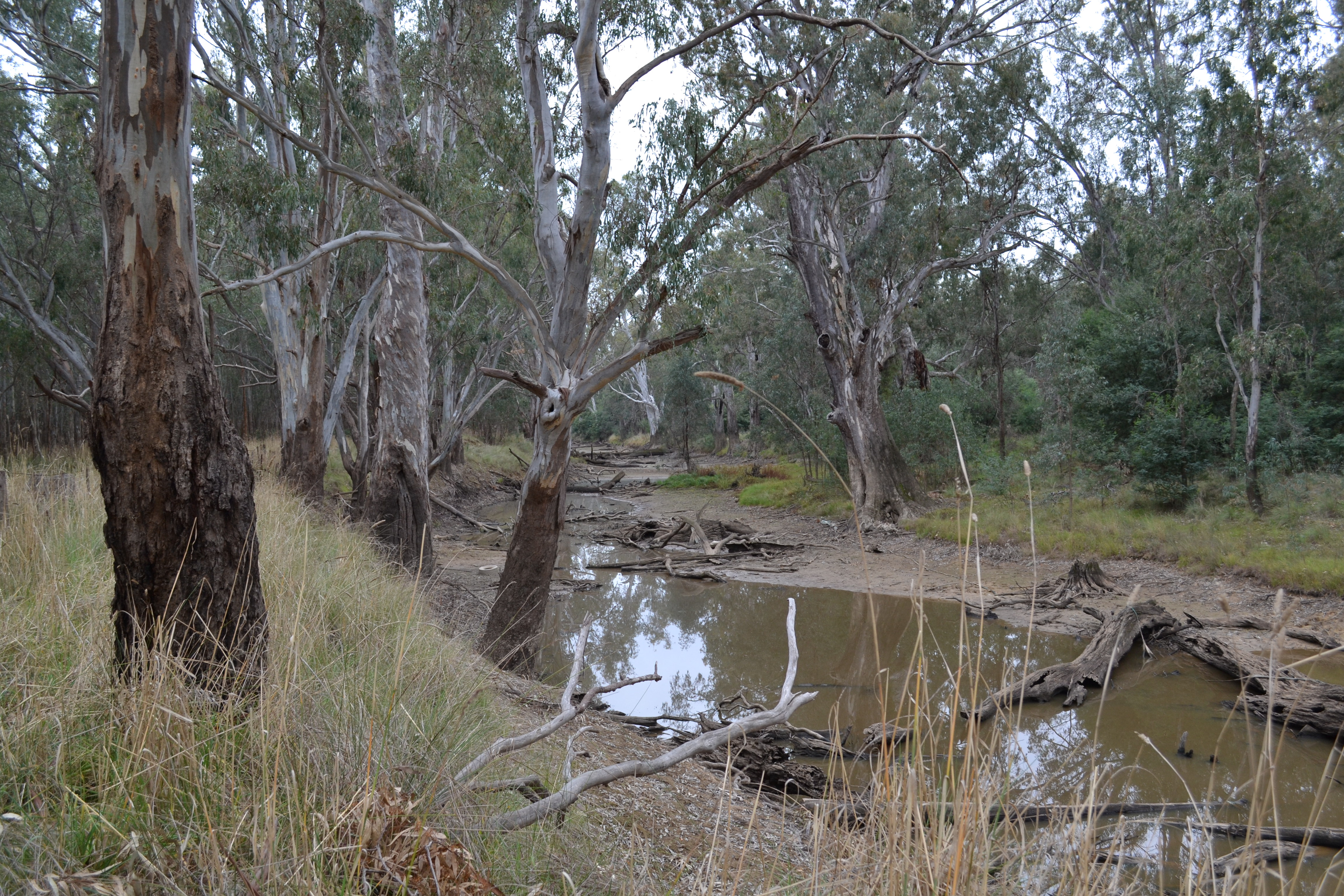
Warby-Ovens National Park was established in 2010 with the addition of over 4,000 hectares of riverine woodland and forest along the lower reaches of Ovens River to Victoria’s parks estate. This state-owned land had been used under license as a resource to water and graze stock since European settlement in 1838. The lower Ovens River and floodplain is a place of significance to the Yorta Yorta people as it was a source of food, fibre and medicine and provided places to camp, hunt, fish, swim and connect with traditional cultures and stories. Creation of the park led to the removal of grazing rights to protect this area of cultural and conservation significance, with grazing licenses successfully phased out by 2013. The park now protects some of the best examples of iconic River Red Gum vegetation in the state, with the Ovens River being one of only two unregulated rivers in Victoria.
Last update: 16 Jun 2021
2883 Views
Context
Challenges addressed
The removal of grazing from Warby-Ovens National Park was undertaken as part of a large, complex project to revoke grazing licences in a number of newly declared parks protecting River Red Gum Forest. This was a highly contentious land management change.
Many adjoining landholders and licensees believed it was their right to graze the Ovens River floodplains, given the practice had occurred over many generations. There was poor understanding of licence conditions with licensees often believing they had 99-year leases rather than the one- or five-year grazing license they held. Boundaries between public and private land were poorly understood, with many encroachments onto public land. Other challenges included fencing park boundaries within a floodplain, lack of alternative water sources for stock, and fears around compulsory land acquisition.
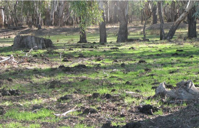
Grazing had resulted in significant impacts on environmental values including trampling of wetlands, reduced water quality and erosion of the river bank.
Location
Warby-Ovens National Park, Victoria
Oceania
Process
Summary of the process
The legislated processes and clear recommendations from VEAC set the basis for the Government to commit to the removal of grazing and the creation of Warby-Ovens National Park and other new River Red Gum parks. Funding provided essential support to affected grazers and significantly reduced the financial impact on most of the affected farmers. This, coupled with strong engagement, including many hours of discussion and getting to know farmers on a personal level, facilitated the transition of grazed land to national park, with many in the farming community previously opposed to the park becoming strong advocates for its continued protection.
Building Blocks
Legislative basis
Under state legislation, the Victorian Environmental Assessment Council (VEAC) is charged with providing advice to government regarding the use of public land, with public consultation a key component of the process. The Victorian government accepted VEAC’s clear, evidence-based recommendations that domestic stock grazing not be permitted on public land along the Ovens River; that a collaborative approach be undertaken with land holders and natural resource agencies to remove stock grazing and develop practical solutions for fencing issues; and that the land along the lower Ovens River be gazetted as National Park. A range of other statutes also facilitated the removal of grazing.
Enabling factors
- VEAC’s review of land use was a participatory process, occurring over multiple years. This resulted in social licence and acceptance of the process.
- There was strong community engagement in the process with over 9,000 submissions received (for the entire River Red Gum footprint (296,000 ha of Crown land across a total area of 1.2 million ha).
Lesson learned
- The existence of VEAC as a Government-supported public land use arbitrator led to the creation of the park and supported improved land management practices (including removal of grazing).
- It’s important to inform community of land use changes and commence engagement processes as soon as possible.
Resources
Government funding
The state government provided $4.5 million for a four-year program to remove grazing from Warby-Ovens National Park and the other Red Gum parks. Licensees were offered $8 per metre for fencing and $3000 per kilometre to install off-stream water for stock where a license included river frontage. Participation in the rebate scheme was voluntary as was fencing in a practical alignment rather than on property boundaries. Funding and technical support was provided to identify legal boundaries. A long phase-out schedule was developed that recognised the significant impact to licensees and their families.
Farmers grazing illegally (i.e. not holding a grazing license) were not funded and faced compliance action if they did not comply with the changes. Many kilometres of unwanted fencing associated with past grazing practices was also removed as part of the program. In some cases, metal bollards replaced the barbed wire fences allowing native animal movement while preventing illegal vehicle access, rubbish dumping and firewood removal.
Enabling factors
· The complexity of the program was acknowledged early and a flexible adaptive approach was taken to deal with assets constructed on public land e.g. a house built on crown land was excised from the park.
· As much as possible, the location of park boundary fencing considered ‘practical boundaries’ with boundary markers used to identify actual boundaries.
· The removal of internal, unwanted fences acted as a deterrent to those graziers who continued to allow their stock to enter the park illegally.
Lesson learned
· Park neighbours were generally willing to negotiate to achieve sensible outcomes. While the majority of park neighbours disagreed with the phase-out of grazing, most gave up freehold land (typically 5 - 10 hectares) to enable boundary fencing to be erected above flood zones and ensure its longevity.
· Complex land use changes take substantial time and negotiation to work through issues and impacts. It was important to allow a sufficient period to enable graziers to be able to modify their farming enterprises. This was especially the case for farmers with smaller landholdings that relied more heavily on Crown land for their income.
Stakeholder and community engagement
A broad range of government agencies, non-government organisations and community groups were engaged with during the phase-out program. As past land managers hadn’t engaged with the farming community regarding management of the licensed areas, much time was spent ‘around the kitchen table’ drinking tea with license holders and listening to their stories and history of the land. It soon became clear that they had a love of the River Red Gum Forest and the special plants and animals that lived there. It was common for farmers to reminisce about their encounters with Wedge Tailed Eagles, Platypus or the big Murray Cod living by their water pump.
Enabling factors
- A dedicated Grazing Officer was assigned to Warby-Ovens National Park, supported by a small team that operated across the River Red Gum parks
- A broad range of community groups, Traditional Owners and non-government organisations supported the removal of grazing for ecological reasons and wanted increased public access to the river frontage.
Lesson learned
- Development of relationships with graziers through acknowledging their connection to the land was essential to gain their acceptance of the park’s creation.
- Farmers didn’t always have access to on-line information or ability to respond to emails. Face-to-face communication and delivery of information proved invaluable.
Impacts
The removal of grazing has seen a significant improvement in the condition of habitat and water quality along the lower Ovens River and associated floodplain. The park boundary is clearly established, with fencing erected along practical lines to ensure damage from flooding is minimised and boundary markers have been installed where this is not possible. The river frontage is now accessible for public use. A positive working relationship has been established with most neighbours, resulting in greater community support for the park and understanding of the values it protects.
Beneficiaries
- Natural and cultural values that are now protected.
- Graziers who received funding for new fencing and water infrastructure
- Community and park visitors who gained access to the river for recreational and social activities such as camping, canoeing and picnicking.
Sustainable Development Goals
SDG 3 – Good health and well-being
SDG 6 – Clean water and sanitation
SDG 14 – Life below water
SDG 15 – Life on land
Story

Fish-friendly crossing. Cement baffles reduce flow velocity and provide refuge; the metal grate lets light penetrate below.
Parks Victoria
Who would have thought that native fish would be scared of the dark?
In 2017, following significant research and planning, North East Catchment Management Authority, Parks Victoria, the Department of Environment, Land, Water & Planning, Yorta Yorta Nation Aboriginal Corporation and the Arthur Rylah Institute for Environmental Research undertook a project to restore native fish passage within the Warby Ovens National Park by constructing two purpose-built fish-ways.
The fish-ways were needed to support migration of 15 native fish species up and down the Ovens River and its adjoining tributaries following a flood event in 2012 that closed fish migration pathways. Research revealed that historical concrete culverts and corduroy (log) crossings were restricting native fish migration and breeding, as native fish are often reluctant to swim into a dark tunnel.
During the design phase of this project, it was decided that not only was fish movement key to the success but also the need to incorporate emergency / tourism access and structural longevity into the final design. The result was a structure designed to allow sunlight to enter the fishway that had purpose-built fish refuges to facilitate the needs of different size native fish as they moved upstream and that could support heavy firefighting equipment and the needs of tourists and their recreational vehicles.
Developing solutions for fish passage was identified as one of the key factors for success in the recovery of native fish populations.
