Participatory 3D Mapping for Land Use Planning and Climate Change Adaptation
Full Solution

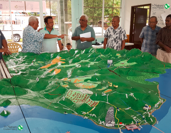
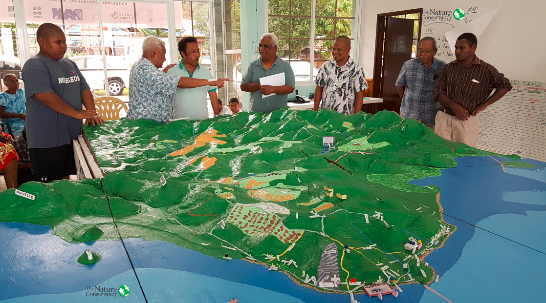
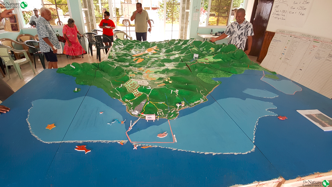
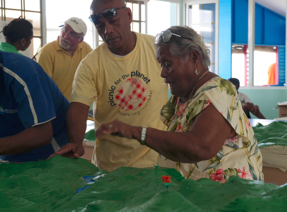
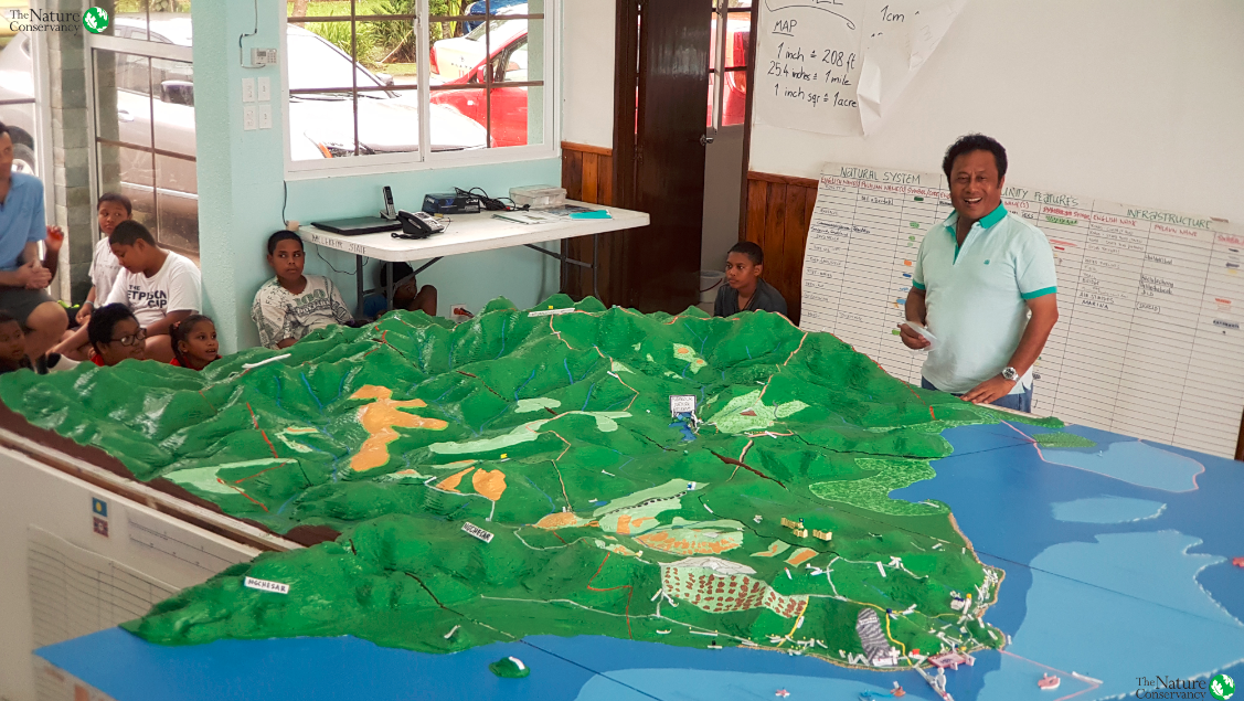
Proud participants, facilitators, and stakeholders look over the 12' x 10.5' model of Melekeok - a model to be used as a land use planning tool for years to come
The Nature Conservancy
Due to increasing pressure on vulnerable natural resources from tourism, local development, and climate change, state government planners in Melekeok (Palau) have identified a need to prioritize land use planning. A 3D model of the state was created using a participatory process, utlizing the knowledge of all demographic sectors of the community. The end result is a 12’ x 10.5’ x 6” model of that serves as a tool to help guide decision makers and community members how to plan for climate change adaptation, manage natural resource, and address land zoning issues.
Last update: 28 Mar 2019
9881 Views
Context
Challenges addressed
As a remote island in the Western Pacific, Palau is dependent on a healthy environment for the ecosystem services it provides. Fresh water resources, healthy fish stock, and stable coastlines are all vital to the well-being of its residents, especially in the state of Melekeok.
Recently, encroaching tourism and its associated development, as well as geophysical impacts along the coastline due presumably to climate change, have threatened the quality and quantity of Melekeok's natural resources that its residents are so reliant upon.
A particular challenge for Melekeok is balancing economic growth with wise stewardship of natural resources and protected areas, as well as the maintenance of their cultural heritage.
Location
Melekeok, Palau
Oceania
Process
Summary of the process
This workshop is primarily a learning experience, with a tangible product/tool as a byproduct. As such, there needs to be a balanced approach to the workshop using sound technical planning and execution, thorough communications, free flow of information and knowledge exchange, and an enthusiasm at the community level to ensure practical value of the tool.
The technical experts must serve in a supporting capacity to the community throughout the process so that ownership of the model takes root. They plan in advance and communicate all GIS technical information to workshop implementers and planners, who also will benefit from some GIS experience/exposure. The planners, by being proactive and thorough, will be able to reach as many participants as possible in an early time. This will ensure the greatest amount of traditional knowledge is being captured. The cooperation across all of these skillsets and demographics are what in turns yields sustained utility. There is greater chance of the project taking root if a diverse and abundant community is equally supportive.
Building Blocks
GIS/Technical Planning
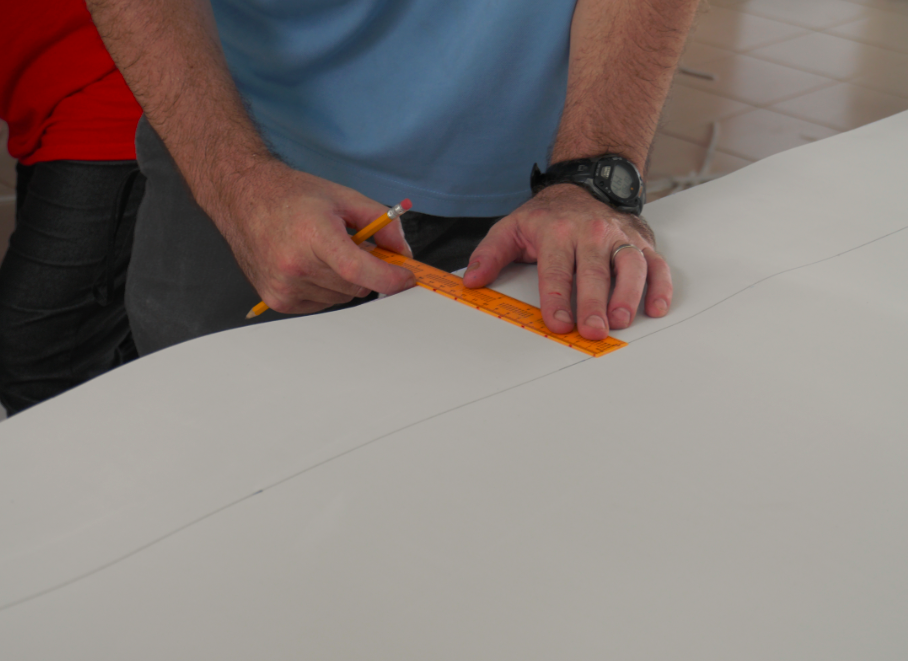
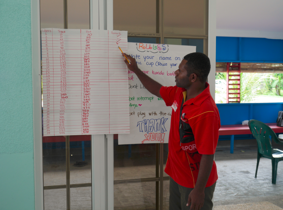
The technical aspects of the table/model must be carefully planned by a GIS specialist. Key considerations include: intent of model, vulnerable natural and social resources, land elevation, land area, marine and water features, space to host the model, and access to model materials.
The spatial extent and the elevation of the land will inform the GIS specialist of the scale to be used. The scale impacts the number of foam layers to be used, and ultimately the amount of foam material needed to create the model. Experience with topographic maps and geospatial analysis is required.
Enabling factors
- The major enabling factor is technical expertise in the field of cartography/GIS.
- If working in a remote location, access to the model materials is critical and need to be arranged in advance.
- The ability to communicate complex geospatial skills into practical and creative excercises is another skill that is very enabling.
Lesson learned
- Foam sheets work better as a foundation than cardboard
- Technical input needs to be received from stakeholders regarding the key considerations above months in advance of the purchasing of materials
- If the land elevation is not very high, changing the scale can create an exaggerated model, which is beneficial to visualize land properties and potential problems
Workshop Planning
The workshop must be carefully planned well in advance to allow for those with jobs, school, or household duties to attend their prioritized needs. A critical component of success is the participatory feature of this workshop, and to make this workshop fully participatory, there must be a coordinator and personnel duties fully established
Enabling factors
- A project coordinator with good communication skills.
- A good outreach strategy to advertise the project to all potential participants and broadcast its purpose and function
Lesson learned
A scoping trip should take place at least two weeks in advance to help prepare. During this time, responsibilities should be delegated so that participants come in time ready to work
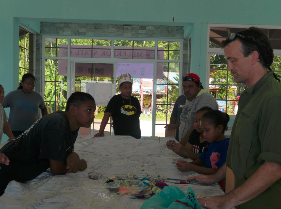
Exchange of Traditional Knowledge
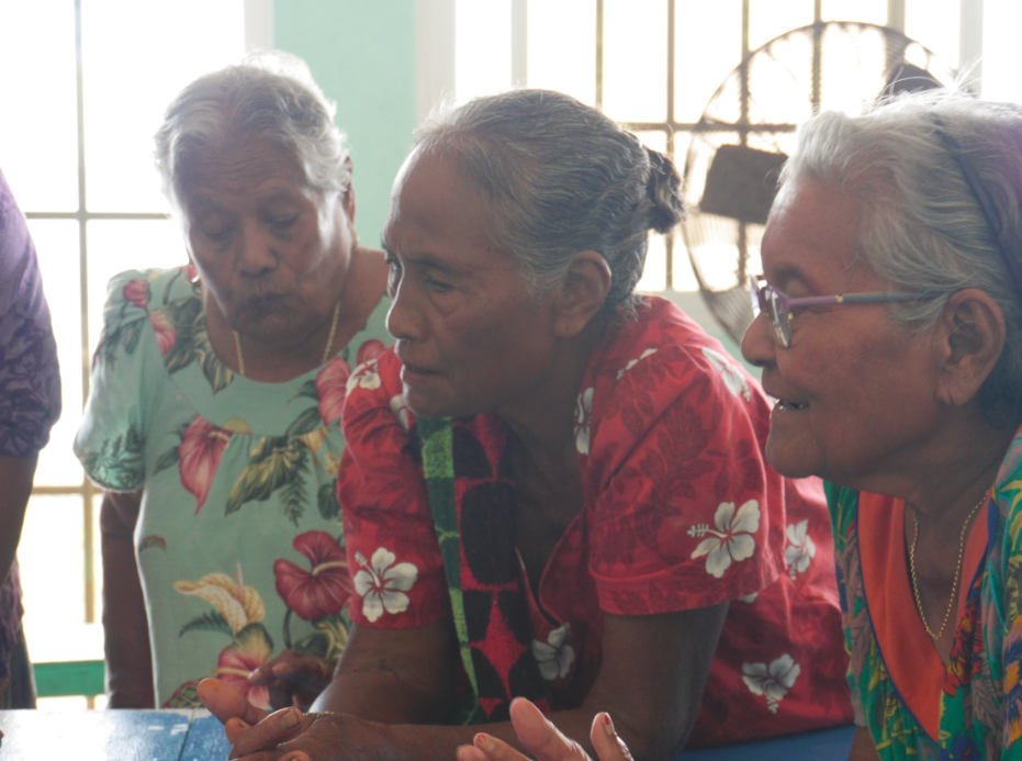
When conducting a P3DM workshop in a place with a high percentage of an indigenous community (like Palau), the utility of traditional knowledge is invaluable and irreplaceable. The format of a P3DM workshop can help capture traditional knowledge better than many planning exercises, and can ensure the prolonged preservation of such knowledge by storing it in a tangible model.
The P3DM captures traditional knowledge through organized, structured discussions around the model. Advanced planning to advertise the event is important for word of mouth to reach those living in more isolated communites. Semi-structured interviews around the model can capture most of the ideas; attention should be given to quieter participants who may shy away from sharing in crowds.
Enabling factors
Representation by the elderly community; high demand for such a workshop to take place (the greater the enthusiasm, the greater the knowledge input); access to researching traditional knowledge in advance through surveying or literature review; spreading news of the workshop early by word of mouth
Lesson learned
- Involve a process during the workshop where elders interact directly with the younger generation so that such a learning exchange occurs directly and in real time
- Elders typically demonstrate more traditional knowledge and are able to supplant important spatial information that does not exist in modern land use plans – it is critical to get as much involvement from them as possible. Reach out to them at early stages
Ensuring Sustained Utility

In order for the finished product to have practical value, the model should be i) hosted in a location convenient and conducive to land use planning, ii) hosted in a place free from environmental elements (rain, wind, salt water, etc), iii) visible by community/state planning agencies, iv) revisited on a regular basis to incorporate spatial information into ongoing planning exercises
Enabling factors
- A hosting space/agency free from environmental elements
- Enthusiasm for use by state and community planning groups
Lesson learned
If a case can be purchased/provided, covering the model will extend its shelf life by years.
Impacts
The model is currently housed in a community center and serves as a visual tool and reference on a daily basis to members of the community. It serves as an educational tool for the community youth, who are able to visualize valuable resources, infrastructure, natural habitats, and community landmarks from a geospatial perspective.
More formally, the model is used by state and national planners during meetings and workshops as a guide in their zoning processes. As tourism development seeks to expand beyond Koror, competing interests are vying for valuable land in Melekeok State, and this model provides an accurate, transparent window to the important natural assets of the area. Furthermore, planned retreat is being considered as an adaptation strategy and requires tools like the 3D model to properly plan for relocation around critical habitats and private property.
Using the 3D model to properly zone and plan not only protects critical habitat and ecosystems, but will contribute to a more cost-effecient process of social and commercial development.
Beneficiaries
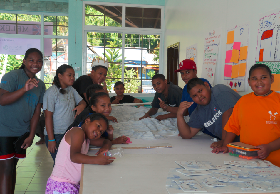
Over 70 participants assisted in constructing the model. Ages ranged from 10-70+ years old, and included all demographics and multiple stakeholder groups. Staff from multiple state and national agencies will benefit directly from this tool.
Story
In a response to how the P3DM workshop will benefit Melekeok, an unnamed 42 year old particpant answered:
"I will promote the 3d model as a learning and planning tool and will disseminate this knowledge to other people. I am more aware of climate change, and ready for it. It motivates me to think of other ideas besides sports to have kids engaged"
Connect with contributors

Other contributors
Nate Peterson
The Nature Conservancy
Mike Aulerio
The Nature Conservancy
Graham Gaines
The Nature Conservancy
Kevin Mesebulu
Melekeok State Government
Patrick Vuet
Partners with Melanesians
Cecile Senive
Partners with Melanesians
Chiara Franco
The Nature Conservancy
Bibbie Kumangai
The Nature Conservancy
Johannes Forster
Helmholtz Centre for Environmental Research
