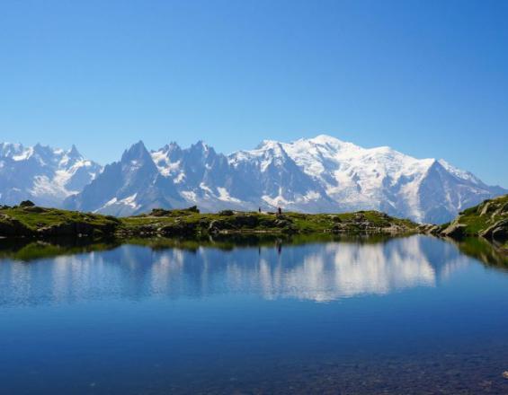
Lake Chesery
Asters
High mountain lakes are fragile, emblematic ecosystems that are highly attractive for outdoor activities (tourism, hiking, bivouacking, fishing, etc.).
Until the years 2000-2010, they were still very little studied; the scientific knowledge that did exist was not used to guide the management or protection of these ecosystems. Each local player worked in isolation (protected area managers, fishing associations, scientists, hydroelectric operators, local elected representatives).
The creation of the Lacs Sentinelles network has made it possible to generate a national observatory, bringing together numerous partners around a common challenge: to understand and protect these sensitive ecosystems, and to anticipate their evolution in the face of climate and societal change.
The Lacs Sentinelles network is coordinated by ASTERS-Conservatoire d'espaces naturels de Haute-Savoie.
For further information, visit
http://www.lacs-sentinelles.org
Last update: 13 Mar 2020
3130 Views
Photo and video gallery
Context
Challenges addressed
The challenges that led to the creation of the network were :
- to acquire scientific data on pioneering ecosystems that are highly sensitive to climate change: high-altitude lakes. This meant encouraging scientists and protected area managers to work together, and finding the financial levers to do so.
- that the data be homogeneous on a national scale to contribute to the understanding of climate change and ecosystem services.
- to involve a wide range of stakeholders in the governance of these fragile ecosystems: protected area managers, local elected representatives and user representatives (fishing, hydroelectricity, tourism, outdoor activities, etc.).
- guide ecosystem management decisions to find the best balance between nature conservation and human activities, and make these decisions in a concerted manner.
Location
Haute-Savoie, France
West and South Europe
Process
Summary of the process
The creation of a Groupement d'Intérêt Scientifique (GIS) has enabled many players to structure decision-making concerning scientific research on these ecosystems.
Annual meetings are organized. Technical seminars are also organized. Numerous events to disseminate and promote knowledge are organized throughout the region (conferences, film screenings, press articles, etc.).
Scientific results are communicated to local players and decision-makers in a popularized form, to help guide management decisions in these ecosystems.
Building Blocks
Governance
Federating partners is essential to achieving good environmental management. To achieve this, it is necessary to :
- identify all conflicts of use
- involve users in the partners: scientists, local communities, protected area managers, fishing federations, etc.
Enabling factors
The two key success factors are :
- neutral, synthetic information on the state of ecosystems (scientific data)
- sufficiently frequent meetings to share information and bring stakeholders together.
Lesson learned
Science + public consultation = effective solution and local acceptance
Scientific knowledge
The aim of the Sentinel Lakes Observatory is to characterize the state of these ecosystems by gathering homogeneous scientific data from different lakes, while guaranteeing political neutrality.
Enabling factors
- Build a robust and efficient scientific protocol
- Work in a multi-disciplinary manner
- Enable replication of this protocol in different lakes
- Analyze, synthesize and promote the results of these scientific studies
Lesson learned
many scientists from different disciplines + protected natural area managers = useful data!
Impacts
Since the Sentinel Lakes network was created :
- 15 members have joined and 6 partners contribute to its funding.
- Some twenty high-altitude lakes have been studied using the same scientific protocol. This has generated an enormous amount of scientific knowledge, comparable on a national scale.
This knowledge provides answers to several fundamental questions: How do high-altitude lakes respond to external pressures? What are these pressures? Can these pressures be reduced to guarantee the conservation of biodiversity and ecosystem services?
- the results of scientific research are promoted within the areas studied, among local players, users, decision-makers and citizens. Information is circulating much more effectively.
- This scientific knowledge feeds into public decisions concerning these lakes. For example, local players in the Haute-Savoie region have proposed and approved a decision to stop stocking high-altitude lakes in nature reserves, in order to better protect their biodiversity. This decision was agreed and adopted by the nature reserve manager, the French government and the Haute-Savoie fishermen's federation.
Beneficiaries
The beneficiaries are :
- Nature itself, especially freshwater ecosystems
- Local communities
- Local and national decision-makers
Sustainable Development Goals
SDG 14 – Life below water
Story

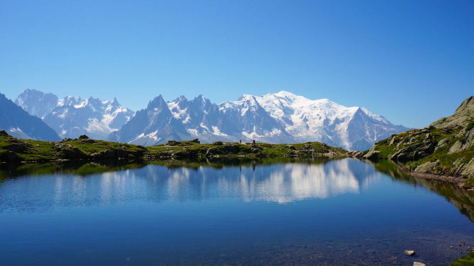
Brevent lake
CEN74
A few key dates:
2009
The first thoughts on the Sentinel Lakes network emerged from the Aqua European program " Water resources in the Protected Areas of the Western Alpine Arc: data sharing, experimentation and management indications ". Objectives: better dissemination of results between partners, pooling of resources and harmonization of monitoring methods.
The Lacs Sentinelles network was then built informally around a coordinating structure: Asters, Conservatoire d'espaces naturels de Haute-Savoie.
2010
A first technical seminar on "Mountain lakes and streams" is organized, laying the foundations for future annual meetings of the network.
2011
Organization of the network's 2nd annual meeting.
These multi-disciplinary meetings encourage exchange and represent a high point in the life of the network, with each partner mobilizing to take part. New collaborations are born of these meetings every year.
2012
Asters officially takes over the management of the Lacs Sentinelles network. A collegial decision is taken to structure the network as a Groupement d'Intérêt Scientifique (Scientific Interest Group) to enhance its visibility.
2013
A common protocol for monitoring lakes is defined, with three parameters listed as essential: continuous temperature measurement, transparency measurement and oxygen measurement.
2014
On February 25, 2014, the modes of operation and governance of the Groupement d'Intérêt Scientifique (GIS) are approved.
2015
The common protocol is applied to 24 Alpine lakes in the network, and new monitoring parameters are tested on some of the lakes.
Network website goes online: www.lacs-sentinelles.org.
2016
"Parcs Nationaux de France" joins the GIS.
2018
The Lacs Sentinelles network is integrated into the "Sentinelles des Alpes" structure, which brings together observation networks across the French Alps (flora, mountain pastures, lakes, biodiversity and refuges).
2019
The scientific knowledge produced by the network has enabled local players in Haute-Savoie to take a concerted decision to stop stocking lakes in nature reserves.
Connect with contributors
Other contributors
Bosson Jean-Baptiste
Conservatoire d'espaces naturels de Haute-Savoie - ASTERS
Birck Carole
Conservatoire d'espaces naturels de Haute-Savoie - ASTERS