Supporting transboundary dialogue on Marine Spatial Planning towards a sustainable blue economy for the Southeast Pacific
This solution is part of the MSPglobal Initiative, designed to support the “Joint Roadmap to accelerate Marine Spatial Planning processes worldwide (MSProadmap)”, adopted by IOC-UNESCO and European Commission and in line with SDG 14.
More specifically, this solution assists its beneficiary countries in generating approaches, tools and actions at transboundary level to contribute to coherent MSP plans in the Southeast Pacific.
This region shows important advances in integrated coastal management, although with different levels of progress; however, implementation of MSP is still incipient. Institutional capacities were reinforced and transboundary dialogue coordinated, resulting in a regional roadmap for transboundary MSP and sustainable blue economy.
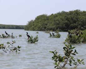
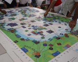
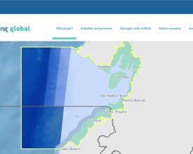
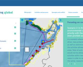
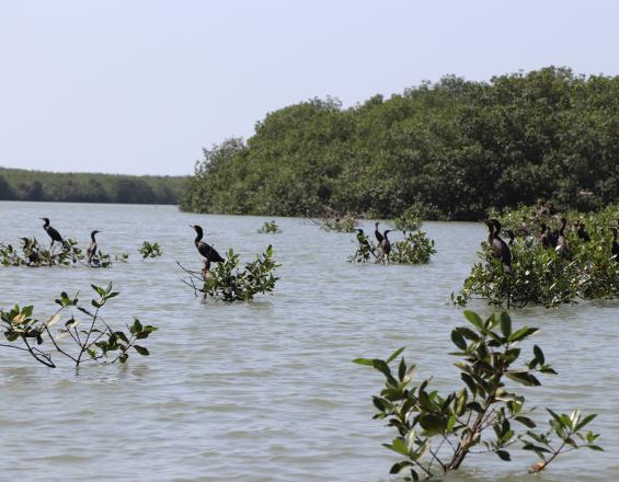
A specific cross-border area - Gulf of Guayaquil (Ecuador/Peru) - was selected for a participatory mapping exercise on current conditions and scenarios.
MSPglobal was co-financed by the European Maritime and Fisheries Fund of the European Union.
Context
Challenges addressed
- Increasing number of maritime uses and conflicts
- Increasing need and demand to improve coastal and marine conservation
- Lack of policies on MSP and/or sustainable blue economy in most of the beneficiary countries
- Lack of capacity on MSP among some governmental institutions and other stakeholders
- Lack of regional coordination towards coherent MSP plans across maritime borders
Location
Process
Summary of the process
The key objectives of this solution were to “strengthen stakeholders’ capacities” (BB2) on MSP and sustainable blue economy in the four beneficiary countries, as well as to “support the development of institutional recommendations at regional scale” (BB6). In order to inspire the beneficiary countries in a more concrete way, an example was developed in a cross-border area between two of the countries through “analyzing current conditions of the marine environment and maritime uses” (BB3) and “building scenarios for MSP and sustainable blue economy” (BB4). Based on this, it was decided to “showcase the key results through a simplified and interactive storytelling tool” (BB5), easily accessible and understood by stakeholders. Everything was done based on engagement activities that required adequate “planning, reporting and monitoring stakeholder participation and communication” (BB1).
Building Blocks
Planning, reporting and monitoring stakeholder participation and communication
This BB aimed to structure the tasks related to stakeholder engagement and communication through the development of:
I) A Strategy for Public Participation based on:
- Three pillars: identification of stakeholders; engagement activities; and monitoring and evaluation of participation
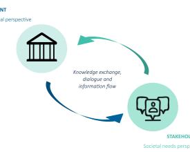
- A two-way participatory approach: balance between top-down and bottom-up
II) A Communication and Dissemination Plan to set a unified tone and direction so that all activities, tools and materials work in harmony to create a shared vision to raise awareness of the initiative and its results. It also included monitoring of a number of metrics – through various channels and means – to evaluate the overall impact and success of communication and dissemination actions.
Standalone communication and dissemination plans, as well as engagement plans and reports were developed to guide and evaluate each activity implemented. The key messages from these reports were used as web news in order to communicate and report back to the stakeholders.
In the Southeast Pacific pilot, the following engagement activities were implemented:
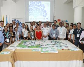
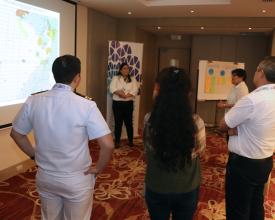
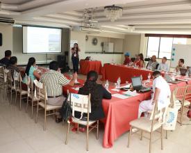
- Stakeholder meetings, especially for the mapping exercise in the Gulf of Guayaquil
- Institutional workshops at national and regional levels
- Training courses for governmental authorities and sectoral stakeholders
Enabling factors
- Contacts from previous project developed in the region
- Nomination of a governmental representative (National Focal Point) to support the identification of stakeholders, as well as to officially invite them to participate
- Development of a Stakeholder Database to include all stakeholders who so wished, facilitating the contact and dissemination of information
- Development of a visual identity
- A member of the team fully dedicated to communication
Lesson learned
- Stakeholder Database: When dealing with hundreds of stakeholders, better to build a database with limited number of essential fields to maintain communication
- Stakeholder mapping: Actively map stakeholders (e.g., snowball technique) in order to expand and diversify the actors engaged
- Engagement activities: Start organizing and publicizing well in advance, as well as send reminders frequently (for both face-to-face and online events)
- Local stakeholders: Field visits to identify and engage with local stakeholders, who might be less willing to use virtual channels
- Communications and outreach: Adapt communication to the stakeholders involved; use different channels to reach larger audience; mix digital, audiovisual and print products
Strengthening stakeholders’ capacities
This Building Block aimed to develop activities to improve stakeholders’ capacities on MSP and sustainable blue economy. It helped the participants to understand the big picture of MSP, as well as the role they can play in such policy.
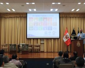
I) Training course for governmental representatives
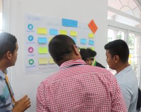
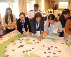
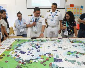
included both theoretical and practical sessions. The first covered topics such as the concepts of MSP and sustainable blue economy, as well as stakeholder participation and data and information. Moreover, the competent authorities had the opportunity to discuss national initiatives on MSP. Putting theory into practice, participants were divided into groups to play the MSP Challenge Game, representing planners and stakeholders. They were asked to define the vision, objectives, indicators, actions and stakeholders of fictitious countries to simulate an MSP process. After, they developed sectoral plans and used the tokens of the game to negotiate space and develop an integrated plan. They also had to link aspects of the plan with the achievement of the SDGs.
II) Seminars for sectoral stakeholders
They presented the concepts and importance of integrated policies such as MSP and blue economy, focusing on conflict resolution and opportunities. They also provided a chance for governmental representatives to disseminate national policies.
Enabling factors
- Training material and course in the language of the stakeholders
- Practical exercises to stimulate the learning process
Lesson learned
- Content: Beyond learning about concepts, participants are interested in real-life examples
- Gender balance: It is important to request that the list of participants invited to the training courses is gender-balanced
- Participation: Ensure that the National Focal Point responsible for co-organizing the activities is communicating with partner institutions to guarantee their involvement
- Private stakeholders: They are usually less willing and available to engage in training courses, especially if it is organized during their working hours
Resources
Analyzing current conditions of the marine environment and maritime uses
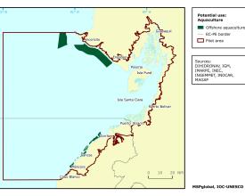
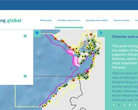
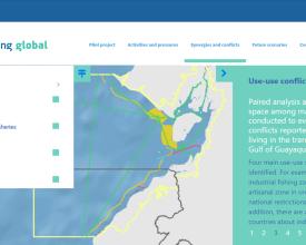
This Building Block aimed to analyze the current conditions of the Gulf of Guayaquil (historical bay shared by Ecuador and Peru) as an example that could be replicated in other cross-border areas. Policies, data and information on the marine environmental and main maritime uses were analyzed to identify use-use and use-nature conflicts and compatibilities, resulting in the development of a technical report publicly available.
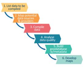
Spatial data was compiled with the support of the National Focal Point of each country, who contacted and requested the data to the competent governmental authorities. A geodatabase with metadata was built and maps developed. Consultation activities (local and binational) were organized with stakeholders in order to review the maps and provide further information about conservation and sectoral issues.
Enabling factors
- Access to public national, regional and international data sources
- Data from previous project developed in the region
- Key governmental partners to support data compilation
- Increasing willingness of data providers to share the data due to engagement activities
- At least one member of the team with expertise in spatial data available during the whole initiative in case additional analysis is necessary
Lesson learned
- Policies: Analyze them as a package to understand their connections, overlaps and gaps, as well as the governance framework. Some policies provide relevant information about zones already established for different sectors, although this kind of spatial data is not always publicly available
- Data providers: Map the potential data providers and then request data through a key governmental partner in order to increase the chance of a positive answer
- Lack of data: Some institutions might not be willing to share data, so it is important to be transparent and acknowledge data gaps
- Data quality: Validate with experts the reliability of data compiled from a source outside of national or international institutions; and if needed, remove it from the analysis
Building scenarios for MSP and sustainable blue economy
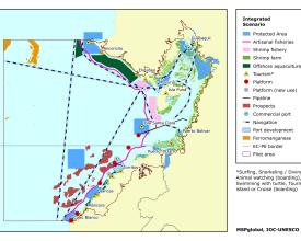
This Building Block aimed to analyze potential future conditions of the Gulf of Guayaquil in order to build three scenarios by 2030: trend scenario; conservationist scenario; and integrated scenario. The developed scenarios DO NOT represent official proposals for the area; instead, they are a starting point for a multi-sectoral and cross-border dialogue about the desired future. A technical report was developed and made publicly available.
Enabling factors
- Sectoral plans with objectives and potential areas of development already identified
- National policies with at least some goals for the coastal and marine socio-ecological system already identified
Lesson learned
- Potential areas of development: Important to confirm with competent authorities if the areas identified in previous policies are still valid
- Transparency: Justify the goals and assumptions of each scenario, as well as how they were developed. If they are not official proposals, make it clear whenever presenting the scenarios in order to avoid any issue, such as a governmental stakeholder upset because it was not involved in the process
- How to use: Develop some guidelines with suggestions on how to use and adapt the scenarios during dialogue and negotiation with stakeholders at national and regional levels
Showcasing key results through a simplified and interactive storytelling tool
This Building Block aimed to develop a multilingual storytelling tool to showcase both existing conditions and scenarios for the pilot in the Gulf of Guayaquil. The objective was to present the data and information in a simplified and interactive way, and as such to turn complex concepts into notions easily understood by all stakeholders.
Enabling factors
- Professionals with previous experience in developing an online storytelling tool with spatial data visualization
- Technical reports with the necessary data and information published in advance
- Spatial data organized in a geodatabase with metadata
Lesson learned
- Teamwork: Those involved in the development of the reports need to work in close collaboration with those responsible for developing the tool to ensure that the key results are properly selected and displayed
- Structure: Organize the story through different themes, titles, taglines and sections
- Be concise: Limit the size of the texts to the key messages. If the user is interested in learning more, reports with the full information should be available
- Technical terms: Whenever possible, avoid using difficult and/or technical language (including acronyms) that might be incomprehensible for a wider audience. If it cannot be avoided, better to add the meaning
- Responsive web tool: Depending on the type and format of the content, it might be difficult to ensure that the tool is sufficiently responsive across different internet browsers, resolutions and electronic devices
- Beta version: It is recommended to develop a beta version (pre-release) and then ask some users to play with it before the launch
Supporting the formulation of institutional recommendations at regional scale
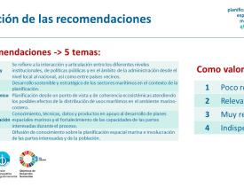
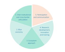
This Building Block aimed to develop a regional roadmap on MSP and sustainable blue economy agreed by the four beneficiary countries: Colombia, Ecuador, Panama and Peru. During national activities, governmental authorities and relevant stakeholders provided recommendations, which were compiled in a summary table by thematic focus and then prioritized by the National Focal Points. The most voted recommendations were selected and rephrased (when necessary) to compose the regional roadmap.
Enabling factors
- Increasing relevance of MSP and sustainable blue economy in the national and international agendas
- Pre-existing collaboration between governmental institutions at national and regional levels
Lesson learned
- Building capacity: Before proposing regional meetings, it is important to provide capacity building at national level so that national representatives are better prepared for regional discussions
- Building cooperation: Before proposing an activity to develop regional recommendations, it is important to organize prior meetings at regional level so that national representatives can meet and get used to working with each other
Impacts
- Increased awareness among different stakeholders about the relevance of marine policies such as MSP and sustainable blue economy
- Increased stakeholders’ capacities to develop and implement MSP plans and sustainable blue economy strategies at national level
- Knowledge-based cross-border dialogue built on technical tools (reports and user-friendly storytelling tool)
- Agreed regional recommendations on MSP and sustainable blue economy
Beneficiaries
- Representatives of governmental institutions involved in institutional discussions about MSP from the 4 beneficiary countries
- Other stakeholders (e.g. maritime users and researchers) that had the opportunity to engage in the trainings and/or mapping exercise

