Using ICT tools in participatory vulnerability assessments
Full Solution
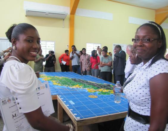
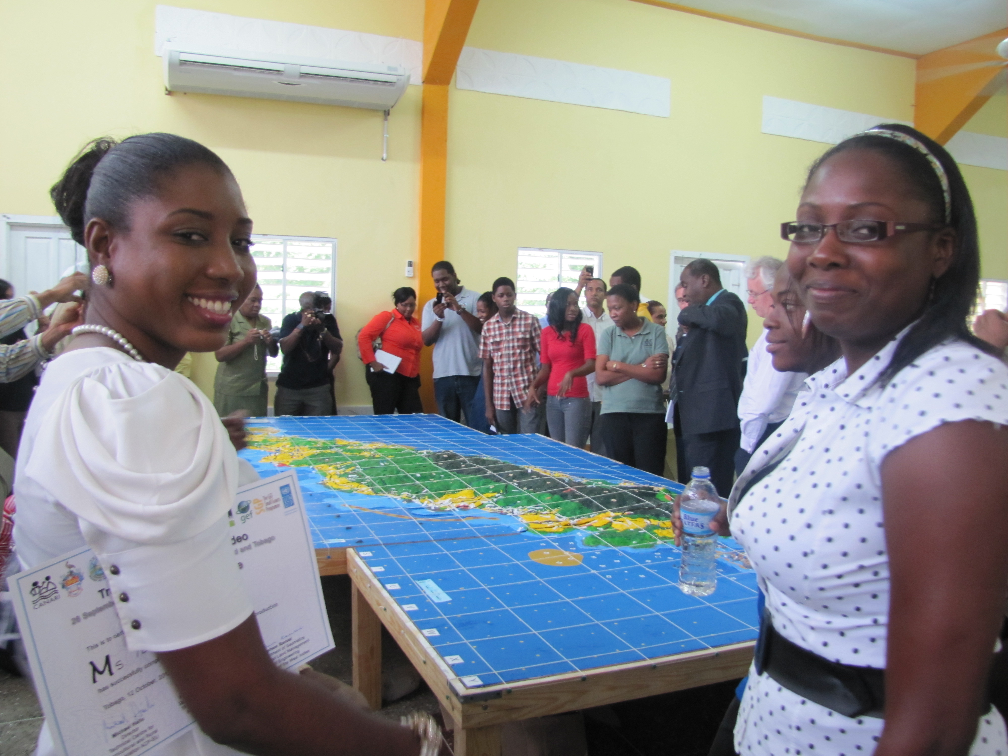
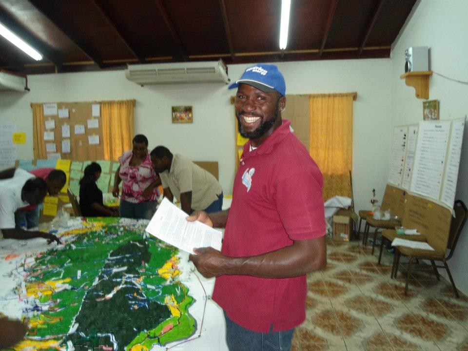
Proud participants at the handover ceremony for the completed 3D Model of Tobago. Copyright CANARI.
Using Information Communication Technologies (ICT) tools to facilitate participatory climate change vulnerability assessments addresses the challenge of effectively engaging a wide range of stakeholders, including those at different literacy and capacity levels, to capture local and traditional knowledge as well as stakeholder input on priority needs and opportunities for resilience building in the Caribbean islands.
Last update: 01 Sep 2020
4304 Views
Context
Challenges addressed
effectively engaging stakeholders in climate change vulnerability assessments
The solution seeks to facilitate means of effectively engaging stakeholders in climate change vulnerability assessment processes to capture local and traditional knowledge as well as stakeholder input on priority needs and opportunities for resilience building.
Location
Trinidad and Tobago
Caribbean
Process
Summary of the process
The building blocks (P3DM and PV) can be used together in different ways. PV can be done before P3DM to start to engage stakeholders and mobilise them for more detailed work in model building. PV can also be done during P3DM to conduct detailed field or stakeholder validation of information captured during the model building process. PV can also be done during and after the P3DM process when the model is completed to help to capture what stakeholders feel are the main points in terms of vulnerability and priorities for resilience building for communication to policy-makers and other stakeholders.
Building Blocks
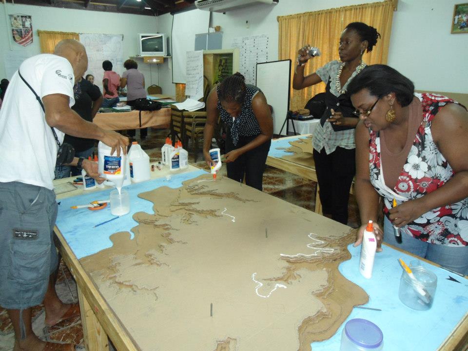
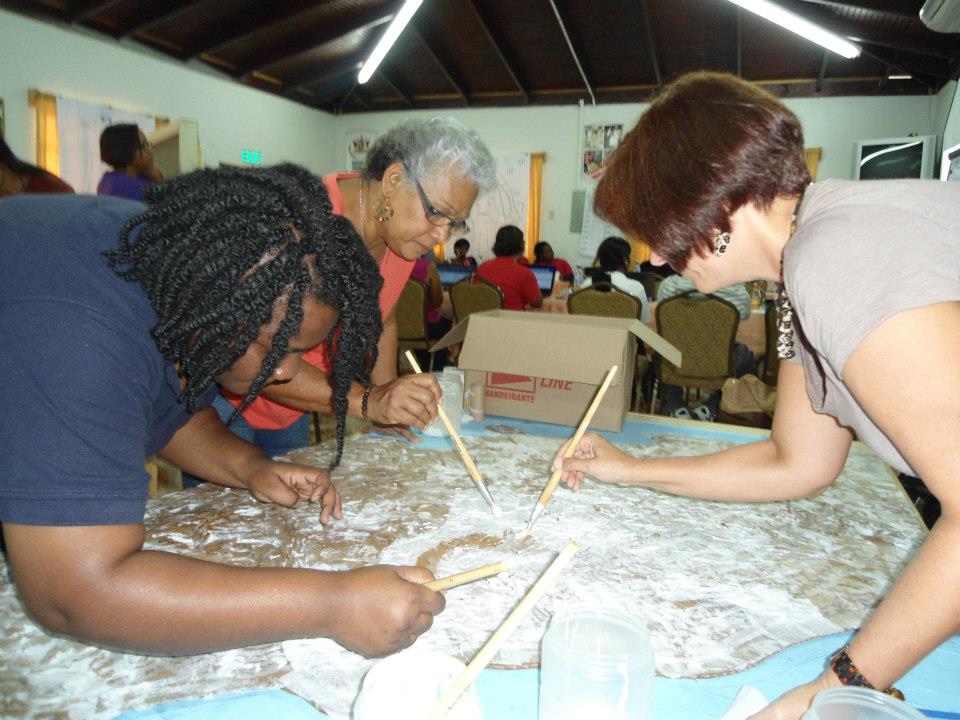
Participatory three-dimensional modeling (P3DM)
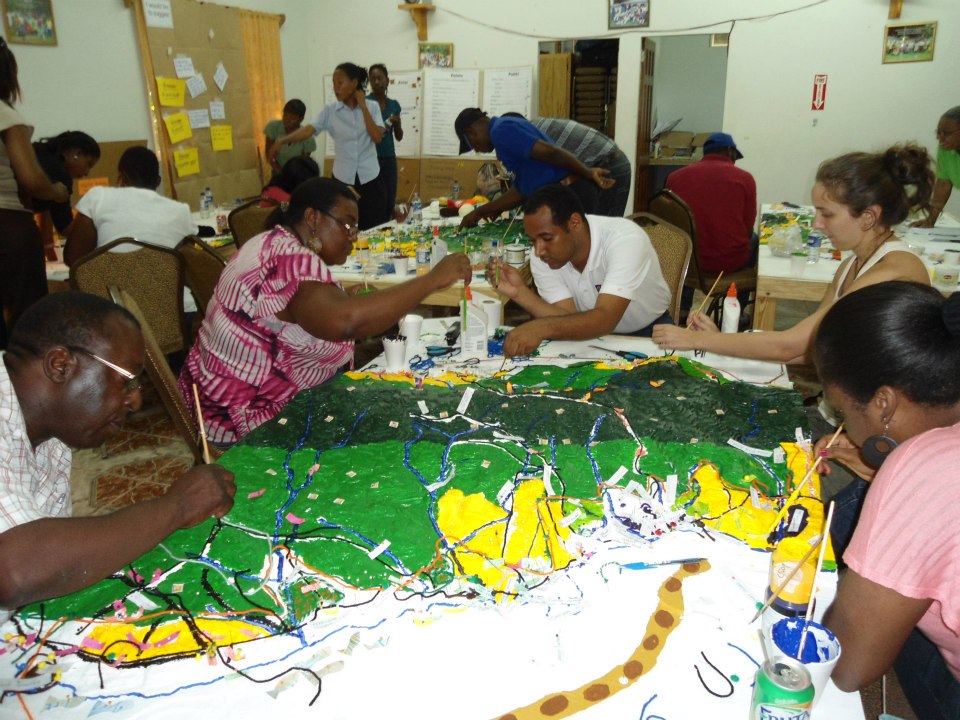
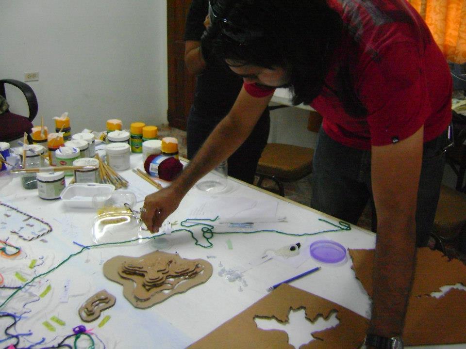
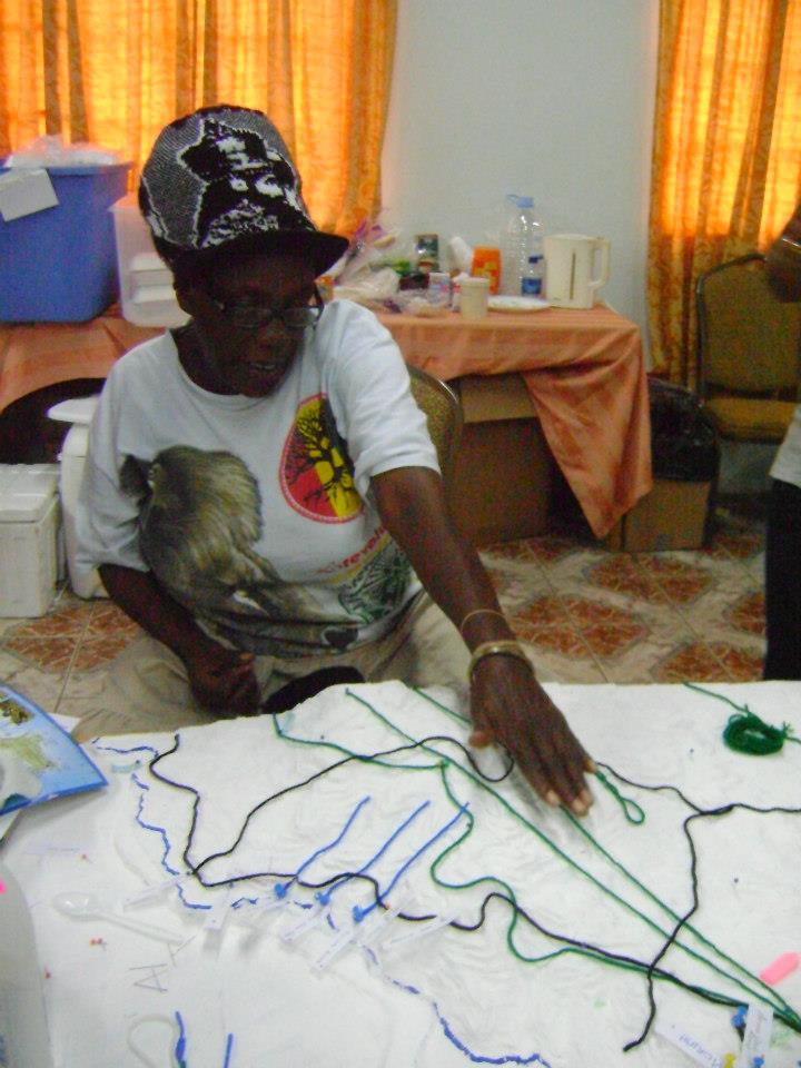
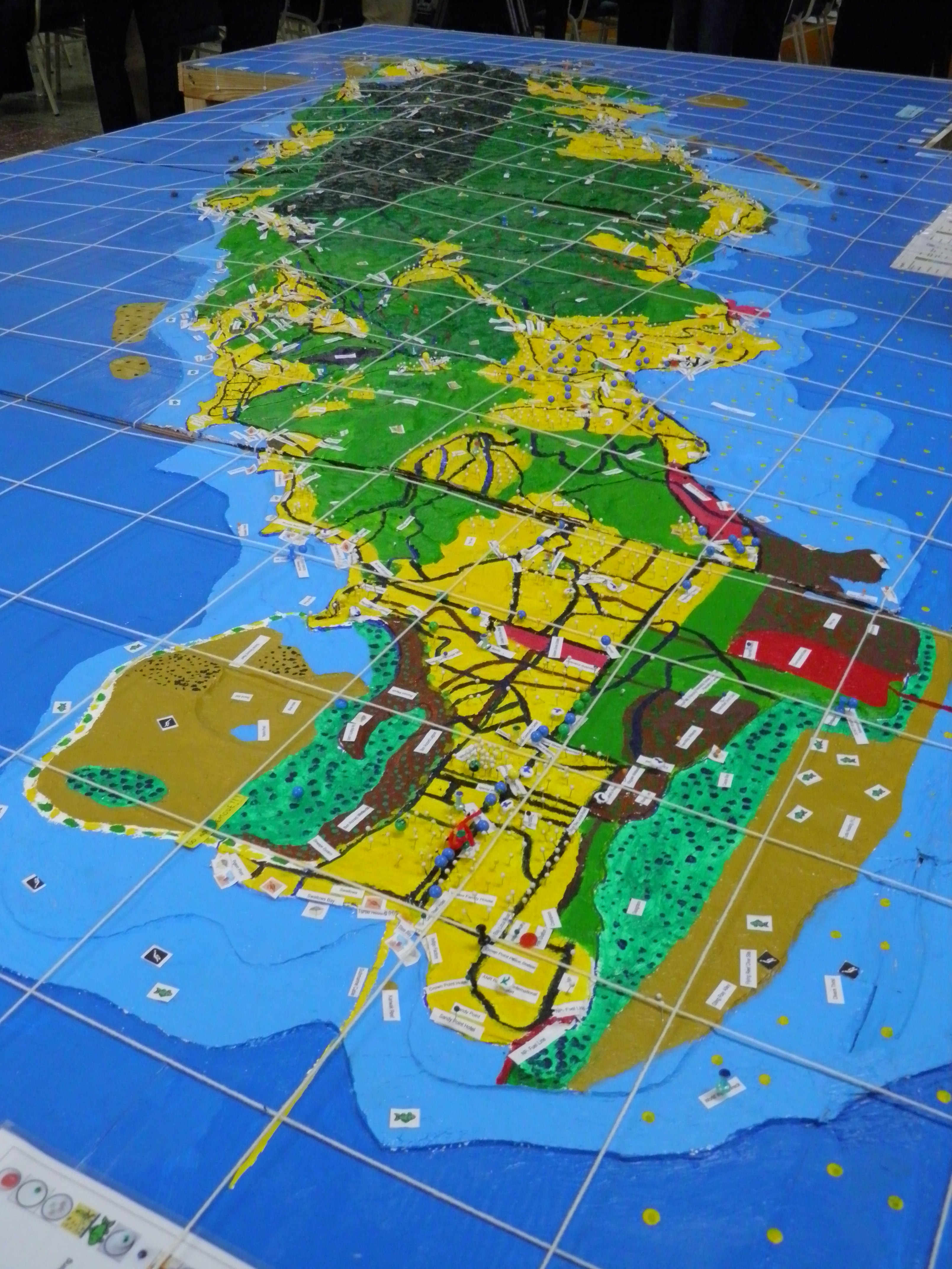
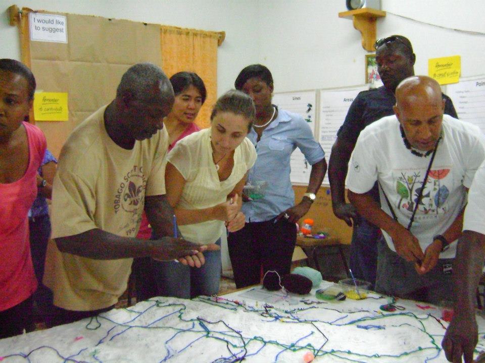
P3DM integrates local peoples' spatial knowledge with elevation data (land and sea) to produce stand-alone, scaled and geo-referenced relief models to inform, for example, marine protected area planning. In a facilitated process of model building, stakeholders depict their knowledge of land/sea use and features on a scaled model using pushpins (points), yarn (lines) and paint (polygons). On completion, a scaled and geo-referenced grid is applied to facilitate data extraction or import. Data depicted on the model are extracted, digitized and plotted. The model remains with the community.
Enabling factors
• Access to topography maps and GIS expertise
• Thorough analysis of who are the stakeholders that need to be involved in the process
• Buy-in of key leaders (community leaders, local media and government personnel) to mobilize participants.
• The site(s) for building a P3DM model, as well as storing it when completed, needs to be in a location convenient for the participants.
Lesson learned
• Various strategies are needed to mobilize and engage stakeholders.
• The P3DM methodology must include facilitated sessions to improve understanding of the basic concepts of climate change and to analyse the impacts of climate change on their livelihoods. This facilitates analysis of impacts and recommendations for policy and action. It also supports civil society engagement in climate change vulnerability assessment and planning.
· Model building is very time intensive for facilitators as well as participants. The process can take anywhere from 5-15 consecutive days depending on the scale of the area and the number of participants being targeted.
Resources
Participatory video (PV)
Participatory video (PV) is a facilitation tool that stakeholders use to tell their story and it involves them from start to finish. PV is not traditional documentary film-making. It gives control to those who are affected by the issues to decide what the issues and questions are, who should be part of the process, who needs to hear the messages and how messages should be crafted. It is a fun process that captures the imagination of the participants. The video can be a documentary, a skit or a music video. PV can be used for stakeholder awareness and advocacy, participatory research, planning or monitoring and evaluation processes.
Enabling factors
• Access to technology (smart phones or video cameras) that is user-friendly.
• Participants who are comfortable using creative and visual tools to express ideas.
• Trust among participants so that they can freely express their ideas and opinions.
Lesson learned
· PV is an easy and accessible medium for people of all literacy levels. Drawing rather than writing is emphasized.
· PV is immediate and powerful and people feel excited to see themselves on film and share their story or idea.
· PV amplifies people’s voices and brings them to life for others in a powerful visual medium. PV empowers a group or community and allows them to communicate their ideas directly to decision-makers and/or other groups and communities.
· Strong facilitation skills are needed to help participants to develop the storyboard for the video.
· Participants need to be trained in techniques to capture good quality video and sound, as well as in basic interviewing techniques.
· Capturing good quality sound is challenging in noisy outside or public environments and a clip on microphone is essential.
· Although the editing decisions are made by participants, help from a professional editor is useful in finalizing the video.
Impacts
· Building stakeholder capacity and social networks: Stakeholders were able to effectively communicate local knowledge and to discuss and quickly develop consensus on what were the key areas of vulnerability and priorities for adaptation. · Cost effective data collection: Participatory 3D Mapping (P3DM) allowed capture, storage and presentation of vast quantities of up-to-date data. • Local and scientific knowledge: P3DM facilitated integration of local knowledge and scientific data for participatory land use development planning.
Beneficiaries
governments, NGOs, local communities, resource users, and private sector enterprises
Story
Smokey is a local community leader and activist in the village of Speyside on the island of Tobago. He is a cultural figure and fisherman and a member of the Speyside Eco Marine Park Rangers. This community organisation is dedicated to community co-management of natural resources to support sustainable livelihoods for the community. Their vision is that of a world-class protected area of rainforest and coral reefs that is well managed by the community of Tobago. Towards this end, they undertake activities in advocacy, education, monitoring and co-management.
Smokey is a frequent feature on a local radio station and speaks passionately on development issues. Given his interest and relevant local knowledge, Smokey was invited to participate in the P3DM process in Tobago. This was planned to allow different communities to participate in building the model on different days by inputting information on their community. Smokey was so enraptured with the process and the opportunity to share information and ideas with others that he attended several of the 14 days it took to build the model. He had passionate discussions on the impacts of climate change that were being felt by fishermen in coastal areas and was key in helping to refine and validate information submitted by various stakeholders.
Smokey was selected by his peers to represent them at the ceremony that was held to hand over the completed model to the local government authority, the Tobago House of Assembly. At the ceremony, Smokey and others highlighted the key findings on what were the key vulnerabilities facing Tobagonians and what needed to be done to address these.