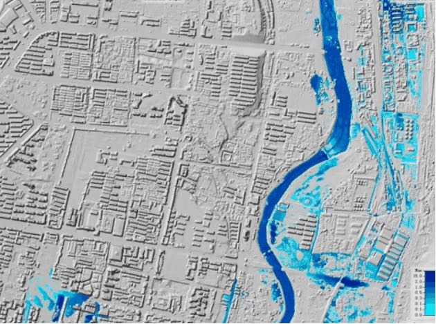

Au cours de la phase initiale du projet, une carte complète des risques d'inondation urbaine a été créée à l'aide du SIG et de HEC-RAS. Cette carte englobe à la fois le fleuve et la vaste zone métropolitaine de Guyuan, qui s'étend sur plus de 150 kilomètres carrés. Le modèle capture efficacement des données cruciales telles que la vitesse des crues, les zones d'inondation, la durée et d'autres informations essentielles, jetant ainsi des bases solides pour une prise de décision éclairée et des stratégies efficaces d'atténuation des inondations.
Grâce au soutien précieux des autorités locales et du service topographique, nous avons pu obtenir des données matricielles de haute définition pour décrire avec précision la topographie du site. Avec une résolution de 0,5 m, qui dépasse les normes des projets habituels, ces informations topographiques détaillées profitent grandement à toutes les phases du projet, y compris la conception et la mise en œuvre.
La visualisation des résultats de la modélisation joue un rôle crucial dans l'amélioration de la compréhension des problèmes d'inondation, en particulier pour les clients. Cette visualisation claire devient un facteur essentiel pour obtenir l'approbation des mesures d'atténuation nécessaires.