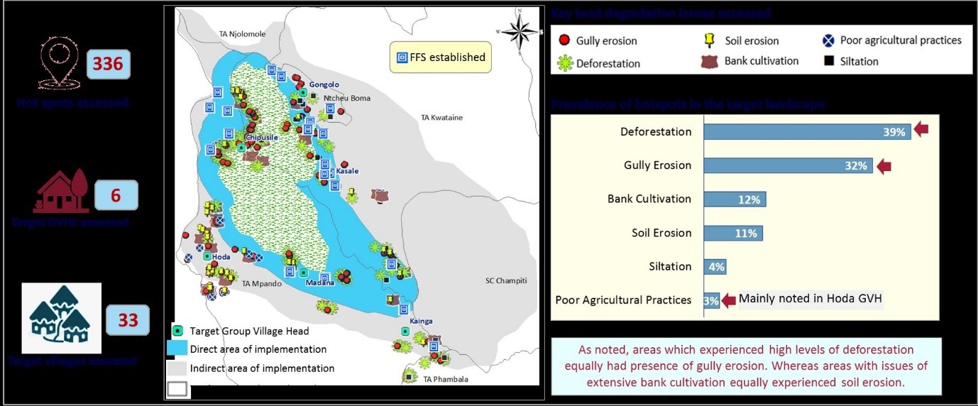

Mapping the degraded areas within Mvai Forest Reserve was an essential first step to identify the extent of encroachment and prioritize restoration efforts. The process involved assessments of the reserve to locate areas impacted by charcoal production, firewood collection, and farming expansion. By 2021, 450 hectares of the forest were confirmed as affected by encroachment activities. This mapping provided a clear view of degradation hotspots and facilitated targeted interventions, forming the foundation for boundary demarcation, enforcement strategies, and community engagement. The mapped data helped the project team and local authorities to understand the scale of degradation and to set measurable targets for restoration and conservation, ensuring that resources and efforts were allocated effectively to the most critical areas.
- Community Participation: Local knowledge contributed to accurately identifying degraded areas.
- Government Support: Official backing from the Forestry Department enabled systematic mapping.
- Technical Resources: Use of mapping tools helped clearly delineate impacted zones for prioritization.
Degradation mapping is vital for understanding the extent of encroachment and organizing targeted responses. Engaging local communities in the mapping process enhances accuracy and ownership, as they provide on-the-ground insights into affected areas. The mapping highlighted that the level of forest degradation is closely linked to the role and effectiveness of local authorities, with variation in encroachment levels depending on the jurisdiction. This insight emphasized the importance of unified enforcement across administrative areas to ensure consistent resource protection. Clear identification of degradation zones allows for efficient allocation of resources and focuses restoration efforts where they are most needed, improving the chances of successful rehabilitation.