Blue Carbon A-Z: from small projects to policy development
Full Solution
Mangrove research helps improve ‘blue carbon’ project planning and design
Miguel Cifuentes
Blue Carbon is still a new concept that needs the right facilitation to kick-start projects and promote blue carbon actions. CATIE undertakes relevant steps to facilitate the development of sound scientific and political frameworks: carbon stock inventories, livelihoods and vulnerability studies, assessment of land-use dynamics and associated historical emissions, facilitation of policy development and promotion of capacities across the Central and Latin American region.
Last update: 08 Feb 2023
11832 Views
Photo and video gallery
Context
Challenges addressed
Limited knowledge and guidance for blue carbon project design and implementation. Despite increasing interest in blue carbon, limited guidance is available for project developers and countries to design and implement initiatives that can offer climate change mitigation and adaptation benefits while delivering improved livelihoods to coastal communities. CATIE addresses these needs through a cohesive package of scientific research and political advising throughout the Americas.
Location
Gulf of Nicoya, Costa Rica
Caribbean
Central America
South America
Process
Summary of the process
Building blocks can operate in concert at the local and national scales. Local carbon inventories (building block 1) and geospatial modeling (building block 3), together with livelihoods and vulnerability assessments (building block 2) provide information to prioritize site selection and inform national decision-making. Local people and government technicians can be recruited and trained so their capacities are enhanced and their experiences can be scaled up. At the national level, the development of national policy frameworks (building block 5) allow for the inclusion of blue carbon elements in national emissions accounting and budgeting, mitigation and adaptation plans, restoration strategies, national forest inventories, and REDD+ and MRV. In addition, economic valuation data (building block 4) are needed for designing financial mechanisms that will allow for potential funds transfers to promote local conservation and enhance local development. Furthermore, the integration of these building blocks across the Americas is designed to promote a regional network of blue carbon scientists and practitioners, policies and projects that integrate mitigation and adaptation goals while promoting local development (building block 6).
Building Blocks
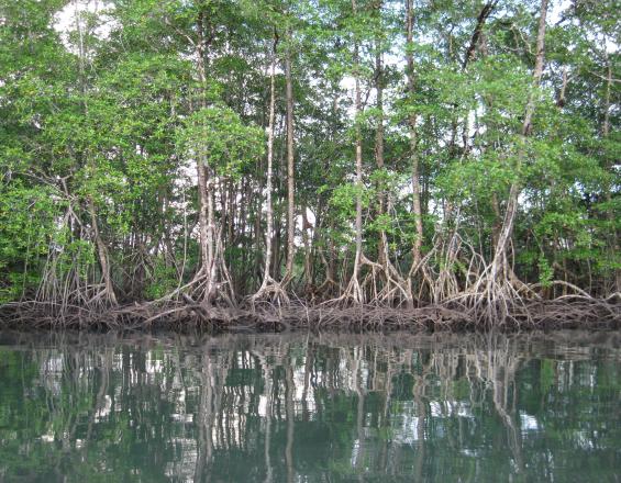
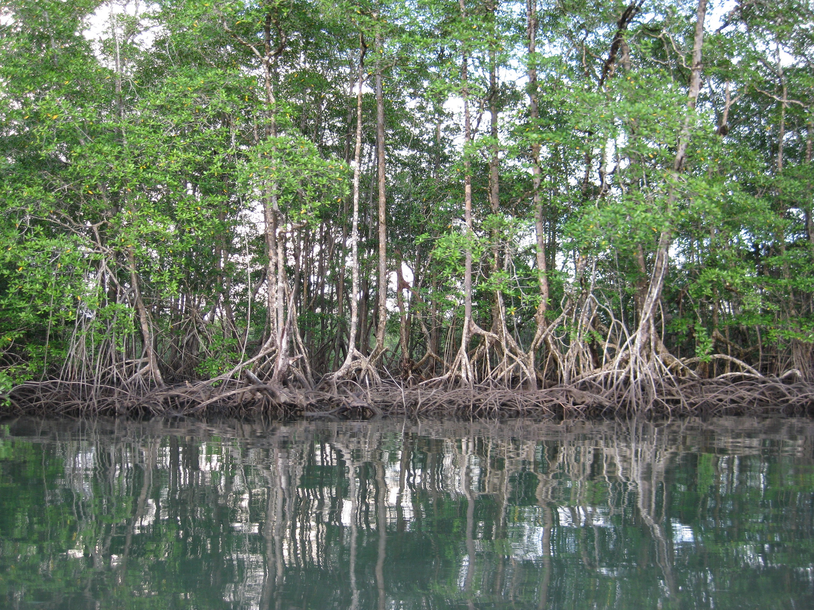
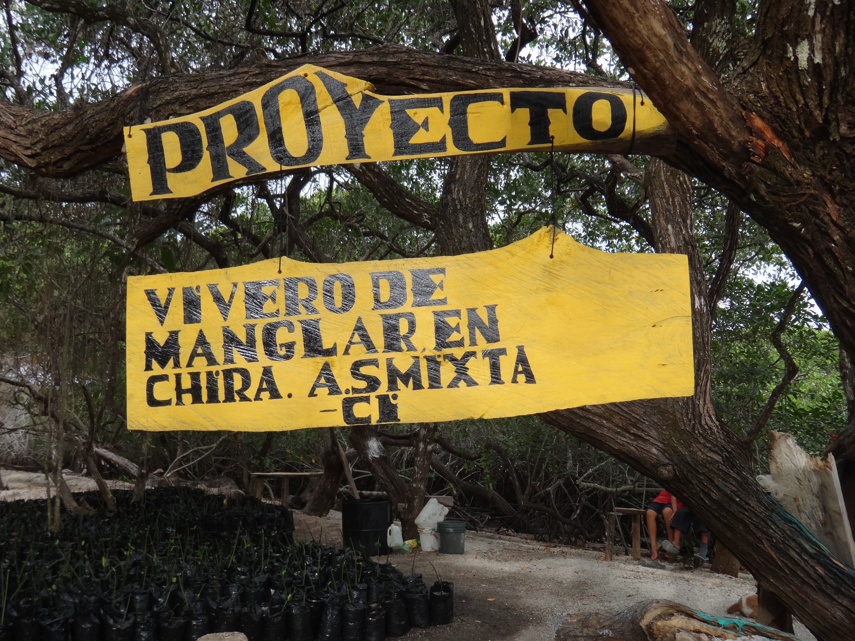
Carbon inventories in mangrove ecosystems
Carbon inventories provide the basis for quantifying current stocks and mangrove areas needed to estimate historical emissions. They allow for characterization of the environment, description of the flora and horizontal and vertical structure of the stands, plus their condition. Carbon assessments can also kick-start local involvement and capacity building. When repeated over time under a robust monitoring system, they provide growth and carbon accumulation rates that are used to calculate higher quality emission numbers than those currently available.
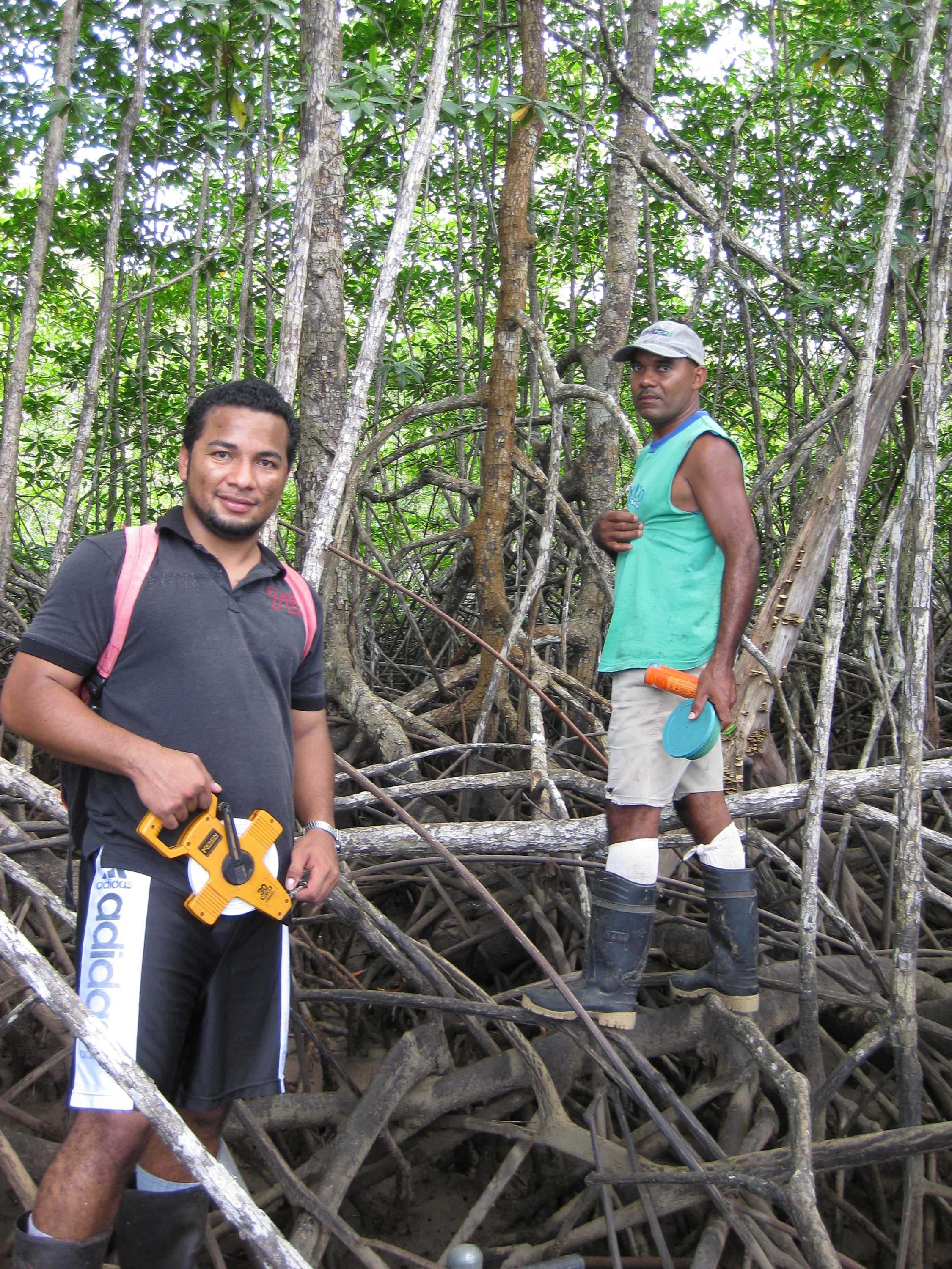
Enabling factors
The involvement of government and local authorities is key. Government officials (local and national) are made aware of the process so they can recognize the value of the inventories in providing detailed data on highly vulnerable ecosystems. Involvement of local actors is key so they are empowered and acquire ownership of the project. Also, their knowledge of the area supports project site selection and ensures safer working conditions.
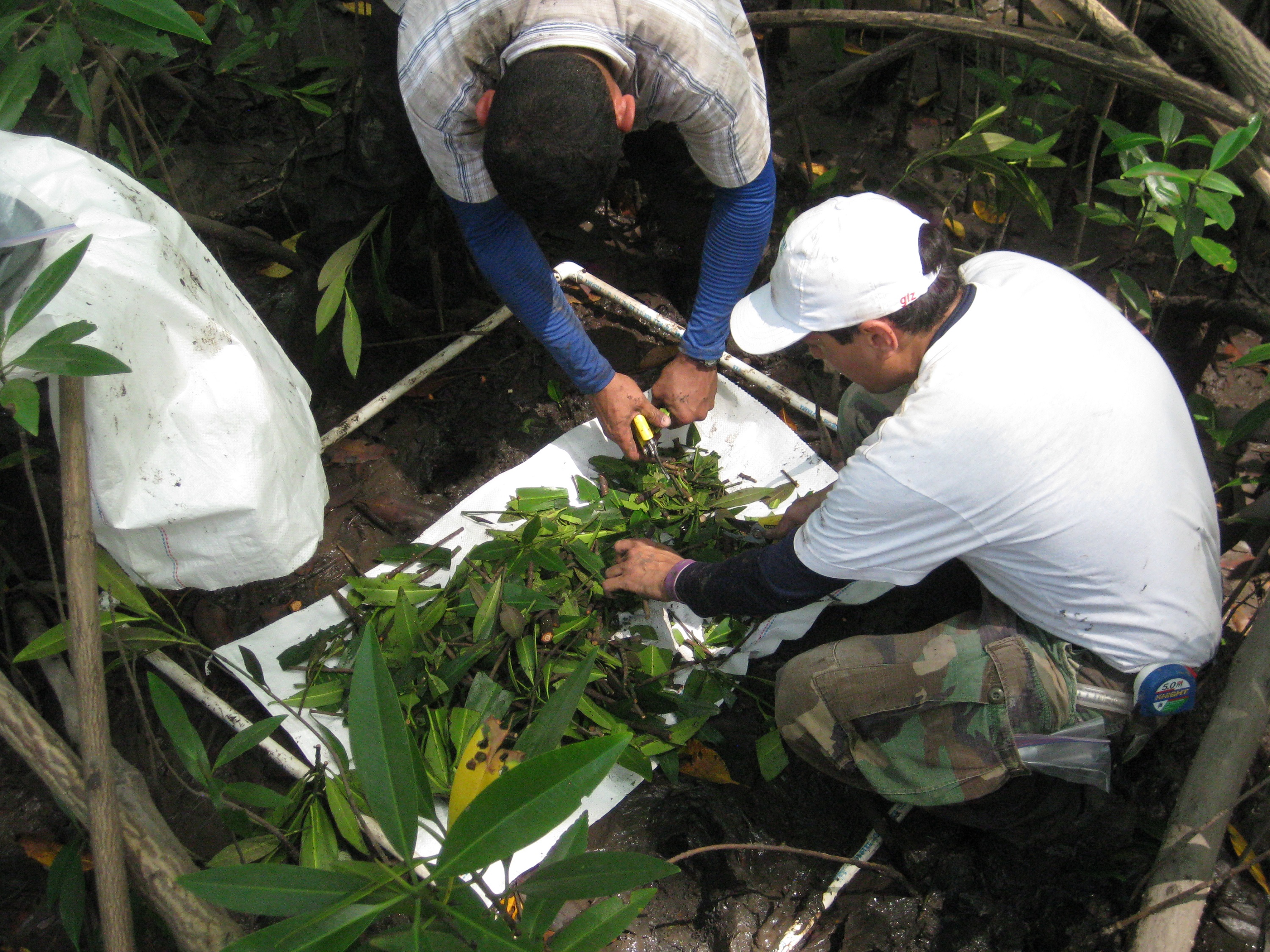
Lesson learned
The quality of the inventories depends upon the use of consistent protocols and the level of trained personnel. Work in mangrove forests is more challenging than in terrestrial ecosystems, and safety of the workers needs to be a strong priority. The logistics of using boats to access field sites, short windows of time between tides, plus the difficult terrain preclude swift completion of tasks which, in turn, increases costs and duration of field work. With local involvement, these costs may be controlled, as boat rental fees may be lowered or waived. Also, collecting and processing soil samples in the field is challenging because of their extreme high water content, implying that laboratory facilities need to be arranged in advance. Having local people involved with the inventories is highly recommended because of their first-hand knowledge of the area, tide behavior and land use dynamics. GIS tools facilitate inventory planning.
Resources
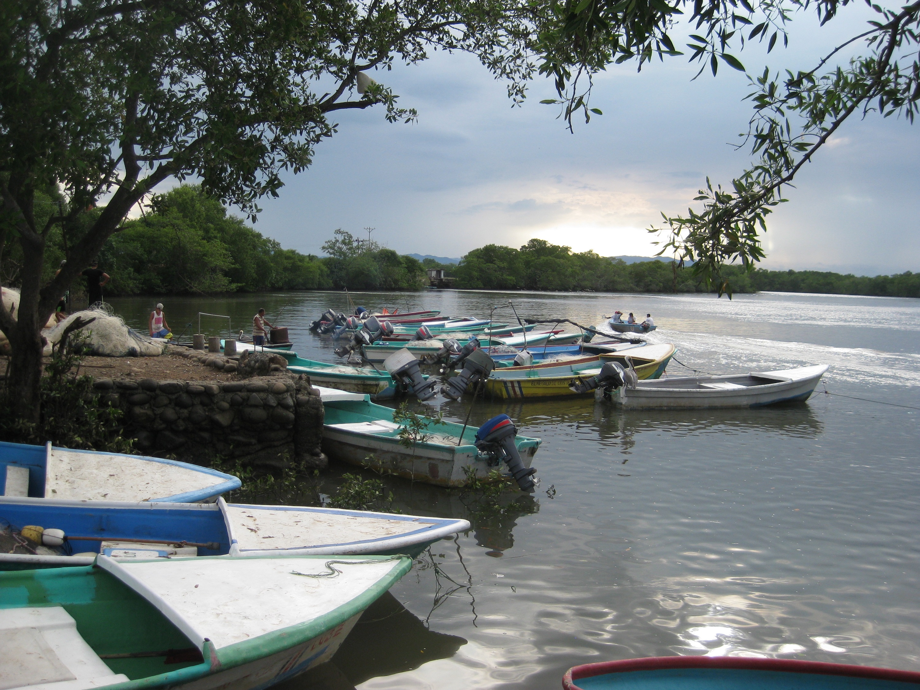
Social and ecological vulnerability assessments
To construct a robust blue carbon project, a clear understanding of local livelihoods and how they are tied in with the surrounding mangrove ecosystems is obtained through a livelihoods assessment. This includes an analysis of the social vulnerability to the effects of climate change. The social and ecological elements of the assessment provide information that helps conceptualize targeted blue carbon projects with interventions that benefit local communities by increasing their resilience, diversifying their production base, and enhancing their governance and human capital.
Enabling factors
Previous contacts with local authorities, NGOs and local leaders is required. The project needs to be explained in a non-technical manner so that locals with varying degrees of education and interest can at least be aware of the project components and the potential benefits for the community. Well trained professionals and experts in community diagnostics, group facilitation, and conflict resolution are required to navigate social nuances that a casual observer may miss.
Lesson learned
The priorities and perceptions of local communities and organizations may differ frequently and significantly. Local interest in a project may be minimal or non-existent, and expectations of project designers can differ from those of the communities. Outside observers may not fully understand local dynamics, conflicts, challenges and needs so it is important to have people trained in social science tools involved at all stages.
Having a local leader buy into the idea of a blue carbon project helps build confidence among the community, increases their participation, and opens the door for more transparent dialogues with the community.
Being open to local needs and wishes, and taking time to know the people and become immersed in their day-to-day lives can yield useful information for project development. Climate change effects may be minor priorities in comparison with far more urgent health, education and infrastructure needs of the community.
Geospatial and emissions modeling
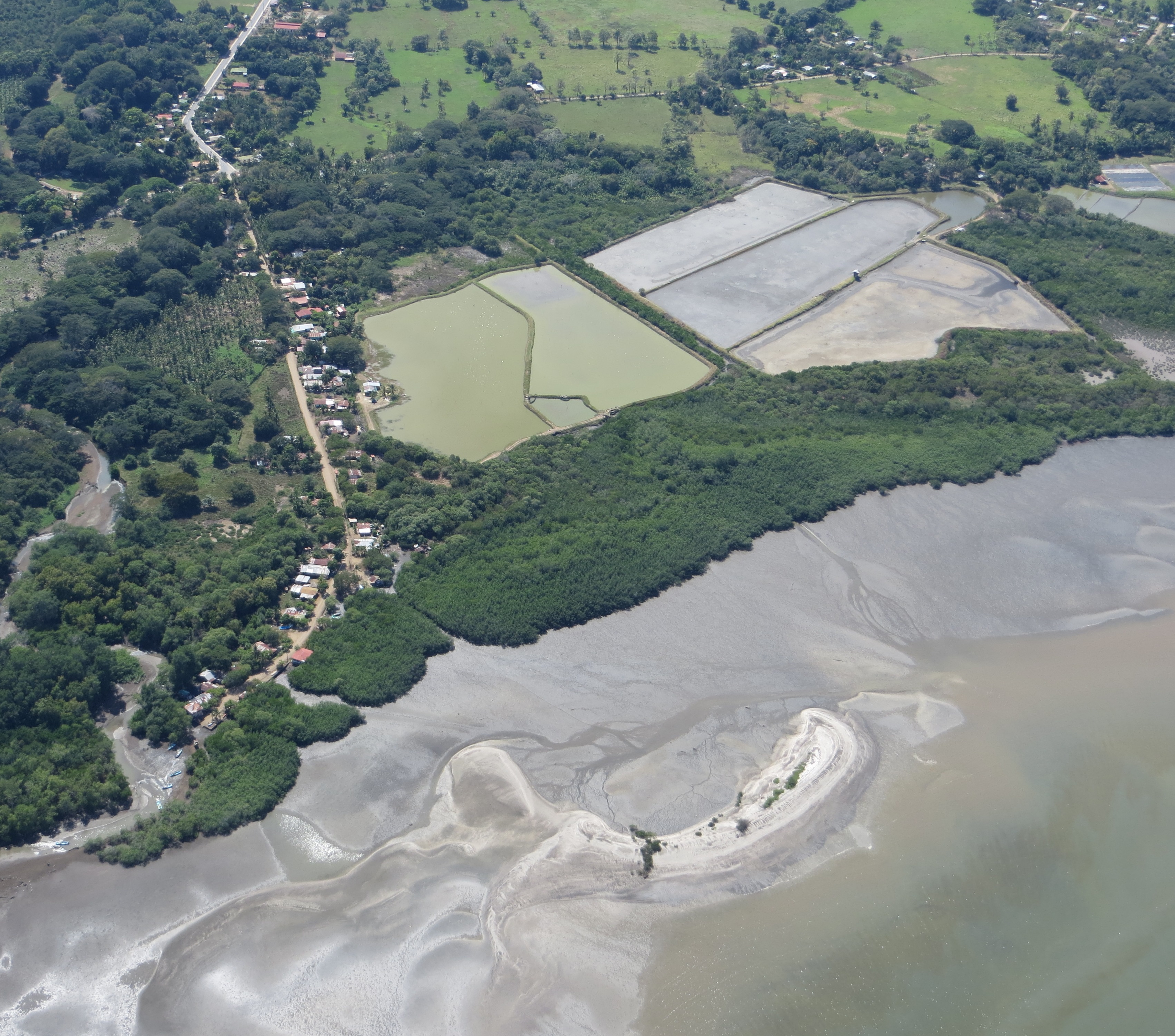
The assessment of historical land use dynamics of coastal areas relies on geospatial analysis of a sequence of satellite images. It classifies land use categories and how their area changes over time. Using these dynamics, the quantification of carbon emissions associated with the conversion of mangrove forests to other land uses can be estimated through modeling. This provides both an assessment of carbon stocks lost as well as an identification of areas suitable for restoration. This can also be tied to estimates of natural capital lost over time.
Enabling factors
The main requirement is the availability of a consistent series of satellite images that is free of cloud cover and offers enough spatial resolution to differentiate mangrove stands (and types), surrounding agriculture and other human uses of the landscape. Local or national capacities for remote sensing processing and advanced GIS analyses of coastal features is also important. Emissions modeling is a challenge, which needs to be resolved through enhanced capacities.
Lesson learned
Although GIS facilities and trained personnel are readily available, capacities to properly classify different types of mangroves within a stand are still lacking in the GIS/remote sensing field, especially when higher resolution images are used. We have been exploring the application of innovative image processing and classification techniques with good results. However, the process cannot be fully automated and the analyses require time and expert judgement to complete.
Access to a consistently cloud-free series of images across different dates is a challenge. This is coupled with the malfunctioning of a well-known satellite, which further limits the availability of images suitable for analyses.
Scaling-up analyses from local to subnational to regional scales presents additional challenges of spatial resolution, data volume for analyses and time required.
Ecosystem services valuation
Quantifying the value of ecosystem services provided by mangroves to the local communities is a required component of blue carbon projects. This informs the design of Payment for Ecosystem Services (PES) schemes. As a full valuation is challenging and costly, priority services are chosen through a participatory consultation process with local communities. Raw data are collected locally and mined through bibliographic searches and interviews. Results emphasize the importance of coastal-marine ecosystems with decision makers, as mangrove losses can be explained as capital losses.
Enabling factors
The availability of local and national data is a determining factor for an adequate valuation of ecosystem services. Even when those data are not available relationships with local officials may provide useful expert criteria and inputs. Also, the participation of the communities in the diagnostics to identify and later quantify priority services is important to guarantee their buy-in into the process. A clear understanding of local livelihoods is also necessary.
Lesson learned
Local perceptions of what constitutes a “priority” ecosystem service for valuation may differ from that of project developers and researchers. In addition, data constraints may limit the extent of the valuation study. It may thus be necessary to negotiate with locals during the preliminary diagnostics phase what services meet their needs and those of the project, and which can be valued. The wide range of services provided by mangroves and surrounding coastal-marine ecosystems make a full valuation exercise very challenging. Thus, most valuation studies are partial and depend on a set of assumptions and a variety of different methods. Good working relationships with government representatives in charge of data processing and archiving, as well as a solid understanding of the details of the local livelihoods and business models is highly advantageous, which is why a livelihoods study should be conducted in parallel.
Development of national policy frameworks
The existence of robust policy frameworks facilitates the design and implementation of local and national blue carbon initiatives. These policies promote official government support and the foundation for institutional roles, and offer links with other national and international policies, mechanisms and strategies (such as NDCs, REDD+ and NAMAs). The policy building process starts with informal consultations with national authorities to map actors, gauge their interest and obtain their support. As these are national-scale constructs, strategic advice and facilitation of the process is important.
Enabling factors
Of utmost importance is to garner the interest and support of national authorities in decision-making positions, as policy development is a government role and must not be imposed onto a country. The existence of other environmental, coastal-marine or climate change policies enables the alignment or incorporation of blue carbon policy notions within pre-existing policies. The availability and communication of sound science for the public is also important during policy development.
Lesson learned
Our experience has been that an initial ‘socialization’ (supply, introduction and communication) of basic blue carbon information and principles is needed through formal and informal meetings with country officials at multiple levels of decision-making. Then, a clear understanding of current country needs and priorities, and how they can be met through blue carbon actions, should be considered to ensure the process is compatible with on-going national processes and international climate change and conservation commitments. The role of the people facilitating the policy process is key to deliver sound information, to understand country needs, to ensure that the interests of different actors are met, to negotiate complex matters and to mediate conflicts that may arise. The pace at which governments respond to specific processes is not necessarily compatible with the short-term goals of local project development and implementation or international cooperation.
Resources
Promoting blue carbon networks
Work is under way to scale up and transfer lessons learned from current projects to other countries in Central and South America. Basic knowledge about blue carbon needs to be disseminated at multiple levels and scales, local “champions” identified, and interest in replicating experiences needs to be gauged. Establishing a network of practitioners, blue carbon scientists and decision-makers promotes the exchange of experiences and information, thereby serving as a catalyst for further work. Also, links to global initiatives ensure common working frameworks to reach similar goals.
Enabling factors
Above all, local and regional capacities need to be promoted such that a shared language, goals and expectations around blue carbon are used across country borders. Having “champions,” or local focal points that drive the development of research and market-ready projects and help develop national policy frameworks is required. Once a critical mass of people is reached, funding streams that promote knowledge exchange and piloting activities must be sought.
Lesson learned
Interest in blue carbon projects is increasing across the Americas, however, a critical mass of scientists, practitioners and policy-makers is still needed. The understanding of blue carbon science and policy building blocks is still at an early stage in many countries, which is why key messages must be delivered in a timely manner to the right audiences.
International literature still needs to break language barriers to facilitate dissemination among multiple actors. Identifying key people in government and research institutes with previous knowledge and experience or current interest in blue carbon is necessary so they can serve as focal points in their countries or sub-regions and disseminate information, design and implement local initiatives, and facilitate scaling up. The culture of sharing information and data across Latin America needs to be understood to promote dialogues and actions in a productive manner.
Impacts
Social: In the Gulf of Nicoya, Costa Rica, people from local organizations see their capacities enhanced and they are further empowered to conserve mangrove resources through a better understanding of their importance for climate change mitigation and adaptation. Economic: We provided the first ever estimate of (mangrove) natural capital loss due to mangrove area losses in the Gulf of Nicoya, Costa Rica. Ecological: The Government of El Salvador committed to doubling by 2016 the area of mangrove forests under sustainable management plans due to blue carbon interventions started in 2014.
Beneficiaries
Governments and greenhouse gas inventorying, reporting and verification institutions
Sustainable Development Goals
SDG 13 – Climate action
SDG 14 – Life below water
SDG 15 – Life on land
Story
CATIE is leading blue carbon science and policy development across Central America. We started with small carbon inventory projects in Costa Rica, which have now been replicated in Panama, El Salvador and Honduras. Other building blocks were later incorporated into our implementation package as further interest in blue carbon was promoted. A recent project in the Gulf of Nicoya, Costa Rica, exemplifies the integration of many of the building blocks described in the solution. We partnered with Conservation International to develop a participatory project that would involve mangrove restoration, capacity building of local organizations and people ranging from school age to adults, a livelihoods assessment, a climate change vulnerability study coupled with proposed local adaptation strategies, valuation of ecosystem services, and ecosystem-level carbon inventories. In parallel, we are facilitating the development of a blue carbon strategy and action plan for the country, which will be part of the larger National Wetlands Policy statement that the Government of Costa Rica is developing. Results from this and previous projects have been showcased in the local news and social media, which has triggered interest in blue carbon in the country and elsewhere in Central America. This has led most countries in the region to recognize the importance of mangrove forests as critical sinks of carbon and include them as separate strata in their national forest inventories and REDD+ (Reducing Emissions from Deforestation and Forest Degradation) MRV (measurement reporting and verification) plans. It is inspiring to see how something that started as a small pilot research project in a protected area in Costa Rica has fueled dialogues across Central America, Mexico, and even as far south as Ecuador, and now has the potential to serve as the basis for much larger scientific and political collaborations. We still face challenges related to project design (i.e. good practice guidelines and standardized international standards and methodologies) and implementation (i.e. ensuring projects can deliver social benefits, increase resilience of coastal communities, and enhance local livelihoods) but we are confident that funding streams and further international support will allow us to continue delivering the best quality blue carbon solutions in Central and South America.