Carbono azul de la A a la Z: de los pequeños proyectos a la elaboración de políticas
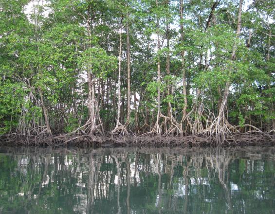
El carbono azul es todavía un concepto nuevo que necesita la facilitación adecuada para poner en marcha proyectos y promover acciones de carbono azul. El CATIE adopta medidas pertinentes para facilitar el desarrollo de marcos científicos y políticos sólidos: inventarios de reservas de carbono, estudios sobre los medios de subsistencia y la vulnerabilidad, evaluación de la dinámica del uso de la tierra y las emisiones históricas asociadas, facilitación del desarrollo de políticas y promoción de capacidades en toda la región de América Central y América Latina.
Contexto
Défis à relever
Conocimientos y orientación limitados para el diseño y la ejecución de proyectos de carbono azul. A pesar del creciente interés por el carbono azul, los promotores de proyectos y los países disponen de una orientación limitada para diseñar y ejecutar iniciativas que puedan ofrecer beneficios de mitigación y adaptación al cambio climático y, al mismo tiempo, mejorar los medios de subsistencia de las comunidades costeras. El CATIE aborda estas necesidades a través de un paquete cohesionado de investigación científica y asesoramiento político en todo el continente americano.
Ubicación
Procesar
Resumen del proceso
Los componentes básicos pueden funcionar conjuntamente a escala local y nacional. Los inventarios locales de carbono (building block 1) y la modelización geoespacial (building block 3), junto con las evaluaciones de los medios de subsistencia y la vulnerabilidad (building block 2), proporcionan información para priorizar la selección de emplazamientos y fundamentar la toma de decisiones a escala nacional. La población local y los técnicos gubernamentales pueden ser contratados y formados para mejorar sus capacidades y ampliar sus experiencias. A nivel nacional, el desarrollo de marcos políticos nacionales (building block 5) permite la inclusión de elementos de carbono azul en la contabilidad y los presupuestos nacionales de emisiones, los planes de mitigación y adaptación, las estrategias de restauración, los inventarios forestales nacionales, y REDD+ y MRV. Además, los datos de valoración económica (building block 4) son necesarios para diseñar mecanismos financieros que permitan posibles transferencias de fondos para promover la conservación local y potenciar el desarrollo local. Además, la integración de estos componentes básicos en todo el continente americano está diseñada para promover una red regional de científicos y profesionales del carbono azul, así como políticas y proyectos que integren los objetivos de mitigación y adaptación al tiempo que promueven el desarrollo local (componente básico 6).
Bloques de construcción
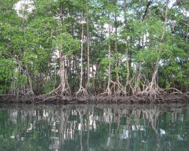
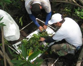
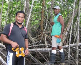
Inventarios de carbono en los ecosistemas de manglares
Factores facilitadores
Lección aprendida
Recursos
Evaluación de la vulnerabilidad social y ecológica
Factores facilitadores
Lección aprendida
Modelización geoespacial y de emisiones
Factores facilitadores
Lección aprendida
Valoración de los servicios ecosistémicos
La cuantificación del valor de los servicios ecosistémicos prestados por los manglares a las comunidades locales es un componente necesario de los proyectos de carbono azul. Esto informa el diseño de los esquemas de Pago por Servicios Ecosistémicos (PSE). Como una valoración completa es difícil y costosa, los servicios prioritarios se eligen mediante un proceso participativo de consulta con las comunidades locales. Los datos brutos se recogen localmente y se extraen mediante búsquedas bibliográficas y entrevistas. Los resultados destacan la importancia de los ecosistemas costero-marinos ante los responsables de la toma de decisiones, ya que las pérdidas de manglares pueden explicarse como pérdidas de capital.
Factores facilitadores
La disponibilidad de datos locales y nacionales es un factor determinante para una valoración adecuada de los servicios ecosistémicos. Incluso cuando no se disponga de esos datos, las relaciones con los funcionarios locales pueden proporcionar criterios y aportaciones de expertos útiles. Asimismo, la participación de las comunidades en los diagnósticos para identificar y posteriormente cuantificar los servicios prioritarios es importante para garantizar su implicación en el proceso. También es necesaria una comprensión clara de los medios de vida locales.
Lección aprendida
La percepción local de lo que constituye un servicio ecosistémico "prioritario" para su valoración puede diferir de la de los promotores e investigadores del proyecto. Además, la escasez de datos puede limitar el alcance del estudio de valoración. Por tanto, puede ser necesario negociar con la población local durante la fase de diagnóstico preliminar qué servicios satisfacen sus necesidades y las del proyecto, y cuáles pueden valorarse. La amplia gama de servicios que prestan los manglares y los ecosistemas costero-marinos circundantes hace que un ejercicio de valoración completo sea muy difícil. Por ello, la mayoría de los estudios de valoración son parciales y dependen de una serie de supuestos y de una variedad de métodos diferentes. Es muy ventajoso tener buenas relaciones de trabajo con los representantes del gobierno encargados del procesamiento y archivo de datos, así como una sólida comprensión de los detalles de los medios de subsistencia y los modelos empresariales locales, razón por la cual debe realizarse paralelamente un estudio de los medios de subsistencia.
Desarrollo de marcos políticos nacionales
La existencia de marcos políticos sólidos facilita el diseño y la aplicación de iniciativas locales y nacionales de carbono azul. Estas políticas promueven el apoyo oficial del gobierno y los cimientos de las funciones institucionales, y ofrecen vínculos con otras políticas, mecanismos y estrategias nacionales e internacionales (como las NDC, REDD+ y NAMA). El proceso de elaboración de políticas comienza con consultas informales con las autoridades nacionales para trazar un mapa de actores, calibrar su interés y obtener su apoyo. Dado que se trata de construcciones a escala nacional, el asesoramiento estratégico y la facilitación del proceso son importantes.
Factores facilitadores
Lo más importante es suscitar el interés y el apoyo de las autoridades nacionales con poder de decisión, ya que la elaboración de políticas es una función gubernamental y no debe imponerse a un país. La existencia de otras políticas medioambientales, costero-marinas o de cambio climático permite alinear o incorporar las nociones de la política del carbono azul dentro de las políticas preexistentes. La disponibilidad y comunicación de datos científicos sólidos para el público también es importante durante la elaboración de políticas.
Lección aprendida
Según nuestra experiencia, es necesaria una "socialización" inicial (suministro, introducción y comunicación) de la información y los principios básicos del carbono azul a través de reuniones formales e informales con funcionarios del país en múltiples niveles de toma de decisiones. A continuación, debe considerarse una clara comprensión de las necesidades y prioridades actuales del país, y cómo pueden satisfacerse mediante acciones de carbono azul, para garantizar que el proceso sea compatible con los procesos nacionales en curso y los compromisos internacionales en materia de cambio climático y conservación. El papel de las personas que facilitan el proceso político es clave para ofrecer información sólida, comprender las necesidades de los países, garantizar que se satisfacen los intereses de los diferentes actores, negociar asuntos complejos y mediar en los conflictos que puedan surgir. El ritmo al que los gobiernos responden a procesos específicos no es necesariamente compatible con los objetivos a corto plazo del desarrollo y la ejecución de proyectos locales o la cooperación internacional.
Recursos
Fomento de las redes de carbono azul
Factores facilitadores
Lección aprendida
Impactos
Social: En el Golfo de Nicoya, Costa Rica, las personas de las organizaciones locales ven mejoradas sus capacidades y se les capacita aún más para conservar los recursos de los manglares gracias a una mejor comprensión de su importancia para la mitigación del cambio climático y la adaptación al mismo. Económicos: Proporcionamos la primera estimación de la pérdida de capital natural (manglar) debida a la pérdida de superficie de manglar en el Golfo de Nicoya, Costa Rica. Ecológico: El Gobierno de El Salvador se comprometió a duplicar para 2016 la superficie de manglares bajo planes de gestión sostenible gracias a las intervenciones de carbono azul iniciadas en 2014.
Beneficiarios
Gobiernos e instituciones de inventario, notificación y verificación de gases de efecto invernadero
Objetivos de Desarrollo Sostenible
Historia
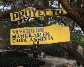
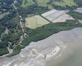
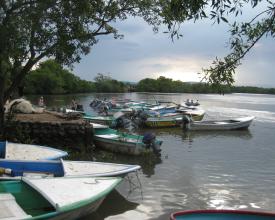
El CATIE lidera la ciencia del carbono azul y el desarrollo de políticas en toda Centroamérica. Empezamos con pequeños proyectos de inventario de carbono en Costa Rica, que ahora se han reproducido en Panamá, El Salvador y Honduras. Posteriormente, se incorporaron otros elementos básicos a nuestro paquete de aplicación a medida que se promovía un mayor interés por el carbono azul. Un proyecto reciente en el Golfo de Nicoya (Costa Rica) ejemplifica la integración de muchos de los componentes descritos en la solución. Nos asociamos con Conservación Internacional para desarrollar un proyecto participativo que incluyera la restauración de manglares, el desarrollo de capacidades de organizaciones locales y personas desde edad escolar hasta adultos, una evaluación de los medios de subsistencia, un estudio de vulnerabilidad al cambio climático junto con estrategias locales de adaptación propuestas, la valoración de los servicios ecosistémicos e inventarios de carbono a nivel de ecosistema. Paralelamente, estamos facilitando el desarrollo de una estrategia y un plan de acción de carbono azul para el país, que formará parte de la declaración de la Política Nacional de Humedales que está elaborando el Gobierno de Costa Rica. Los resultados de este proyecto y de otros anteriores han aparecido en las noticias locales y en las redes sociales, lo que ha despertado el interés por el carbono azul en el país y en otros lugares de Centroamérica. Esto ha llevado a la mayoría de los países de la región a reconocer la importancia de los manglares como sumideros críticos de carbono y a incluirlos como estratos separados en sus inventarios forestales nacionales y en sus planes de MRV (medición, notificación y verificación) de REDD+ (Reducción de Emisiones por Deforestación y Degradación de los Bosques). Es inspirador ver cómo algo que empezó como un pequeño proyecto piloto de investigación en un área protegida de Costa Rica ha alimentado diálogos en toda Centroamérica, México e incluso tan al sur como Ecuador, y ahora tiene el potencial de servir de base para colaboraciones científicas y políticas mucho mayores. Todavía nos enfrentamos a retos relacionados con el diseño de proyectos (es decir, directrices de buenas prácticas y normas y metodologías internacionales estandarizadas) y la ejecución (es decir, garantizar que los proyectos puedan aportar beneficios sociales, aumentar la resiliencia de las comunidades costeras y mejorar los medios de vida locales), pero confiamos en que las fuentes de financiación y el apoyo internacional nos permitirán seguir ofreciendo soluciones de carbono azul de la mejor calidad en América Central y del Sur.
