Digitising Data Collection for Enhanced Wildlife Management
Full Solution

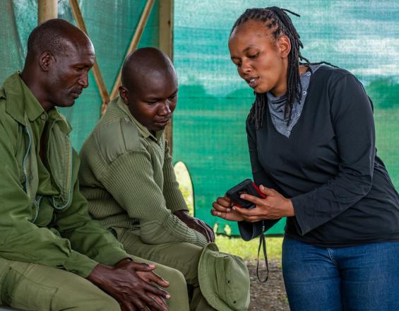
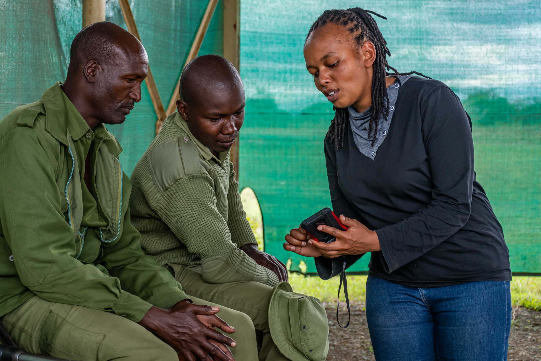
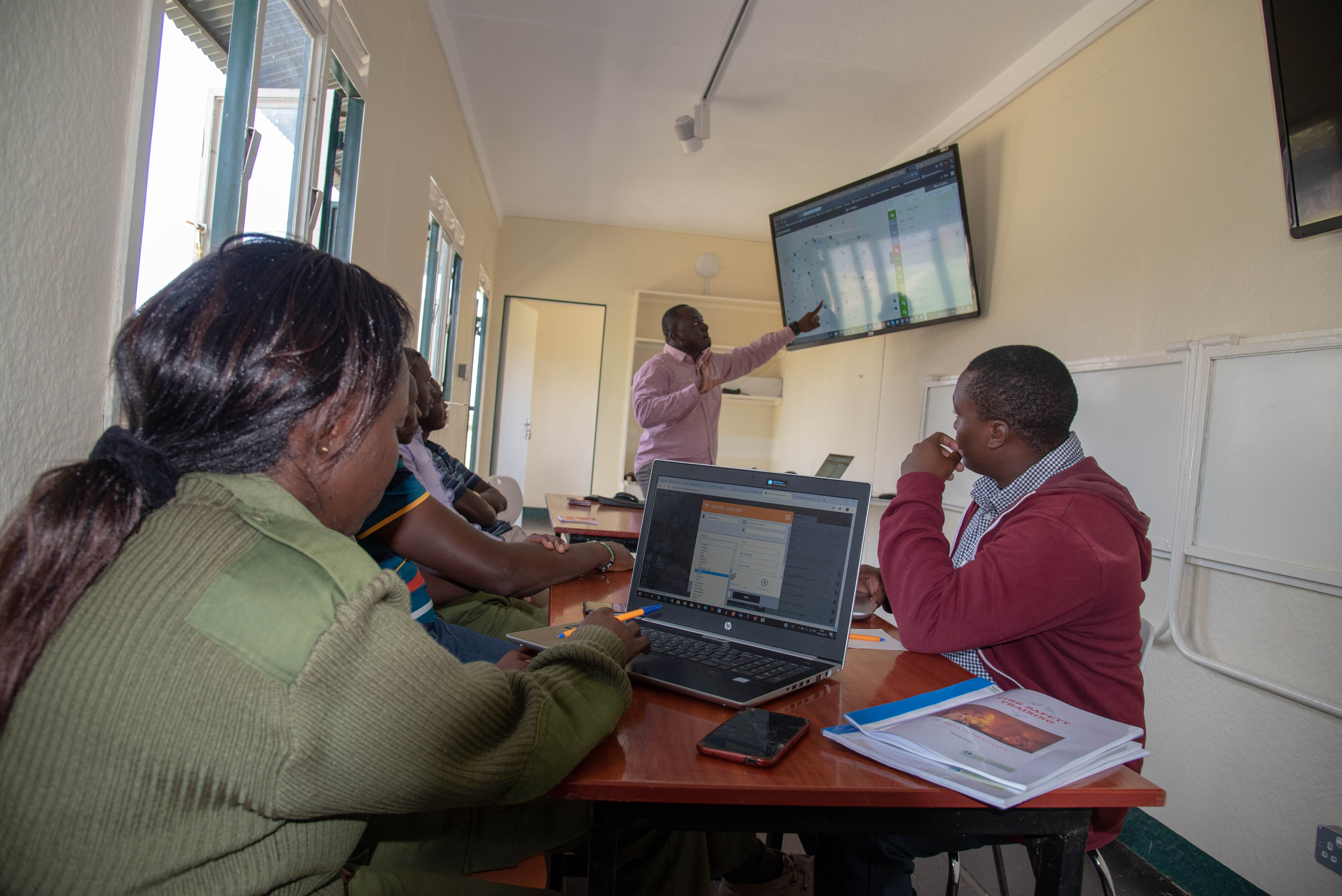
SMART Mobile user training
Ol Pejeta Conservancy
Ol Pejeta Conservancy, seeks to conserve biodiversity with a key focus on threatened species including the critically endangered black rhino. To achieve this, the conservancy undertakes robust wildlife monitoring where field teams routinely capture wildlife sightings, mortality, human-wildlife conflicts, intrusions and environmental hazards. For a long time, such data was recorded on paper datasheets and later transferred to spreadsheets for analysis. This was characterized by errors, missing information, loss of data and delayed decision making.
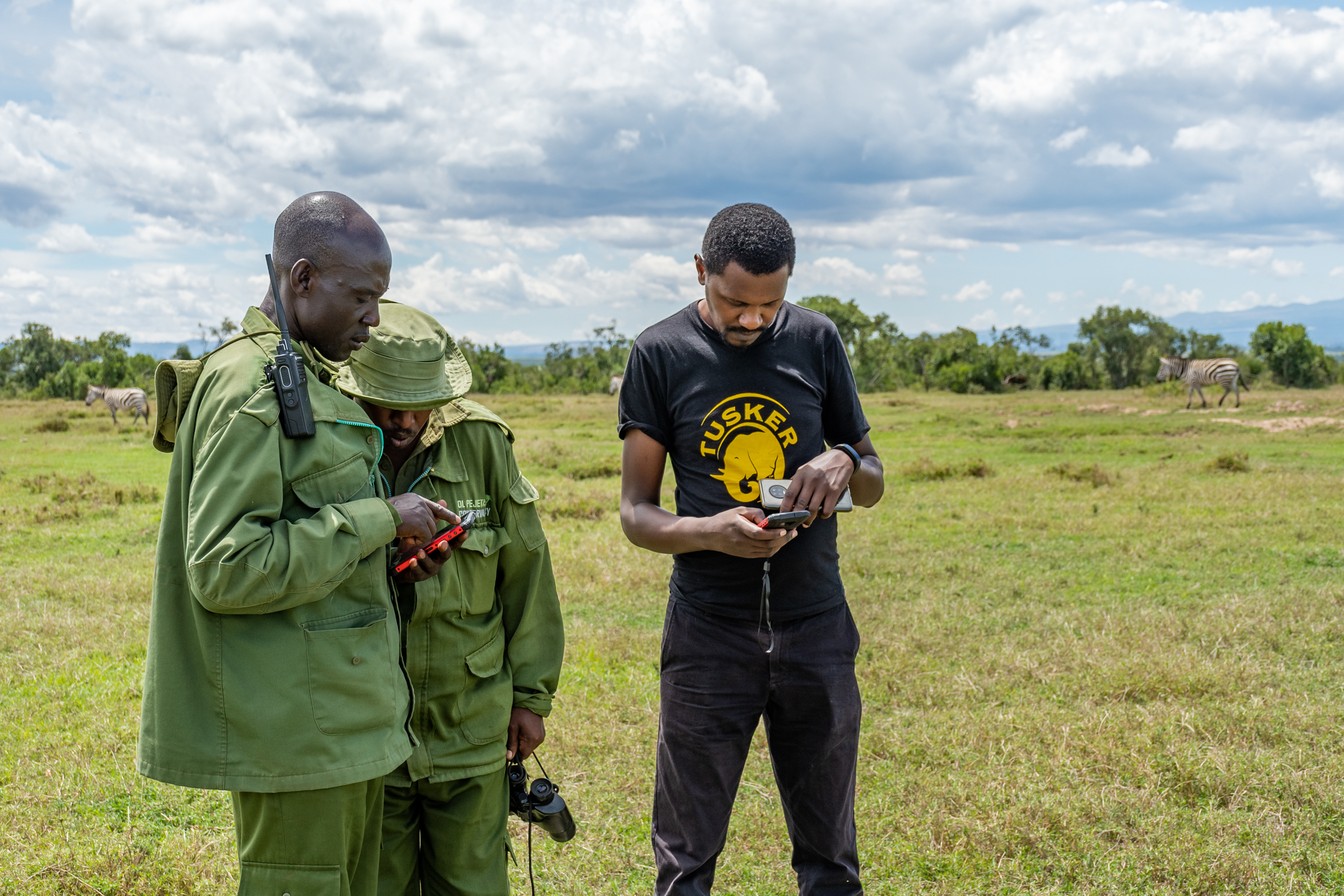
This solution enhanced wildlife monitoring and management through digitized data collection to reduce chances of error, missing information and delayed submissions. The project provided ruggedized phones and undertook necessary installations and training . All data is now relayed to managers within 24 hours of collection. This has greatly enhanced decision making with major influence on response time for HWC incidences and animal rescue.
Last update: 06 Jun 2023
1132 Views
Photo and video gallery

Context
Challenges addressed
The main challenge addressed is inefficient wildlife monitoring and management due to delays and gaps in data collection. Previously, methods of collecting and reporting field data (wildlife monitoring, anti-poaching, human-wildlife conflicts) were largely manual and required updating. Loss of data and inconsistencies were common and managers often got the data so late, two-weeks to a month after collection. Lack of geographic information on observations hindered identification of hotspots and implementation of focused interventions.
With this challenge, it was difficult to make prompt and appropriate decisions to address immediate threats to wildlife, respond to HWC incidents and analyze the temporal & spatial variation in poaching threats, HWC, wildlife mortalities among other key monitoring components. There were therefore inadequate efforts to reduce such threats to wildlife and communities leading to sustained losses in the biodiversity and livelihoods of the neighbouring communities.
Location
Laikipia, Kenya
East and South Africa
Process
Summary of the process
Knowledge of appropriate technology (Building block 1) informs the kind of investment that will be put into implementation particularly equipment and applicable installations (Building block 2). Engagement of partners (Building block 3) who have used the identified technology (Building block 1) in the past is helpful in informing the inventory of equipment and required installations (Building block 2) for efficient use and such partners are resourceful during set up, configuration and training (Building block 4). All these are fundamental components for successfully rolling out such a technology.
Building Blocks
Identification of appropriate technology

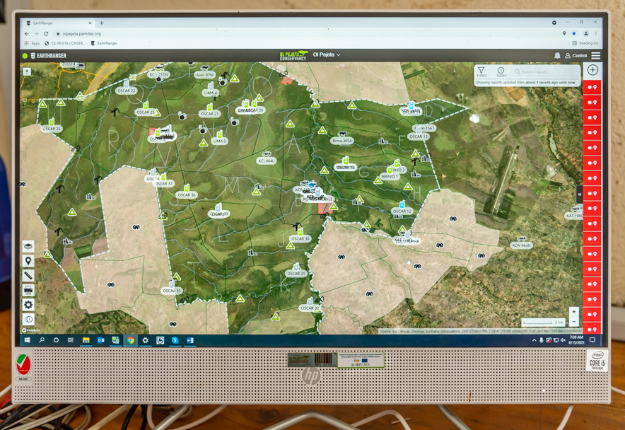
Data collection is digitised using technological applications often selected to meet the needs of a particular project. In wildlife monitoring and protection, SMART for Conservation was identified as a suitable software for it provides a quick form to record incidents while tracking the distance covered by each team. Further, data collected in this manner needs to be used alongside other datasets for well informed decision making. To achieve this, an integration with Earthranger (an online visualization platform) was instituted to allow visual analysis of incidents and patrol coverage against other components such as tagged animals, live streaming images from security cameras, points of interest and environmental hazard reports.
Enabling factors
-
Landscape-level collaboration - Learning from other players in the field to select technologies that have worked and can help in collaboration and sharing
-
Conservation Technology Laboratory - Existence of a technology development and trialing facility at the project site enhanced consultations with developers and other users. It was essential for conducting training, software configurations and system integration.
-
Knowledge of existing gaps - There was a clear understanding of gaps in data submission (time, geolocations and inconsistencies)
Lesson learned
-
Team participation - Deliberate involvement of key staff members who have knowledge in the fieldwork designs, management needs and existing gaps is useful in pointing out technological needs.
-
Engagement of other organizations and people - It is important to learn from others who will indicate successful parts of the solution and associated shortfalls. These engagements would often help identify training needs, appropriate equipment and sustainability of the project
-
There is probably no fit-for-all solution - Application of identified technology/solution for data collection and/or analysis may need to be implemented together with other applications to enhance information management and sharing
-
Piloting before implementation - At the point of identification, it is useful to undertake a pilot rollout with a trial group if resources allow to gauge applicability and highlight potential pitfalls
Infrastructural development
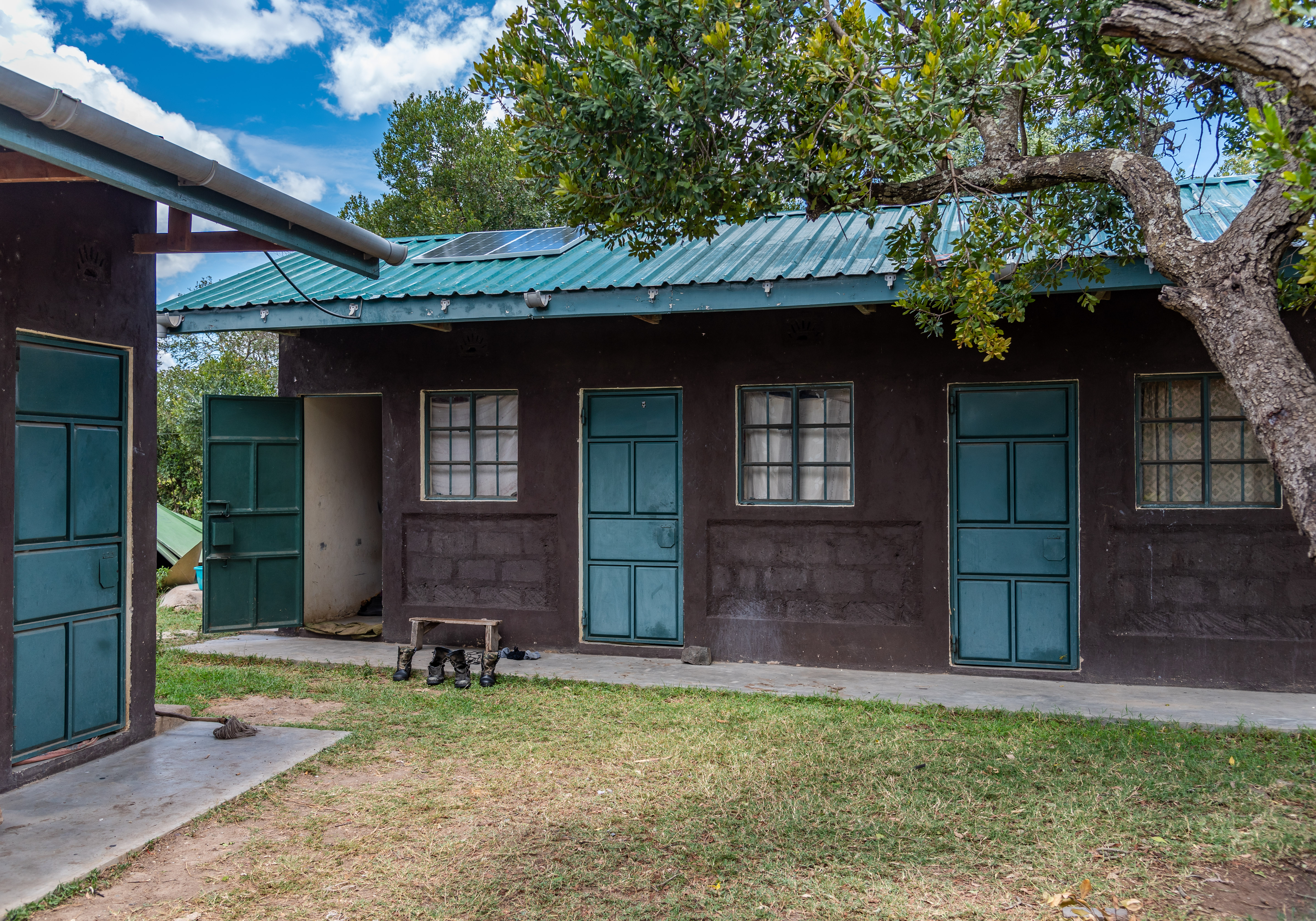

Installations such as electricity provision, servers and computers are necessary to rollout such technological solutions. In the current project, 35 ranger outposts were equipped with solar chargers and inverters to keep the mobile phones charged; a server and air conditioner were purchased and installed at a central server room; and two computers were purchased to support data processing and configuration of mobile devices. Further, the servers and computers were configured to facilitate creation of SMART databases (desktop and connect) and enable the rollout of data collection using SMART Mobile, submission through the server, processing at the desktop and sharing over SMART Connect.
Enabling factors
-
Existing infrastructure - Establishment of infrastructure related to the project was complementary to existing installments such as, server room where the server was installed and usable buildings in ranger outposts for solar powering
-
Internal capacity - The organization had capacity in information technology (IT) and electricity to undertake installation without contracting external party
Lesson learned
-
Take inventory and analyze gaps at the planning stage - To avoid gaps in equipment and facilities, it is necessary to have a complete list while designing the project. In the current study, additional costs were incurred to acquire electricity inverters which were not included in the original plan for solar power provision in ranger posts.
-
Internal capacity - Where possible, organizations can continuously enhance their capacity to absorb technological innovations. This reduces costs of installation and maintenance while ensuring sustainable management of adopted technologies.
-
Piloting before actual implementation - Most technological solutions will evolve based on gaps identified in the course of implementation. It is therefore important to conduct a trial to identify such gaps in time for appropriate action. In this project, internet coverage was found to be inadequate and a decision was made to use the GSM network by providing data bundles through SIM cards in the mobile phones.
Partnership and collaboration
Since the software being deployed (SMART) was not being developed but rather an implementation, there existed other organizations that have used it. It was necessary to adapt and capitalize on the experience of other partners for a smooth process. This project engaged Space for Giants (SFG) who monitor large mammals in the landscape to provide guidance, templates and training. The training of trainers was conducted by SFG who also offered support in the development and configuration of necessary databases, online platforms and data collection models.
Two years before the project was conceived, a collaboration between Ol Pejeta and Vulcan Inc. through the Tech Lab saw the creation of an online visualization platform, EarthRanger that has since been used to integrate reports from various sources within the organization and from partners.
Enabling factors
-
Landscape level information sharing - Organizations in Laikipia have partnerships which facilitate collaborative monitoring of particular aspects of biodiversity and preparation of landscape reports. This enables easy collaborations in capacity building and innovation.
-
Common goal - OPC has established a Conservation Technology Lab for developing, testing and monitoring technologies for the benefit of all players in the landscape. SFG also provides a centralized database for wildlife monitoring to some conservancies in Laikipia.
Lesson learned
-
Collaborations help reduce costs - The partnership with SFG in this project significantly reduced the cost of developing SMART data collection models and training of staff which would otherwise require the hiring of a consultant(s).
-
Past and current partnerships have future benefits - The collaboration with Vulcan Inc which was developed 2 years earlier became beneficial to this project where SMART was integrated with EarthRanger to enhance visual analysis and sharing.
Staff training and coaching
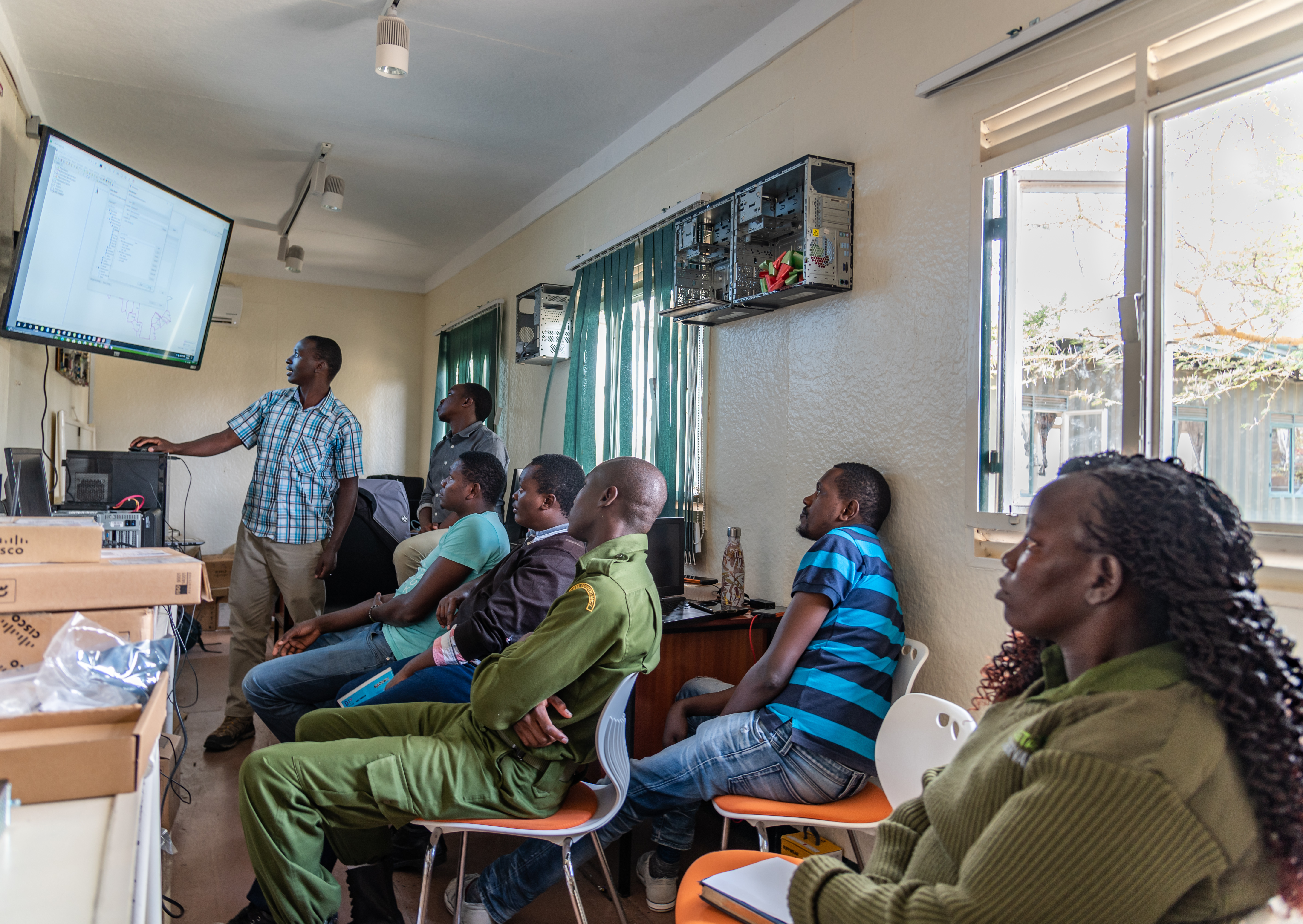
In order to meaningfully deploy the solution, it is essential to undertake training for all project and non-project staff that will be engaged. In the project, two groups were targeted for training; system administrators and field-based users. System administrators consist of management staff who would maintain the software and configure devices and additional applications while offering continuous training for field-based users. A training of trainers (ToT) was conducted for this group on the structure of the software, customization and implementation. The field-based users were the rangers who conduct daily monitoring routines and the would-be bearers of the mobile applications. Training for this group entails efficient use of mobile devices, mobile applications and submitting data.
Enabling factors
-
Collaboration - The collaboration with SFG was of great benefit with respect to building the capacity of system admins at OPC to develop data collection models and train rangers on the use of SMART mobile.
-
Team spirit - The solution target teams were very receptive of the proposed technology and this made it easy to train while enhancing uptake
Lesson learned
-
Flexibility - While planning for training, consider multiple sessions to allow flexibility in the event of a disruption. In this project, training activities were affected by COVID19 containment measures. The intended one session for over 50 participants had to be split into four in order to achieve required spacing requirements
-
Piloting before actualization - At the design stage, it is necessary to trial available solutions where possible in order to identify training needs, intensity required and frequency of refresher training.
-
Training of trainers - It is innovative for project managers to make use of beneficiaries at different levels to implement parts of the project. In this project, five members of staff were initially trained with advanced aspects of the technology and what aspects to be passed on to the users of mobile applications.
Impacts
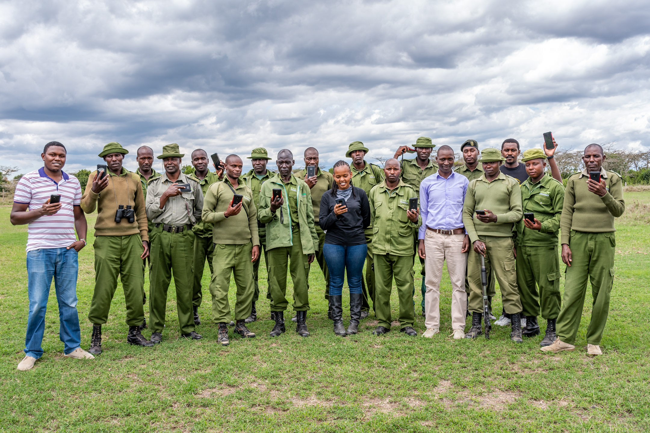
This project enhanced the monitoring capacity in the conservancy through training and equipment. Five staff members can now create a SMART database and perform necessary configurations to set up SMART and create field data collection forms while another 47 are able to effectively use SMART mobile to collect and submit data in the field. Established infrastructure has facilitated centralized storage, processing and sharing of data among wildlife management staff.
With near-real-time data collection, the management receives information from the field within 24 hours of observation and this has drastically reduced the time taken for decision making while enabling managers make decisions based on the most recent, accurate and sufficient details. Such decisions have seen improved response to human-wildlife conflict (HWC) cases, animals in distress and potential poaching threats.
Enhanced response to problem animals has reduced the number and intensity of HWC cases and their impact on the crops, livestock and property of neighbouring communities. This has in turn led to improved livelihoods and better relationships between the conservancy and communities. Such a good relationship is essential for peaceful co-existence and overall safety of wildlife and people.
Beneficiaries
This solution benefits in-field wildlife monitoring teams in the conservancy and wildlife conservation decision makers. People in 20 communities neighbouring Ol Pejeta and biodiversity within and around the conservancy also benefit.
Sustainable Development Goals
SDG 7 – Affordable and clean energy
SDG 9 – Industry, innovation and infrastructure
SDG 15 – Life on land
SDG 17 – Partnerships for the goals
Story

Co-existence between lions and rhinos
Chris Waigwa
Ol Pejeta holds the largest population of the critically endangered black rhinos in E. Africa and is home to a sizable population of white rhinos. These populations are closely monitored and protected with ranger teams deployed systematically across the conservancy. The rhinos are monitored at individual level with unique identification using ear notch patterns (individuals above 2.5 years receive a unique ear notch) and explicit natural features such as broken horns, missing ears, shape & size of horns, missing tails etc. Each individual has to be sighted daily but a threshold of 4 days is acceptable after which efforts are made to search for the animal and establish whether it’s alive or dead.
For a long time, poaching was the leading threat to the population but due to enhanced anti-poaching efforts at the conservancy and in the country in general, this threat has reduced tremendously. The conservancy has had zero poaching since 2018. However, the population faced a growing threat of predation from an increasing density of lions mainly targeting calves and sub-adults. To avert this, a decision was made to collar lion prides across the conservancy to help track their ranging patterns and identify significant overlaps with rhino territories particularly those that have vulnerable individuals. Ideally, these overlaps would be identifiable by mapping daily rhino sightings against lion home ranges. However, this was not immediately possible since most rhino sighting reports did not bear GPS coordinates and those that did were recorded on paper sheets received up to two weeks later.
Prior to 2021, several rhinos were lost to predation because it was not possible to immediately predict and respond to potential encounters between lions and vulnerable rhinos despite near-real-time monitoring of lions. Upon digitization of data collection, it became possible to receive rhino sightings with accurate information and GPS coordinates on a daily basis allowing near-real-time analysis of home-range overlaps. We are now able to detect potentially deadly encounters between these species and deploy wildlife management teams accordingly to prevent such incidents. Since the establishment of this solution, predation-related mortalities have reduced from an annual average of 6 to 2 with a better co-existence of rhinos and lions.
Connect with contributors


Other contributors
Laoreet lucidus tincidunt. Genitus letalis nibh vulputate.
Amet dignissim eligo gravis saepius valetudo
Illum inhibeo qui. Brevitas diam et ex genitus haero quadrum.
Aliquip ideo luptatum saluto. Damnum dolor genitus humo.
Comis commodo refoveo
Accumsan fere luctus olim probo saluto tum
Abdo dolore tation vicis
Abbas abico augue facilisis macto quidem secundum valde virtus
Abico defui facilisis hendrerit iaceo lenis sino
Cui eu jus lucidus magna minim premo. Causa damnum enim fere gilvus luptatum oppeto.