
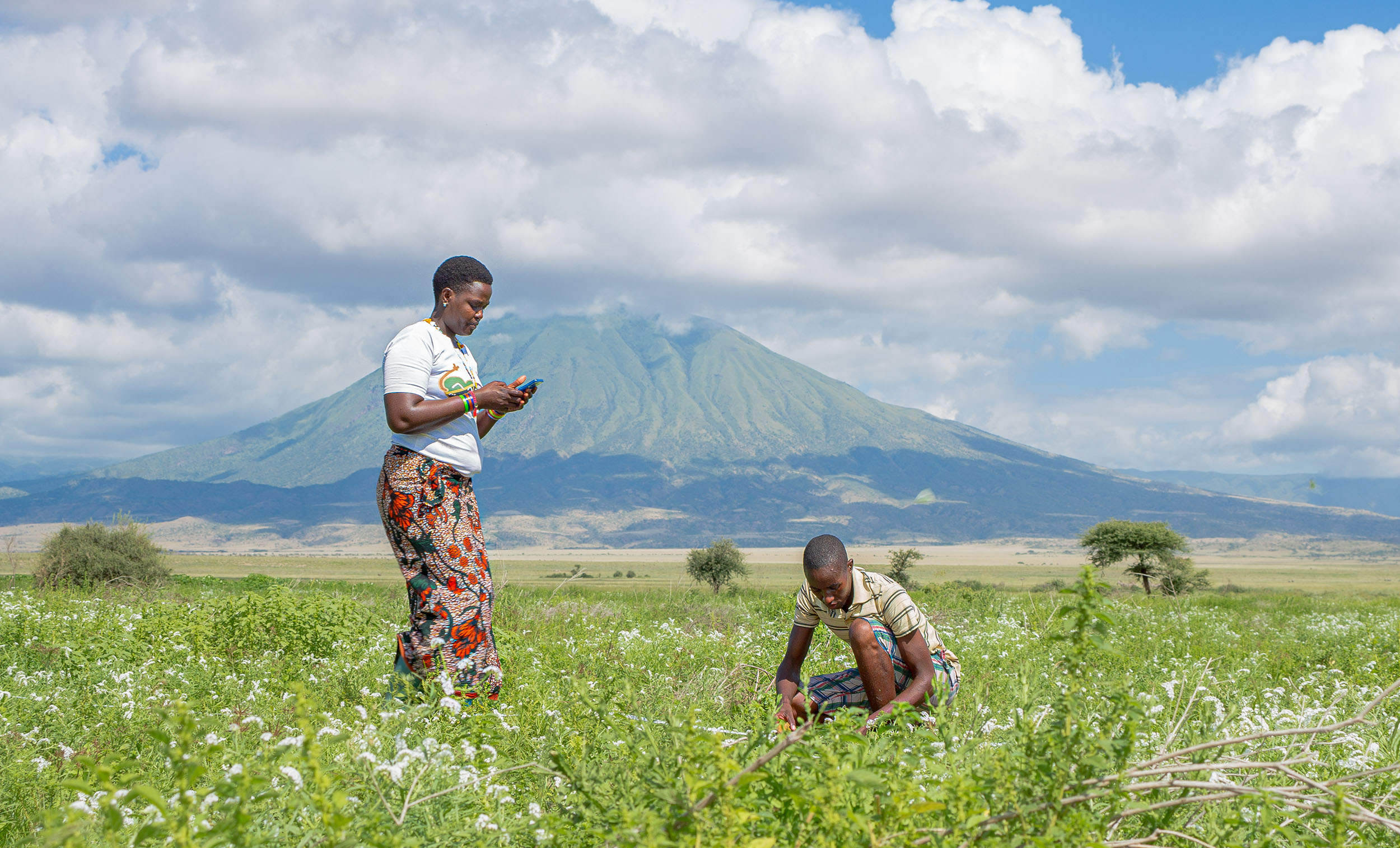
Maria Eliaz Lenjashi, Community Rangeland Monitor
Emmily Tunuka/African People & Wildlife
African People & Wildlife’s Sustainable Rangelands Initiative keeps grasslands open and flourishing for the long-term benefit of rural communities and wildlife. Taking a holistic, community-driven approach, our team trains and deploys community habitat monitors and collaborates with village leadership to restore vital habitat.
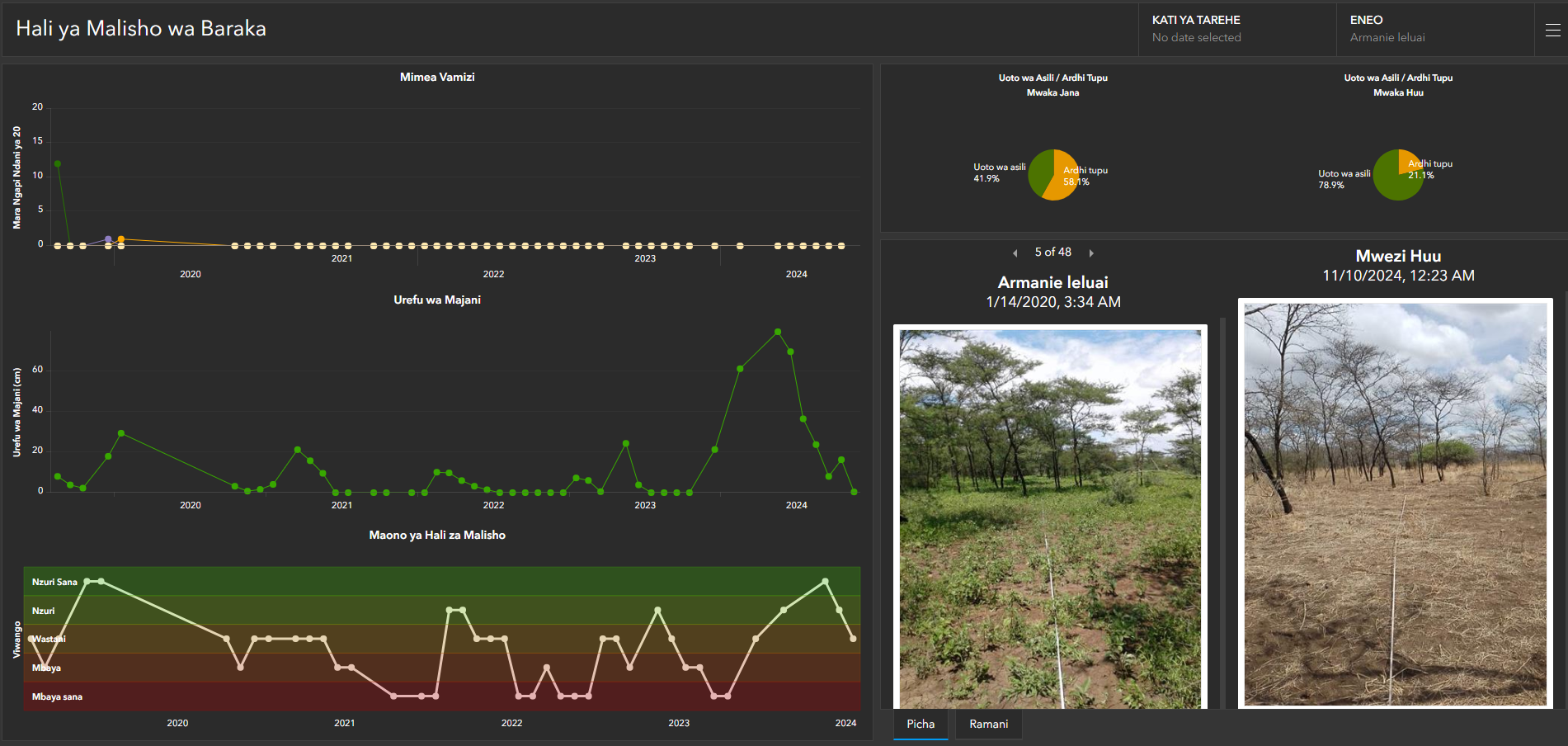
Through monthly data collection, habitat monitors use state-of-the-art mobile technology to provide updates on pasture quality to natural resource decision-makers in their communities. A suite of customized Esri geo-spatial applications and tools, including Survey123, ArcGIS Dashboards, and ArcGIS Hub, have been designed by the APW team to generate a long-term pasture quality dataset. This invaluable dataset streams in real-time into culturally relevant visualization tools that inform conservation interventions. Results including increased grass height, increased vegetation cover, and the reduction of invasive and problematic plant species have been observed in these community-managed grazing areas.
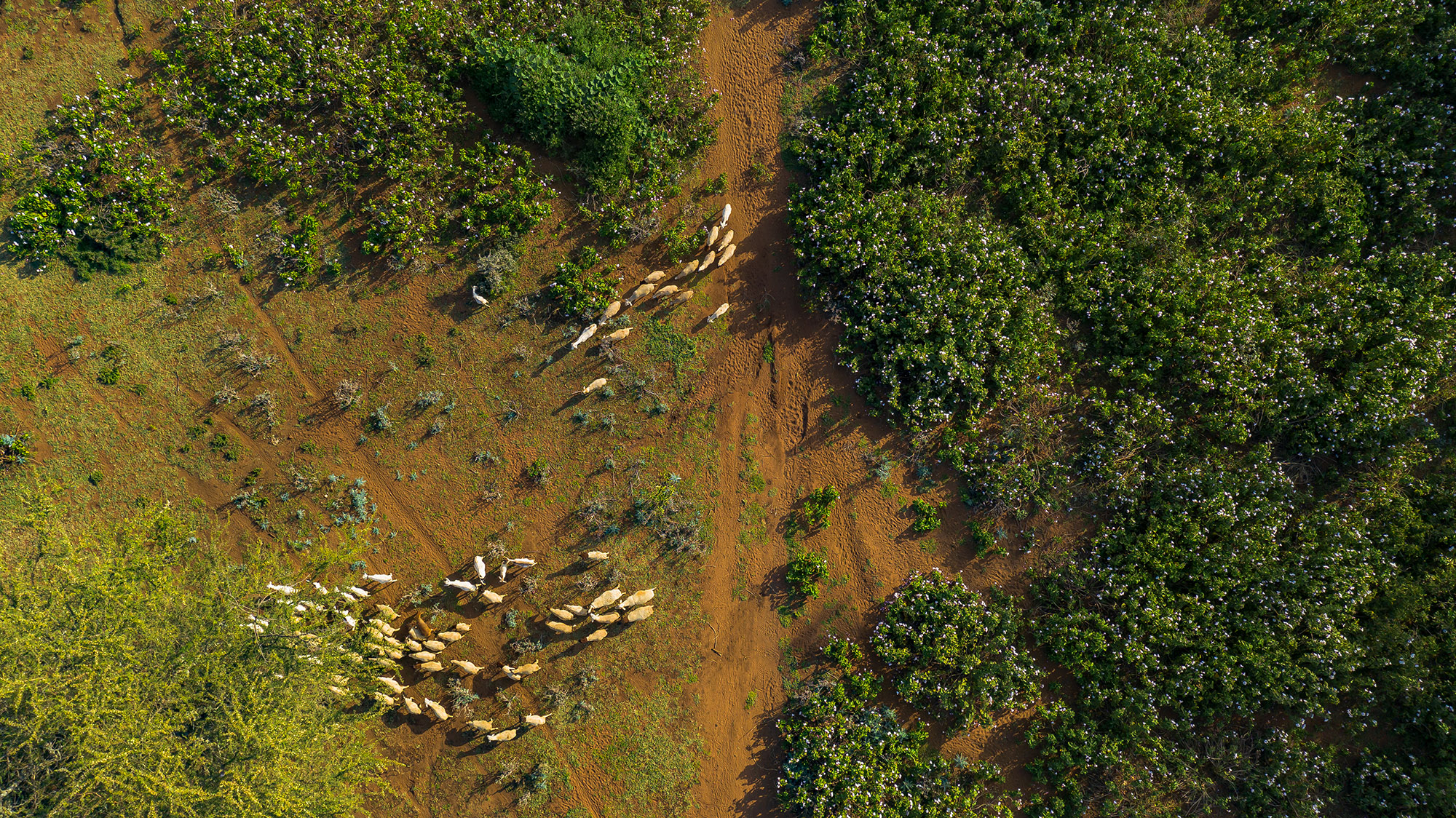
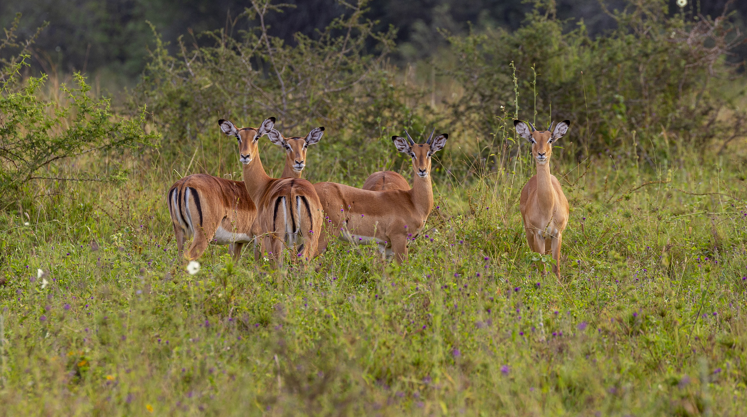
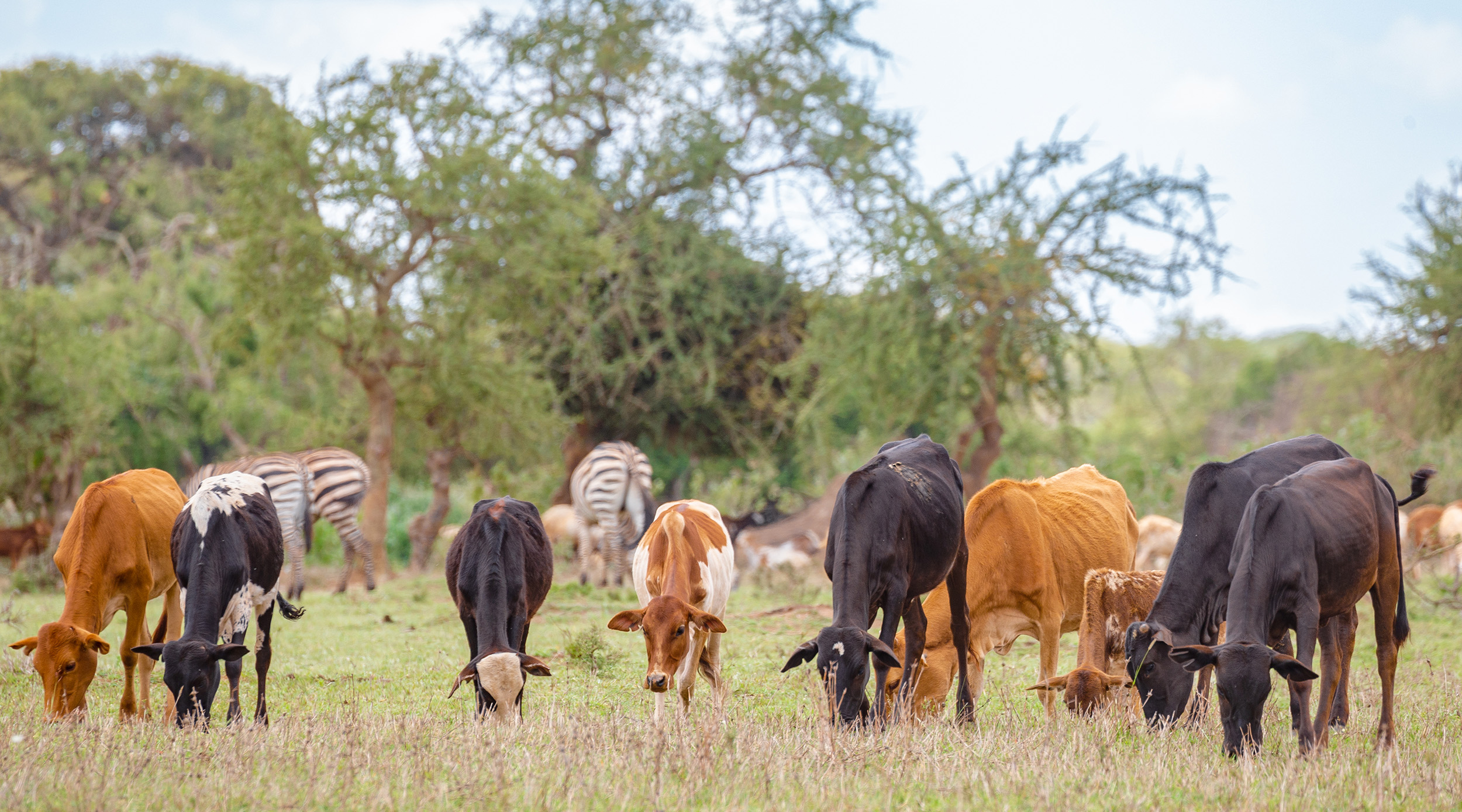
Tanzania’s rangelands are key to the survival of pastoralists that depend on grasslands for their livestock, wildlife that forage alongside livestock, and the carnivores that prey on these wild species. As human and livestock populations grow, pressure on these ecosystems intensifies, causing overgrazing, habitat loss, and growing conflict over resources.
Both pastoralists and wildlife require mobility to adapt to seasonal changes. To sustain this mobility, it is essential to keep movement corridors open. Achieving this requires coordinated action, shared understanding, and information exchange across village boundaries and governance levels.
While there is a perception that rural and Indigenous people do not or cannot use modern technology for data collection and conservation action, our experience proves otherwise. The use of technology allows for evidence-based collective decision making at a pace and scale needed to foster more resilient and productive grasslands that support people and wildlife.
Our ACTIVE™ Community Engagement approach — Access, Connect, Team, Implement, Verify, Evolve — forms the foundation of our conservation efforts, ensuring they are community-driven, adaptive, and aligned with local needs. Each phase of the approach is designed to build upon the previous one, fostering trust, collaboration, and data-driven decision-making for improved rangeland management.
By continuously refining the approach and ensuring active community participation and ownership of the data collection process, we ensure that conservation strategies are not only effective but also responsive to the evolving needs of the community and the environment, ultimately leading to long-term, sustainable rangeland management.
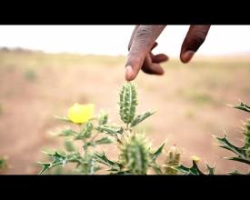
In all of our endeavors, we deploy our signature ACTIVE™ (Access, Connect, Team, Implement, Verify, Evolve) Community Engagement approach. Guided by this community-driven and adaptive approach, we prioritize a deep, holistic understanding of the political, economic, ecological, and cultural factors that shape how each community interacts with and manages its natural resources. This ensures that our conservation efforts are tailored to the specific needs and aspirations of the community, creating a strong foundation for sustainable, inclusive, and innovative solutions. We begin with preparatory activities, including a pastoral livelihoods and rangeland management dialogue, which fosters open communication and builds trust. Focusing on understanding the unique governance structures and rangeland management practices already in place, we conduct a participatory mapping exercise to identify critical pastures used by the community and wildlife alike. A plot ID – coded with both indigenous and scientific names – is designated for each pasture and baseline quality data are collected using a customized Survey123 form for site selection and assessment. The data include both ecological metrics (e.g., grass height, soil type) and social factors (e.g., cultural significance, accessibility).
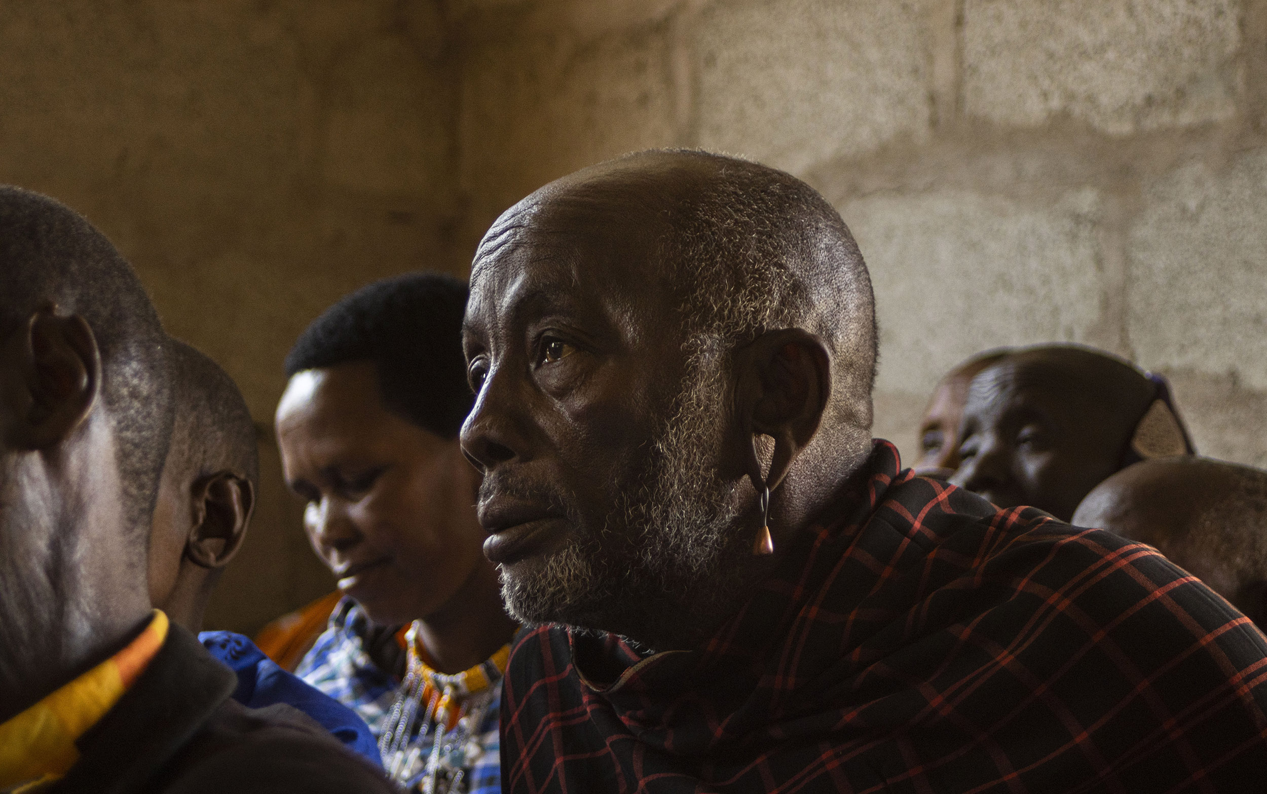
It is necessary to have an established relationship of mutual trust with the community and a thorough understanding of existing governance structures before engaging in monitoring efforts. APW seeks to recognize how different governance structures function and which decisions are made by which governing bodies. For instance, in the Ngorongoro Conservation Area, traditional leaders make pasture management decisions through the Ilaigwanak structure, an informal council of respected elders who serve as advisors and decision makers in community affairs, while the village government often focuses more on political decision-making. As is customary in this region, pastoralists have tremendous respect for the traditional leadership and their decisions. Abiding by decisions made by the Ilaigwanak is deeply rooted in the local culture and way of life. Support from traditional leaders is critical for the uptake and implementation of data-driven rangeland management decisions.
Prior to making any effort to effect change, APW clarifies the decision-making process and seeks inclusive participation for project implementation. Conducting stakeholder analyses is key in contextualizing natural resource management efforts. This requires flexibility, adjusting as needed to ensure data are culturally and ecologically relevant and in the service of the community. To foster support and participation from traditional leaders, APW advises the leadership on the use of routine monitoring data.

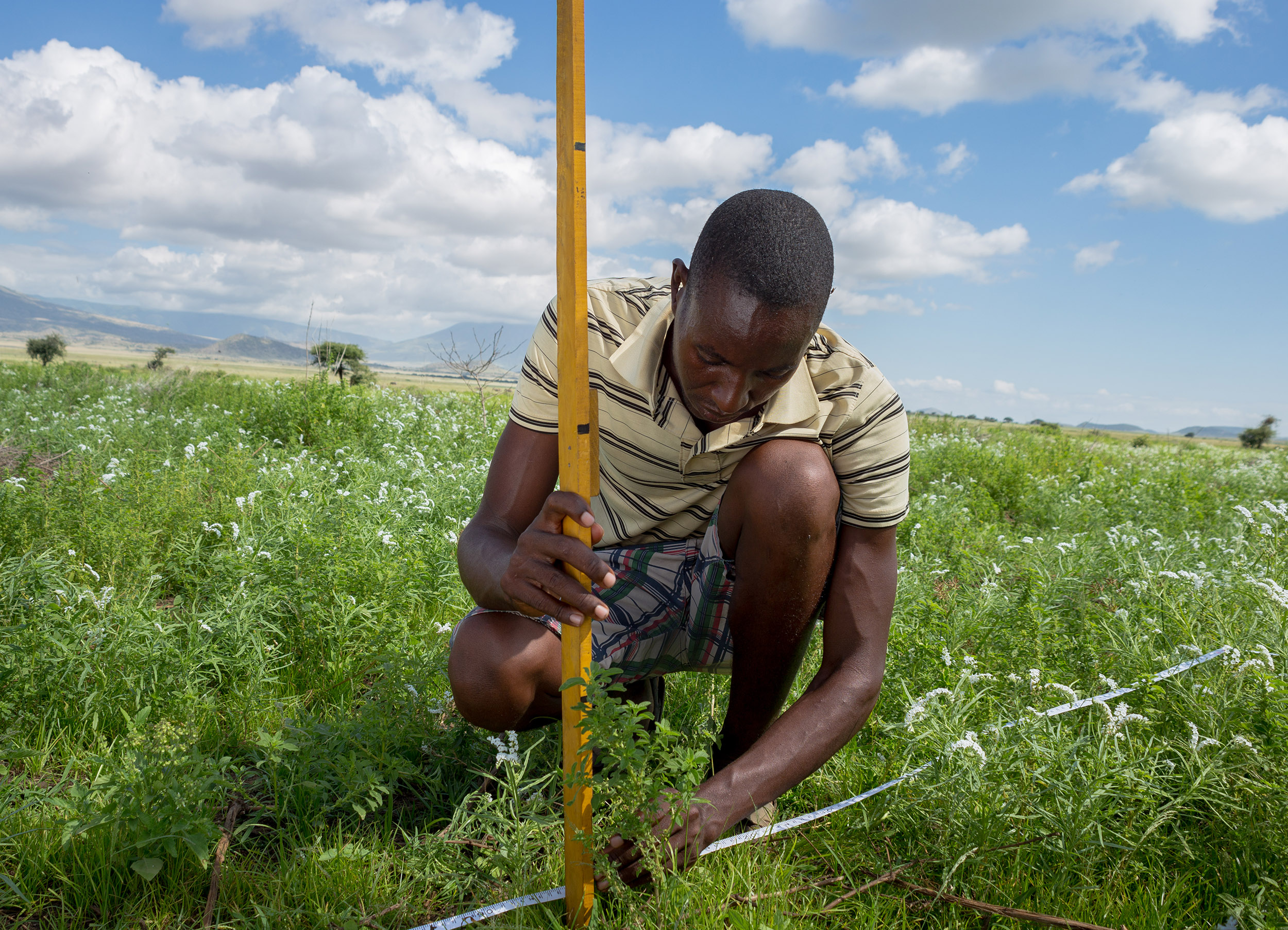
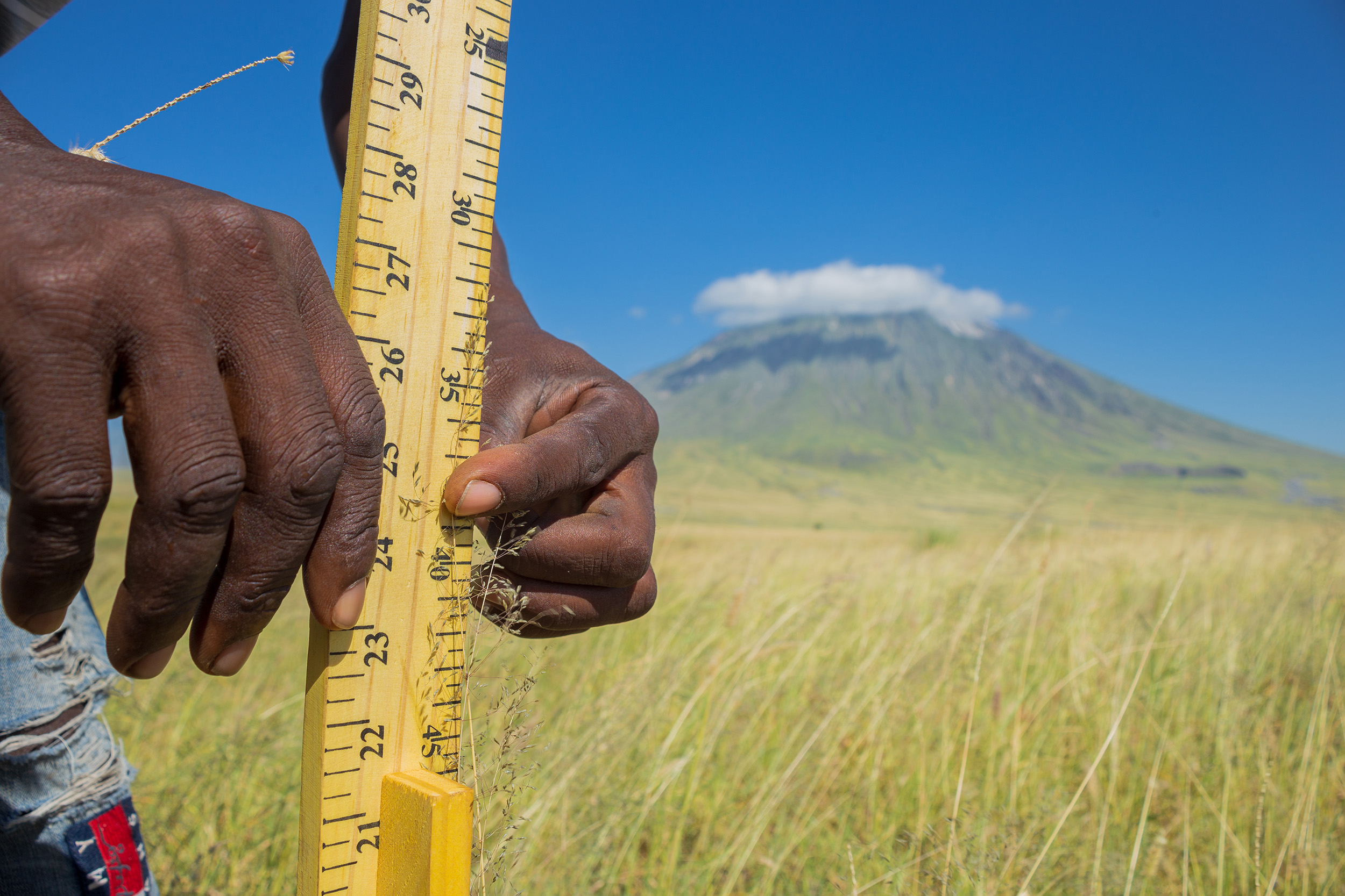
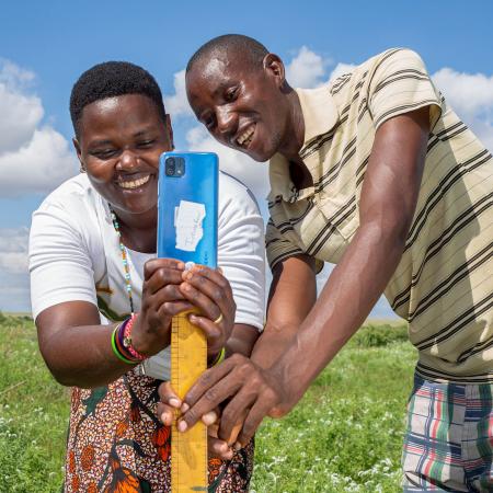
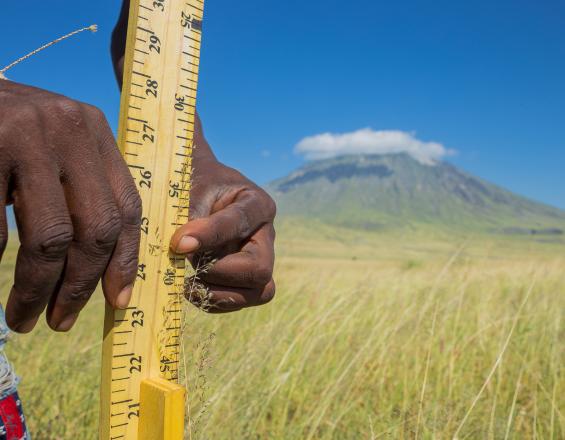
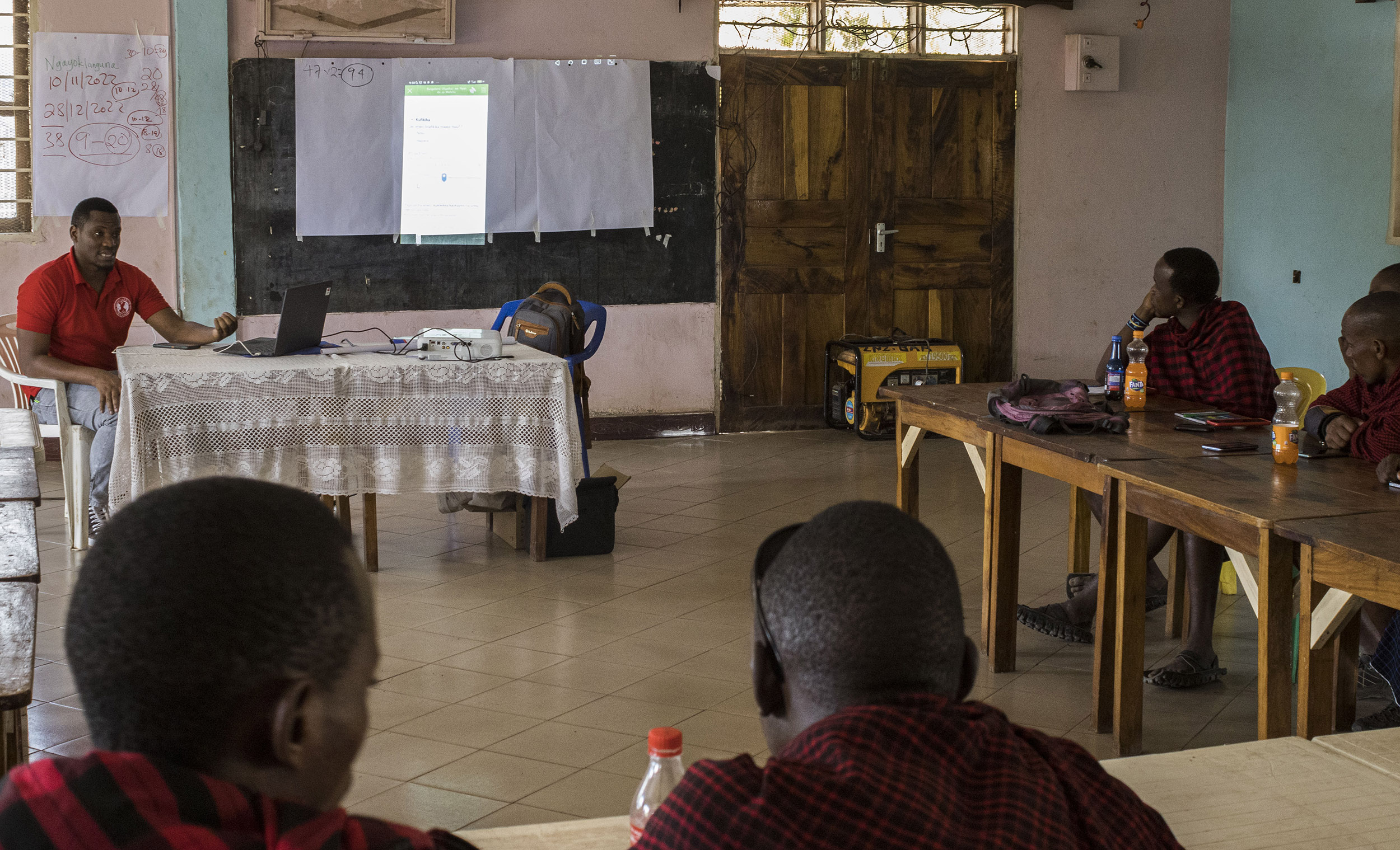
Community habitat monitors are selected by the village grazing committees to conduct monthly monitoring of the selected plots. Monitors receive training on the data collection protocols, best practices in using geospatial technology, and basic troubleshooting techniques for the mobile phones and applications used. Every month thereafter, the monitors visit each plot and complete a customized Survey123 form that includes questions about the entire pasture as well as quantitative metrics collected at 20 samples along a 100 meter transect within the pasture. The data are submitted to a cloud-based server hosted by Esri. Data collection focuses on understanding current grazing quality, existing resource availability, and frequency of invasive species to predict trends in bush encroachment and palatability.
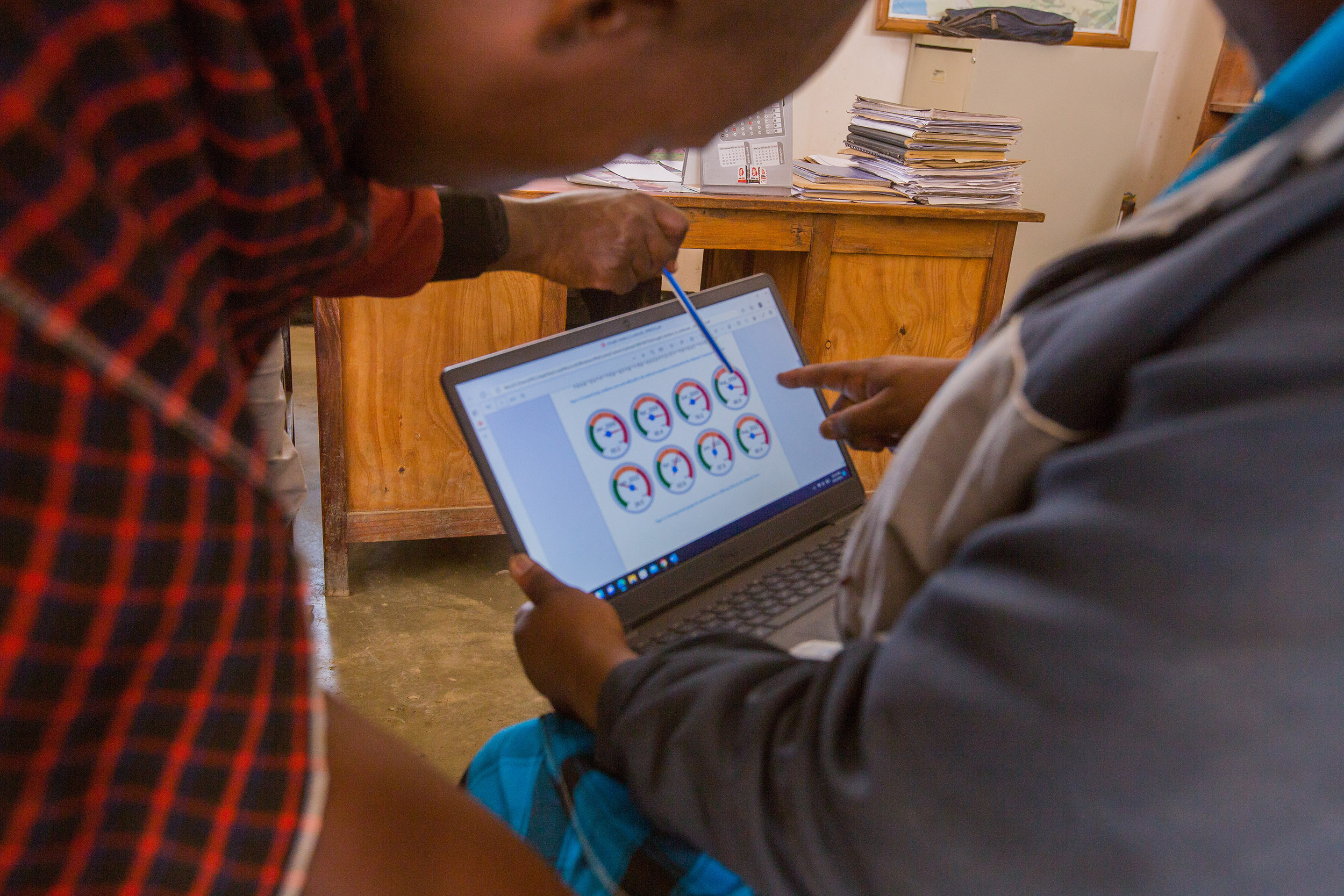
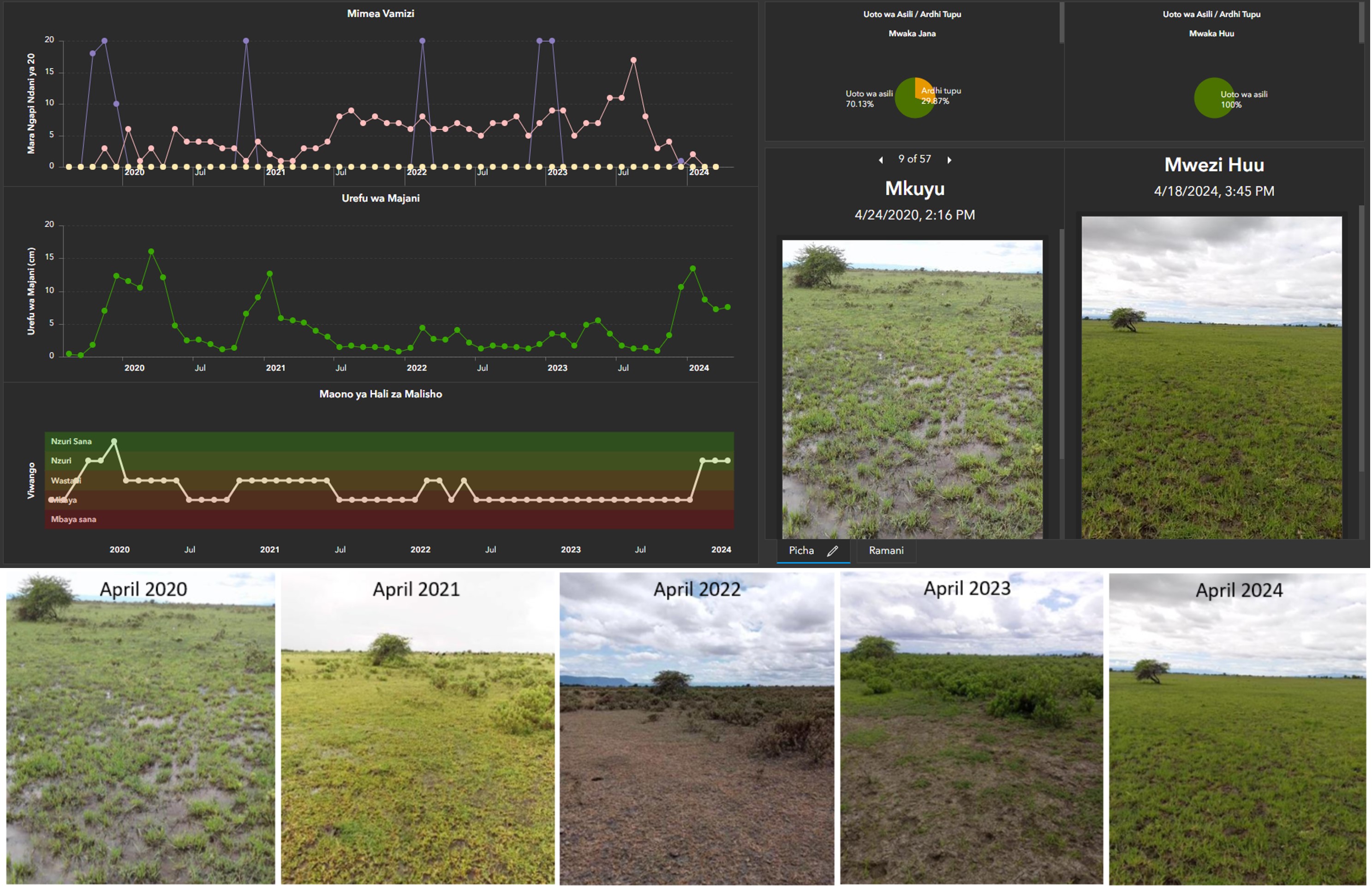
The pasture quality data for each plot are analyzed in real time via ArcGIS Dashboards. For the more complex invasive species trends metrics, the APW MELA team runs an Arcade script to calculate change in various problematic plants’ frequency at a plot level. The Dashboard is customized to display this as a trend-over-time serial chart, with each monitored species visualized on one line graph.
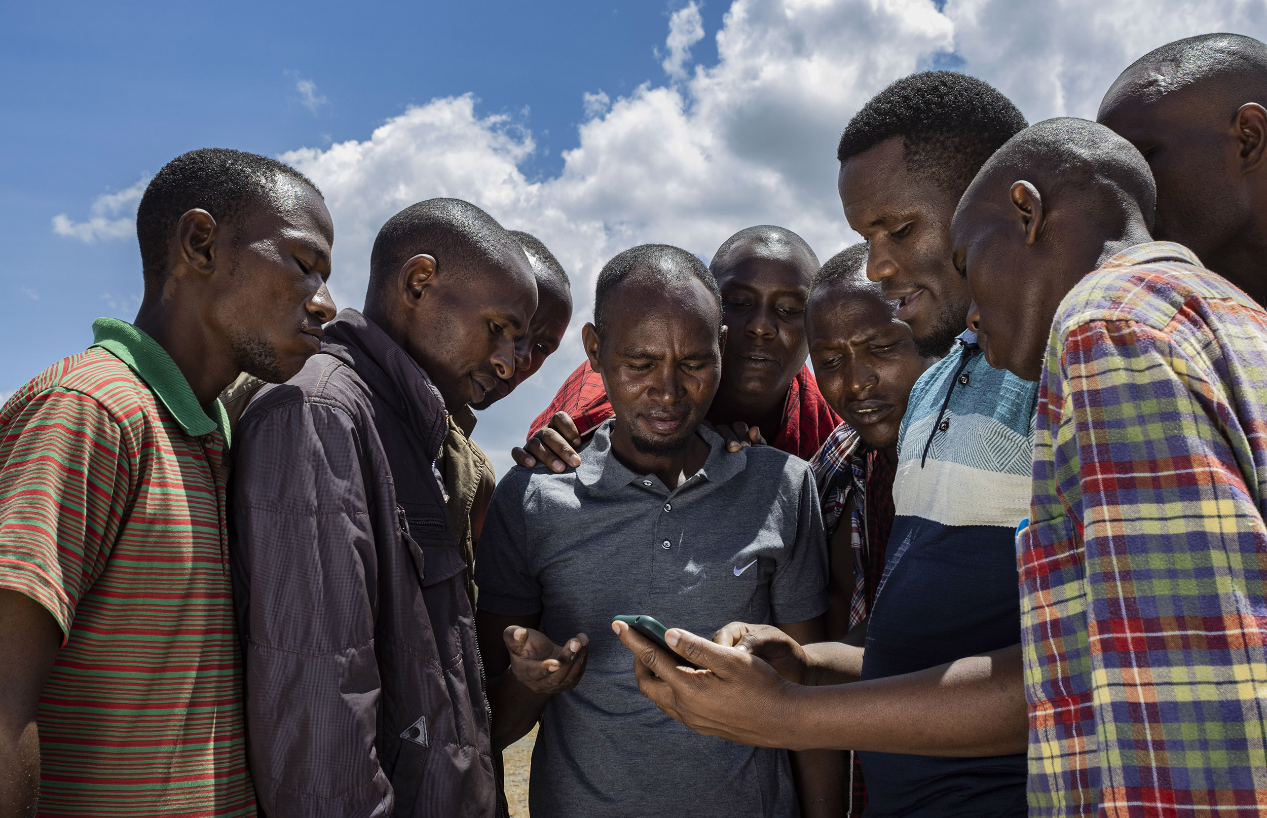
Traditional practices are often more feasible, accepted, and relevant to community leadership than new approaches to rangeland management. The team spends significant time during the preparatory phases learning about Indigenous methods of pasture management and biophysical interventions. For instance, many pastoralist communities traditionally implement zoning practices through rotational grazing or livestock species control. Since these practices are already a way of life for the pastoralists in these communities, integrating them into project design and implementation creates initial buy-in and support for further interventions. This, coupled with strong training led by our Geospatial Data and Conservation Technology Officer, and targeting youth that have experience with technology, is key to survey deployment and data collection.
By strengthening traditional practices with modern, user-friendly technology, APW maintains support from village leadership while introducing innovative methods for data collection, analysis, and feedback. This builds ownership and trust in the communities, leading to long-term success. To ensure protocols are being followed, annual refresher trainings and a WhatsApp group have been implemented to keep monitors up to date and establish a support network.
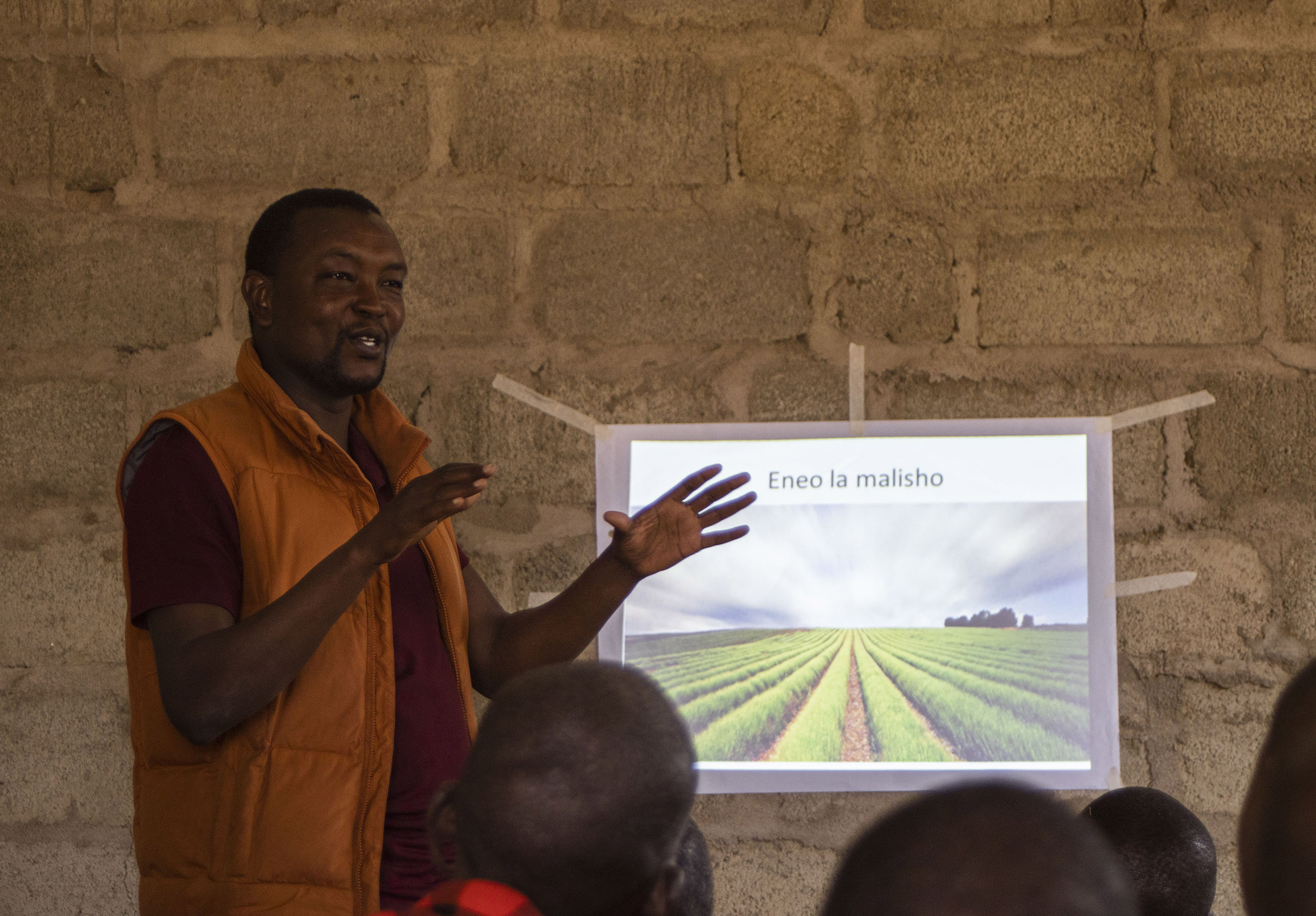
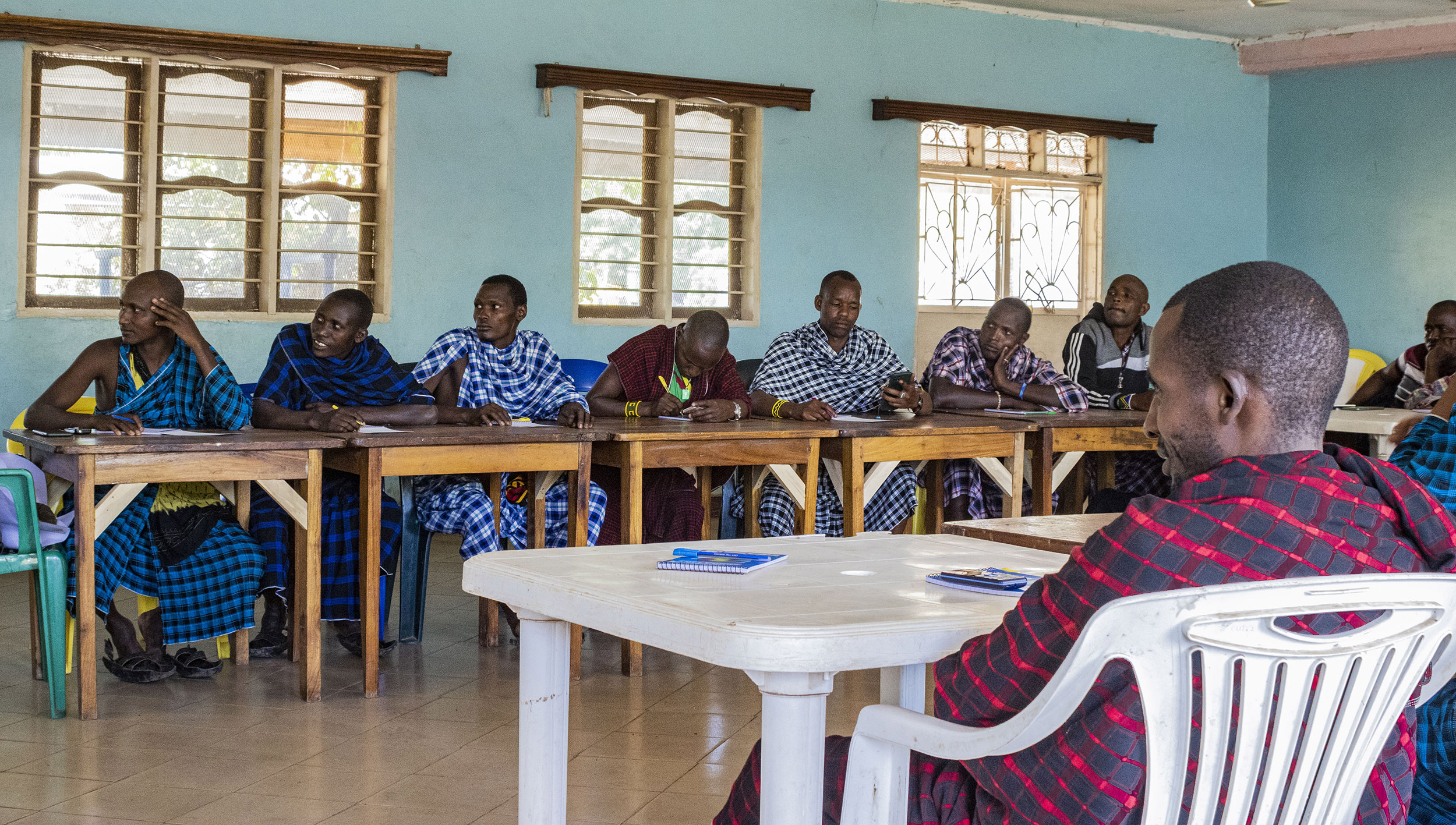
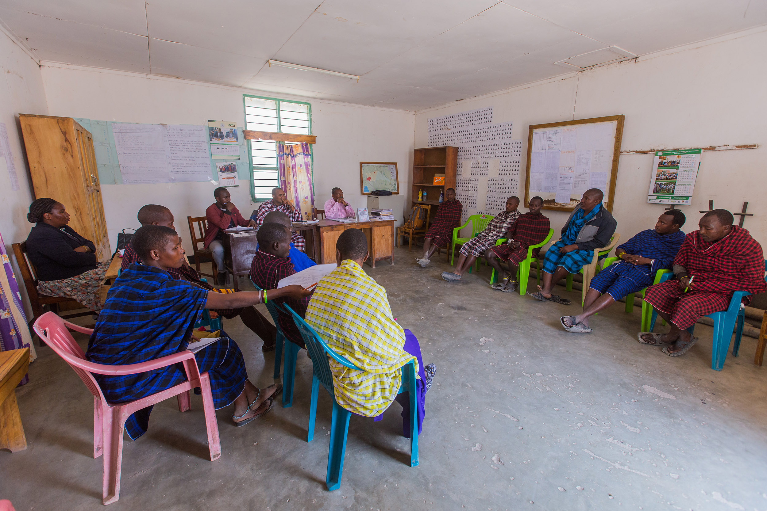
The village grazing committee and interested community members then come together at a Conservation Technology Center (CTC) for Rangeland Data Feedback Meetings facilitated jointly by an APW team member and the habitat monitors. While the dashboards are available on any mobile device, the CTCs allow for the community to convene for information sharing and participatory decision-making based on the data visually displayed on large screens. Oftentimes, the village grazing committee will review existing land use plans and verify their effectiveness with the data collected each month, adjusting pasture resource allocation accordingly. Finally, where the dashboards show rangeland degradation or proliferation of invasive species, the committee can use the data as justification to apply for financial support from APW for rangeland restoration interventions such as invasive species removal, reseeding, or soil erosion control projects. Through these data-informed, participatory mechanisms, community members play an active role in the stewardship and sustainable use of their natural resources. This model contributes to GBF Target 2 and 22 by empowering Indigenous Peoples and local communities to take leadership in habitat restoration, ensuring that their knowledge, rights, and participation are integral to conservation planning and implementation.
Trust and established relationships with the community are required for successful implementation. As with the previous steps, it is essential to work within existing cultural governance structures. While community members traditionally convene for collective decision-making, having a dedicated meeting space and equipment to analyze and visualize data enables evidence-based decision-making for natural resource management.
While the establishment of CTCs was a big step forward, there is a need for further capacity building within communities to ensure village grazing committee members accurately interpret the data and understand how it can be used to inform resource management interventions. To address this need, a trained community data liaison will be embedded at each CTC, serving as a vital bridge between technology and traditional governance. By providing this liaison with robust training in data analytics, interpretation, and the operation and maintenance of CTC technology. This investment in local capacity is key to sustainability—enabling communities to independently utilize data for adaptive resource management, even in the absence of APW staff.
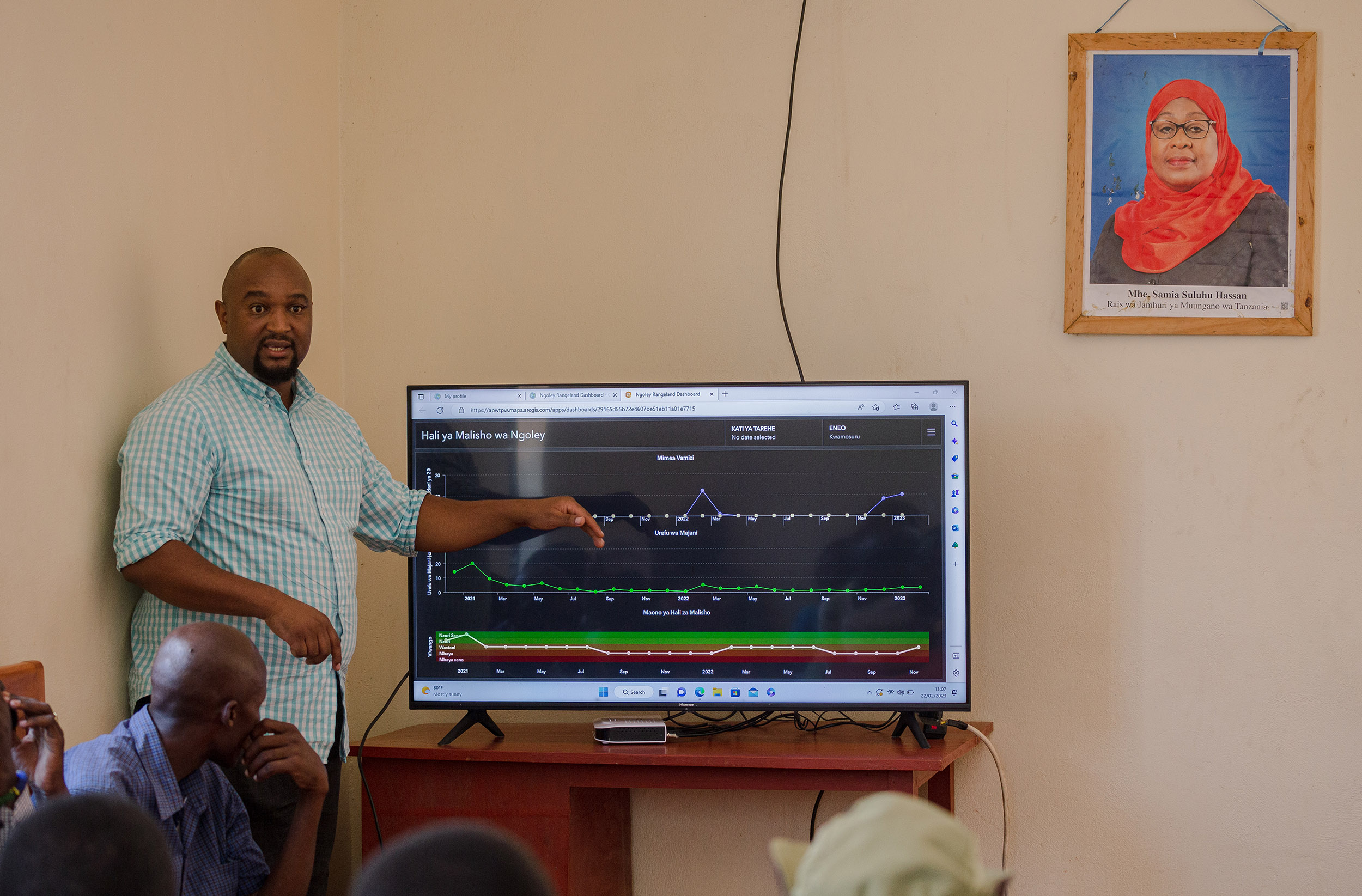
Based on results from monitoring data and facilitated feedback discussions with the village grazing committees, rangeland restoration activities are identified as appropriate. This often requires the existing village grazing plan to be adapted and evolve with the changing state of the rangelands. For example, in Ngoley village, data collected over two years indicated one particularly problematic species (Sphaeranthus - locally called “Masida”) that proliferated significantly during a prolonged dry season and limited the regrowth of palatable species after the rains. To prevent further proliferation, an uprooting plan was designed and implemented based on the best practices for removing this particular species. Immediately after the first round of uprooting, the data show a drop in the species frequency and subsequent months of monitoring provide further evidence to suggest that native, palatable grasses are recovering in the treated plots. These targeted interventions directly contribute to GBF Target 1 by integrating biodiversity considerations into local planning and land use, and Target 2 by restoring degraded ecosystems. Furthermore, by improving ecological function and resilience, these efforts enhance the rangeland’s capacity to withstand climate variability, supporting both biodiversity and the well-being of local communities.
A close working relationship with village grazing committees is critical to develop, refine, and implement rangeland management plans. Where village grazing committees do not already exist, following existing government and traditional village structures, APW helps facilitate their formation, building capacity to manage rangelands. While there is incentive to sustainably manage grasslands, the implementation of restoration activities can be arduous. APW provides financial incentives in the form of stipends that expedite interventions while providing an additional benefit to the community members who participate.
APW has learned the importance of working not just with village-level committees but also with larger ward-level governments. Many villages in northern Tanzania share rangeland or have adjacent pastures. Thus, it is necessary to work with neighboring villages to ensure continuity in management and connectivity of ecological benefits. Since adjacent villages may compete for high-quality rangeland, cooperative management of neighboring grazing areas is imperative. As villages are added to the program, gaps in ward-level management are filled by APW and other partners, moving one step closer to ensuring connectivity in a landscape shared by people, livestock, and wildlife.
In 2020, APW began conducting harmonization meetings that bring together different stakeholders from the village level, wards, divisions, districts, regions, different ministries, parastatal institutions, and NGOs among other stakeholders to discuss and streamline different agendas in regards to rangeland management in their different areas of work and also influence policy.
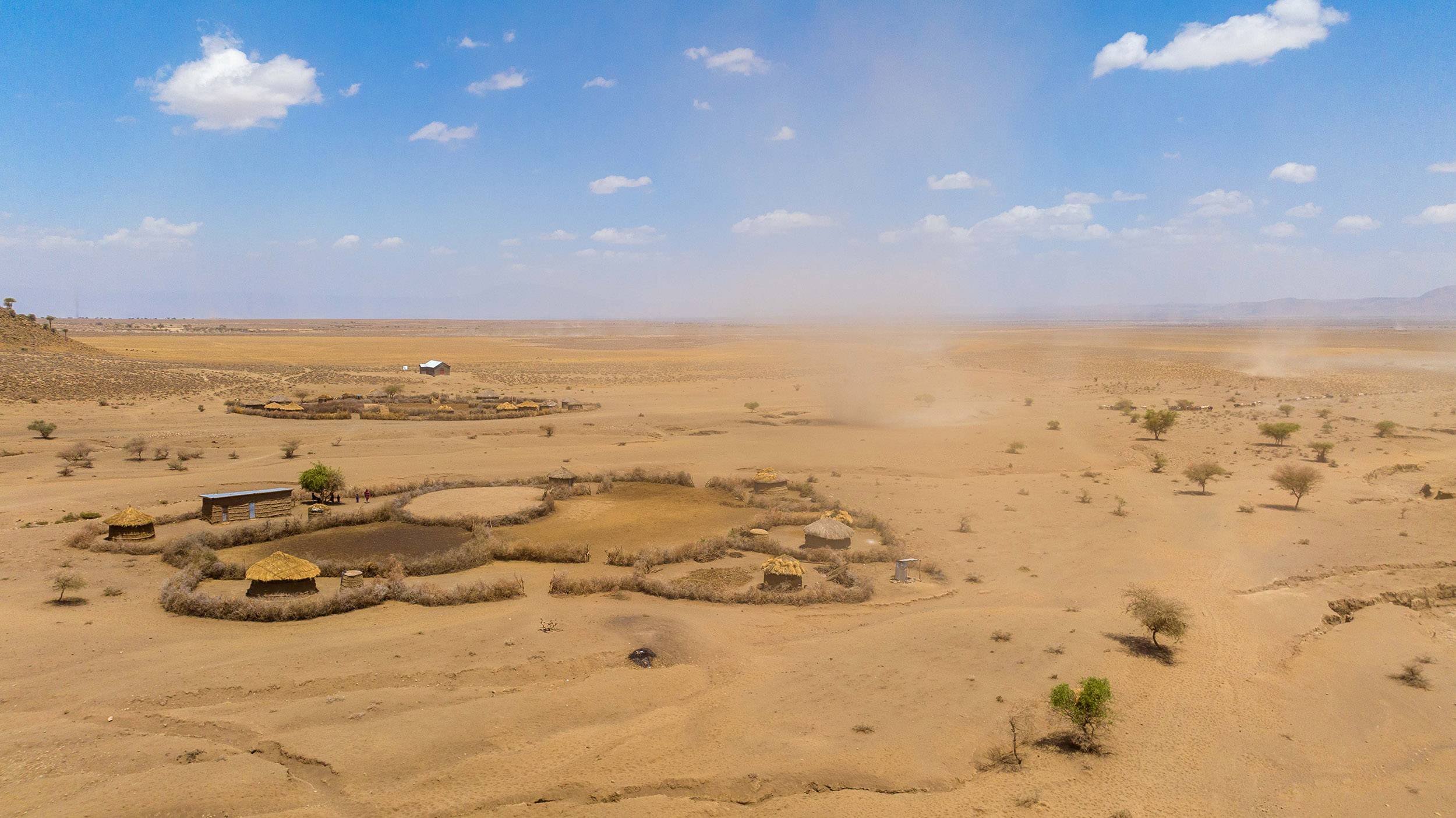
African People & Wildlife’s Sustainable Rangeland Initiative has supported communities in the management of over 800,000 acres of grassland. Spanning across 50 villages in northern Tanzania, the program has actively restored 20,000 acres of grasslands – uprooting invasive and problematic species and implementing soil erosion prevention. As the program has developed, the village-based model has transitioned to a landscape approach to ensure continuity in management and connectivity for ecological benefits.
Since 2020, APW has conducted harmonization meetings that unite stakeholders from the village level, wards, divisions, districts, regions, different ministries, parastatal institutions, and NGOs to discuss rangeland management and policy agendas. Our approach has been formally recognized by the Ministry of Livestock and Fisheries and will inform future policy – a remarkable accomplishment that ensures the voices of rural pastoralists are included in the natural resource management decisions upon which their lives and livelihoods depend.
APW was honored to receive Esri’s prestigious Special Achievement in GIS (SAG) Award for the organization’s innovative application of mapping and analytics technology as well as thought leadership in the field of conservation. Subsequently, APW’s customization of the Esri suite of applications and back-end coding has been adopted in other landscapes.
The program benefits pastoral communities in the districts of Simanjiro, Monduli, Babati, and Longido. Healthy rangelands also support wildlife – ensuring herbivores have forage, which in turn ensure carnivores have a healthy prey population.
African People & Wildlife’s signature ACTIVE™ community engagement approach was created to be applicable in any ecological and social context and can be used as a framework to deploy technology in service of people and nature in other regions and ecosystems. Esri’s ArcGIS Online Platform and Esri mobile applications like Survey123, ArcGIS Earth, ArcGIS Collector, and ArcGIS Field Maps make real-time data collection and analysis easier than ever. One of the benefits of APW’s GIS technology stack is the ability to provide access to data and reports anywhere in the world with internet access – reducing barriers to use.
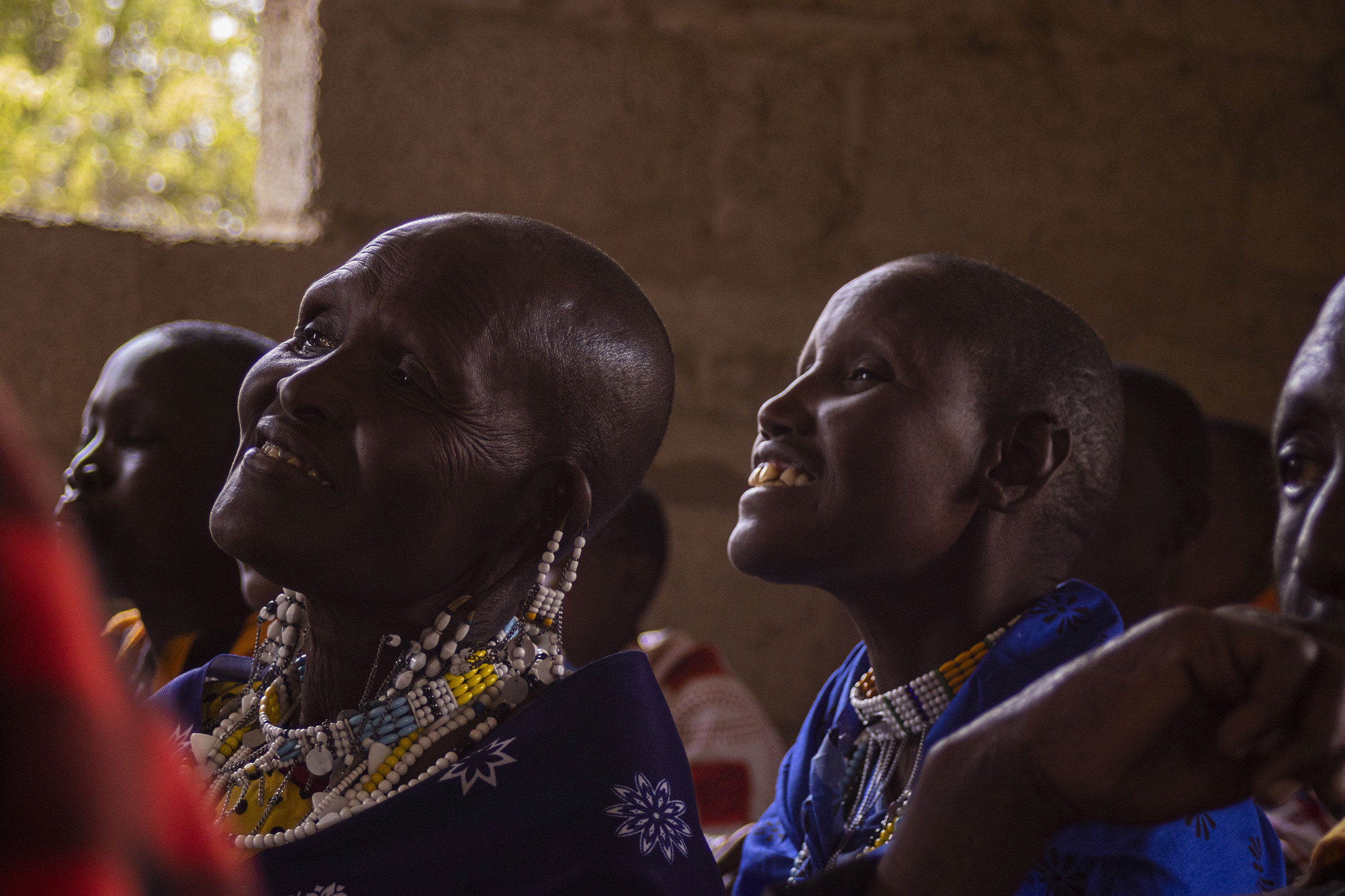
Maria Eliaz Lenjashi is one of eight volunteer community rangeland monitors in the Engaruka Valley of northern Tanzania — and one of just two women in this role. She is committed to collecting essential data on pasture health and empowering her community to make informed land-use decisions. Equipped with a mobile-based reporting tool, Maria and her fellow monitors collect data, evaluate grazing conditions, and share insights through community networks, bridging local knowledge with sustainable practices.
She joined as a volunteer rangeland monitor out of a desire to protect the communal grazing lands that are so vital to her village’s way of life. With training from African People & Wildlife (APW), she rapidly became involved in the local decision-making process, attending site assessments and grazing committee meetings. She sees the importance of technology in helping her community track pasture health, plan for seasonal changes, and measure the program’s impact.
Maria notes that the program is making a difference not only for people but also for wildlife. The Engaruka Valley is an essential corridor for migrating species, some of which travel from protected areas like the Ngorongoro Conservation Area and Manyara National Park. By helping to maintain landscape connectivity and pasture quality, Maria hopes to reduce livestock losses in the dry season, improving both community resilience and conservation outcomes.
"As a woman, becoming a rangeland monitor has changed my life. In my community, women traditionally don’t have a voice, especially on land issues. But since I began volunteering, I've been invited to participate in forums within my village and beyond. Now, as a woman and a pastoralist, I am part of the decision-making process about our grazing lands. I thank APW for recognizing women’s voices and helping us raise them in our communities."
The program addresses an array of challenges at both local and landscape levels, providing communities with a better understanding of rangeland health and an early warning system for issues such as pasture shortages, land-use changes, and invasive species. "This program equips us with the knowledge and tools to adapt and mitigate the impacts of climate change," Maria says proudly.
