

Leveraging Remote Sensing for Ecological Management and Conservation at Jiangsu Yancheng Wetland & Rare Birds National Natural Reserve
Full Solution
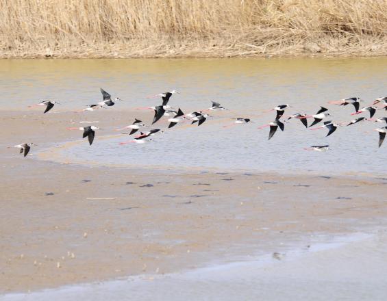
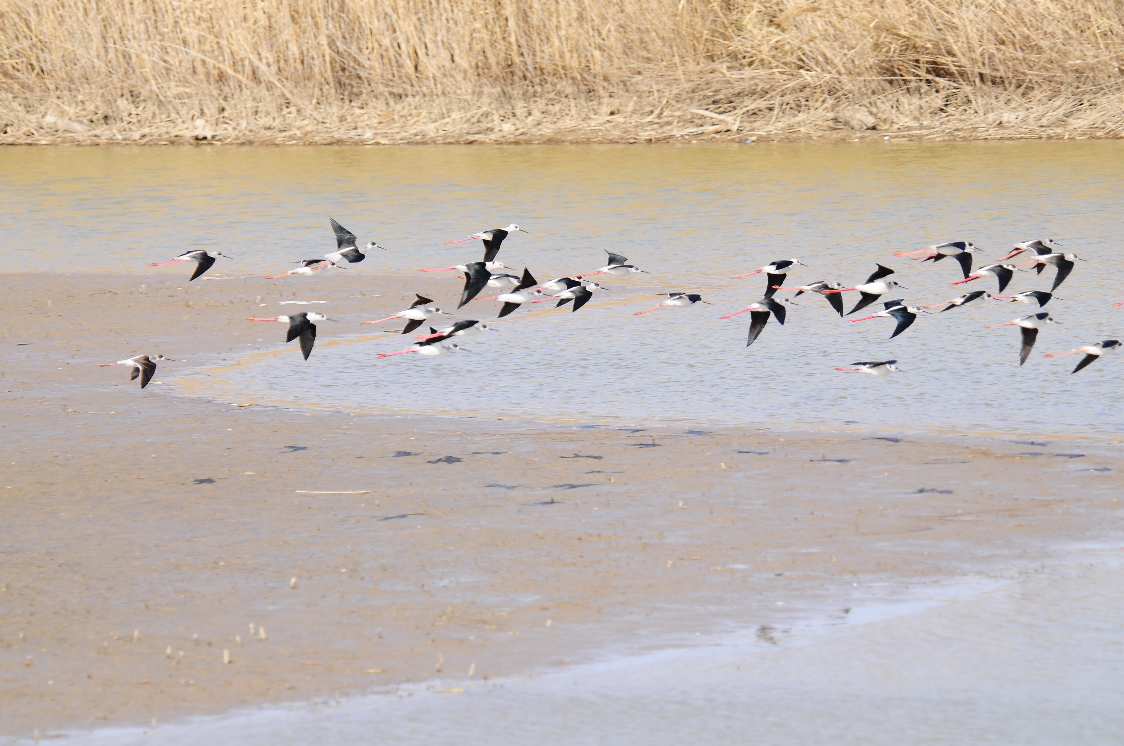
Grus japonensis in Jiangsu Yancheng Wetland & Rare Birds National Natural Reserve
Nanjing Normal University
Jiangsu Yancheng Wetland & Rare Birds National Natural Reserve is home to the critically endangered Grus japonensis and other rare species, dependent on wetland mudflat ecosystems. However, invasive species like Spartina alterniflora threaten biodiversity, causing ecological degradation and diminishing biodiversity. To address this, remote sensing technology is used to monitor vegetation evolution, offering valuable insights for ecological management.
Yangtze River Delta Pilot Site of the UN Ocean Decade’s CoastPredict Program, led by Nanjing Normal University, combines remote sensing technology and conservation efforts to support management in Yancheng. Remote sensing has tracked the evolution of key wetland vegetation (Spartina alterniflora, Suaeda salsa, and Phragmites australis) since 1990, helping to understand environmental impacts, human activities, and species interactions. This initiative aids in developing more effective conservation strategies, benefiting both the reserve and broader global effort.
Last update: 10 Oct 2025
228 Views
Tech4Nature Award
Technology Description
This solution leverages remote sensing, Geographic Information Systems (GIS), and digital twin modeling, combined with deep learning and field validation, to monitor the long-term evolution of wetland vegetation (Spartina alterniflora, Phragmites australis, Suaeda salsa). By integrating satellite data processing, machine learning, GIS spatial analysis, and ecological modeling, it enables precise, scalable monitoring to support wetland conservation and invasive species management. An intuitive dashboard ensures accessibility for non-expert users, including local communities, fostering inclusive participation.
Notable Advancements and Innovations
Deep Learning with Remote Sensing: Deep learning algorithms process time-series Landsat data (1990–2022), achieving high-precision classification of vegetation types. This innovation enables detailed tracking of invasive species spread and native vegetation recovery, supporting targeted conservation measures over a 32-year period.
GIS for Spatial Analysis: GIS tools map and analyze vegetation distribution, identifying migration patterns, habitat fragmentation, and aggregation trends. This provides spatially explicit insights critical for effective conservation planning and restoration prioritization.
Digital Twin Ecosystem Modeling: A digital twin of the Yancheng wetland integrates remote sensing, GIS layers, and real-time environmental metrics (e.g., soil salinity, sea-level anomalies). This virtual replica simulates scenarios like invasive species impacts or climate change effects, enabling proactive, data-driven decision-making.
Comprehensive Environmental Database: A multi-dimensional database combines vegetation data with climatic, marine, and anthropogenic variables (e.g., sea surface temperature, aquaculture distribution). This holistic dataset supports driver analysis and informs adaptive conservation strategies.
Scalable and Replicable Framework: The methodology, built on open-source data (Landsat, Sentinel) and Google Earth Engine (GEE), is adaptable to diverse ecosystems globally, offering a cost-effective tool for monitoring invasive species and habitat changes.
Cost-Effective Monitoring: Leveraging freely available satellite data and GEE ensures low-cost, high-efficiency monitoring, enhancing temporal resolution and reducing resource demands for long-term conservation.
This integration of technologies transforms wetland management by providing predictive, scalable, and inclusive tools, aligning with GBF Targets 2 (restore ecsystems), 6 (invasive species control), 8 (climate resilience), 20 (strengthen capacity), 21 (accessible knowledge), and 22 (participation in decision). The solution’s low-cost, data-driven approach ensures long-term sustainability and broad applicability.
Donors and Funding
This project is supported by the National Natural Science Foundation of China (Grant 42230406).
Photo and video gallery
Context
Challenges addressed
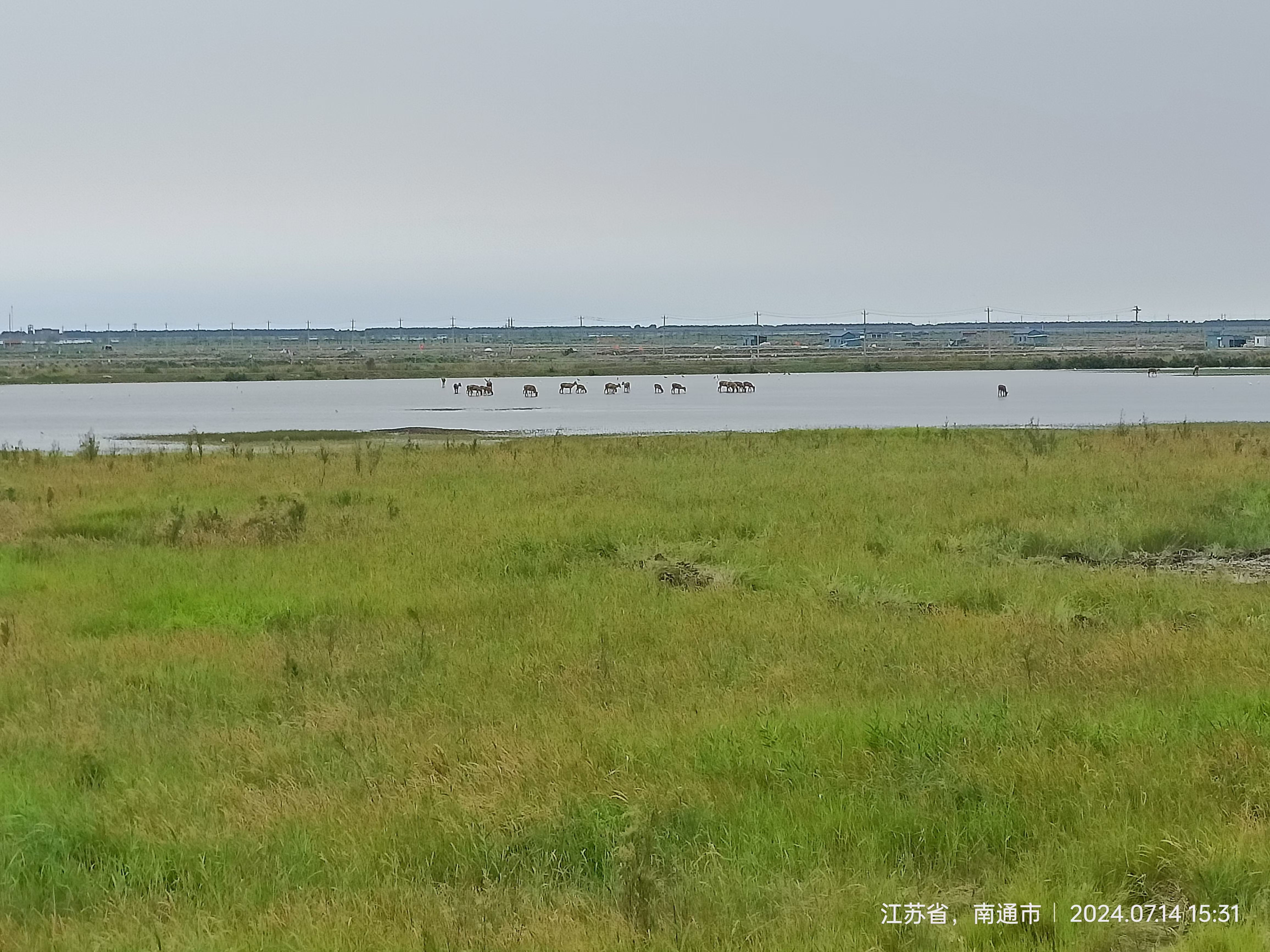
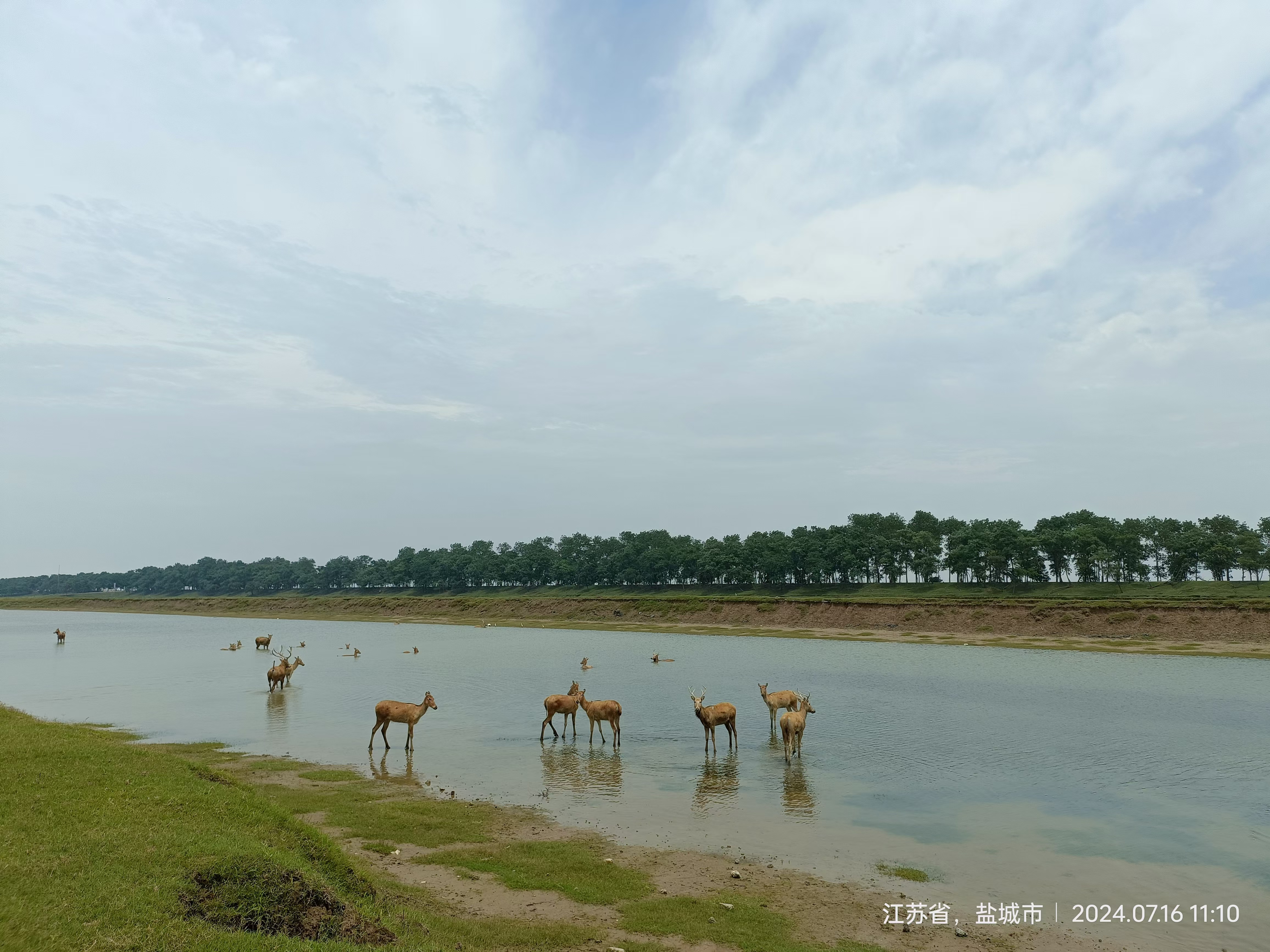
The Jiangsu Yancheng Wetland & Rare Birds National Natural Reserve, located in Jiangsu Province, China, is a globally significant protected area. It serves as a critical habitat for some of the world’s most endangered bird species, particularly the Grus japonensis, and other rare wildlife species. The reserve also contains essential ecosystems, specifically the mudflat wetlands, which are crucial for the survival of these species.
However, despite its ecological importance, the reserve faces several significant environmental challenges. One of the most pressing issues is the invasion of Spartina alterniflora , an exotic plant species that has begun to dominate the wetland ecosystems. This invasive species disrupts the balance of native vegetation, leading to ecological degradation and diminishing biodiversity. As a result, effective management and monitoring of the reserve’s ecosystems have become increasingly essential to ensure the preservation of its unique biodiversity.
Location
Yancheng, Jiangsu, People's Republic of China
East Asia
Process
Summary of the process
This project adopts a structured methodology based on six interlinked building blocks (BBs) to systematically monitor the long-term evolution of wetland vegetation using remote sensing technology.
- BB1 (Data Collection) and BB2 (Wetland Vegetation Type Identification) provide the foundational inputs for BB3 (Data Quantification and Database Establishment).
- BB3, in turn, supports BB4 (Analysis of Spatial and Temporal Characteristics) and BB5 (Identification of Key Drivers of Vegetation Evolution).
- Insights and findings derived from these stages are shared through BB6 (Academic Communication) and BB7 (Training and Capacity Building), enhancing knowledge exchange and amplifying the project’s broader impact.
Each building block is logically sequenced to collectively contribute to the overarching goals: conserving wetlands, preventing the spread of invasive species, and offering a scalable methodology applicable to similar ecosystems globally.
Building Blocks
Data collection
Using the Google Earth Engine (GEE) platform, Landsat series remote sensing data from 1990 to 2022 were systematically acquired, encompassing TM5, ETM+ (Landsat 7), OLI (Landsat 8), and OLI (Landsat 9) sensors. To ensure data quality for subsequent analyses, key spectral bands—near-infrared (NIR), red, and green—were selected and fused.
GBF Alignment: Supports GBF Target 21.
Contribution: Enhances decision-making with real-time, validated datasets, adding value to existing conservation efforts through technological innovation.
Enabling factors
- Only remote sensing images with cloud cover ≤10% were selected, followed by radiometric and atmospheric correction via batch processing.
- Vegetation-specific information was extracted using optimized band combinations, particularly leveraging the high reflectance of vegetation in the NIR range.
Lesson learned
- Limitations in spatial, temporal, and spectral resolutions introduced potential uncertainties, highlighting the importance of robust radiometric and geometric correction methods.
- Data fusion across different Landsat sensors was essential for achieving consistent long-term time series, though it required substantial additional processing to harmonize spatial and temporal resolutions.
Wetland Vegetation Type Identification
Vegetation index time series were smoothed using Gaussian fitting to reduce noise and extract key phenological features. A random forest deep learning algorithm was applied to classify wetland vegetation into three dominant types: Spartina alterniflora, Phragmites australis, and Suaeda salsa. Classification accuracy from 1990 to 2022 was validated through field surveys.
GBF Alignment: Contributes to GBF Target 6.
Contribution: Reduces invasive species impact by accurately identifying Spartina alterniflora for targeted control, addressing a key biodiversity threat.
Enabling factors
- Gaussian curve fitting effectively minimized noise in raw vegetation index curves, enhancing classification accuracy.
- The random forest algorithm leveraged spectral differences between species, enabling robust feature extraction and reliable identification.
Lesson learned
- Spectral features related to vegetation moisture and structural attributes significantly improved interspecies separability.
- Preprocessing steps such as curve fitting and denoising were essential for improving the reliability of long-term classification.
Data Quantification and Database Establishment
A comprehensive geospatial database was developed, integrating vegetation cover data derived from remote sensing with key environmental, climatic, and anthropogenic variables. Included metrics encompassed soil salinity, sea surface temperature, seawater salinity, and locations of aquaculture ponds, providing a robust analytical foundation.
GBF Alignment: Supports GBF Target 21.
Contribution: Integrates diverse data layers for holistic analysis, adding value to fragmented conservation datasets.
Enabling factors
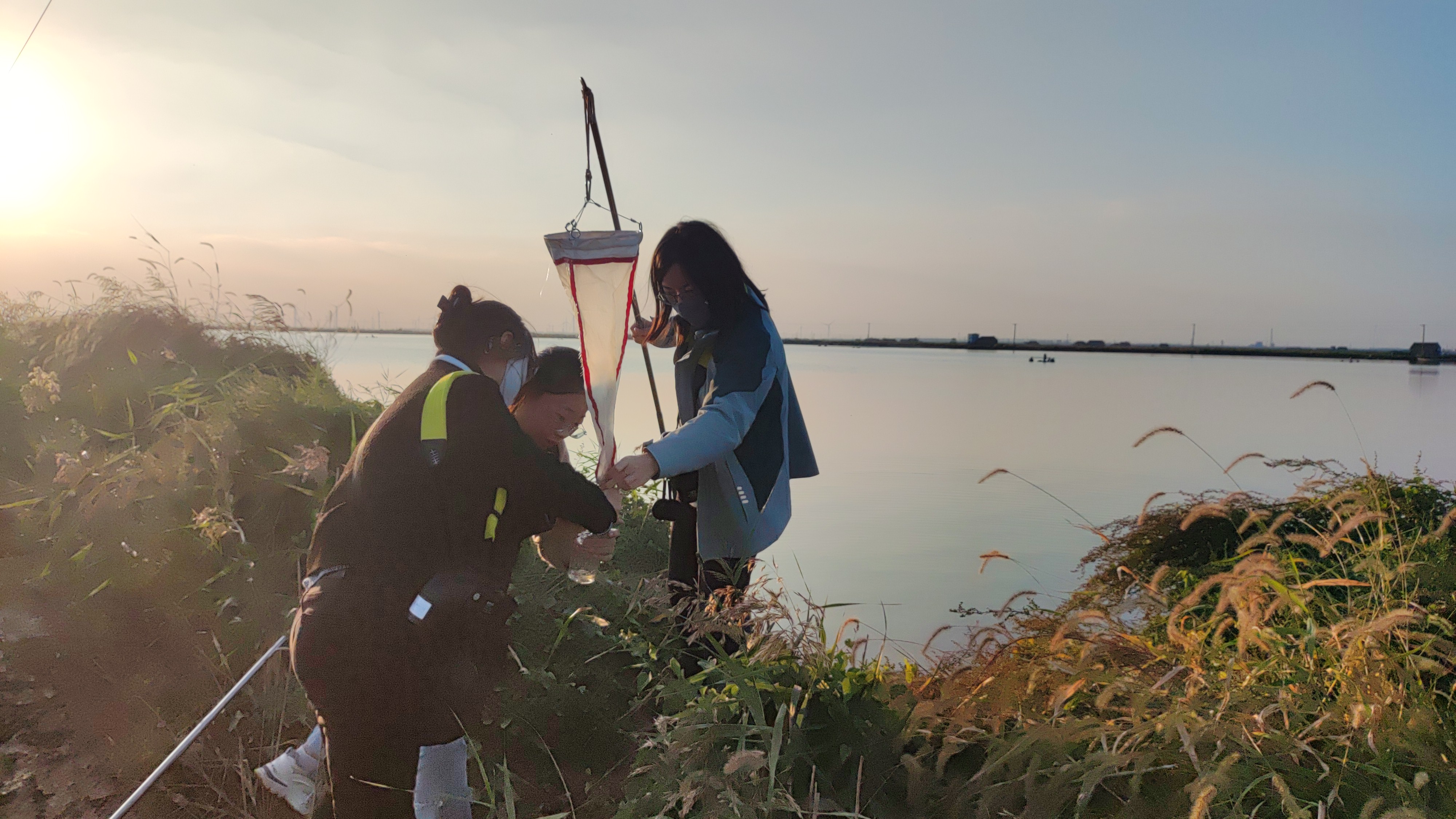
- Field validation confirmed the accuracy of remote sensing interpretations (see Figures 1 and 2).
- The database facilitated the integration of spatial and environmental data, supporting multi-variable analyses and ecological modeling.
Lesson learned
- Accurate ground-truth data are vital for validating remote sensing outputs and ensuring database reliability.
- A well-structured, multi-source database improves analysis efficiency and enables more sophisticated correlation and causality studies.
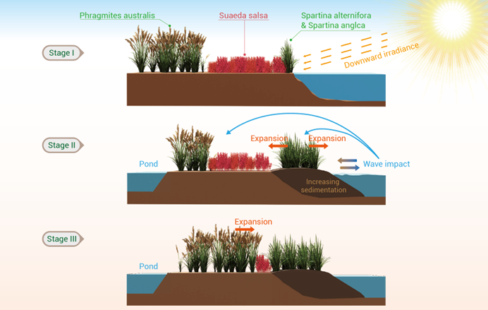
Spatial and Temporal Characteristics Analysis of Wetland Vegetation
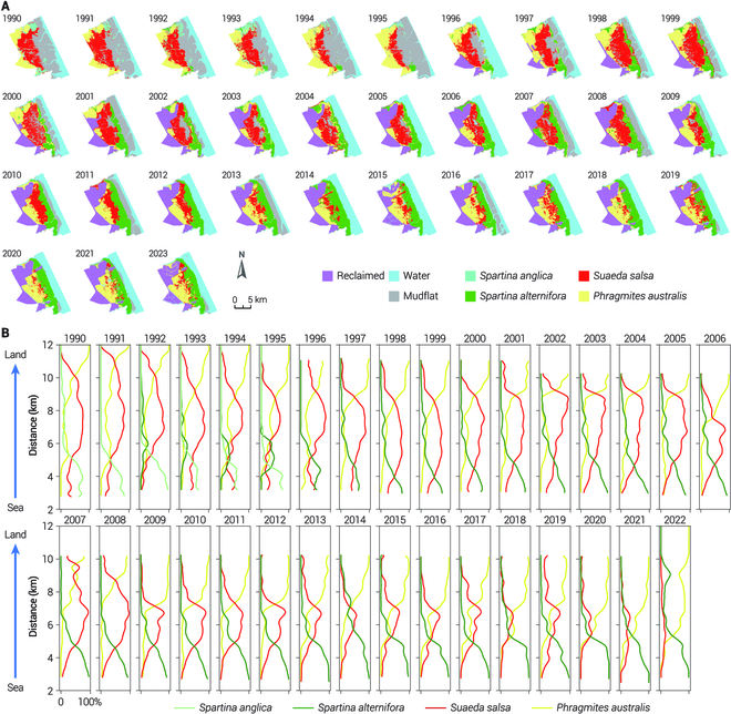
Spatiotemporal analysis was conducted to reveal long-term distribution patterns of wetland vegetation within the protected area from 1990 to 2022.
- Figure 1A illustrates changes in vegetation spatial patterns over time.
- Figure 1B presents percentage vegetation cover along the sea–land gradient.
Analytical tools such as landscape pattern indices, migration models, and expansion–contraction dynamics were used to quantify ecological changes.
Key Findings
- Spartina alterniflora exhibited high spatial aggregation but showed a declining trend over time.
- Phragmites australis and Suaeda salsa displayed greater fragmentation and increasing spatial coverage.
- Vegetation migration exhibited significant heterogeneity and a clear banded distribution along the land–sea gradient.
GBF Alignment: Aligns with GBF Target 2.
Contribution: Measurable outcomes enhance restoration planning, filling gaps in uniform management approaches.
Enabling factors
- Temporal and spatial heterogeneity necessitate multifaceted analysis methods.
- Spatial analyses provide crucial ecological insights that inform targeted conservation and management strategies.
Lesson learned
- Temporal and spatial heterogeneity of vegetation dynamics require multi-faceted analytical approaches.
- Spatial analyses revealed critical ecological patterns, aiding targeted management strategies.
Key Drivers of Vegetation Evolution
The influence of natural and anthropogenic drivers on vegetation dynamics was explored using a Generalized Additive Model (GAM). This model evaluated non-linear relationships between vegetation changes and key factors:
- Spartina alterniflora was primarily influenced by marine environmental variables such as salinity and wave height.
- Phragmites australis and Suaeda salsa were affected by precipitation, anthropogenic pressures (e.g., aquaculture), and interspecies competition.
Understanding these drivers supports adaptive ecosystem management and invasive species control.
GBF Alignment: Supports GBF Targets 6 and 8.
Contribution: Predictive models improve on reactive conservation, offering measurable driver insights.
Enabling factors
- GAM effectively captured complex, non-linear interactions between drivers and vegetation changes.
- Integration of environmental and human activity datasets enhanced the robustness of driver attribution.
Lesson learned
- Continuous data collection and model refinement are critical for long-term predictive accuracy.
- Mechanistic understanding of ecological drivers underpins the development of forward-looking conservation strategies.
Academic Communication
Project findings were disseminated through multiple academic and public platforms, including:
- An academic article in Ocean-Land-Atmosphere Research (a Science Partner Journal).
- Featured content on the AAASScience WeChat Public Platform, the official media of the American Association for the Advancement of Science in China.
- A case study contribution to the Yangtze River Delta Pilot Site.
- Integration into major NSFC-supported oceanographic research projects.
GBF Alignment: Aligns with GBF Target 20.
Contribution: Enhances global conservation efforts by sharing scalable methodologies.
Enabling factors
- Transparent communication of challenges and methodologies enhanced engagement across disciplines.
- Systematic presentation to stakeholders increased awareness and facilitated practical application.
Lesson learned
- Open and accessible dissemination promotes interdisciplinary collaboration and global knowledge sharing.
- Publishing actionable insights in both scientific and public domains accelerates their translation into conservation practices.
Resources
Training and Capacity Building
As part of the project’s broader impact strategy, training and capacity building were prioritized to enhance technical literacy in remote sensing and geospatial analysis. Since 2021, a series of training programs has been hosted annually by the School of Geography at Nanjing Normal University, focusing on geospatial modeling and remote sensing applications. Over the past four years, the program has successfully trained more than 4,000 participants, including young scholars, research volunteers, and early-career professionals.
GBF Alignment: Supports GBF Targets 20 and 22.
Contribution: Scalable training programs fill capacity gaps, enhancing local conservation efforts.
Enabling factors
- The training courses were supported by experienced faculty and tailored curricula, emphasizing practical applications in remote sensing and GIS.
- Collaboration with academic and public institutions expanded outreach and ensured participation from a diverse group of learners across disciplines.
Lesson learned
- Capacity building plays a pivotal role in sustaining long-term research impact, enabling a new generation of researchers to engage in wetland monitoring and ecological analysis.
- Continuous education and hands-on training effectively bridge the gap between research outputs and real-world applications, particularly in conservation and resource management contexts.
Impacts
- Improved Monitoring Efficiency: The remote sensing technology developed in this project enables long-term, cost-effective monitoring of wetland vegetation evolution. This enhancement has significantly expanded the time scale for monitoring, allowing for a more comprehensive understanding of wetland dynamics and effectively elevating the standard of conservation monitoring in the reserve.
- Contribution to the Study of Invasive Alien Species: The project has advanced our understanding of the invasion process of Spartina alterniflora and other invasive species, highlighting the influence of environmental factors, human activities, and interspecific competition. This data helps researchers better predict and manage the spread of invasive species, ensuring timely and more effective interventions.
- Support for Biodiversity Conservation: By revealing the evolutionary patterns of invasive species, the technology lays the groundwork for the prevention and control of these threats in the reserve. This directly benefits the Grus japonensis and other native species by protecting critical wetland habitats, contributing to long-term biodiversity conservation efforts.
- Raising Awareness of Conservation: The project fosters knowledge exchange on the use of remote sensing in wetland conservation, offering valuable insights into wetland management and vegetation monitoring.
Beneficiaries
- Grus japonensis
- Local communities
- Reserve
- Academia
- Visitors
Additionally, explain the scalability potential of your Solution. Can it be replicated or expanded to other regions or ecosystem?
The proposed solution—built upon the integration of remote sensing technologies, deep learning algorithms, and ecological analytical frameworks—demonstrates strong scalability across regions and ecosystem types. Its modular architecture (BB1–BB7) enables customization, replication, and expansion in both spatial and thematic dimensions, making it especially suitable for addressing challenges such as invasive species spread, habitat fragmentation, biodiversity loss, and ecosystem degradation.
Technical Scalability
- The use of globally accessible datasets (e.g., Landsat, Sentinel) and cloud computing platforms like Google Earth Engine ensures low technical barriers for deployment in other regions.
- Deep learning and machine learning classifiers (e.g., Random Forest, GAM) are model-agnostic and can be re-trained with localized data to accommodate different species compositions and ecological contexts.
Geographic and Ecosystem Transferability
- The methodology has been successfully applied in the Yancheng National Rare Bird Nature Reserve, validating its effectiveness in coastal wetlands.
- It has strong potential to be transferred to similar environments, including:
- Other East Asian coastal wetlands affected by Spartina alterniflora or similar invaders (e.g., Yellow River Delta, Hangzhou Bay)
- Inland wetland ecosystems undergoing salinization, fragmentation, or seasonal vegetation changes
- Estuarine and delta regions globally, where invasive species and hydrological shifts threaten biodiversity.
Potential Extension: Tianjin–Hebei Coastal Flats
- The solution is currently being extended conceptually to the Tianjin Binhai and Cangzhou coastal tidal flats, where over 700 hectares of Spartina alterniflora have altered ecosystem functions.
- Through regional coordination, monitoring tools and spatial models are being adapted to support cross-jurisdictional ecological governance, demonstrating not only technical but institutional scalability.
Institutional and Capacity-Building Expansion
- The framework includes a dedicated capacity-building component (BB7), enabling knowledge transfer through training programs hosted by Nanjing Normal University, which have already trained over 4,000 participants. This ensures local uptake and sustainability in newly adopted regions.
Global Relevance
- The solution has been shared through peer-reviewed publications, policy dialogues, and international collaborations, increasing its visibility and readiness for global replication.
- Its data-driven, low-cost, and modular nature makes it well-suited for adoption in the Global South, where cost-effective tools are urgently needed for conservation and climate adaptation.
This solution is not only replicable but also scalable in scope, adaptable in method, and sustainable through capacity building—making it a robust contributor to global efforts in biodiversity conservation and ecosystem resilience.
Global Biodiversity Framework (GBF)
GBF Target 2 – Restore 30% of all Degraded Ecosystems
GBF Target 6 – Reduce the Introduction of Invasive Alien Species by 50% and Minimize Their Impact
GBF Target 8 – Minimize the Impacts of Climate Change on Biodiversity and Build Resilience
GBF Target 20 – Strengthen Capacity-Building, Technology Transfer, and Scientific and Technical Cooperation for Biodiversity
GBF Target 21 – Ensure That Knowledge Is Available and Accessible To Guide Biodiversity Action
GBF Target 22 – Ensure Participation in Decision-Making and Access to Justice and Information Related to Biodiversity for all
Story
The Jiangsu Yancheng Wetland & Rare Birds National Natural Reserve is home to the Grus japonensis, one of the world’s most endangered bird species. For years, this vast wetland area served as a critical habitat for these cranes and countless other species, relying on a delicate ecological balance. However, as time passed, the wetlands began to face severe threats from invasive species, particularly Spartina alterniflora, which rapidly outcompeted native vegetation and endangered the species that depended on the area.
The reserve had long struggled with traditional monitoring techniques, which were slow, costly, and lacked the ability to cover the vast wetland area efficiently. As a result, crucial ecological changes were often detected too late. Invasive species like Spartina spread unchecked, and the impact on biodiversity was devastating.
Yangtze River Delta Pilot Site of the UN Ocean Decade’s CoastPredict Program, led by Nanjing Normal University, combines remote sensing technology and conservation efforts to support management in Yancheng.The remote sensing system allowed the reserve team to monitor vegetation changes on a monthly scale. Satellite data provided real-time insights into the dynamics of the wetland ecosystem, including the spread of Spartina alterniflora and the condition of native plants like Phragmites australis and Suaeda salsa. For the first time, It is possible to monitor how environmental factors, human activities, and interspecies competition were driving ecological changes across the reserve.
Beyond controlling invasive species, the technology also allowed for the study of long-term vegetation trends, enabling the reserve to better understand how climate change, salinity variations, and human activities were impacting the ecosystem. The project’s ability to track these factors provided the reserve with powerful tools to adapt its conservation strategy in real-time.
Connect with contributors

Other contributors
Zhenxia Liu
Nanjing Normal University
Pei Du
Nanjing Normal University
Yufeng Li
Nanjing Normal University
Taisheng Chen
Suzhou University of Science and Technology