

From participatory mapping to management measures of seagrass
Full Solution

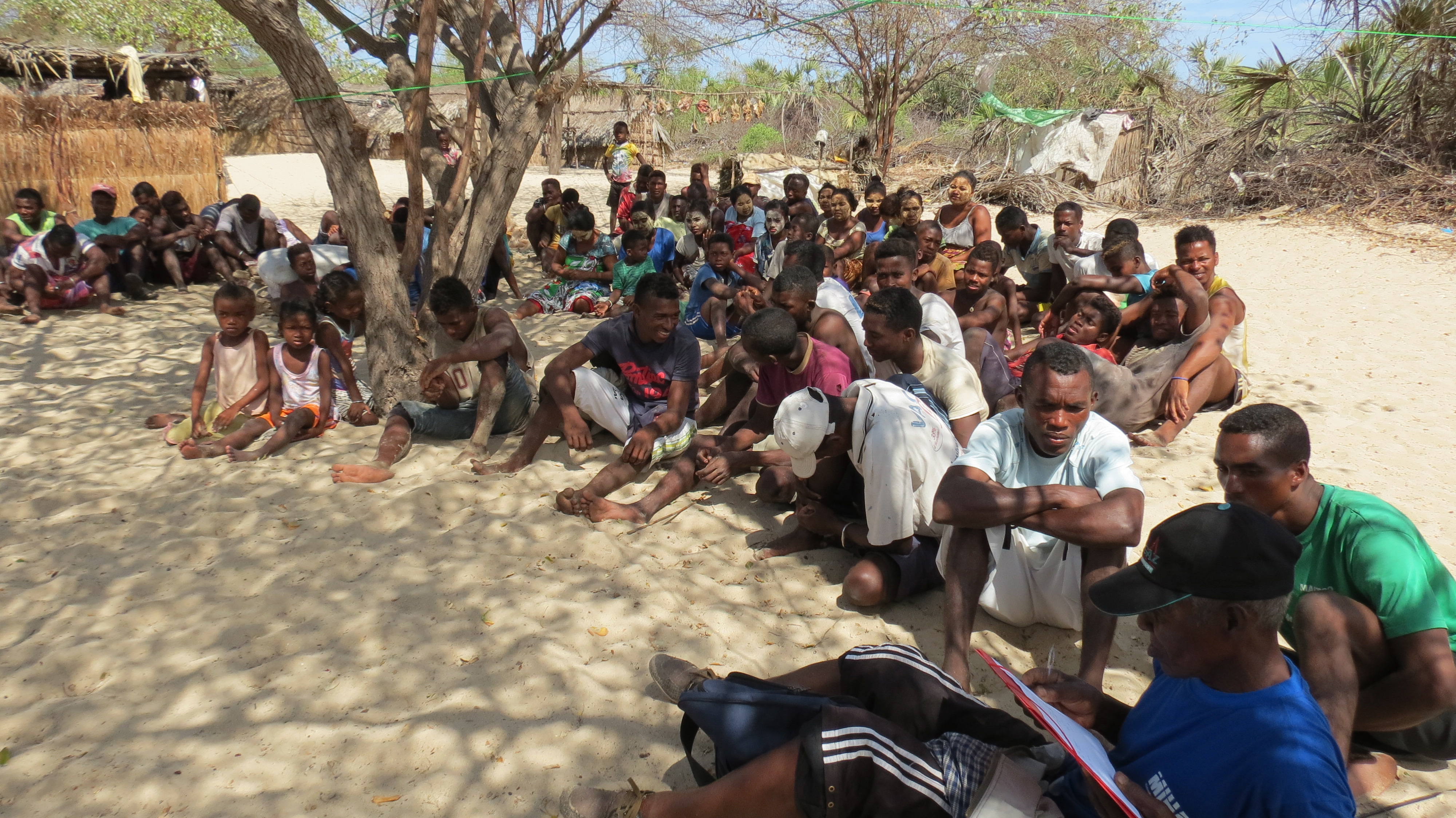
Community training
Rindra Rasoloniriana
The Barren Isles are located off the coast of Maintirano, in the Melaky Region, on the west coast of Madagascar. This MPA (4,300 km²) is co-managed by the small-scale fishers association called Vezo Miray Nosy Barren.
The right conditions are found here for the development of seagrass beds, home to, among others, needlefish harvested by small-scale fishers during bad weather.
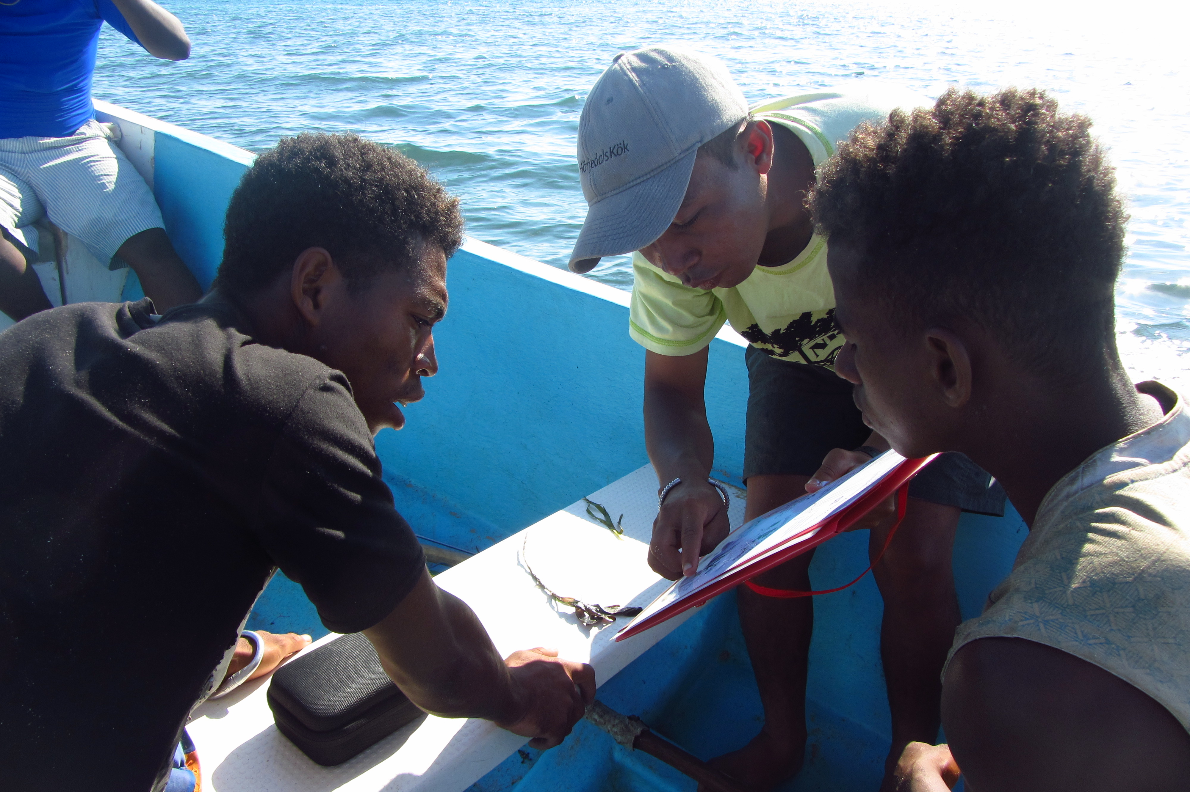
The preservation of this habitat required the delineation of the management areas involving active community participation. Participatory mapping revealed a seagrass area of about 600 hectares. Data feedback on the extent of seagrass beds coupled with education sessions on the ecological services of the seagrass beds were explained to the communities to raise their awareness.
Monitoring was carried out by the communities adopting the seagrass watch approach to assess the seagrass beds and introduce the communities to the monitoring technique. A data feedback session was conducted with the community members to engage discussions around management measures.
Last update: 14 Feb 2022
1957 Views
Photo and video gallery

Context
Challenges addressed
- A low level of education among local fishers characterized by their difficulty in reading maps and understanding some of the seagrass ecological services, like carbon sequestration and photosynthesis
- A dearth of knowledge among communities about seagrass beds, which makes it difficult for them to make appropriate and timely decisions and prioritize their protection;
- The use of bottom-scraping fishing gears, including beach seines used by small-scale fishers and industrial shrimp trawls, poses a direct threat to this habitat, although this is prohibited in this area. These gears increase the turbidity of the water as a result of sediment suspension which limits the photosynthetic capacity of seagrass;
- Significant sediment and sand runoff due to upstream and coastal erosion have similar impacts on this habitat;
- Anthropogenic perturbation to seagrass beds is significant; due to trampling by fishermen during low tide, as they access the reef flats where they target octopus, sea cucumber and various molluscs.
Location
Barren Isles, Melaky Region, Madagascar
East and South Africa
Process
Summary of the process
These building blocks describe the steps from the data collection on seagrass beds to the decision making about management measures. The participatory monitoring approach developed in McKenzie et al. (2003) is appropriate for local community use to get an understanding of seagrass resources. This monitoring is however preceded by participatory mapping of seagrass beds boundaries using the local knowledge. These two activities show that local community members are fully integrated in the process.
However, this involvement in data collection is not enough to ensure they are empowered and engaged in the decision-making process. These data should be transmitted back to communities as it is a bridge to local community decision-making. Often, communities are dispossessed of the data about them, collected by third parties. Ensuring the information is in their hands will build local skills, strengthen local ecological knowledge and provide momentum for conservation. Thus, it is easy for communities to make very quick and responsive management actions through their local conventions.
Building Blocks
Participatory mapping
-
We worked with the community to assess perceptions of the status of seagrass beds and local threats;
-
During a local community meeting, we drew seagrass bed boundaries onto a projected satellite image with the guidance of the participants;
-
Along with representatives of local fishers, community/association leaders and village elders who have a good knowledge of the zone, we collected GPS coordinates of seagrass beds (perimeter points aligning with community maps created in the previous step);
-
We then projected the collected GPS coordinates onto satellite images for validation by the local community during a second meeting.
Enabling factors
-
Participatory mapping was not completely new to the communities, as similar exercises had previously been carried out during the mapping of fishing zones and the implementation of temporary reserves;
-
Involving local communities throughout the entire process leads to real buy-in;
-
Integration of local community knowledge for reliable data collection.
Lesson learned
-
The first local community meeting was very useful to get a layout of the boundaries and made the validation easier during the second meeting. The ground truthing by collecting manually GPS points provided more accurate data;
-
Data was more reliable with the local community knowledge.
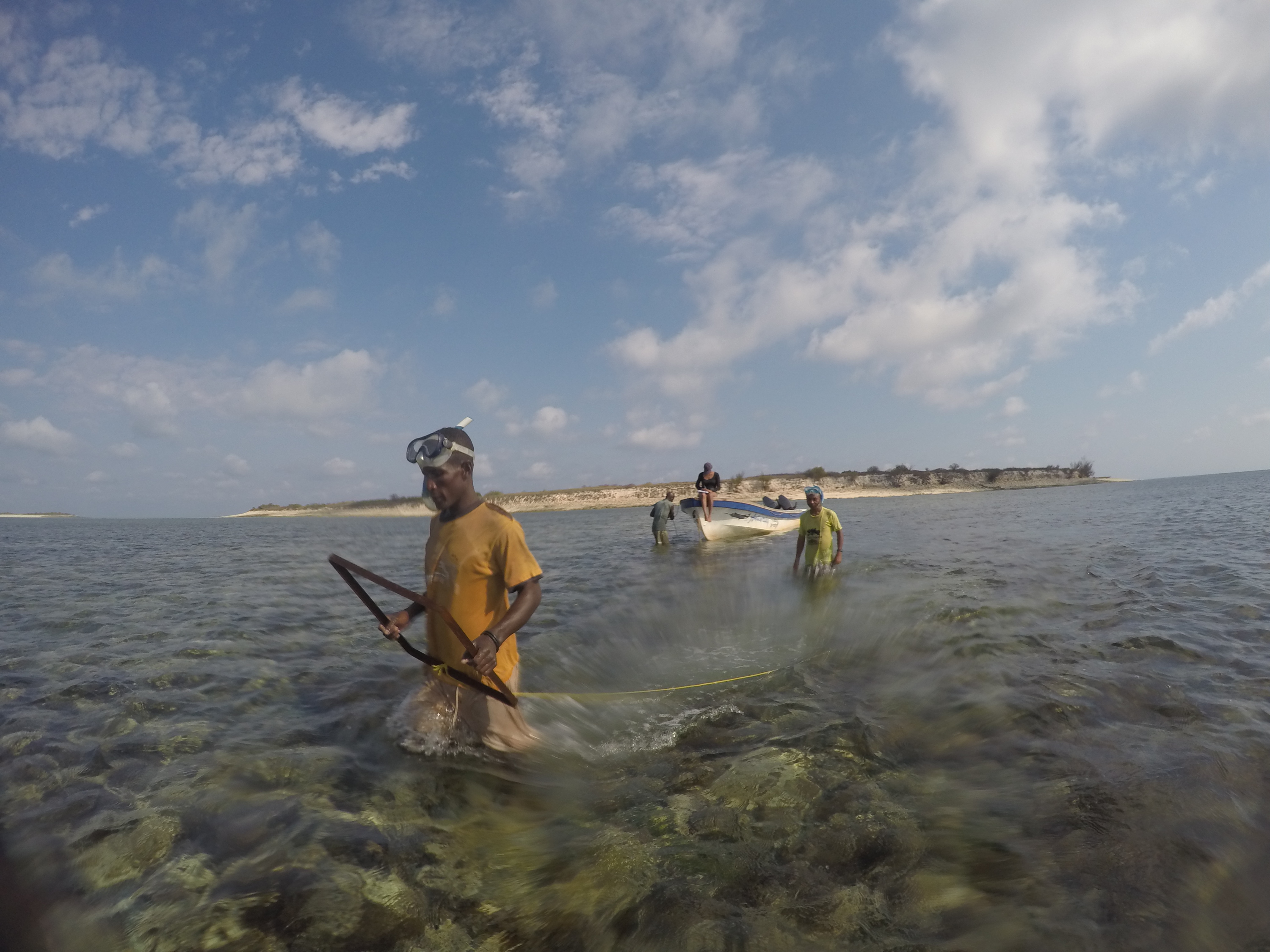
Participatory monitoring
-
We provided refresher training on ecological services of the seagrass;
-
We trained representatives of local fishers on monitoring protocols (Seagrass Watch methodology (McKenzie et al., 2003));
-
We conducted the assessment of seagrass beds with trained fishers collecting data on the location of boundaries/edges, species, percentage of cover, sediment type and depth;
-
We collected data using paper-based records and entered data into a computer database before analysis.
Enabling factors
-
As a result of the various conservation awareness raising activities, communities became increasingly interested in the health of the ecosystems, referring to it as their “pantry” during bad weather.
Lesson learned
-
Even though the methodology was adapted for use by the local fishermen, it was necessary to do refresher training in order for them to carry out the monitoring.
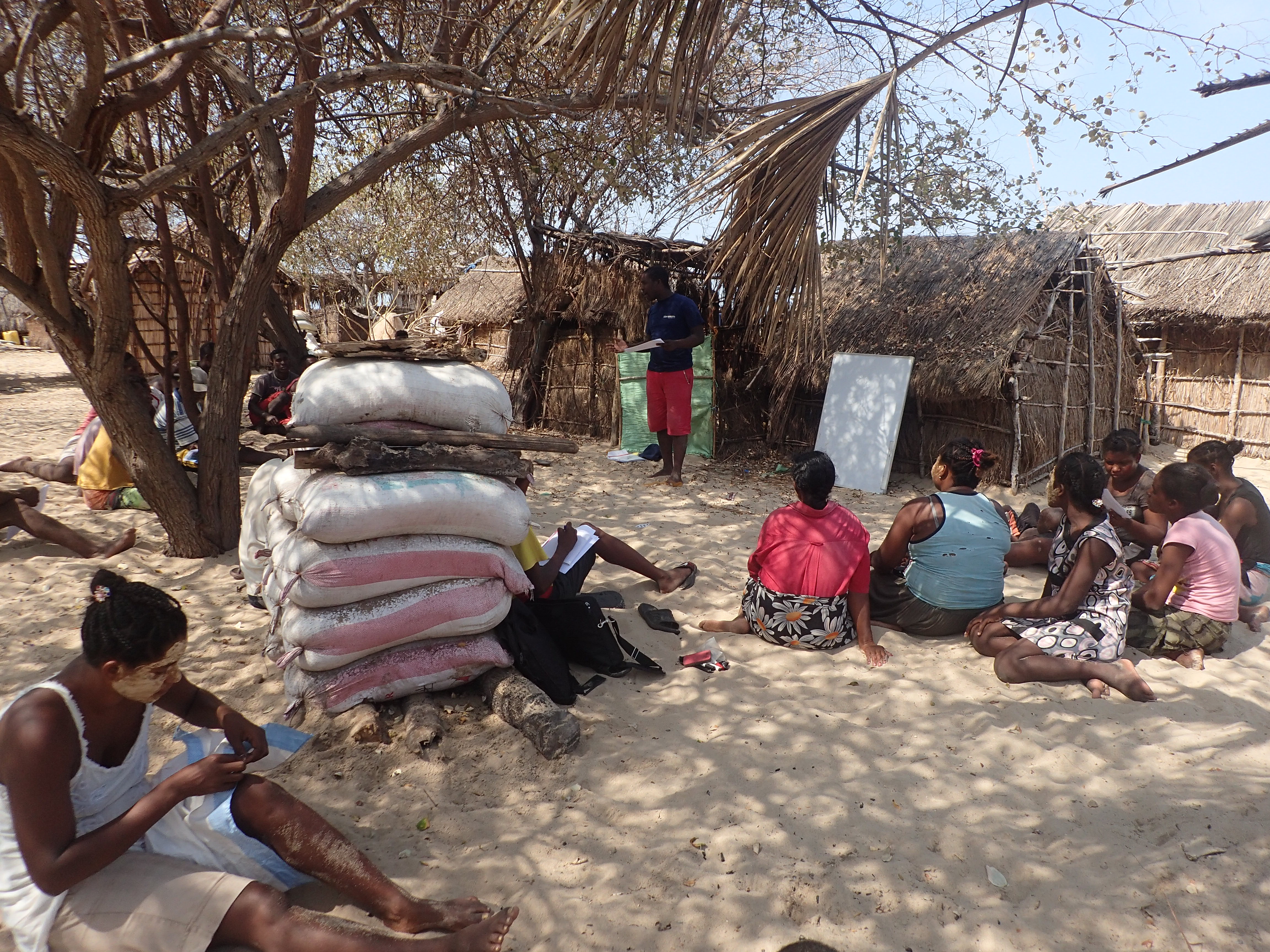
Data feedback and interpretation
-
We analysed and interpreted the data collected during the monitoring, mapping and community meetings;
-
During local community meetings, using visual approaches through imagery, projection of slideshows and discussions, the results and interpretations of the seagrass mapping and monitoring, as well as the perceptions of the status of the seagrass are presented to the community. With this the community receives feedback on the collected data and its interpretation.
Enabling factors
-
Data feedback can help local community members to better understand their fishing activities and related habitats, to promote discussion among them and suggest appropriate measures;
-
Fishers participating in the training and data collection gave an overview of the data collection during the local community meeting, highlighting that they understand the goal and related approach. This was key in generating community enthusiasm and ownership.
Lesson learned
-
The involvement of the communities in the different stages is essential. Therefore, in this stage related to the interpretation of results, they will be involved in a progressive manner as it requires a wider variety of skills.
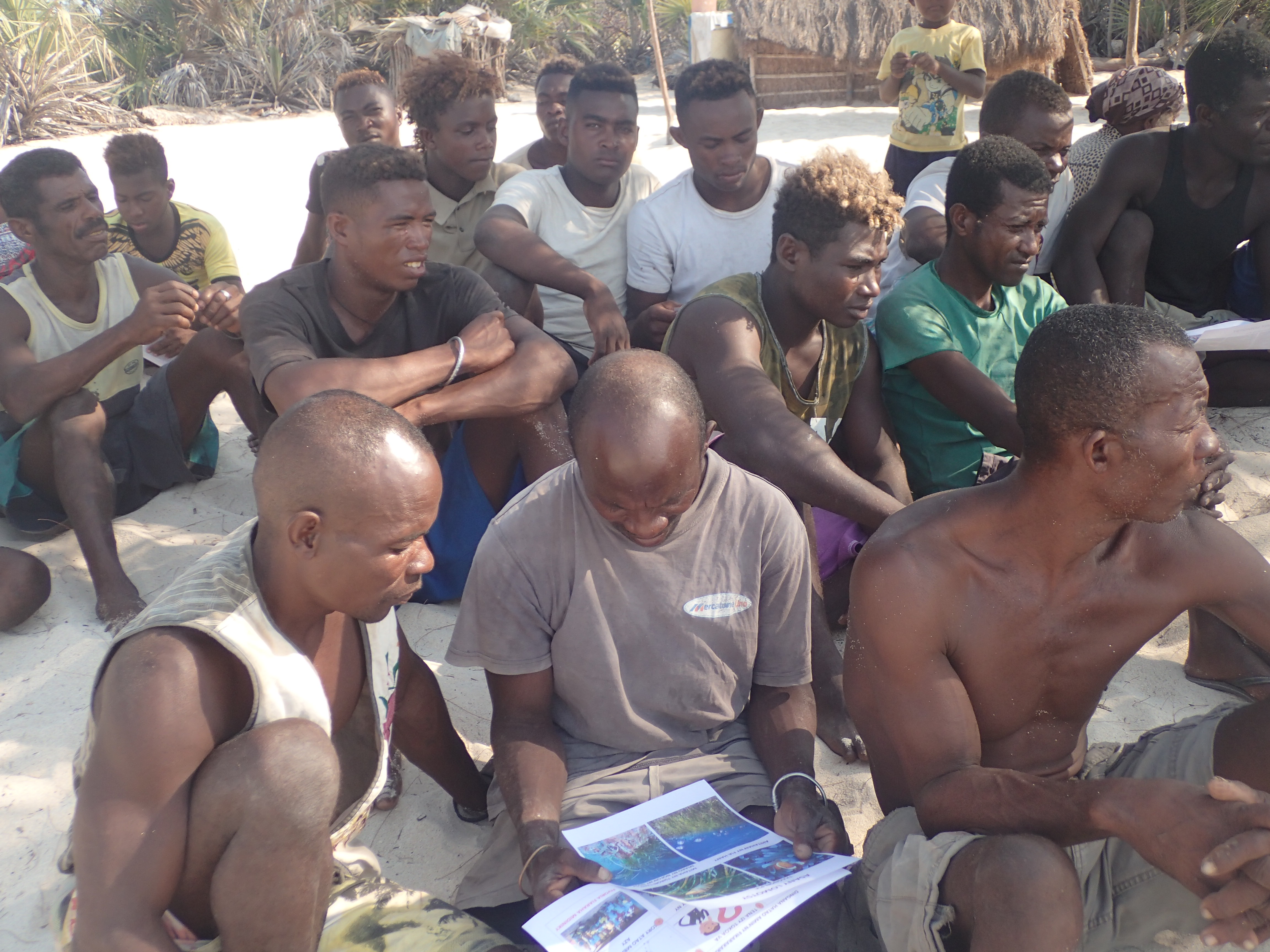
Community management decision making
-
After coaching from Blue Ventures, association leaders from each village organized a meeting to discuss and identify the management strategy and the management measures based on the results of the assessment and the perceptions of the community.
-
The meeting, chaired by associations and/or village leaders, is conducted under non-exclusive conditions and is attended by all fishers, women and men. First, the participants propose measures to be taken which are then voted on by a show of hands if there are many divergent ideas. It may happen fishers will postpone the meeting to reflect and discuss the decisions to be taken within their clan or family.
-
In the presence of the fisheries administration, representatives of the Dina Committee, the Management Committee and the community-based patrollers, the local community validated the strategy and particularly the measures.
-
In the future, these measures could be adapted based on the result of the implementation and participatory monitoring of landings.
Enabling factors
- The conservation measures on seagrass were combined with catalyst activity such as temporary octopus closures which through delivery of economic benefits helped to create a strong local buy-in
- Some of the association leaders had participated in an exchange visit to learn from strategies of other communities
-
The Fisher association had already been in place with different structures, namely the Management committee, the Dina committee and the community-based patrollers
- The fisheries management plan already contained some measures related to seagrass
Lesson learned
-
To set up management measures or a new activity, it is useful to do an exchange visit to other sites. It is easier for the local community to accept or trial a new idea if one or more community leaders are already convinced of it or there is evidence of success from elsewhere;
-
Local community ownership of the decision-making system and process is more likely when the local community members see direct tangible benefits.
-
Data feedback and discussion of the management measures take place in two different meetings, which gives the community members time to reflect on the points presented and the corresponding appropriate measures.
Impacts
-
The local community members have included the preservation of seagrass in their social convention called Dina
-
The communities decided to include part of the seagrass beds within the areas of octopus temporary reserves which are closed annually for a few months.
-
The participatory mapping and monitoring of seagrass have promoted social cohesion and led to greater commitment to the protection of marine habitats
-
Overall, we have seen a greater ownership of sustainable fisheries management by small-scale fishers, contributing to the implementation of a community-led conservation programme.
Beneficiaries
Fisher communities living in the Barren Isles Marine Protected Areas (MPA)
Sustainable Development Goals
SDG 2 – Zero hunger
SDG 10 – Reduced inequalities
SDG 11 – Sustainable cities and communities
SDG 14 – Life below water
Story

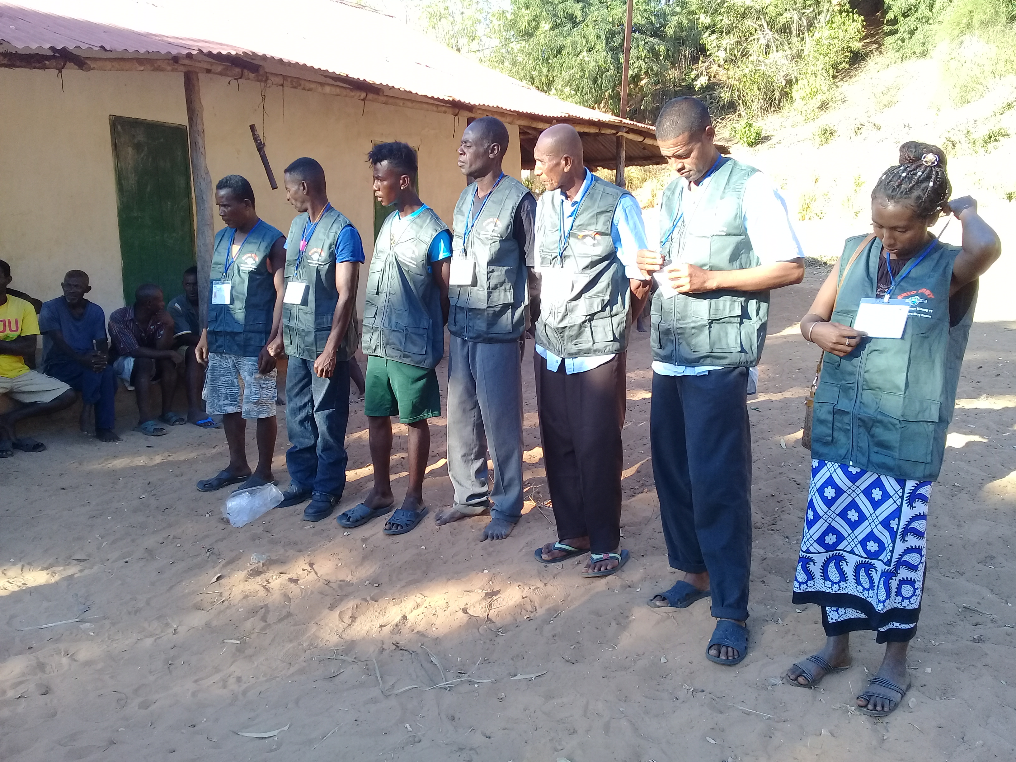
Formalization of patrollers
Rindra Rasoloniriana
Aware of the social and ecological values of seagrass beds, local community members of the Barren isles have included the preservation of this ecosystem in their social convention called Dina, including the use of unsustainable fishing gears. They had this key tool in the local management and governance of fisheries approved by the fisheries and environment administrations.
To ensure its implementation and to further establish its legitimacy, the local Court ratified the Dina. Trained community patrollers subsequently enforced it. For instance, in 2019, migrants from southern Madagascar used fishing gears consisting of gillnets connected vertically and mosquito nets at the bottom weighted down with stones. These patrollers directly informed the communities and the co-manager of the MPA to reach these migrants and explain the substance of the agreement with respect to such fishing gears.
Legislation promotes the implementation of a fisheries management plan (FMP) as the main management tool. For the MPA, the FMP was developed using a transparent, participatory and inclusive approach through local community consultations. Barren Isles communities had taken this opportunity to integrate the Dina into a formalized framework document. It also includes additional management measures for fishing activities on seagrass beds.
Fishers decided to include part of the seagrass beds in the areas of octopus temporary reserves which are closed annually for a few months. They noticed that this decision fosters the growth of octopus and protects seagrass beds and the marine resources contained within them. This decision reveals their motivation to engage in fisheries management and conservation activities.
At the local community level, the participatory mapping provided data for local decision making, for example informing the selection of temporary and permanent reserve areas. Moreover, it has promoted social cohesion and led to greater commitment to conservation. Overall, we have seen a greater ownership of sustainable fisheries management by local fishers, contributing to the implementation of a conservation programme. We believe that this active participation of local community members also helped to convince those who were still doubtful to get involved in the local governance of the MPA.
Connect with contributors

Other contributors
Tahiry Randrianjafimanana
Blue Ventures
Charlotte Gough
Bue Ventures
Jenny Oates
Blue Ventures