De la cartographie participative aux mesures de gestion des herbiers marins
Les îles Barren sont situées au large de Maintirano, dans la région Melaky, sur la côte ouest de Madagascar. Cette AMP (4 300 km²) est cogérée par l'association de pêcheurs artisanaux Vezo Miray Nosy Barren.
Les conditions y sont réunies pour le développement d'herbiers marins, abritant entre autres des aiguilles de mer récoltées par les petits pêcheurs par mauvais temps.
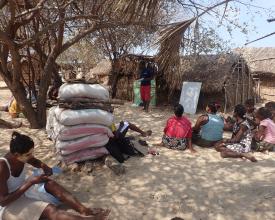
La préservation de cet habitat a nécessité la délimitation de zones de gestion impliquant une participation active de la communauté. La cartographie participative a révélé une zone d'herbiers d'environ 600 hectares. Des données sur l'étendue des herbiers, associées à des sessions d'éducation sur les services écologiques des herbiers, ont été expliquées aux communautés afin de les sensibiliser.
Le suivi a été effectué par les communautés en adoptant l'approche "seagrass watch" pour évaluer les herbiers et initier les communautés à la technique de suivi. Une séance de restitution des données a été organisée avec les membres de la communauté afin d'engager des discussions sur les mesures de gestion.
Contexte
Défis à relever
- un faible niveau d'éducation des pêcheurs locaux, caractérisé par leur difficulté à lire les cartes et à comprendre certains des services écologiques des herbiers marins, comme la séquestration du carbone et la photosynthèse
- un manque de connaissances des communautés sur les herbiers marins, ce qui les empêche de prendre des décisions appropriées et opportunes et d'accorder la priorité à leur protection ;
- L'utilisation d'engins de pêche raclant le fond, notamment les sennes de plage utilisées par les petits pêcheurs et les chaluts à crevettes industriels, constitue une menace directe pour cet habitat, bien qu'elle soit interdite dans cette zone. Ces engins augmentent la turbidité de l'eau en raison de la suspension des sédiments, ce qui limite la capacité de photosynthèse des herbiers marins ;
- L'écoulement important de sédiments et de sable dû à l'érosion en amont et à l'érosion côtière a des effets similaires sur cet habitat ;
- Les perturbations anthropogéniques des herbiers sont significatives ; elles sont dues au piétinement des pêcheurs à marée basse, lorsqu'ils accèdent aux platiers récifaux où ils ciblent les poulpes, les concombres de mer et divers mollusques.
Emplacement
Traiter
Résumé du processus
Ces éléments décrivent les étapes allant de la collecte de données sur les herbiers marins à la prise de décision concernant les mesures de gestion. L'approche de suivi participatif développée par McKenzie et al.(2003) est appropriée pour l'utilisation par les communautés locales afin d'obtenir une compréhension des ressources en herbes marines. Ce suivi est toutefois précédé d'une cartographie participative des limites des herbiers, qui s'appuie sur les connaissances locales. Ces deux activités montrent que les membres de la communauté locale sont pleinement intégrés dans le processus.
Cependant, cette implication dans la collecte de données n'est pas suffisante pour garantir leur autonomisation et leur participation au processus de prise de décision. Ces données doivent être transmises aux communautés, car elles constituent une passerelle vers la prise de décision au niveau local. Souvent, les communautés sont dépossédées des données les concernant, collectées par des tiers. S'assurer que l'information est entre leurs mains permettra de développer les compétences locales, de renforcer les connaissances écologiques locales et de donner un élan à la conservation. Ainsi, il est facile pour les communautés de prendre des mesures de gestion très rapides et réactives par le biais de leurs conventions locales.
Blocs de construction
Cartographie participative
-
Nous avons travaillé avec la communauté pour évaluer les perceptions de l'état des herbiers marins et des menaces locales ;
-
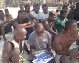
Au cours d'une réunion de la communauté locale, nous avons dessiné les limites des herbiers sur une image satellite projetée avec l'aide des participants ;
-
Avec les représentants des pêcheurs locaux, les leaders des communautés/associations et les anciens du village qui ont une bonne connaissance de la zone, nous avons collecté les coordonnées GPS des herbiers (points du périmètre alignés sur les cartes communautaires créées à l'étape précédente) ;
-
Nous avons ensuite projeté les coordonnées GPS collectées sur des images satellites pour validation par la communauté locale lors d'une deuxième réunion.
Facteurs favorables
-
La cartographie participative n'était pas totalement nouvelle pour les communautés, puisque des exercices similaires avaient déjà été réalisés lors de la cartographie des zones de pêche et de la mise en place de réserves temporaires ;
-
L'implication des communautés locales tout au long du processus permet une réelle adhésion ;
-
L'intégration des connaissances des communautés locales pour une collecte de données fiable.
Leçon apprise
-
La première réunion de la communauté locale a été très utile pour obtenir un schéma des limites et a facilité la validation lors de la deuxième réunion. La vérification au sol par la collecte manuelle de points GPS a permis d'obtenir des données plus précises ;
-
Les données étaient plus fiables grâce aux connaissances de la communauté locale.
Suivi participatif
-
Nous avons dispensé une formation de remise à niveau sur les services écologiques de l'herbier marin ;
-
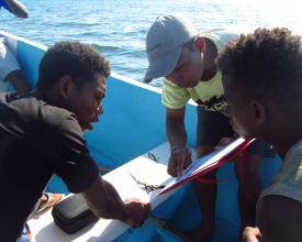
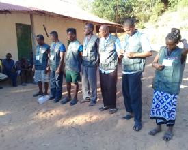
Nous avons formé des représentants des pêcheurs locaux aux protocoles de surveillance (méthodologie Seagrass Watch (McKenzie et al., 2003)) ;
-
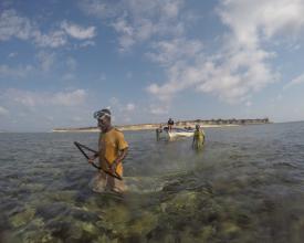
Nous avons procédé à l'évaluation des herbiers marins avec des pêcheurs formés qui ont collecté des données sur la localisation des limites/bords, les espèces, le pourcentage de couverture, le type de sédiment et la profondeur ;
-
Les données ont été collectées sur papier et saisies dans une base de données informatique avant d'être analysées.
Facteurs favorables
-
Grâce aux diverses activités de sensibilisation à la conservation, les communautés s'intéressent de plus en plus à la santé des écosystèmes, qu'elles considèrent comme leur "garde-manger" en cas de mauvais temps.
Leçon apprise
-
Bien que la méthodologie ait été adaptée pour être utilisée par les pêcheurs locaux, il a été nécessaire d'organiser une formation de remise à niveau pour qu'ils puissent effectuer le suivi.
Retour et interprétation des données
-
Nous avons analysé et interprété les données recueillies au cours de la surveillance, de la cartographie et des réunions communautaires ;
-
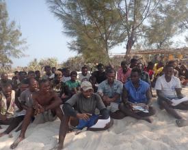
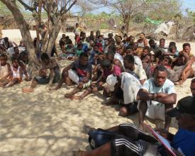
Lors des réunions de la communauté locale, les résultats et les interprétations de la cartographie et du suivi de l'herbier, ainsi que les perceptions de l'état de l'herbier, sont présentés à la communauté au moyen d'approches visuelles par l'imagerie, la projection de diaporamas et les discussions. La communauté reçoit ainsi un retour d'information sur les données collectées et leur interprétation.
Facteurs favorables
-
Le retour des données peut aider les membres de la communauté locale à mieux comprendre leurs activités de pêche et les habitats associés, à promouvoir la discussion entre eux et à suggérer des mesures appropriées ;
-
Les pêcheurs participant à la formation et à la collecte de données ont donné un aperçu de la collecte de données lors de la réunion de la communauté locale, en soulignant qu'ils comprenaient l'objectif et l'approche correspondante. Cette démarche a été déterminante pour susciter l'enthousiasme et l'adhésion de la communauté.
Leçon apprise
-
L'implication des communautés dans les différentes étapes est essentielle. Par conséquent, dans cette étape liée à l'interprétation des résultats, elles seront impliquées de manière progressive car elle requiert une plus grande variété de compétences.
Prise de décision en matière de gestion communautaire
-
Après un accompagnement de Blue Ventures, les responsables des associations de chaque village ont organisé une réunion pour discuter et identifier la stratégie de gestion et les mesures de gestion basées sur les résultats de l'évaluation et les perceptions de la communauté.
-
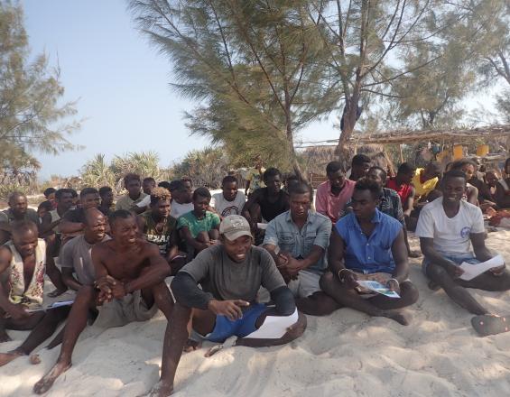
La réunion, présidée par les associations et/ou les chefs de village, se déroule dans des conditions non exclusives et tous les pêcheurs, hommes et femmes, y participent. Dans un premier temps, les participants proposent des mesures à prendre qui font l'objet d'un vote à main levée s'il y a beaucoup d'idées divergentes. Il peut arriver que les pêcheurs reportent la réunion pour réfléchir et discuter des décisions à prendre au sein de leur clan ou de leur famille.
-
En présence de l'administration des pêches, des représentants du comité Dina, du comité de gestion et des patrouilleurs communautaires, la communauté locale a validé la stratégie et notamment les mesures.
-
A l'avenir, ces mesures pourraient être adaptées en fonction des résultats de la mise en œuvre et du suivi participatif des débarquements.
Facteurs favorables
- Les mesures de conservation des herbiers marins ont été associées à des activités catalytiques telles que des fermetures temporaires de la pêche au poulpe qui, grâce aux avantages économiques qu'elles procurent, ont contribué à créer une forte adhésion locale.
- Certains dirigeants de l'association ont participé à une visite d'échange pour apprendre les stratégies d'autres communautés.
-
L'association de pêcheurs était déjà en place avec différentes structures, à savoir le comité de gestion, le comité Dina et les patrouilleurs communautaires.
- Le plan de gestion de la pêche contenait déjà des mesures relatives aux herbiers marins.
Leçon apprise
-
Pour mettre en place des mesures de gestion ou une nouvelle activité, il est utile d'effectuer une visite d'échange sur d'autres sites. Il est plus facile pour la communauté locale d'accepter ou de tester une nouvelle idée si un ou plusieurs dirigeants de la communauté en sont déjà convaincus ou s'il existe des preuves de réussite ailleurs ;
-
L'appropriation par la communauté locale du système et du processus de prise de décision est plus probable lorsque les membres de la communauté locale voient des avantages directs et tangibles.
-
Le retour des données et la discussion des mesures de gestion ont lieu lors de deux réunions différentes, ce qui donne aux membres de la communauté le temps de réfléchir aux points présentés et aux mesures appropriées correspondantes.
Impacts
-
Les membres de la communauté locale ont inclus la préservation des herbiers marins dans leur convention sociale appelée Dina.
-
Les communautés ont décidé d'inclure une partie des herbiers marins dans les zones de réserves temporaires de poulpes qui sont fermées chaque année pendant quelques mois.
-
La cartographie et le suivi participatifs des herbiers marins ont favorisé la cohésion sociale et conduit à un plus grand engagement en faveur de la protection des habitats marins.
-
Dans l'ensemble, nous avons constaté une plus grande appropriation de la gestion durable de la pêche par les petits pêcheurs, ce qui a contribué à la mise en œuvre d'un programme de conservation dirigé par la communauté.
Bénéficiaires
Communautés de pêcheurs vivant dans les zones marines protégées (ZMP) des îles Barren
Objectifs de développement durable
Histoire
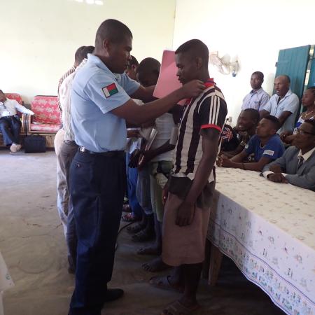
Conscients de la valeur sociale et écologique des herbiers marins, les membres de la communauté locale des îles Barren ont inclus la préservation de cet écosystème dans leur convention sociale appelée Dina, y compris l'utilisation d'engins de pêche non durables. Ils ont fait approuver cet outil clé de la gestion locale et de la gouvernance de la pêche par les administrations chargées de la pêche et de l'environnement.
Pour garantir sa mise en œuvre et asseoir sa légitimité, le tribunal local a ratifié le Dina. Des patrouilleurs communautaires formés ont ensuite assuré son application. Par exemple, en 2019, des migrants du sud de Madagascar ont utilisé des engins de pêche composés de filets maillants reliés verticalement et de moustiquaires au fond, lestés de pierres. Ces patrouilleurs ont directement informé les communautés et le cogestionnaire de l'AMP pour rejoindre ces migrants et leur expliquer la teneur de l'accord concernant ces engins de pêche.
La législation encourage la mise en œuvre d'un plan de gestion des pêches (FMP) comme principal outil de gestion. Dans le cas de l'AMP, le plan de gestion de la pêche a été élaboré selon une approche transparente, participative et inclusive, dans le cadre de consultations avec les communautés locales. Les communautés des îles Barren ont profité de cette occasion pour intégrer le Dina dans un document-cadre formel. Ce document comprend également des mesures de gestion supplémentaires pour les activités de pêche sur les herbiers marins.
Les pêcheurs ont décidé d'inclure une partie des herbiers dans les zones de réserves temporaires de poulpes qui sont fermées chaque année pendant quelques mois. Ils ont constaté que cette décision favorise la croissance du poulpe et protège les herbiers et les ressources marines qu'ils contiennent. Cette décision révèle leur motivation à s'engager dans des activités de gestion et de conservation de la pêche.
Au niveau de la communauté locale, la cartographie participative a fourni des données pour la prise de décision locale, par exemple pour la sélection des zones de réserve temporaires et permanentes. En outre, elle a favorisé la cohésion sociale et conduit à un plus grand engagement en faveur de la conservation. Dans l'ensemble, nous avons constaté une plus grande appropriation de la gestion durable de la pêche par les pêcheurs locaux, ce qui a contribué à la mise en œuvre d'un programme de conservation. Nous pensons que cette participation active des membres de la communauté locale a également permis de convaincre ceux qui avaient encore des doutes de s'impliquer dans la gouvernance locale de l'AMP.

