Promotion of threatened, high value indigenous trees of Tanzania through agroforestry
This project addresses the restoration of soils, which have been degraded over previous decades, drying streams and habitat loss especially of high-value threatened tree species, which were overharvested in the wild. This submission nominates 3 NGOs (RUCONET, RGEEPT, and ECHO) and 8 villages collaborating to impact highly erosive, drought-prone western slopes of Mt. Meru, Arusha, Tanzania with multiple impacts, specifically, reinforcing an agroforestry effort through the promotion of threatened, high value indigenous trees of Tanzania. This benefits the catchment through: 1) conservation of soil and water; 2) increase in soil fertility & agricultural production/resilience; and, 3) increasing local biodiversity through establishing threatened indigenous trees on farms and water sources. Continued collaboration will further sustain the momentum to combat the hunger and poverty prevalent and provide benefits in the form of fodder, medicines and timber.
Context
Challenges addressed
The main challenges of this project are the restoration of degraded soils , drying streams and habitat loss especially of high-value threatened tree species overharvested in the wild. Rapid development and population growth around Mt. Meru are a serious threat to its fragile ecosystem and the communities, whose livelihoods depend on it. Land degradation from soil erosion averaging seven tons per acre annually is reducing the natural assets on the foothills of the mountain and creates gullies of roads. Water sources in forests lying above the villages have been stripped of their indigenous tree cover, diminishing seasonal streams, increasing conflicts over water, and longer treks for water and firewood by the women. Climate related hazards (irregular rains and droughts) challenge the resilience of rural communities and natural resources. Sustainable agriculture is a challenging objective needing to be addressed on a continual basis.
Location
Process
Summary of the process
The building blocks interact as a progression and relationship building among the community leaders.
- Facilitating community discussion on natural resources management action;
- Facilitating formation of village by-laws in support of land use & natural resource management; two plans have been recognized by the district;
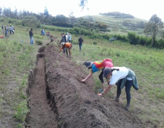
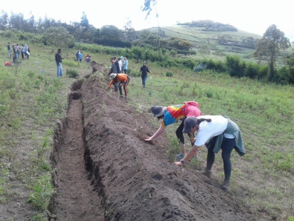
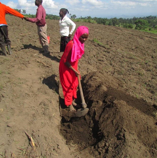
- Facilitating measuring of contours and establishing grasses for livestock fodder, to conserve water and soil; in one village, gathering water from roads into field contours instead of the opposite (idea still needs more promotion);
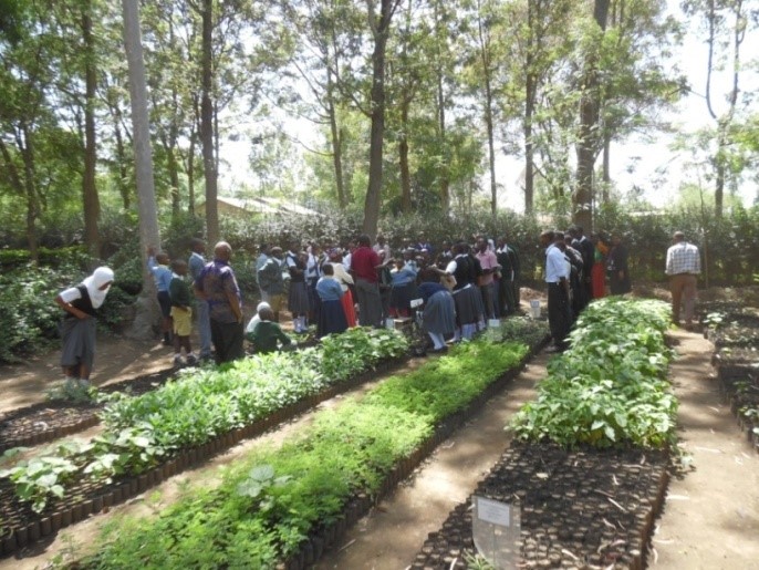
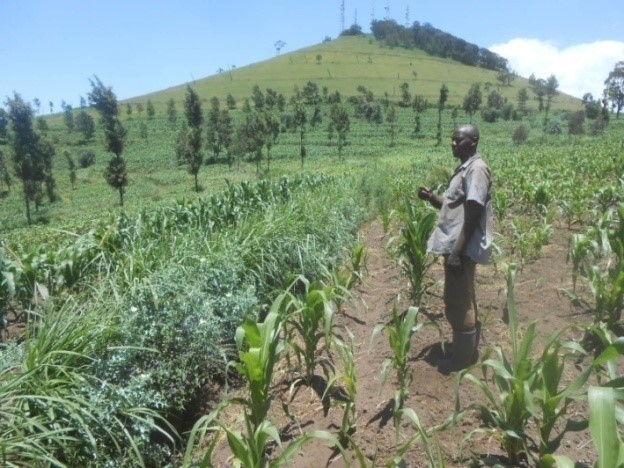
- Planting of threatened indigenous trees for high value timber include Dalbergia, Khaya, Afzelia, Millettia, Podocarpus, & Juniper spp.
- The NGOs themselves were key in the partnership; each brings a different strength: RUCONET’s experience mobilizing communities for land use planning, and generating self-help village savings and loan associations. RGEEPT’s environmental focus through tree planting, and ECHO’s sharing best practices across the East Africa region in sustainable agriculture, biodiversity interest, ecological farming, and appropriate technologies.
Building Blocks
• Facilitating community discussion on natural resources management action;
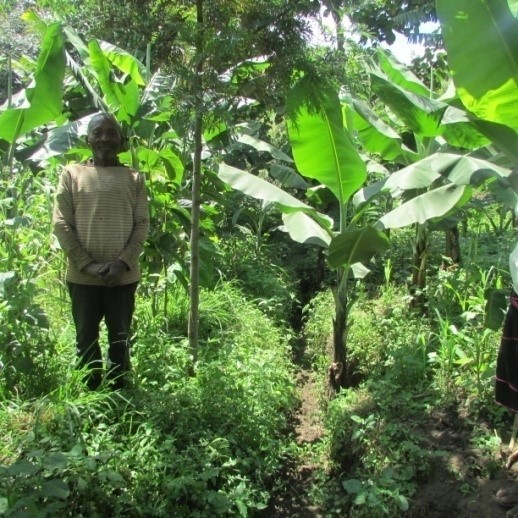
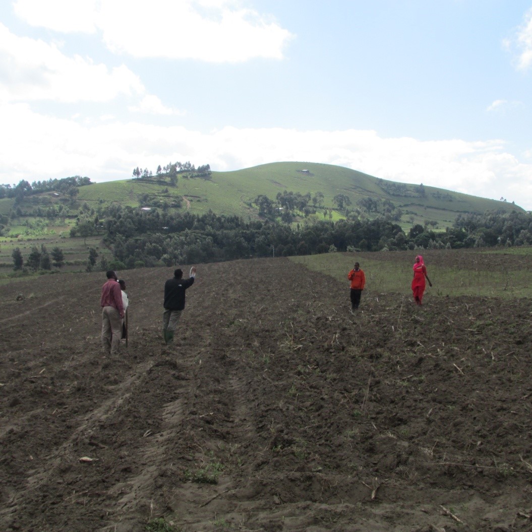
The solution was to empower the communities to take action using sustainable agriculture through their voluntary involvement. Community members were involved in describing their situation and finding solutions which they were willing to implement, emphasizing participation and action to stop the environmental and food security decline. They proposed a number of activities which they agreed to commence. They identified multiple solutions including soil conservation measures and planting of indigenous trees in their fields, land use planning with local bylaws to be monitored and enforced by village environment committees, water source restoration using indigenous trees, and planting of grasses along soil & water conservation measures in farmers’ fields. The capacities of the communities were built with the help of NGOs but the initiative was implemented as a participatory action research in which villagers led the collaboration with the NGOs in a supportive role. They worked closely with the community leaders and early-adapter farmers to further refine the solutions and develop specific activities to address the challenges.
Enabling factors
The communities have embraced the goal of increasing food security and environmental restoration by building capacity of community members by the two local NGOs. The first farmers engaged have noticed increased production and arresting soil erosion and increased water retention on their farms. The focus has addressed education, starting in the higher altitude farms. Not all obstacles like population have been addressed.
Lesson learned
1 - The NGOs worked with the communities to find solutions and develop activities which they themselves identified. These discussions created ownership and led them to address other challenges.
2 - Instead of following methods of previous initiatives which primarily used exotic tree species, used a difficult-to-use technology for measuring contours (line-level) which farmers could not do themselves, and imposed engagement of farmers, this collaboration showed change by example, engaged first lead farmers voluntarily, generated adherence to bylaws first by education, later by coercion, used indigenous trees, and introduced simple tools & technologies.
3 - Historical approaches have left bad memories; forced destocking is illogical to the local agro-pastoralists whose assets are measured in land and livestock numbers.
4 - Population pressure has caused cultivation of steep lands which should not be farmed. Households high on the hillsides need to take the lead; those lower down suffer from the effects of the poor practices above them and their efforts are destroyed during heavy rains.
Resources
• Choosing to plant threatened indigenous trees for high value timber
Overharvesting in Tanzania in general and in this area's forests which lie within the adjacent Mt. Meru National Park have contributed to the threatened status of nationally treasured species such as Dalbergia, Khaya, Afzelia, Millettia, Podocarpus, & Juniper spp. The capacities of the communities were built with the help of NGOs but the initiative was implemented as a participatory action research in which villagers led the collaboration with the NGOs in a supportive role.
Enabling factors
The community recognized that some of these species are hard to find,and illegal to harvest in the wild. They identified multiple solutions including soil conservation measures and planting of these indigenous trees in their fields. They combined this with land use planning with local bylaws to be monitored and enforced by village environment committees, water source restoration using indigenous trees, and planting of grasses along soil & water conservation measures in farmers’ fields.
Lesson learned
1 - A facilitating approach rather than directives let to voluntary formation of village by-laws in support of land use & natural resource management; two plans have been recognized by the district to date.
2 - Facilitation included training on measuring of contours and establishing grasses for livestock fodder, thus bringing multiple benefits: to conserve water and soil; in one village, gathering water from roads into field contours instead of the opposite (this idea still needs more promotion as farmers fear the effects of too much runoff water entering their fields.)
3 - The NGOs worked with the communities to find solutions and develop activities which they themselves identified. These discussions created ownership and led them to address other challenges.
Resources
Impacts
The solution was to empower the communities to take action using sustainable agriculture through their voluntary involvement. Community members were involved in describing their situation and finding solutions which they were willing to implement, emphasizing participation and action to arrest the environmental and food security decline. They proposed a number of activities which they agreed to commence. They identified multiple solutions including soil conservation measures and planting of indigenous trees in their fields, land use planning with local bylaws to be monitored and enforced by village environment committees, water source restoration using indigenous trees, and planting of grasses along soil & water conservation measures in farmers’ fields. The capacities of the communities were built with the help of NGOs but the initiative was implemented as a participatory action research in which villagers led the collaboration with the NGOs in a supportive role. They worked closely with the community leaders and early-adapter farmers to further refine the solutions and develop specific activities to address the challenges. This collaboration showed change by example, engaged first lead farmers voluntarily, generated adherence to bylaws first by education, later by coercion, used indigenous trees instead of exotics, and introduced simpler tools & technologies than earlier used.
Beneficiaries
The catchment population exceeds 24,000 people in 8 villages in 3 wards. First farmers including women were engaged and have noticed increased production, less soil erosion and increased water retention on their farms. The NGOs have felt success.
Sustainable Development Goals
Story
ECHO collects manure from generous local farmers to establish its tree nursery which produces thousands of tree seedlings this year onwards. On one such trip to Ilkurot village, a farmer, Lemali Mollel, asked for help from ECHO’s Venance Mollel how to measure contours. Two decades ago, the Soil Conservation Agroforestry Project had measured them for farmers in the village, but the technique has been lost. Venance trained Lemali using a method ECHO has been reintroducing which is a simple water ring which farmers themselves can utilize. In turn, Lemali engaged his neighbor to help him to dig contours, and they helped each other to establish them.
The next week torrential rains fell in Ilkurot and neighboring Lengijave, flooding fields and homes along several water ways, in some fields removing a foot of topsoil. Villagers were desperate to see their fields flooding and soil washing away. When a village executive secretary, Godson Emmanuel, visited Lemali’s fields and saw that two farmers had constructed contours which were full of water and no erosion, he said, “Let us get the village behind reintroducing contours village-wide. We can re-enact village by-laws for all to adhere to.”
Requests have come from both villages to learn the simple measuring technique; the number of farmers who have agreed voluntarily to establish terraces was 49. However, owing to the energy of the village leadership in response to the recent floods, a stronger directive has been enacted whereby any household which does not establish contours in their fields will be fined over $100.
One week before the new bylaw the number of farmers who had measured contours and started to dig ditches which ultimately become terraces is 13. As a result of the village directive that number is rising fast. It has been encouraging two local NGOs, RUCONET and RGEEPT have come alongside the farmers to train more skilled farmers in contour measuring and to find planting material to plant along the ditches. Farmers are clearly ready to test different ways of measuring and establishing terraces