Using drones for non-invasive monitoring and assessment of crocodilian populations - a generalizable and accessible tool for stakeholders in conservation
Full Solution
Drone crocodile surveys
Clément Aubert
This standartised solution combines drone technology and an innovative allometric approach to monitor and assess crocodilian populations who face significant threats, leading to population declines with 50% the 27 crocodilian species are threatened, with 25% critically endangered. Drones equipped with high-resolution cameras capture images of even partially submerged crocodiles, allowing precise, non-invasive length estimates based on head-to-body allometric ratios. This method overcomes challenges like logistical constraints, cost, need for highly trained personnel, observer bias, detectability, wildlife disturbance, and safety risks of traditional surveys. By covering remote areas efficiently, the solution enhances biodiversity mo,nitoring, informs conservation strategies, and enables a wide range of additional information to be collected. This solution is very cheap, requiring minimal training, and accessible to a wide range of users, including indigenous peoples and local communities and conservation practitioners.
Last update: 31 Oct 2025
313 Views


Context
Challenges addressed
Environmental:Traditional crocodilian survey can be invasive, logistically constrainedand and subject to observer bias. Crocodilians face significant threats, including habitat loss, pollution, invasive species, climate change, illegal activities, and Human-Crocodile Conflicts, leading to population declines in some species by up to 80%. Of the 27 crocodilian species, 13(50%) are threatened, with 7(25%) critically endangered, making them one of the most imperiled taxonomic groups
Social:Human expansion near aquatic habitats exacerbates Human-Crocodile Conflicts, causing attacks, economic losses, and negative perceptions. Limited community engagement in conservation including inadequate tools and training. Cost-effective solutions like drones empower Indigenous Peoples and Local Communities, fostering active involvement and empowerment
Economic:Traditional monitoring is expensive, limiting long-term conservation in underfunded regions. Drone offer a scalable, affordable alternative, reducing costs and enhancing data reliability
Location
West and Central Africa
North Africa
East and South Africa
Caribbean
Central America
South America
North America
Southeast Asia
South Asia
Oceania
Process
Summary of the process
The building blocks complement and reinforce one another to ensure successful conservation outcomes. Standardized protocols (Building Block 1) provide consistent data collection, while size estimation models (Building Block 2) add value through demographic insights. Ease of use and cost-effective of the method and the tools developed promotes their deployment and generalization (Building Block 3) and allow local Stakeholders engagement (Building Block 4) ensures local ownership, increasing the sustainability of the approach. Finally, the evolution of on-board technologies and AI integration (Building Block 5) enhances the efficiency and scalability of data analysis. Together, these components create a robust framework adaptable conservation challenges and accessible to all stakeholders involved in conservation.
Building Blocks
1) Standardized Drone Survey Protocols

This building block establishes standardized flight parameters for effective crocodilian monitoring
Lesson learned
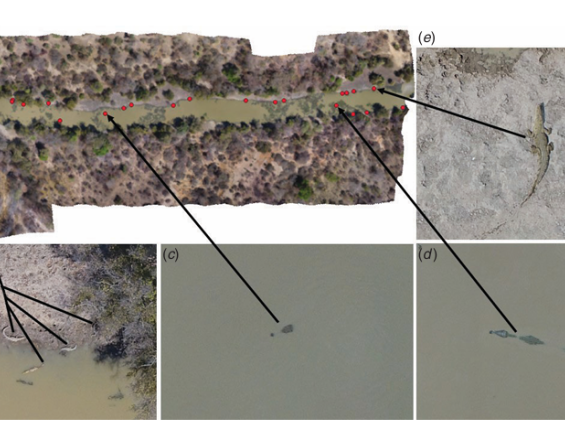
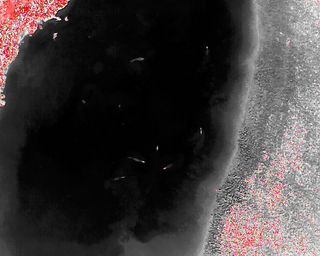
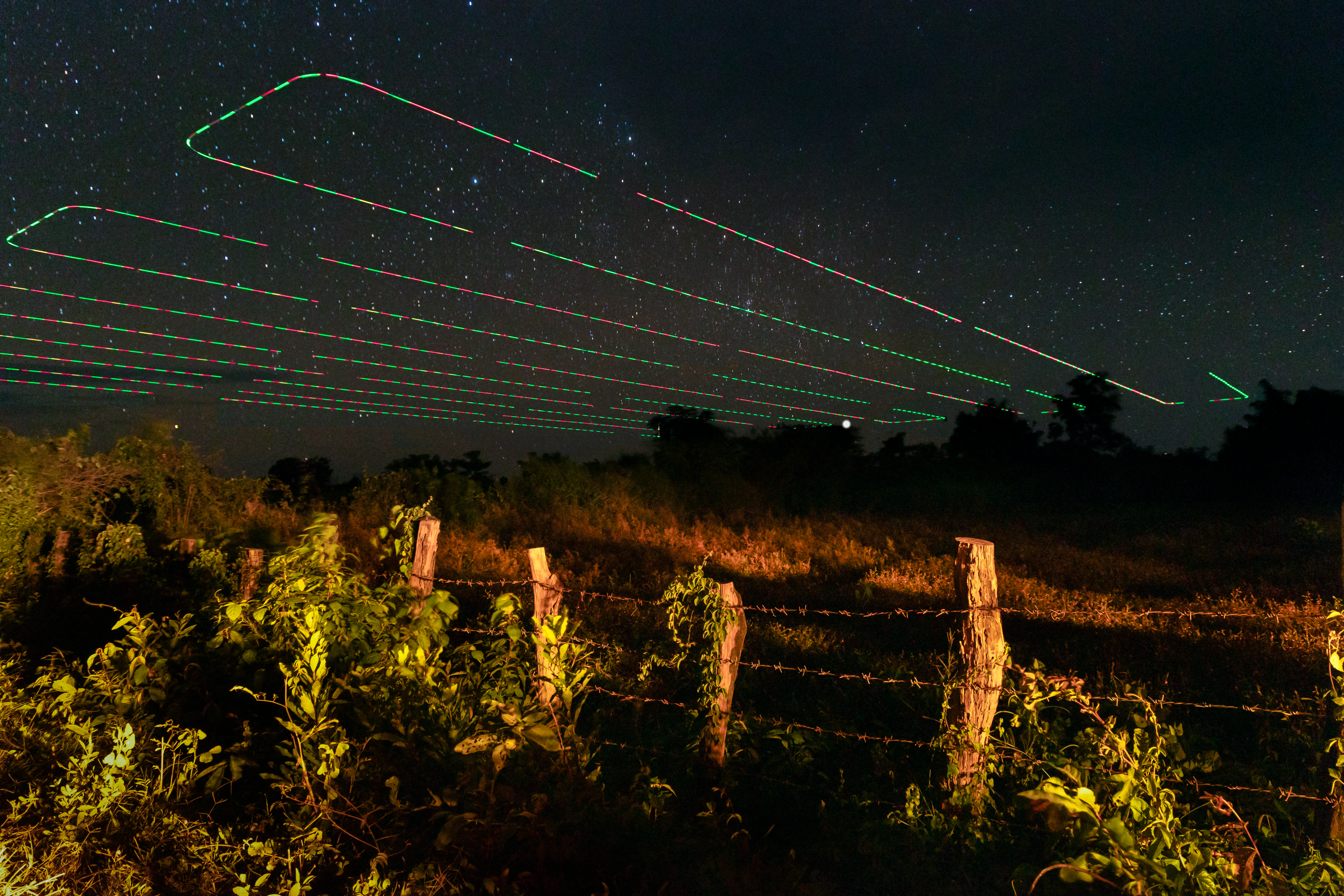
Crocodiles can be closely approached (.10 m altitude) and consumer-grade drones do not elicit flight responses in West African large mammals and birds at altitudes of 40–60 m. Altitude and other flight parameters did not affect detectability, because high-resolution photos allowed accurate counting. Observer experience, field conditions (e.g. wind, sun reflection), and site characteristics (e.g. vegetation, homogeneity) all significantly affected detectability. Drone-based crocodylian surveys should be implemented from 40 m altitude in the first third of the day. Drone surveys provide advantages over traditional methods, including precise size estimation, less disturbance, and the ability to cover greater and more remote areas. Drone survey photos allow for repeatable and quantifiable habitat assessments, detection of encroachment and other illegal activities, and leave a permanent record.
Overall,dronesofferavaluableandcost-effectivealternative forsurveyingcrocodylianpopulationswith compelling secondary benefits, although they may not be suitable in all cases and for all species
2) Estimating total length of crocodylians from drone-captured images by using a model
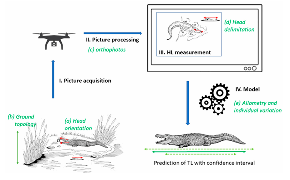
Understanding the demographic structure is vital for wildlife research and conservation. For crocodylians, accurately estimating total length and demographic class usually necessitates close observation or capture, often of partially immersed individuals, leading to potential imprecision and risk. Drone technology offers a bias-free, safer alternative for classification. This study evaluated the effectiveness of drone photos combined with head length allometric relationships to estimate total length, and propose a standardized method for drone-based crocodylian demographic classification.
Lesson learned
An allometric framework correlating head to total length for 17 crocodylian species was developed, incorporating confidence intervals to account for imprecision sources (e.g., allometric accuracy, head inclination, observer bias, terrain variability).This method was applied to wild crocodylians through drone photography. Terrain effects were less impactful than Ground Sample Distance (GSD) errors from photogrammetric software. The allometric framework predicted lengths within ≃11–18% accuracy across species, with natural allometric variation among individuals explaining much of this range. Compared to traditional methods that can be subjective and risky, our drone-based approach is objective, efficient, fast, cheap, non-invasive, and safe.
3) Allometric Framework for Crocodilian Size Estimation
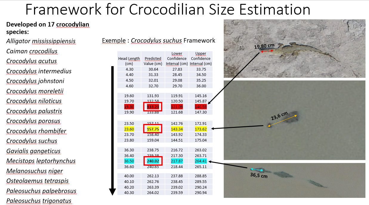
The allometric framework is a non-invasive tool designed to estimate the total body length of crocodilians based on the measurement of their head length, captured through high-resolution drone imagery. By leveraging established species-specific head-to-body length ratios, this method eliminates the need for physical capture or handling, reducing risks for both researchers and wildlife. Validated for 17 of the 27 crocodilian species, the framework allow to provides reliable demographic data essential for population monitoring and conservation management.
The framework uses easy-to-read tables (abaques), making it accessible to non-specialists, operators can quickly apply the method without requiring advanced scientific expertise.
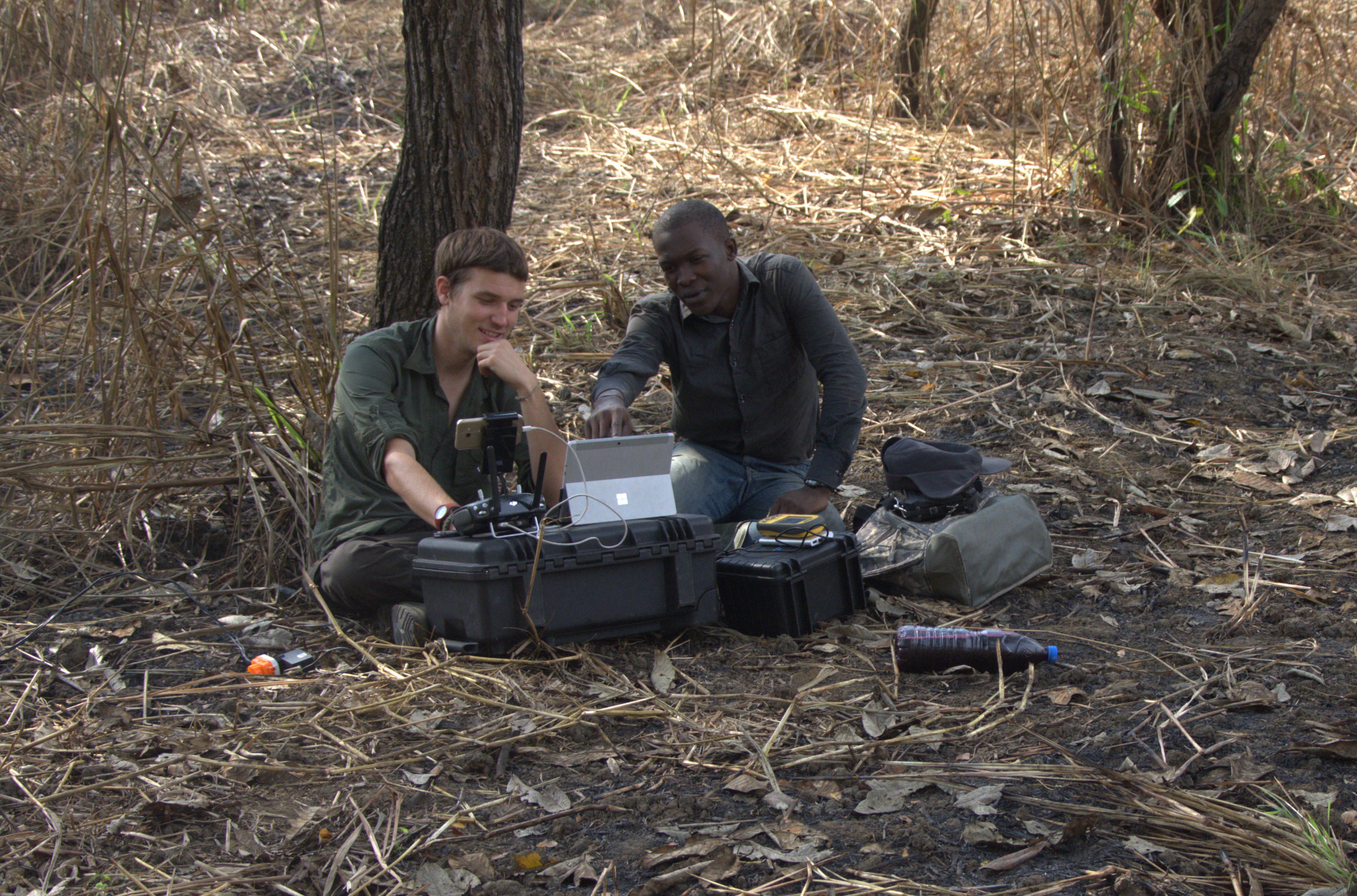
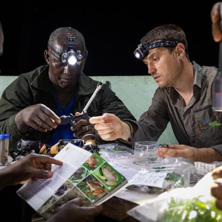
4) Empowering Local Stakeholders through Drone Technology

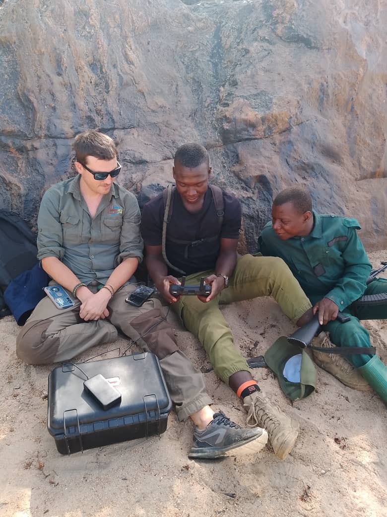
This building block on capacity building on local stakeholders including Indigenous including Peoples and Local Communities (IPLCs) to operate drones, enabling them to take active roles in conservation.
Ease of Use of the method devellopted:
- Minimal Technical Skills Required:
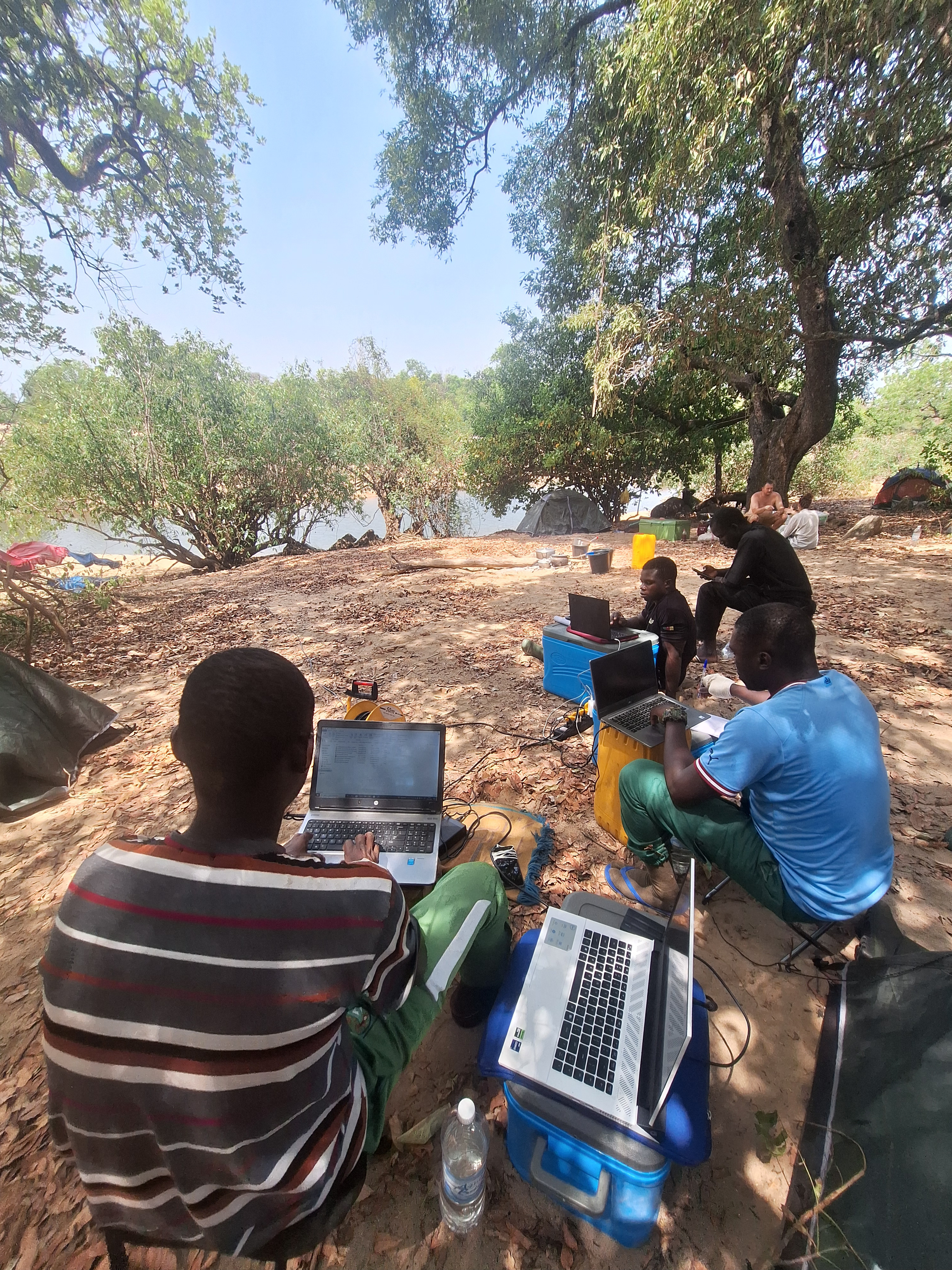
Users only need basic training in drone operation and measurement extraction from high-resolution images. The process is straightforward:- Fly the drone following the standardized flight protocol.
- Marke crocodilians on overhead images.
- Measure the visible head length using accessible image analysis tools (e.g., ImageJ, QGIS).
- Apply the corresponding allometric equation or lookup from pre-prepared tables (abaques) for total length estimation.
- Readily Adaptable:
The framework uses easy-to-read tables (abaques), making it accessible to both specilialists and non-specialists for operators can quickly apply the method without requiring advanced scientific expertise. - Accessible Equipment:
The approach relies on consumer-grade drones and widely available software, ensuring affordability and reducing barriers to adoption.
Why It’s Effective:
The framework’s simplicity, scalability, and reliability make it ideal for diverse contexts, from remote wetlands to urban-adjacent habitats. It empowers a broad range of users to generate scientifically robust data.
5) Evolution of on-board technologies and AI integration

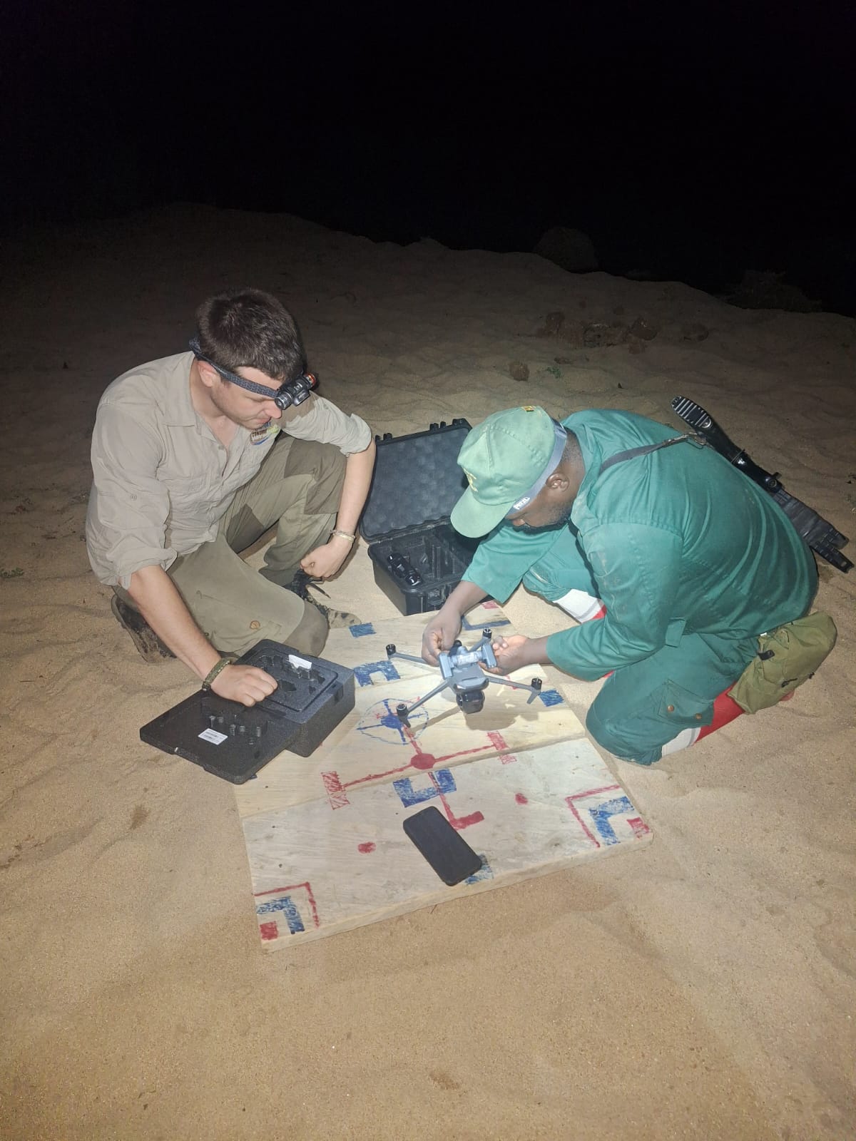
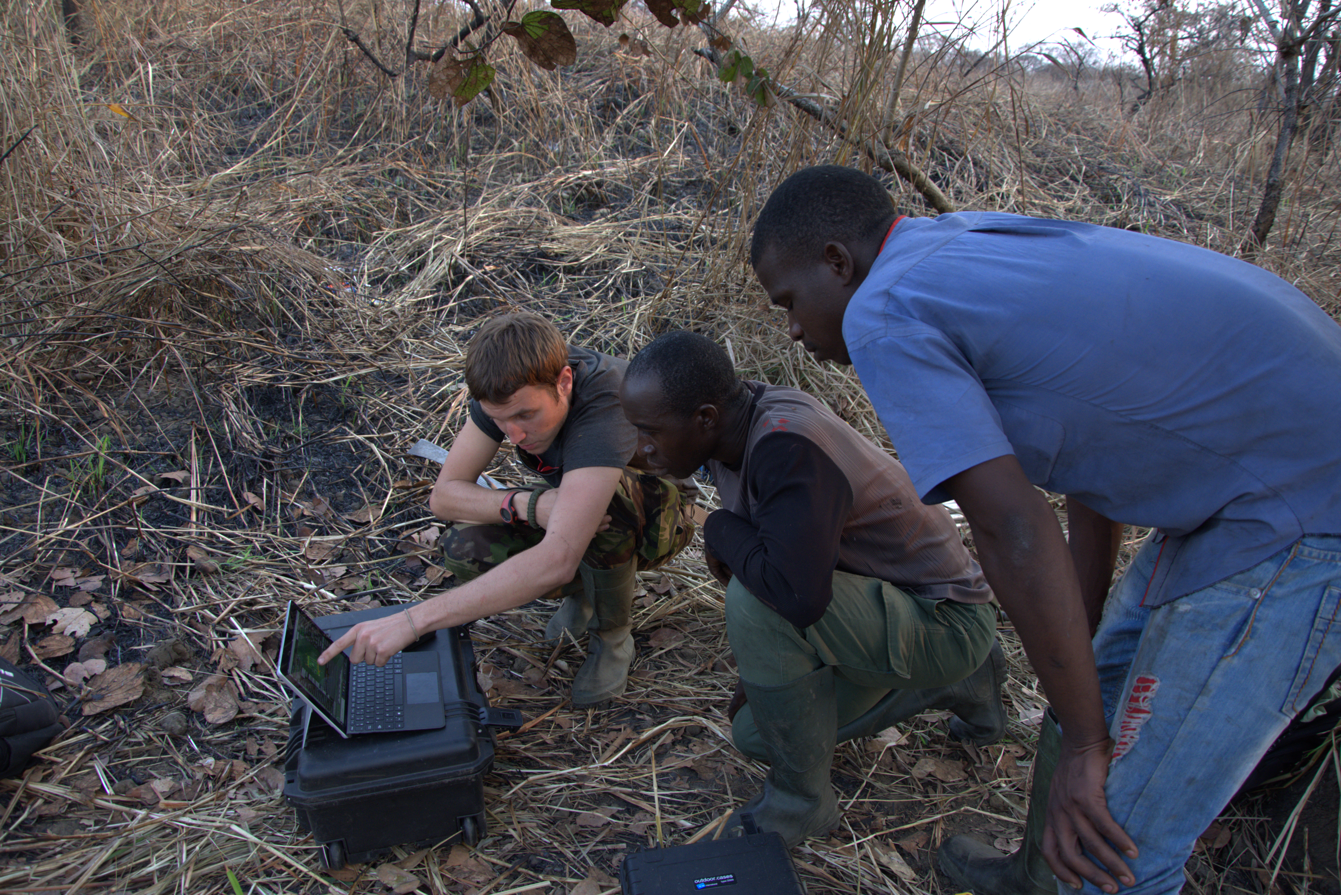
Advancements in on-board technologies and AI integration hold great potential to further enhance the existing drone-based crocodilian monitoring method. Improvements in drone hardware, such as hybrid models with extended flight times and enhanced camera resolutions, allow for broader habitat coverage and the capture of more detailed imagery in complex environments. Integrating artificial intelligence (AI) represents a significant opportunity to streamline image analysis by automating crocodile detection and size estimation using allometric models. These AI-driven enhancements could provide near real-time data processing, reducing reliance on time consuming manual analysis.
This improvements are currently under development. We conducted an experimental study in Cameroon in April 2025 with students and young researchers from the University of Ngaoundéré and local NGOs, using drones equipped with thermal cameras and searchlights, and including AI-assisted automated data processing.
Lesson learned
The data is currently being analyzed and will be published
Impacts
This first have been study to use of drones for crocodilian monitoring has delivered significant results and published in two peer-reviewed scientific journals. Optimized flights enabled to detect, precise identification and measurement of crocodiles. By combining high-resolution imagery with allometric tables, reliable size estimates were generated for 17 of the 27 crocodilian species (within 11–18% accuracy). These data were crucial in assessing the demographic structure of Crocodylus suchus populations in W National Park, Niger.
This approach has the advantage that it can be easily implemented by a variety of environmental stakeholders without requiring particularly advanced skills or experience of drones and crocodiles. In addition, it is cheaper to set up than traditional methods Methods based on the use of drones can detect crocodiles and robustly estimate their total length without capturing them, and should be considered a viable approach by researchers, managers and all stakeholder like indigenous peoples and local communities. This solution has been specially developed for use by everyone.
The study brought together 22 researchers and crocodile conservationists from over 20 countries. It gathered 7,368 biometric measurement data from 17 crocodilian species to create the world's largest database, which will be used for other studies on a variety of themes.
This method is increasingly being used
Beneficiaries
This solution was specifically designed and developed to be used by a wide range of stakeholders, including academic and research institutions, protected area managers, NGOs, conservation organizations, and local communities and Indigenous Peoples
Additionally, explain the scalability potential of your Solution. Can it be replicated or expanded to other regions or ecosystem?
Scalability and Geographic Potential
The method developed for drone-based monitoring of crocodilians demonstrate significant scalability potential, both geographically and across various ecosystems. At least one species of crocodile is present in more than 90 countries, or about half of the countries in the world. Although the method is not currently suitable for forest species, it could be deployed for at least half of crocodile species. Due to the use of consumer-grade drones and standardized protocols that are adaptable to different environmental contexts, this methodology is highly versatile. Combined with the accessibility of drone technology, it positions the solution as a model that can be replicated and expanded globally.
Applications in Human-Crocodile Conflict Mitigation and Biodiversity Monitoring
In regions where Human-Crocodile Conflicts (HCC) are prevalent, the solution could support conflict mitigation efforts by mapping crocodilian habitats and identifying hotspots of interaction with human activities. Beyond crocodilians, the drone methodology can simultaneously collect habitat information, identify threats, and monitor other aquatic or semi-aquatic species. Its non-invasive nature and ability to operate in challenging terrains make it suitable for biodiversity surveys across a range of ecosystems.
Cost-Effectiveness and Community Empowerment
The solution’s simplicity and cost-effectiveness allow it to be implemented in low-resource settings. Its accessibility makes it suitable for a large panel of actors, enabling its use in community-based conservation projects. This approach promotes capacity building and the empowerment of Indigenous Peoples and local communities, significantly increasing the scalability and impact of its deployment.
Open Access and Technical Assistance
This solution and the tools developed are fully available in open access through two peer-reviewed scientific papers. Additionally, I offer technical assistance for the deployment of this solution on the HAC 30x30 Technical Assistance Matchmaking Online Platform of the High Ambition Coalition for Nature and People (HAC for N&P) for conservation stakeholders who request it. The methodology is also being discussed within the Drone Working Group of the IUCN Species Survival Commission (SSC) Crocodile Specialist Group (CSG). Some members of the Crocodile Specialist Group are already utilizing this solution.
Ongoing and Future Developments
This method requires additional studies, on other species and in other contexts. I am ongoing work in Cameroon to develop and improve this method further, particularly by using thermal sensors, fashlight equipment to conduct nighttime inventories with drones, and AI integration to count crocodile and hippopotamus populations which have provided very interesting initial results. The future integration of hybrid drones and the development of strong and diversify AI tools. These advancements are being pursued in collaboration with other researchers and the Pl@ntNet team to enhance the solution’s efficiency and applicability.
Global Biodiversity Framework (GBF)
GBF Target 4 – Halt Species Extinction, Protect Genetic Diversity, and Manage Human-Wildlife Conflicts
GBF Target 20 – Strengthen Capacity-Building, Technology Transfer, and Scientific and Technical Cooperation for Biodiversity
Sustainable Development Goals
SDG 14 – Life below water
SDG 15 – Life on land
SDG 17 – Partnerships for the goals
Story
Participatory inventory of reptiles and amphibians with the community of Dohouan in Ivory Coast
Michiel van Noppen
Everything began several years ago during my internship at the Smithsonian Tropical Research Institute in Panama. I had the opportunity to test a small drone at a time when their use in ecology was still rare. This experience immediately sparked ideas for applications, particularly for monitoring crocodilians, a group for which traditional survey methods posed challenges. At that time, no study had yet explored the use of drones for this specific purpose on this taxon.
With limited resources, I decided to launch a small project, investing my energy and even my personal funds due to a lack of sufficient financing for an initial pilot feasibility study. Fortunately, this pilot study yielded very promising results, allowing me to continue my efforts and develop it.
I am glad to have been able to engage part of the IUCN Crocodile Specialist Group community in this project, leveraging biometric data collected through crocodilian research over the past 50 years to expand this method to most crocodilian species. This work has enabled me to design an effective, inclusive, and affordable solution for conservation stakeholders focused on a crucial taxon: crocodilians, apex predators in freshwater ecosystems in more than 90 coutries. Despite being key species in their habitats, crocodilians remain understudied. Given the growing challenges associated with aquatic habitat conservation, water management and Human-Crocodile Conflict, this solution support these current and futures conservation challenges.
Through my PhD, I have been able to go further in this approach by combining technological adaptation and community-based conservation strategy applied to crocodilians. In parallel, I co-founded and preside Nature Conserv’Action, an organization dedicated to supporting conservation initiatives led by Indigenous peoples, local communities, and local NGOs. We adopt a transdisciplinary approach that integrates scientific research, conservation management, human-wildlife conflict mitigation, and awareness-raising.
Today, I am proud to contribute to and promote an inclusive conservation approach that highlights the importance of associating Indigenous peoples and local communities with conservation projects. By considering social, economic, and environmental dimensions, this approach increases the chances of success and sustainability for conservation programs. This work and these approaches are now a real life project that I and my team are developing with a long-term vision within Nature Conserv'Action.