
Afin d'établir un cadre de gestion des ressources en eau durable et tenant compte des risques pour le bassin de la Lukaya, des mesures basées sur les écosystèmes sont intégrées dans un plan d'action de gestion intégrée des ressources en eau (GIRE). L'Association des utilisateurs du bassin de la rivière Lukaya (AUBR/L) a élaboré le plan avec le soutien du PNUE et d'un expert international et est responsable de sa mise en œuvre.
Le plan présente une série d'actions prioritaires sous quatre piliers principaux : l'eau, l'environnement, l'aménagement du territoire et la gouvernance. La promotion d'approches de gestion durable des écosystèmes dans le cadre général de la gestion intégrée des ressources en eau fait partie intégrante du plan d'action.
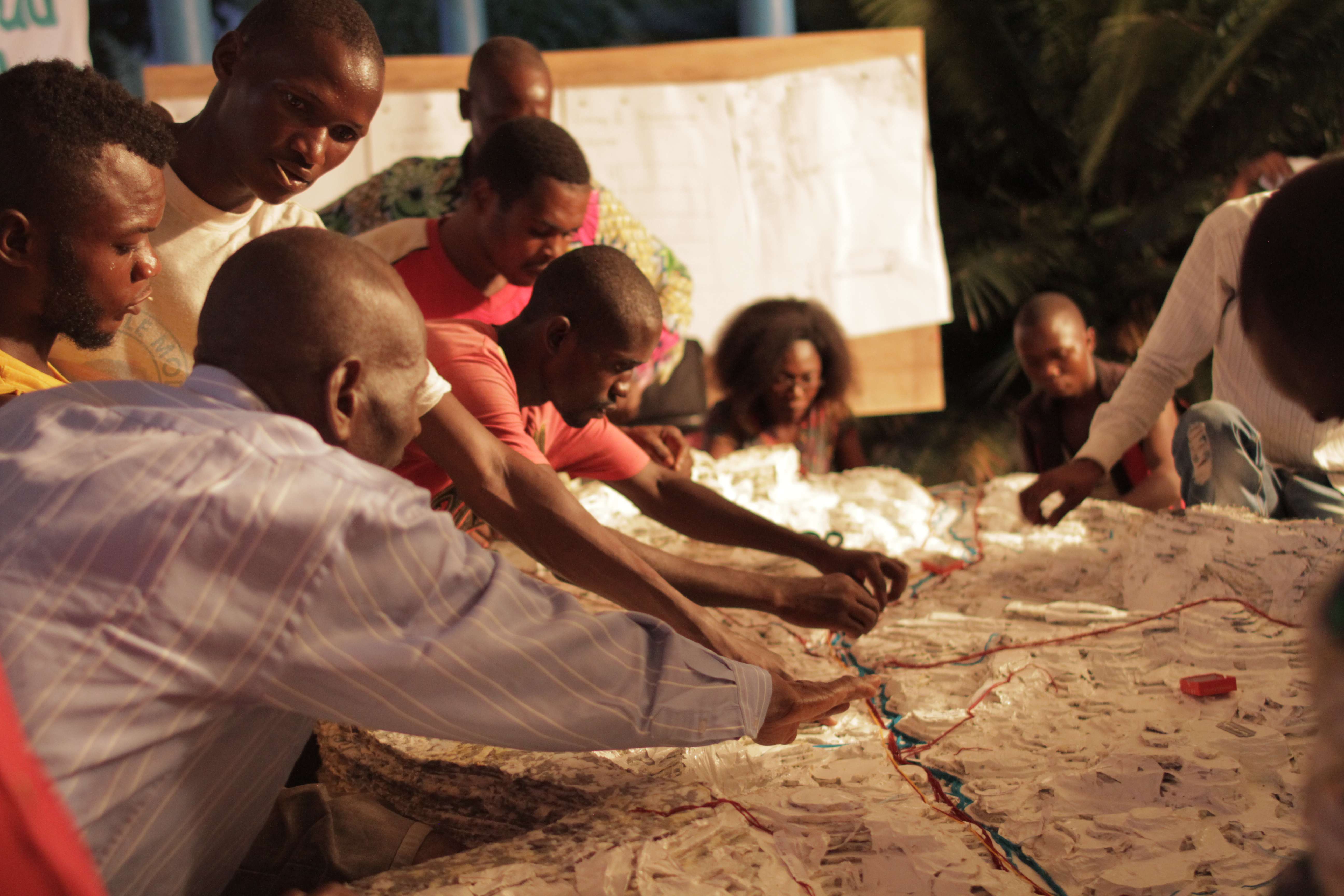
L'élaboration du plan d'action de la GIRE a mis l'accent sur l'importance de relier les communautés en amont et en aval et de renforcer leur connaissance des conditions géographiques et socio-économiques au sein de leur bassin fluvial commun. La cartographie participative en 3D a été utilisée pour cartographier les risques, les types d'utilisation des sols, les ressources naturelles et pour identifier les principaux problèmes environnementaux et les zones à risque dans le bassin, par le biais d'une approche participative multipartite.
En outre, une surveillance de l'érosion des sols et de l'hydrométéorologie a été mise en place pour permettre la modélisation des risques d'inondation. Cela permettra d'établir des bases de référence et de fournir des données pour informer la planification de la gestion intégrée des ressources en eau.
Le projet Eco-DRR a été mis en œuvre conjointement avec un projet de gestion intégrée des ressources en eau financé par l'UNDA dans la même région.
La cartographie participative en 3D est un excellent outil car elle facilite l'intégration des connaissances spatiales locales aux données topographiques grâce à la participation de nombreux acteurs et à l'utilisation de systèmes d'information géographique.
La cartographie participative en 3D est un excellent outil car elle facilite l'intégration des connaissances spatiales locales aux données topographiques grâce à la participation de nombreuses parties prenantes et à l'utilisation de systèmes d'information géographique.
La participation soutenue des utilisateurs locaux des cours d'eau, par l'intermédiaire de l'AUBR/L, a été un ingrédient clé de la promotion réussie de l'éco-RSE par le biais de la GIRE en RDC.
Le processus de planification de la GIRE a été intensif et il a fallu près d'un an pour produire le premier projet.
L'approche communautaire (par l'intermédiaire de l'AUBR/L) est appropriée en raison de la faible présence de l'administration technique centrale au niveau local dans la RDC post-conflit. Le fait de disposer d'une institution de gestion de l'eau existante a été une chance et a permis de réunir les principales parties prenantes en amont et en aval et de renforcer les relations de collaboration. L'obtention de l'adhésion a été cruciale pour l'élaboration du plan et pour les activités, telles que l'installation de systèmes de surveillance sur les terres.
Plusieurs ateliers multipartites et des actions de sensibilisation ont été organisés dans le cadre de ce processus. Les participants ont ainsi pu apprécier le bassin comme un paysage partagé et identifier des priorités communes pour une gestion durable des bassins versants, qui contribue également à la résilience face au climat et aux catastrophes.