Mapping, Needs Assessment, and Data Collection
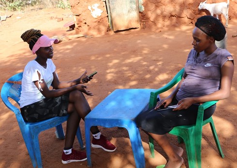
An Enumerator administering the questionnaire to a of the respondents - collecting needs assessment data
Tsavo Trust
Thorough assessments were conducted to identify human-wildlife conflict (HWC) hotspots and ensure the project addressed the most critical areas. This involved gathering quantitative and qualitative data to make informed decisions about fence placement and other interventions. GIS mapping, surveys, and interviews were utilized to understand current land use patterns, wildlife corridors, and areas experiencing frequent HWC. Surveys were also conducted with households to establish threats, crop and property destruction, and the amount of harvest farmers were getting. The results of the needs assessment were submitted to the Kamungi Board, who used this information to select three final beneficiaries of the 10% Fence Plan. Their decision was then passed through a public participation community meeting, where members present endorsed the identified beneficiaries.
- GIS Mapping: Geographic Information Systems (GIS) were employed to map current land use patterns, wildlife corridors, and areas experiencing frequent HWC. This technology provided detailed spatial data that was crucial for planning and implementing the 10% Fence Plan effectively.
- Surveys and Interviews: Structured surveys and interviews with community members were conducted to gather data on HWC incidents, economic losses, community needs, and the amount of harvest farmers were getting. This approach ensured that the project was grounded in the actual experiences and requirements of the affected communities.
- Historical Data Analysis: Historical data on HWC incidents were reviewed to identify trends and predict future conflict zones. This analysis helped in understanding long-term patterns and preparing proactive measures.
- Community Involvement: Local community members were involved in data collection processes, which helped in building trust and ensuring that the data gathered was comprehensive and accurate.
- Technology Integration: Advanced data collection tools and software (kobotool box) were utilized to streamline the data gathering and analysis processes, improving efficiency and accuracy.
- Board Engagement: The Kamungi Board reviewed the needs assessment results and selected three final beneficiaries of the 10% Fence Plan. This ensured that decisions were made by trusted local authorities.
- Public Participation: The selection of beneficiaries was endorsed through a community meeting, ensuring transparency and community buy-in.
- Accurate data collection and mapping were crucial for targeting interventions effectively.
- Community input provided valuable insights into local challenges and needs, ensuring that the project was responsive and relevant.
- Involving local community members in data collection fostered ownership and increased the accuracy of the information gathered.
- Utilizing technology improved the efficiency and accuracy of data collection and analysis processes.
- Regular updates to mapping and data collection ensured that interventions could adapt to changing conditions, maintaining their relevance and impact.
- Historical data analysis provided important context and helped in predicting future conflict zones, enabling proactive planning.
- Effective communication of data and findings to the community and stakeholders built trust and facilitated better decision-making.
- Continuous learning and adaptation based on data analysis allowed for ongoing improvement of intervention strategies.
- Engagement of the Kamungi Board in the beneficiary selection process ensured that decisions were made by trusted local authorities.
- Public participation in endorsing the beneficiaries built community trust and support for the project.