SeaSketch : Un outil en ligne pour la planification participative de l'espace marin
SeaSketch est un logiciel de cartographie participative et collaborative. À l'aide d'outils simples, les utilisateurs peuvent (1) visualiser et interroger des cartes, (2) apporter des connaissances et identifier des zones importantes à l'aide d'enquêtes cartographiques, (3) esquisser et évaluer des scénarios de zonage prospectifs et (4) partager et discuter des plans de zonage dans un forum de discussion basé sur des cartes. La plateforme a été utilisée dans de nombreux cas pour développer des scénarios de zonage complets qui reflètent les valeurs des parties prenantes dans la planification de l'espace marin (MSP). L'outil est actuellement propriétaire et nécessite l'achat d'une licence, mais en janvier 2022, une nouvelle version sera publiée en tant que source libre et gratuite.
Contexte
Défis à relever
L'un des principaux défis de la planification spatiale marine est de maximiser la participation au processus de planification en fournissant des outils de systèmes d'information géographique (SIG) qui peuvent être utilisés dans divers contextes (à distance et en personne) par divers utilisateurs (techniques et non techniques).
Emplacement
Traiter
Résumé du processus
Les processus de planification spatiale marine (PSM) sont souvent facilités par des outils d'aide à la décision. Le choix des outils pour les questions essentielles de la planification spatiale marine, telles que la gestion des données spatiales et l'engagement des parties prenantes, est essentiel (BB1 - SeaSketch Software as a Service). Les gouvernements ont besoin d'un mandat légal pour établir des plans spatiaux marins (BB2 - Government Buy-In for Collaborative Planning), sans lequel les plans ont peu de chances d'être adoptés.
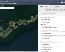
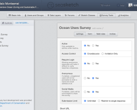
La première étape consiste à collecter les meilleures informations géospatiales disponibles (BB3 - Services de géodonnées et de cartes faisant autorité). Toutes ces données peuvent être affichées sous forme de couches de données dans SeaSketch. De nouvelles données peuvent être collectées par le biais de sondages (BB4 - Sondages SeaSketch pour évaluer l'utilisation de l'océan). Les résultats des enquêtes peuvent montrer la distribution des activités dans l'océan. Ces cartes peuvent être considérées comme la base de données "faisant autorité" à partir de laquelle les utilisateurs peuvent commencer à planifier.
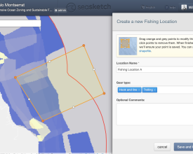
Le principal outil de planification est le "croquis", un élément du plan prospectif (BB5 - Croquis et évaluation des zones prospectives). Les esquisses peuvent être analysées pour déterminer si le plan atteint ses objectifs. Les forums permettent aux utilisateurs de partager et de discuter des zones prospectives.
Blocs de construction
Logiciel SeaSketch en tant que service
Dans la plupart des cas, SeaSketch est utilisé pour soutenir les efforts de planification à grande échelle lorsque les gouvernements ont mandaté l'établissement d'un plan spatial marin et que la participation d'un grand nombre de parties prenantes est essentielle. Dans ce cas, SeaSketch doit être autorisé par un organisme chef de file ou un partenaire. SeaSketch peut être utilisé pour visualiser des données géospatiales sous forme de services cartographiques, collecter des informations par le biais d'enquêtes, esquisser des plans et en discuter. Si les plans doivent être évalués à l'aide d'analyses, les services de géotraitement et les rapports doivent être développés dans notre laboratoire. Notez qu'une licence gratuite est disponible pour les établissements d'enseignement afin d'utiliser SeaSketch à des fins strictement éducatives.
En janvier 2022, nous publierons la prochaine version de SeaSketch qui sera entièrement gratuite et open source. Comme pour la version actuelle, de nombreuses fonctionnalités de SeaSketch peuvent être configurées avec une connaissance ou une expérience minimale des SIG. Les analyses et les rapports seront exécutés sur lambda et encodés à l'aide de langages de programmation tels que Javascript. Les propriétaires de projets peuvent donc mettre en place leur propre projet SeaSketch - du début à la fin - sans intervention de notre laboratoire. Il convient toutefois de noter que le cadre de géotraitement et de reporting, bien que gratuit et open source, nécessitera une expérience significative en matière de programmation.
Facteurs favorables
Actuellement, l'agence chargée de la mise en œuvre (organisme gouvernemental, fondation ou ONG) doit acheter la licence et passer un contrat pour le développement de l'analyse. La version actuelle nécessite une connexion Internet, mais la prochaine version comprendra des fonctionnalités hors ligne. La mise en œuvre réussie de SeaSketch nécessitera l'assistance d'un technicien SIG, par exemple pour la publication et l'importation de services cartographiques.
Leçon apprise
SeaSketch est extrêmement utile pour créer une atmosphère de transparence et de collaboration, maximiser la participation des parties prenantes et fonder les décisions sur des informations scientifiques. Nous obtenons les meilleurs résultats lorsque SeaSketch est utilisé en combinaison avec d'autres outils tels que des applications SIG de bureau, des analyses de compromis, des outils de hiérarchisation (par exemple Marxan, Prioritizr) et des analyses d'impact cumulatif.
L'adhésion des pouvoirs publics à la planification concertée
SeaSketch est conçu pour être utilisé principalement pour la planification collaborative. Nous nous sommes concentrés sur la planification spatiale marine, mais le logiciel peut également être utilisé pour la planification terrestre. En outre, le logiciel est conçu pour aider à générer des solutions de zonage des océans. Pour que ces zones aient un impact significatif, tel que la conservation ou des avantages pour l'économie bleue, il faut que les institutions gouvernementales hôtes adhèrent au processus de planification. Si les zones développées dans SeaSketch ne sont pas légalement adoptées, elles ont moins de chances d'avoir l'effet désiré.
Facteurs favorables
Un mandat légal pour la planification de l'espace marin est essentiel, sans lequel les plans ont peu de chances d'être adoptés. En outre, la mise en œuvre réussie de SeaSketch nécessite un véritable engagement des parties prenantes à différents niveaux. C'est une chose de mettre en place un projet SeaSketch avec des cartes, des classes de croquis, des forums et des enquêtes, mais c'en est une autre de structurer un processus de planification de manière à ce que SeaSketch soit utilisé par les parties prenantes. Il faut créer un plan d'engagement des parties prenantes pour s'assurer qu'elles utilisent l'outil à bon escient.
Leçon apprise
Il est essentiel de disposer d'un mandat légal pour la planification collaborative de l'espace marin et de maximiser la participation des parties prenantes. Sans mandat ni calendrier de planification, on peut planifier pour des lustres sans générer de solution de zonage. Le simple fait de disposer d'outils de planification collaborative ne garantit pas que les parties prenantes seront impliquées ou que les solutions refléteront une variété d'intérêts des parties prenantes.
Services de géodonnées et de cartes faisant autorité
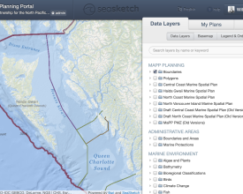
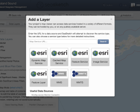
La base de tout projet SeaSketch est constituée d'informations géospatiales (cartes) affichées sous forme de services cartographiques. Il n'y a pas d'exigences minimales en matière de données. Vous pouvez commencer à travailler avec ce que vous avez. Les cartes peuvent être publiées sous forme de services Esri REST (par exemple, avec ArcGIS Server ou ArcGIS online) et de services cartographiques open source (par exemple, WMS, WMTS), puis importées dans SeaSketch. Les exemples de cartes comprennent les limites administratives (par exemple, ZEE, mer territoriale, AMP existantes), les habitats des fonds marins, la bathymétrie, les utilisations humaines, etc.
Les cartes que vous choisissez d'inclure en tant que couches de données dans SeaSketch dépendent des objectifs de votre processus. Si vous planifiez des zones marines protégées, des couloirs de navigation et des sites d'aquaculture, vous voudrez peut-être des cartes de navigation, des cartes d'habitat, la répartition des activités de pêche et d'autres couches qui peuvent être utilisées pour guider les utilisateurs dans la conception de leurs plans. Les zones protégées n'ont de sens que si elles protègent efficacement certains habitats, les couloirs de navigation minimisent les collisions et maximisent l'efficacité, les sites d'aquaculture sont situés dans certaines zones de profondeur, etc. Au cas par cas, vous devrez évaluer quelles données doivent être visualisées sous forme de cartes et quel sous-ensemble de ces données doit être analysé.
Facteurs favorables
Dans certains cas, les données cartographiques pertinentes peuvent déjà être publiées en tant que services cartographiques et être accessibles dans les atlas côtiers et autres portails cartographiques. Tant qu'elles sont dans les bons formats (services cartographiques Esri, WMS, WMTS, etc.), elles peuvent être importées directement dans SeaSketch et affichées en tant que couches cartographiques.
Dans de nombreux cas, il sera avantageux de publier vos propres services cartographiques pour les afficher dans SeaSketch. Cela vous permettra de contrôler la cartographie et la performance des cartes.
Leçon apprise
Les projets réussis disposent généralement d'un seul technicien SIG chargé de localiser les services cartographiques existants, d'acquérir des données auprès des fournisseurs (agences gouvernementales, ONG, universitaires) et de générer de nouveaux services cartographiques à l'aide d'outils de cartographie de bureau et de cartographie Web standard.
Les enquêtes SeaSketch pour évaluer l'utilisation de l'océan
SeaSketch dispose de fonctionnalités permettant de développer et de déployer des enquêtes spatiales qui, par exemple, demandent aux utilisateurs de l'océan d'identifier les zones valorisées ou importantes (lieux importants pour la pêche, la navigation, la plongée, l'aquaculture, les utilisations traditionnelles, etc.) Les résultats de l'enquête peuvent être utilisés pour créer des cartes thermiques décrivant la répartition des zones valorisées. Ces résultats peuvent être visualisés (ou non) et analysés lorsque les utilisateurs dessinent des zones océaniques prospectives afin de comprendre la valeur et l'impact potentiels des scénarios de zonage.
Facteurs favorables
Actuellement, les enquêtes SeaSketch ne fonctionnent que sur un ordinateur de bureau avec une connexion Internet. Elles ne fonctionnent pas hors ligne ou sur des appareils mobiles. (La prochaine version de SeaSketch, qui sera lancée en janvier 2022, sera compatible avec les appareils mobiles. Peu de temps après, elle fonctionnera également en mode hors ligne). Prévoyez donc de mener vos enquêtes dans un environnement connecté à l'internet et en utilisant un ordinateur de bureau.
Dans de nombreux cas, les enquêtes devront être facilitées, en particulier lorsque la population générale ne dispose pas d'ordinateurs personnels.
Leçon apprise
S'il est facile d'élaborer une enquête dans SeaSketch, il n'est pas toujours facile de le faire d'un point de vue scientifique. Envisagez de travailler avec un spécialiste des sciences sociales qui pourra vous aider à créer une enquête utilisant des techniques d'enquête bien établies.
Envisagez de former une équipe de facilitateurs d'enquête capables d'interroger les populations locales en personne en les rencontrant sur les quais, à la plage, dans les cafés, dans les institutions, etc. Ces animateurs doivent être formés à la communication de la structure du processus de planification et, en particulier, à la manière dont les réponses à l'enquête seront traitées et utilisées dans le cadre de la planification.
Les enquêtes doivent être très simples. Plus l'enquête est simple, plus le taux de réponse est élevé. Les scientifiques et les planificateurs sont souvent désireux de recueillir autant d'informations que possible auprès des parties prenantes. Résistez à la tentation de poser plus de questions qu'il n'est absolument nécessaire pour impliquer correctement les parties prenantes et planifier l'espace marin.
Impacts
Une planification réussie dépend de l'engagement du gouvernement à maximiser l'implication des parties prenantes, notamment dans la définition des objectifs, l'élaboration et l'évaluation des plans et la prise de décision. Dans cette optique, la plateforme SeaSketch abaisse les barrières à la participation et fournit un moyen par lequel les parties prenantes peuvent concrètement proposer leurs idées et opinions, partager des informations et exprimer leurs valeurs sur la manière dont l'espace océanique est géré. Les plans de zonage qui reflètent ces idées, valeurs et opinions sont plus susceptibles d'être acceptés par la société et ont donc plus de chances d'être mis en œuvre et respectés.
En outre, si les parties prenantes ont la possibilité d'utiliser SeaSketch de manière pratique, elles comprendront mieux les informations utilisées dans la planification ainsi que la structure du processus de planification lui-même. En visualisant des cartes, en dessinant et en évaluant des plans, les utilisateurs comprennent mieux ce que l'on entend par "habitats" ou par "répartition de l'effort de pêche".
Enfin, en utilisant les données et les outils disponibles dans SeaSketch, les utilisateurs ont accès à un langage commun dans lequel ils peuvent collaborer et communiquer avec d'autres. Une zone étiquetée "aire marine protégée" ou "zone interdite" a une signification spécifique qui se reflète dans les attributs et les rapports qui lui sont associés. Ainsi, les parties prenantes savent clairement ce qu'elles veulent (ou ne veulent pas) lorsqu'elles partagent leurs idées.
Bénéficiaires
Les planificateurs, les parties prenantes et les représentants des agences gouvernementales qui sont directement impliqués dans la planification de l'espace marin.
Histoire
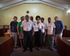
SeaSketch a été utilisé dans l'île de Barbuda, dans les Caraïbes, pour créer un plan spatial marin complet. Le Conseil de Barbuda (l'organe directeur de l'île), avec le soutien invité de l'Institut Waitt, a fait des compromis complexes entre les utilisations de l'espace pour concevoir et codifier légalement le zonage pour l'ensemble de leur juridiction marine. Après une année d'engagement communautaire intensif dans le cadre de l'initiative Blue Halo, des règlements ont été adoptés en août 2014, établissant des zones pour les sanctuaires, l'interdiction des filets de pêche, l'ancrage et l'amarrage, et la navigation. Les données clés utilisées comprenaient une carte de l'habitat et une carte thermique de la valeur de la pêche. Les Barbudiens ont conçu toutes les zones, avec un soutien technique, à l'aide de SeaSketch. Tout au long du processus, le Conseil a intégré les contributions des pêcheurs et d'autres membres de la communauté, cherchant à obtenir un plan de zonage final qui minimiserait les impacts négatifs sur les moyens de subsistance et obtiendrait un large soutien de la part de la communauté. Le plan de zonage final établit un équilibre entre les utilisations économiques, culturelles et de conservation. Il comprend treize zones et répond aux objectifs préétablis de protection d'un tiers de l'ensemble des eaux et d'environ un tiers de chaque type d'habitat. Le processus de consultation a comporté sept réunions de consultation des communautés, cinq réunions de consultation des pêcheurs et deux réunions d'un comité de parties prenantes. L'initiative est maintenant dans la phase de mise en œuvre, mais l'ouragan Irma a dévasté Barbuda en septembre 2017, créant des défis substantiels pour la mise en œuvre en cours.
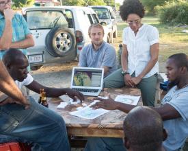
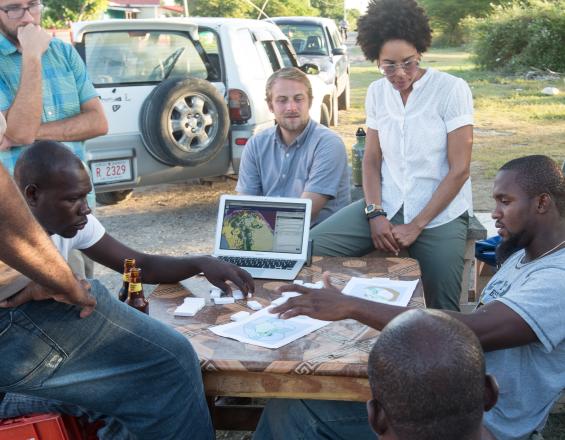
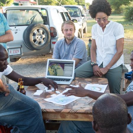
Au début de l'initiative Blue Halo, certains doutaient que les parties prenantes seraient en mesure d'identifier sur une carte l'endroit où elles pêchaient - une étape importante pour montrer la répartition des zones de pêche valorisées à éviter en tant que zones d'interdiction de pêche. En effet, certaines personnes qui avaient pêché autour de l'île n'avaient jamais regardé une carte de navigation ou une carte détaillée du littoral. Il était assez fréquent que le personnel et les partenaires de l'initiative s'assoient pendant une vingtaine de minutes avec des parties prenantes individuelles pour examiner les cartes dans SeaSketch et les orienter vers leurs zones de pêche. Dans tous les cas, les parties prenantes ont fini par pouvoir s'orienter et identifier les zones où elles pêchaient. Dans la plupart des cas, nous avons constaté que les discussions facilitées (par exemple, les entretiens) étaient le moyen le plus facile d'impliquer les parties prenantes, même celles qui disposaient d'un ordinateur personnel avec accès à Internet. Bien que SeaSketch soit assez facile à utiliser, il peut nécessiter 10 à 15 minutes de formation et, plus important encore, une motivation spécifique pour utiliser l'outil dans le cadre d'un processus participatif.

