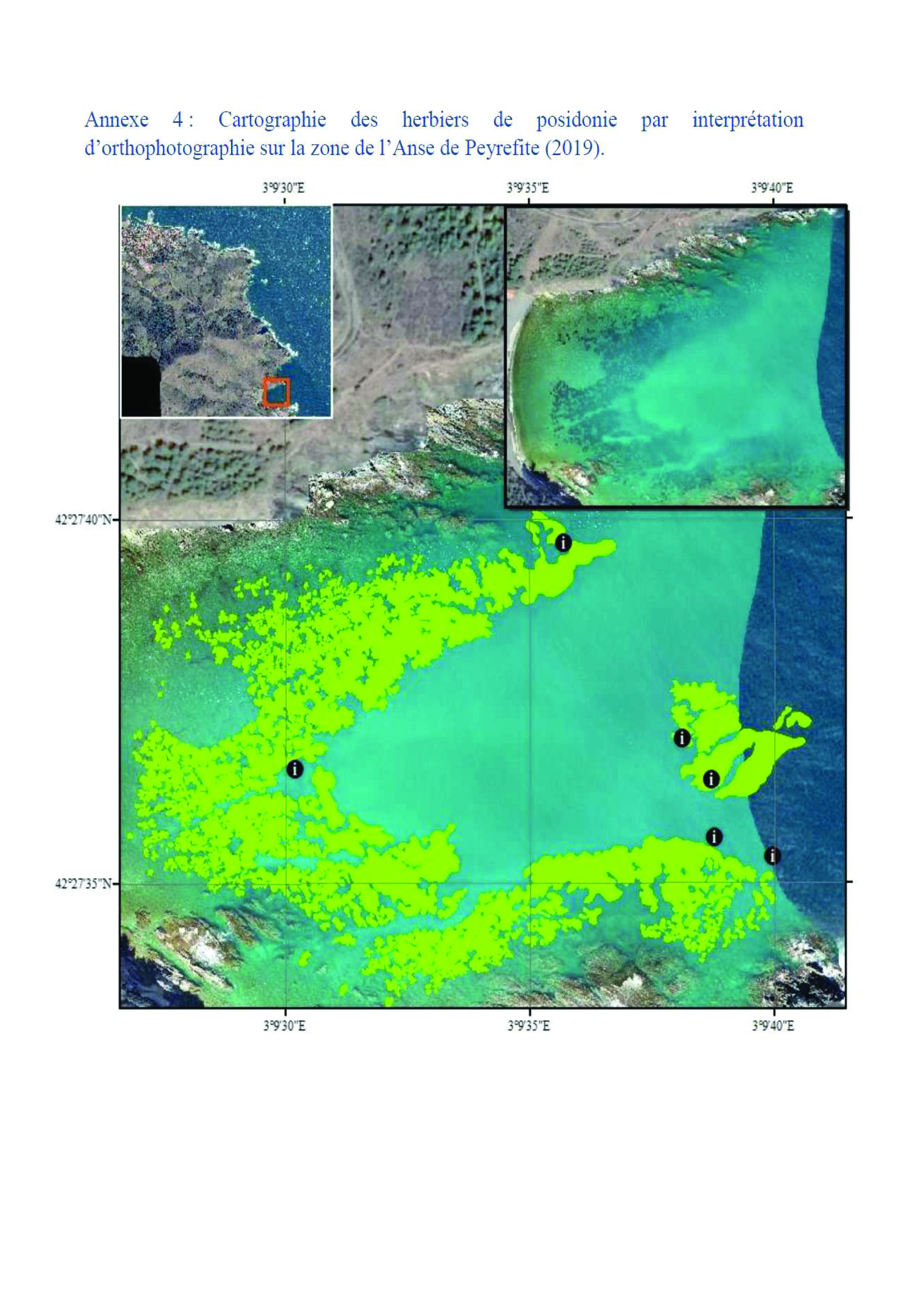

The shallow depth near the coast precluded the use of sonar in these areas, which have sufficient water transparency to allow remote sensing. In order to complete the mapping of the shallow waters during this survey, the use of a Phantom 4MD drone during one outing enabled a clear interpretation of the Peyrefite area in terms of Posidonia, particularly in view of its shallow depth. A second outing enabled us to obtain further orthophotos along the "Tynes" coast. Due to lack of time and poor weather conditions, the Pin Parasol area did not benefit from orthophotos. Using a drone, we were able to obtain an orthophoto that accurately revealed seagrass beds or dead matte through water transparency.
The choice of using these systems is due to the characteristics of the study sites. The Albères coast has one of the lowest water transparency levels in the Mediterranean. The combined use of these three monitoring systems made it possible to obtain surface data for the various locations and thus determine their evolution. Knowledge of the area also contributed to the smooth running of the monitoring program.
It is necessary to adapt the equipment to the different conditions of the study area. For this survey, the combination of the 3 pieces of equipment was validated for 2 of the 3 sites. The third site, where the meadow was the deepest, did not allow the use of the drone. However, the 2 other methods, combined with ground truthing, produced very satisfactory and complementary results.