Connecting Carnivore landscapes through coexistence and collaboration
Snapshot Solution
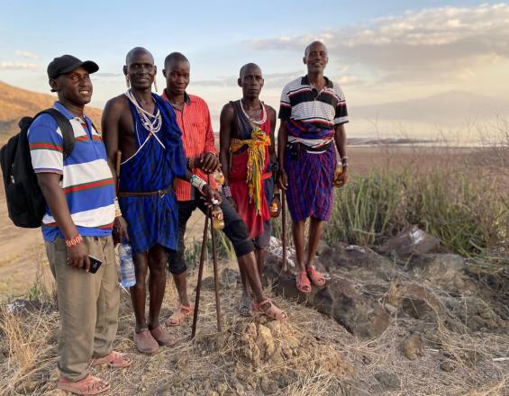
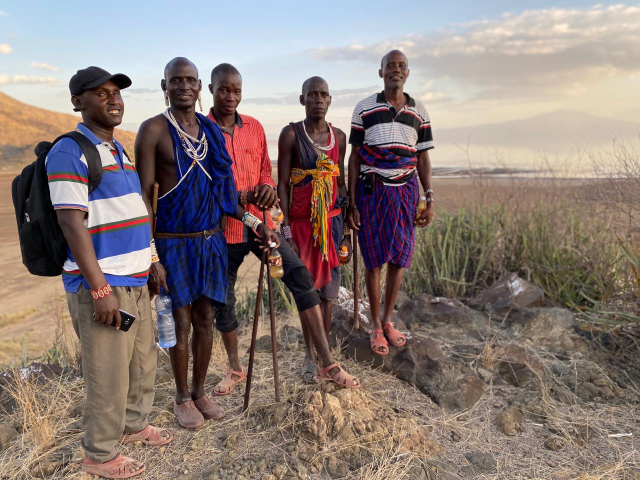
Community helpers(illaretok)on Patrol
SORALO
Kenya’s South Rift is vital for free-ranging lions, cheetahs, and wild dogs outside protected areas. The "Connecting Carnivore Landscapes Through Coexistence and Collaboration" project aimed to foster human-carnivore coexistence across 1.1M hectares, ensuring connectivity between the Mara-Serengeti and Amboseli-Tsavo ecosystems. Key goals included:
- Enhancing human-carnivore conflict response and prevention in eight communities (680,000 ha).
- Increasing community tolerance and carnivore presence in these areas.
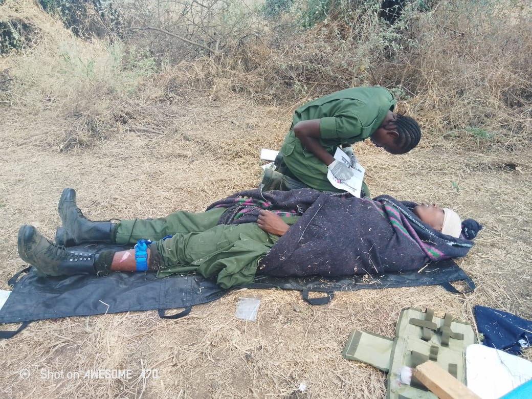
Strategies involved hiring community carnivore ambassadors and illaretok (seasonal livestock guardians) in conflict hotspots and training communities in first aid. This project is part of the IUCN Save Our Species African Wildlife initiative, co-funded by the EU.(https://iucnsos.org/initiative/sos-african-wildlife/)
Last update: 20 Mar 2025
127 Views
Photo and video gallery
Impacts
Human carnivore conflict response and prevention was improved across 988,000 ha of project landscape by establishing coexistence teams focused on monitoring large carnivores and responding to human carnivore conflict. This empowered eight communities to begin to tackle human-carnivore conflict for the first time.
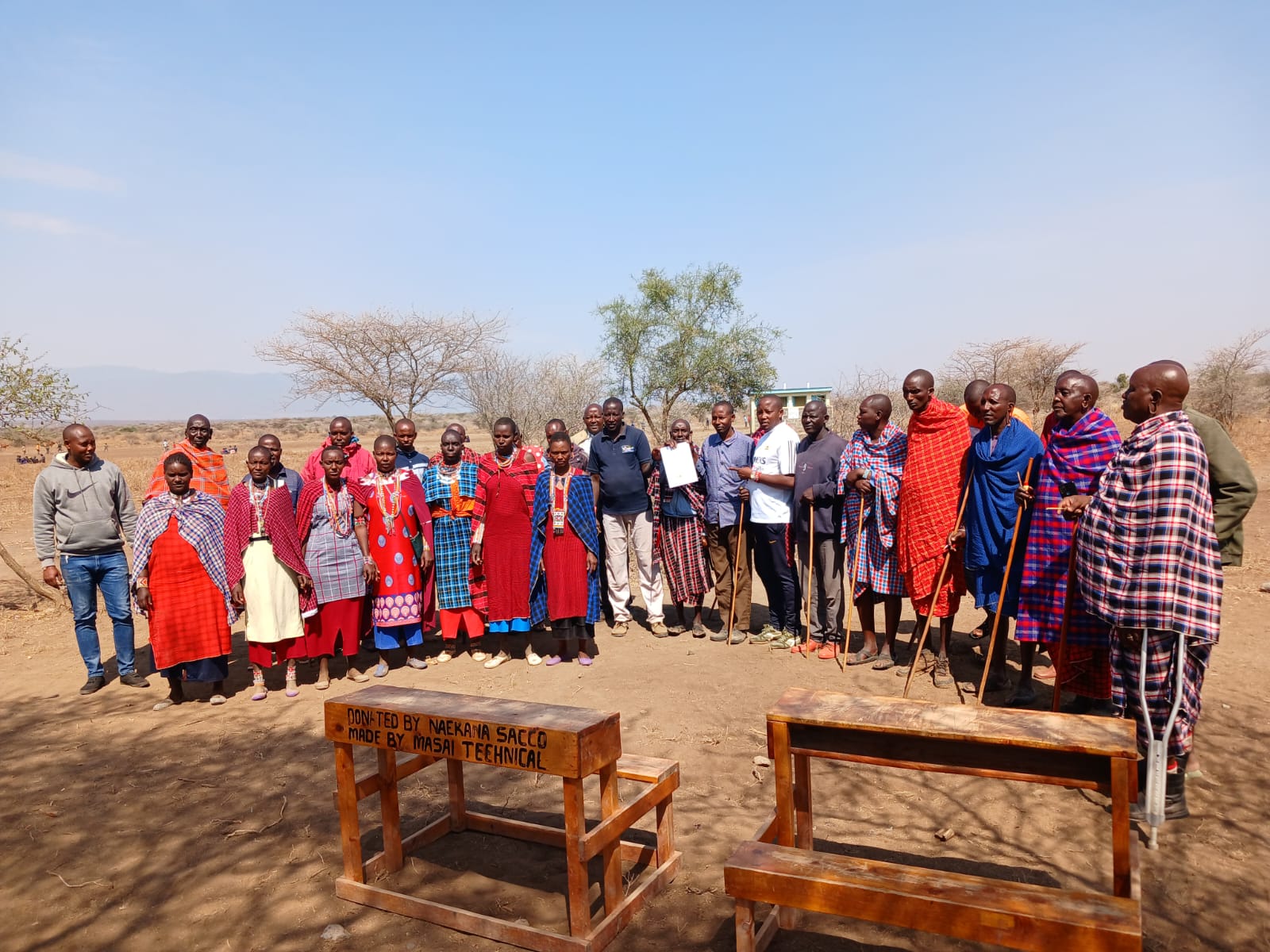
SORALO also developed a landscape-specific Human-Carnivore Coexistence Cycle and associated training modules on conflict prevention, conflict response, information collection, rebuilding unity, and peace-making. To institutionalise the training, 6 SORALO staff were trained as instructors. Doing so enabled the project to deliver training on the conflict prevention module to over 150 community members from 12 communities across the landscape.
Inter-community learning journeys, community dialogues and engagement with county government created a deeper understanding and a desire for carnivore conservation. Across all the conversations rangeland health and human-wildlife conflict emerged as the two most pressing conservation issues.
Created active dialogue around carnivore conservation between county government and local communities, primarily through the engagement of ward admins and county assembly members. Maps of critical corridors and settlements were created and used to inform the development of the Greater Mara Ecosystem Plan.
Sustainable Development Goals
SDG 3 – Good health and well-being
SDG 15 – Life on land