Landscape Level Biodiversity Vulnerability and Landuse Assessment, Namibia
Snapshot Solution
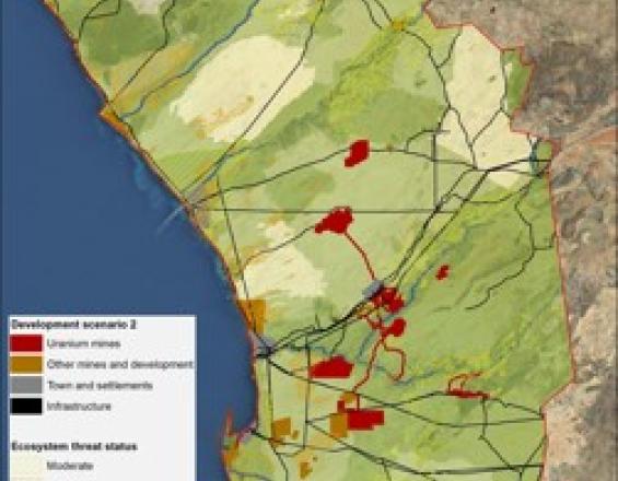
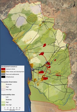
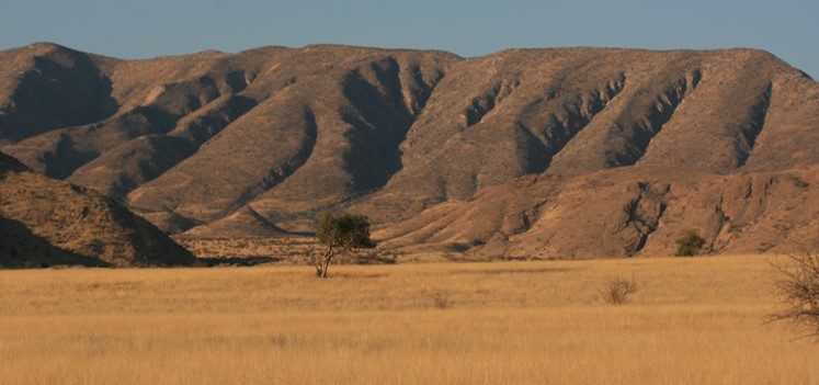
Mining Landscape, Namibia
Pippa Howard
Fauna & Flora International (FFI) recognises the need for landscape level approaches to biodiversity conservation and ecosystem service preservation. The Landscape Level Assessment (LLA) approach uses and analyses evidence and spatial data to transparently assess the relative importance of different areas in their contribution towards conservation objectives. It is also used to estimate the socio-economic values of natural assets and to assess the vulnerability of biodiversity, ecological processes and land uses to current and future pressures.
The Namibia LLA forms a live decision support tool comprising a series of maps, technical reports, communications pieces and database of information. These can be used to guide land use planning and to help decision makers understand the relative importance of biodiversity and ecological processes across a landscape.
Last update: 30 Sep 2025
3632 Views


Impacts
The decision support tool can be used in Namibia to:
- inform policy development around integrated and sustainable land use planning;
- support implementation of the Environmental Management Act by assisting in the application of best practice principles for the approval of exploration and mining licenses;
- inform conservation planning and prioritisation to further strengthen the conservation areas network;
- help identify areas that should not be subjected to exploration and development;
- guide where detailed site level assessment is needed;
- inform consultation processes relating to any proposed new developments in the region;
- provide a landscape context than can help stakeholders assess and manage their impacts on biodiversity and ecosystem services;
- identify areas where mining and other development pressures coincide with high tourism values;
- act as a basis from which biodiversity offset planning can move forward;
- support integrated land use planning that takes account of environmental and socioeconomic values;
The LLA has been widely supported by government, industry, NGOs and specialists and was officially endorsed by the Ministry of Environment and Tourism in 2012.
Sustainable Development Goals
SDG 15 – Life on land
SDG 16 – Peace, justice and strong institutions
SDG 17 – Partnerships for the goals

