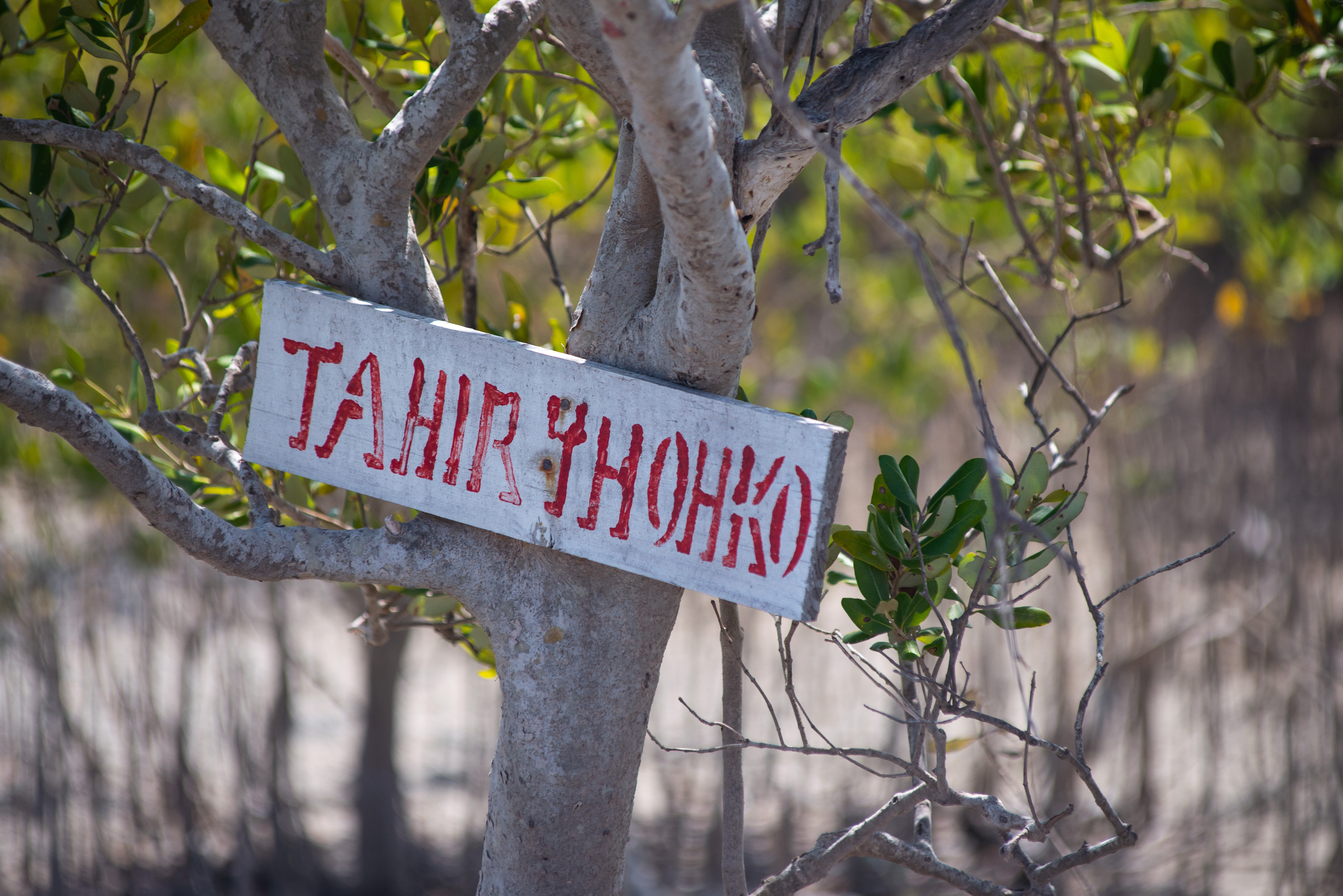
The Tahiry Honko project: Community-led mangrove management to protect coastal ecosystems and livelihoods in the Bay of Assassins, Southwest Madagascar. PATHFINDER AWARD 2021 WINNER
Full Solution
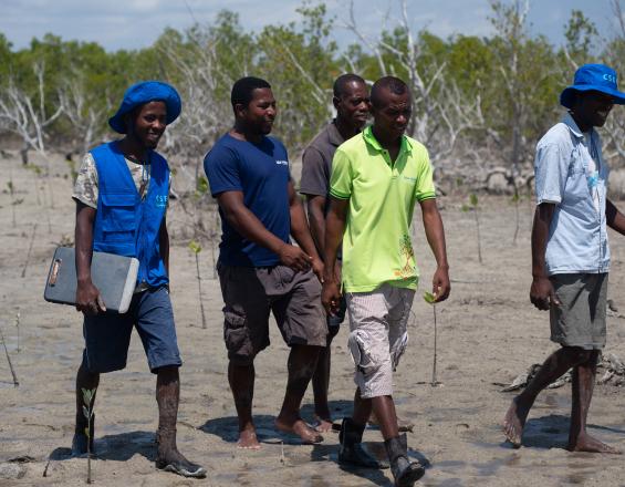
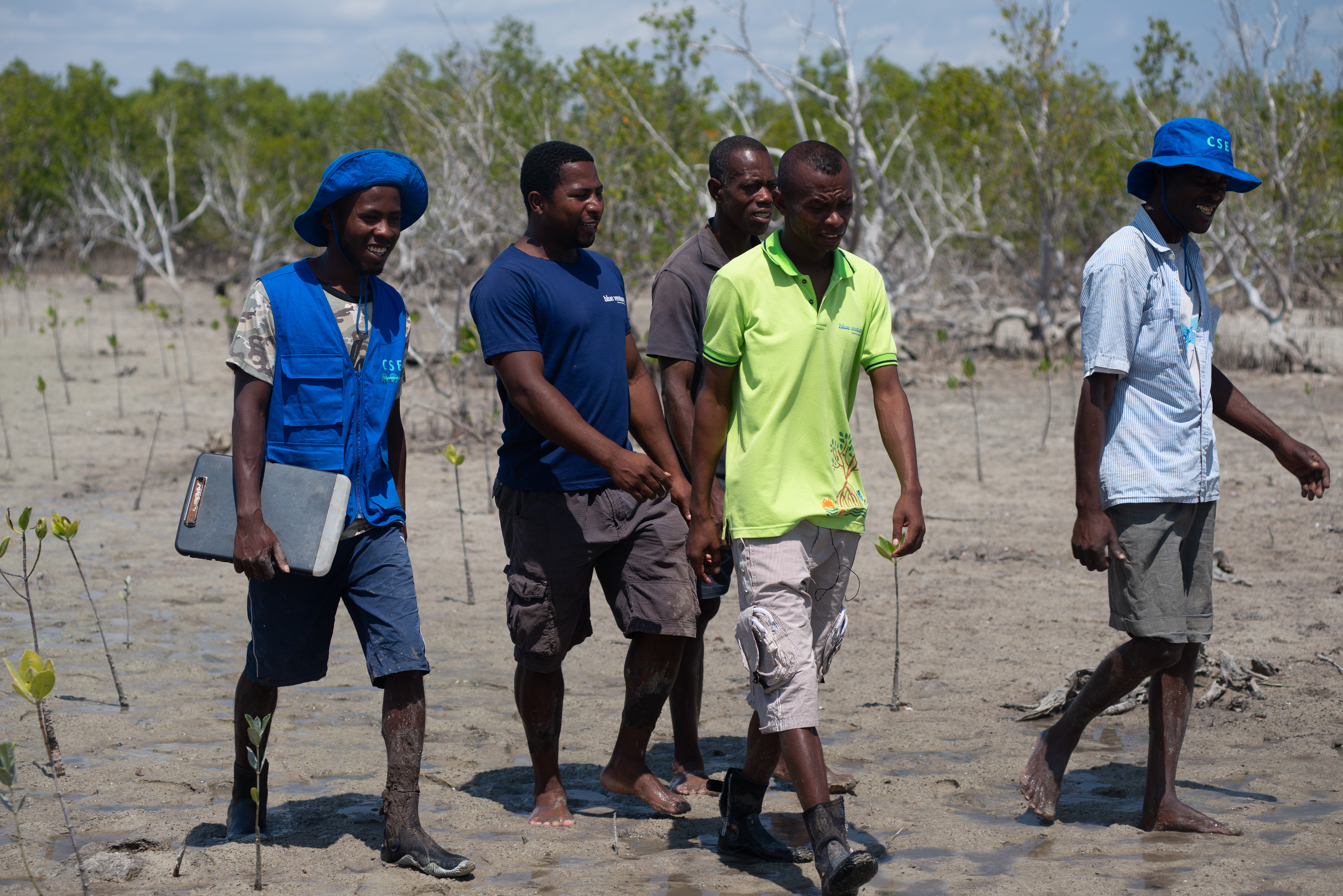
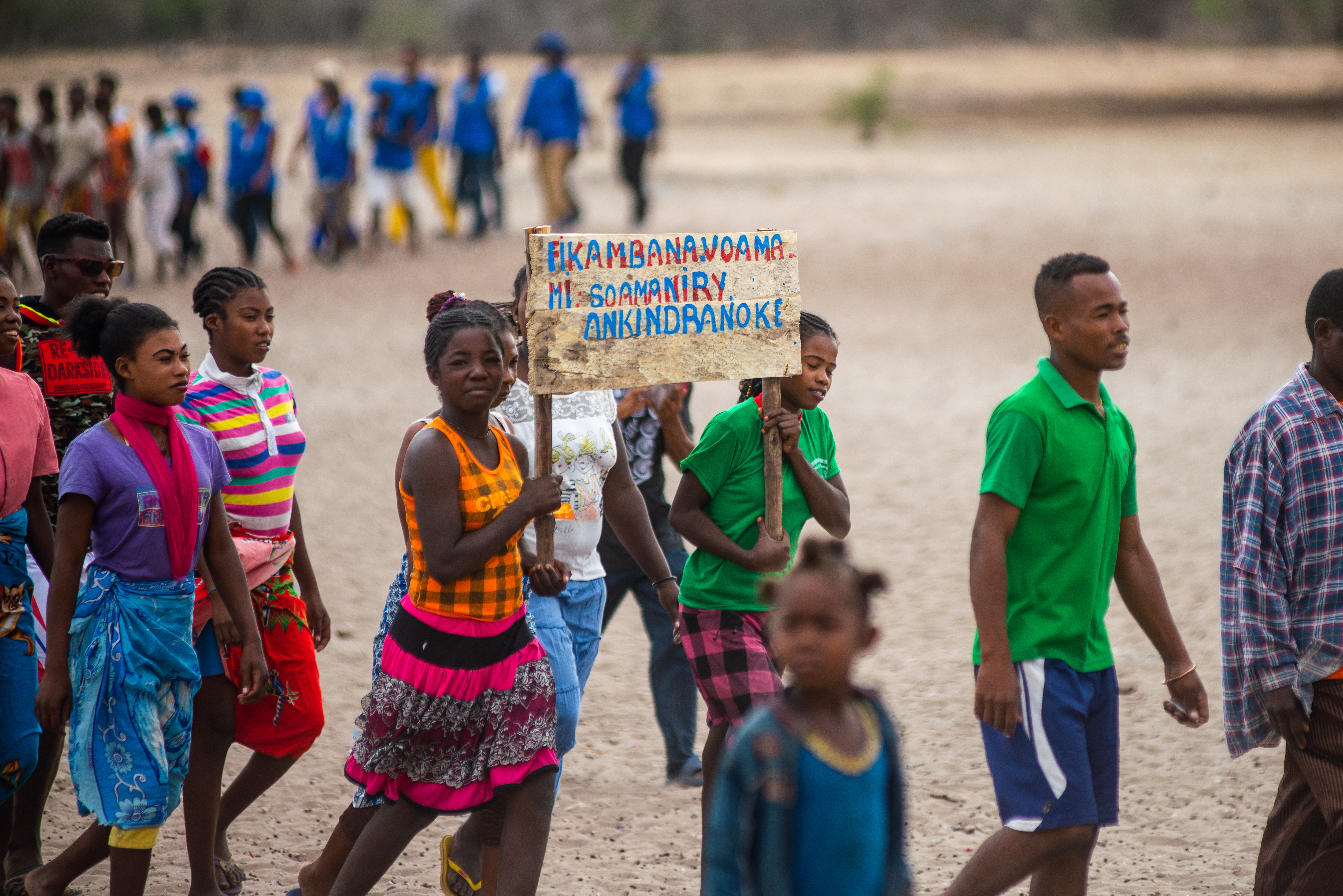
Tahiry Honko Project community patrolers
Louise Gardner-Blue Ventures
The project, co-managed by Blue Ventures and the Velondriake Association in the Velondriake MPA, aims to establish a sustainable, long-term mangrove payment for ecosystem services scheme which will reduce deforestation and degradation and restore mangroves in the Bay of Assassins (southwest Madagascar), avoiding emissions of over 1,300 tonnes of carbon dioxide per year.
Carbon credits generated by conserving and restoring mangrove ecosystems will make an important contribution to poverty alleviation and biodiversity conservation in the area by establishing a secure revenue flow offering communities the opportunity, where feasible, to construct schools, dig wells, provide community health services and other related services that will directly benefit community members of all ages.
The Velondriake Association is progressively increasing their presence in the field in order to monitor the implementation of this project with relevant communities, playing a key outreach role.
Last update: 25 Sep 2025
6131 Views

Context
Challenges addressed
-
Fluctuation of the international carbon credit market presents a challenge for generating stable revenue from carbon credits;
-
Takes time to develop as this requires extensive community consultations (for Tahiry Honko about 6 years)
-
A number of policy-related challenges:
-
-
Madagascar’s government still does not have a clear policy on carbon credit benefit sharing at the initial stage of the project development. Currently policy states that 22% of carbon revenue goes to the government, 5% is held as a risk buffer, resulting in less benefits for the communities managing and protecting these resources.
-
Carbon credit sale agreement is to be carried out between the buyer and the government, not the communities themselves, resulting in a long administration process that could potentially take many months or even years to distribute funds to the communities.
-
Location
Madagascar
East and South Africa
Process
Summary of the process
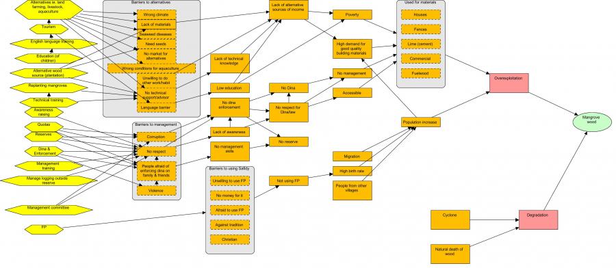
The full engagement of communities in the management of natural resources (BB1-4) enhances social integration of the resource managers, and co-operation between local communities and other stakeholders. This can solve many of the sustainability problems posed by external and hierarchical management. When the community has a better understanding of the natural resource health and impacts of anthropogenic activities, they can establish effective natural resource management and implement management strategies for sustainable use of resources. Promotion of the voluntary work for mangrove reforestation (BB5), along with education in why this is important at the start-up stage, and the carbon revenue from the sale of the carbon credits can be used for the long term project activities (carbon monitoring, replanting, law enforcement). BB1-5 are in themselves building blocks for a carbon project (BB6). This last building block both helps to fund the management that is integral to the LMMA and in the first place incentivizes this management.
Building Blocks
Participatory mapping for management
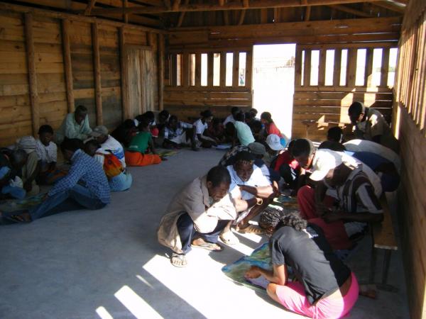
Participatory mapping is undertaken with communities to understand spatial patterns (land use, land tenure, land cover type and historical change and trend) and the state and use of mangrove resources in the project area.The participatory mapping creates maps which will later support the management planning and zoning. Google Earth imagery covering the whole area of interest (AOI) combined with questionnaires is used to assess community perceptions of resource use. All stakeholders (farmers, loggers, fuel wood collectors, charcoal producers, lime makers, elders and fishers), identified through interviews with key informants, are involved in this exercise and create a resource use map of the AOI. They are divided according to activity groups of 5 or more. Only one person is designated to the group to draw the boundary of each land use type on the map. Ideally each group should be assisted by one staff member from the support organization. Each group comprises a range of sex and age (male and female/young and old) that are already active in the respective activities (usually over 15 years old).
Enabling factors
-
High resolution Google Earth map of the area is available and contains familiar landmarks (e.g school building, church) to facilitate community reading.
-
The questionnaires for the stakeholders aiming to gather additional information about the resources used are available and translated into local dialect to avoid confusion.
Lesson learned
-
Good engagement with the community in advance of the mapping to ensure convenient timing and optimal participation.
-
The mapping exercise should last 2-3 hours to enable community members to balance participation with other commitments.
-
The staff from the support organization should be familiar with the local dialect and avoid using scientific/very technical words.
-
Consensus between groups must be respected before drawing/delineating the boundary on the map.
-
The facilitator must be able to make a quick analysis of information given by the community during the exercise.
Participatory theory of change
-
The participatory concept model and strategy development exercise aims to identify the drivers and underlying causes of mangrove loss; and to identify potential strategies/solutions that could be implemented to reduce threats to mangrove and promote sustainable mangrove use.
-
At the end of the exercise the community has developed a concept model. This model depicts the drivers of mangrove loss in their community and the additional factors which contribute to this loss.
-
They identify solutions and work through the activities they need to implement to reach their desired results through a theory of change (ToC).
-
The exercise is carried out with community members in a focus group format development of the concept model and ToC is completed using different coloured paper and chalk.
-
Following the participatory meetings the final concept model with threat ratings, and ToC models are digitized using MiradiTM (2013) software.
Enabling factors
-
Announcement of the planning is sent to village leader prior to the exercise;
-
High participation and presence of all stakeholders during the exercise and participants should be fully aware of the purpose of the exercise;
-
The facilitator from the support organization has enough skills and is familiar with the concept model exercise and able to motivate people to express their idea;
-
The support organization is able to adapt to the local context (using the available materials).
Lesson learned
To address community reticence and for stronger dialogue within the community, employing two community-based facilitators from the village to assist the Theory of change exercise is recommended. Good practice includes hiring people already engaged in the LMMA management (dina enforcement committee, mangrove commission, women’s group) activities. The community-based facilitators are trained by the technical staff from the support organization in advance of the participatory theory of change exercise. Volunteers from the community should be invited to present the outcome from their group work, aiming to assess the level of consensus on the concept model they developed. It is vital to ensure representation from key stakeholder groups, particularly women and young people who may otherwise be marginalised. If needed, separate women and men in different groups to facilitate open discussion.
Participatory Forest Management plan
-
A participatory management plan aims to support the local community to sustainably manage mangrove forest within the LMMA.
-
Using a printed high resolution Google Earth map, a first draft management plan is created by each concerned (proposed project area for the mangrove carbon project) village with the boundary of the mangrove zoning (core zone, reforestation area and sustainable logging area).
-
When all the relevant villages within the LMMA have completed the zoning, the data from the Google Earth map are digitized and projected on a big screen for validation. Delegates from each village are invited to attend a workshop for the validation of the mangrove zoning. For the validation, at least four people from each village must attend. Ideally both men and women are elected by villagers who they feel may best reflect their opinions (elders, chef Village).
-
Each community determines, agrees and implements the rules and regulations governing each mangrove zone.
-
This is conducted through a large village meeting. The support organization facilitates the process until the local law is ratified at the court.
Enabling factors
-
A local convention or law enables communities to govern the natural resource management;
-
Aptitude of the support organization to incorporate the mangrove management plan into the existing LMMA management plan;
-
Ability of the law enforcement committee to enforce the Dina and deal with the fine payment in their respective zone without support/inputs from the government;
-
Demarcation of the management zone enables the community to observe on the ground the boundary of the mangrove zoning.
Lesson learned
-
The support organization must be familiar with the government law, as the local laws/conventions (such as Dina) should not conflict with the national law. It has proven effective to involve appropriate government actors in processing the Dina (local law) at the village level to make the ratification easy.
-
Make sure villages sharing mangrove forest are consulted together through village meetings/workshops for a compromise on the mangrove zoning. For the demarcation at the forest, delegates from villages at the AOI must assist the technician staff from the support organization to make sure that the marks/signs are in the right place.
-
Colour of the marks/signs used for the demarcation should consistently be within the LMMA (e.g colour red for the core zone boundary for both marine area and mangrove forest).
Participatory monitoring
-
The participatory monitoring aims to develop a greater understanding of natural resource health and the impacts of anthropogenic activities within local communities through a socially integrated resource assessment.
-
The participatory ecological monitoring process begins with an initial village meeting to inform the purpose of the activities, select indicator species, monitoring sites and a local monitor team.
-
The local monitoring teams are either designated or elected by community members at the village level or can be volunteers. However, they should at least be able to read/write and count. A local monitoring team consists of five people per village and contains male and female.
-
The monitoring method is developed by the support organization and the monitoring has a simple design and method to be accessible to anyone, irrespective of educational level (using simple count of cut stump to assess the amount of carbon loss; measuring the tree height with graduated pole wood to measure tree biomass and carbon).
-
Local monitors were trained by the technical staff from the support organization on the method before conducting the fieldwork.
Enabling factors
-
The support organization assists the community to identify the relevant indicators, these should be the key natural resources or target species providing useful information to allow local community to perceive the effectiveness of the management in place;
-
The support organization provides technical assistance in the long term monitoring and builds the capacity of the local monitors.
Lesson learned
-
The monitoring method developed must be an effective means of illustrating to coastal communities the benefits of natural resource management. The number of cut stumps or number of mangrove mud crab holes could be a good indicator to demonstrate clearly to the community the effectiveness of the mangrove management.
-
The dissemination of the results of the monitoring helps the community to understand the state of their resources and the amount of carbon stocks in their mangrove forest. The support organization must define the key messages from the monitoring results (the carbon stocks at the mangrove reserve are much higher compared to the unmanaged mangrove forest).
-
Local monitor team is not paid but they are given a daily food allowance when they are conducting the forest inventory and carbon monitoring. The income from the sale of the carbon credits is planned to secure the long term monitoring activities.
Mangrove reforestation by communities
-
Reforestation of mangroves in previously deforested or degraded areas helps to improve the health of mangroves and increases the services provided by mangrove ecosystems.
-
The area for reforestation is identified by the local community during the participatory mangrove zoning.
-
For the viviparous (producing seeds that germinate on the plant) mangrove species (e.g. Rhizophora spp), replanting is undertaken through propagules and for non-viviparous (e.g. Avicennia marina, Sonneratia alba) mangrove species through nursery establishment. The density should be one propagule/plant per square meter to ensure that they have enough space to grow properly.
-
The monitoring of the replanting takes place within three to four months after the replanting. The number of plants alive/dead within the sample plot is assessed. The number of sample plots (5mx5m) depends on the size of the area replanted but at least three replicas should be done. Community members are involved in the monitoring activities.
Enabling factors
-
The reforestation area is identified by the community during the participatory zoning process and the plantation takes place when mangrove seeds/plants are available(depending on the fructification season).
-
The technical staff provides support to local community on mangrove reforestation (familiar with mangrove ecology and adaptation);
-
Propagules are harvested and selected a day before the replanting as sometimes they are not available nearby the site where the replanting takes place.
Lesson learned
-
The best time for the mangrove replanting should be checked /decided with community members in advance and this must take place at the low tide during the spring tide.
-
Promoting voluntary mangrove reforestation is critical to ensure that it can be continued without external financial support. Motivation in kind (refreshment and biscuits) could be given to the participants when activities are completed to avoid them requesting money. The revenue from carbon payment can be a source of finance for long term reforestation.
-
If the propagules are not available near the place where replanting takes place, they can be collected elsewhere.
-
The monitoring of the reforestation is allowing evaluating the survival rate of the mangrove replanting. Community members are involved in the monitoring activities to allow them realize the impact they are having and thus keep their enthusiasm for replanting going.
Impacts
The impact to date has happened on different fronts:
-
Social development: have helped develop local infrastructure, developed alternative livelihoods, such as beekeeping within mangrove forests, which has provided additional income to the local community.
-
Environmental: have improved conservation of the 1,300 ha mangrove ecosystem, which hosts a wide array of biodiversity, such as bird and reptile species, and marine species important for fisheries that depend on mangrove health.
-
Governance: have helped strengthen community capacity to manage a locally managed marine area (LMMA), of which the blue forests are a part. Through this support, local communities themselves are establishing their own regulations and building a strong governance structure for management of the LMMA.
-
Women’s empowerment: Have supported women’s involvement in governance of natural resources, whose participation was previously limited due to local culture in which women rarely had a voice in local governance and management. Over the last 5 or 6 years, BV actively promoted women’s involvement in both mangrove and fisheries activities. Women are now engaged in carbon stock monitoring every year and are the leaders in mangrove planting. Women also now make up 30% of the executive committee board for the LMMA.
Beneficiaries
Coastal community and mangrove dependent community.
Sustainable Development Goals
SDG 1 – No poverty
SDG 2 – Zero hunger
SDG 3 – Good health and well-being
SDG 4 – Quality education
SDG 5 – Gender equality
SDG 6 – Clean water and sanitation
SDG 9 – Industry, innovation and infrastructure
SDG 11 – Sustainable cities and communities
SDG 13 – Climate action
SDG 14 – Life below water
SDG 15 – Life on land
SDG 17 – Partnerships for the goals
Story

By the end of day 1 the women were teaching one another to select the good seedlings.
Blue Ventures
The village of Lamboara, has been involved in community-based seaweed farming since 2009 and became part of BV’s Plan Vivo mangrove project in 2013.
After a series of education and outreach sessions concerning potential impacts of climate change on coastal areas and the importance of mangrove forests in future coastal protection and climate change mitigation, as well as information about the Plan Vivo project, Lamboara chose to opt into the Plan Vivo scheme. Following extensive participatory zoning exercises of their mangroves for future management, Lamboara embarked on its first mangrove planting effort back in 2015.
This mangrove planting effort was held over two days; the first day consisted of training for all those interested, followed by a meeting with the village President, 21 female and 1 male seaweed farmers. Three Blue Forests team members also trekked out to the island’s mangrove forest, located not far from the village, to learn how to select and collect the best mangrove seedlings.
Once everyone was confident and understood the process, we started hiking around the muddy (and sticky) mangrove forest to collect the seedlings. Even though it was swelteringly hot during the day, it was also really fun as the women initiated a competition of who could collect the most seedlings.
On the second day we started by selecting the good seedlings, and once finished started with the actual planting. The women were worried at first that they would not be able to plant all the seedlings because there weren’t enough people (only 22) and that the area they had suggested for planting was too narrow.
Despite the concerns, we began planting in Bezezike, the area proposed during the mangrove zoning. Bezezike is located at around 400m south of the village.
Despite their anxieties about completing the planting, with much determination, these women finished planting all the seedlings in only 45 minutes and expressed surprise that the area was definitely large enough.
Everyone was very pleased with their efforts and impressed that the process was so easy and could be done independently from Blue Ventures in the future.


