Sistema tecnológico de prevención de incendios para salvar el hábitat vital del panda gigante en la reserva natural nacional de tangjiahe (lista verde) y otras 165 importantes zonas protegidas de la provincia china de sichuan. GANADOR DEL PREMIO PATHFI...

Importante impacto de la tecnología en la conservación: la solución utiliza el análisis en tiempo real de imágenes por satélite para detectar posibles incendios. Éstos se verifican rápidamente y se comunican al instante a los guardas forestales de las zonas protegidas afectadas. La rapidez es esencial. El cambio climático hace que los incendios sean más frecuentes y se propaguen con mayor rapidez. Sin embargo, gracias a esta solución, en lo que va de 2021 se ha producido un descenso del 71% en los incendios graves.
Contexto
Défis à relever
La solución utiliza el análisis de imágenes por satélite para detectar incendios en 8,2 millones de hectáreas de hábitat importante para el panda. Las alertas instantáneas se comunican a los guardabosques, que actúan de inmediato. Hasta la fecha, se ha reducido en un 71% el número de incendios graves en 2021.
Ubicación
Procesar
Resumen del proceso
El MÓDULO DE CAPTURA DE PUNTOS CALIENTES transmitirá los puntos calientes captados desde satélites, vehículos aéreos no tripulados y cámaras terrestres al MÓDULO DE COMPROBACIÓN DE PUNTOS CALIENTES, y confirmará si el punto caliente es un incendio a través del MÓDULO DE COMPROBACIÓN DE PUNTOS CALIENTES. Si el MÓDULO HOT SPOT CHECK confirma que el punto caliente es un incendio, éste se enviará automáticamente a los bomberos a través del MÓDULO FIRE SUBMISSION; si el MÓDULO HOT SPOT CHECK confirma que el punto caliente no es un incendio, el punto caliente se cerrará automáticamente.
Bloques de construcción
MÓDULO DE CAPTURA DE PUNTOS CALIENTES
El sistema capta los puntos calientes (posibles incendios) desde satélites, vehículos aéreos no tripulados y cámaras terrestres, y obtiene información sobre los incendios de los guardas forestales. Más de una docena de satélites escanean diariamente la reserva a diferentes frecuencias. En caso de mal tiempo y nubes densas en la zona de protección, el sistema puede enviar vehículos aéreos no tripulados (UAV) que vuelen a baja altura para escanear la zona de protección, detectar los puntos calientes a partir de las imágenes de vídeo escaneadas por el UAV y enviar la alarma de punto caliente; La red compuesta por miles de cámaras terrestres puede vigilar la situación de la zona protegida en tiempo real, analizar automáticamente las imágenes obtenidas por las cámaras terrestres, filtrar los puntos calientes y enviar la alarma de punto caliente. Una vez detectado un incendio, pueden llamar inmediatamente a los bomberos a través del sistema. Los satélites, los vehículos aéreos no tripulados, las cámaras terrestres y los guardas forestales cooperan entre sí, lo que reduce enormemente el tiempo necesario para encontrar puntos calientes e incendios.
Factores facilitadores
Los satélites desempeñan un gran papel en la captación de puntos calientes. Los satélites con resolución HD pueden captar fácilmente los puntos calientes.
Lección aprendida
Es necesario utilizar satélites de alta resolución y de órbita síncrona para captar los puntos calientes de la zona protegida.
MÓDULO DE COMPROBACIÓN DE PUNTOS CALIENTES
Una vez que el sistema recibe la alarma del punto caliente desde el satélite, el UAV y la cámara terrestre, puede enviar a tiempo a los guardas forestales que se encuentren cerca del punto caliente para que verifiquen si se trata de un incendio. Si el punto caliente no es un incendio, no se informará a los bomberos; si es un incendio, se informará a los bomberos a través del módulo de presentación de informes.
Factores facilitadores
El MÓDULO HOT SPOT CHECK puede localizar con precisión la posición del guarda forestal y guiarle para comprobar los puntos calientes.
Lección aprendida
Experiencia de los guardas forestales en la resolución de problemas de localización de patrullas diarias y notificación de sucesos con retraso.
MÓDULO DE PRESENTACIÓN DE INCENDIOS
Una vez que el sistema obtiene la información sobre el incendio de los satélites, los UAV, las cámaras terrestres y los guardas forestales, transmite inmediatamente la imagen de vídeo del lugar del incendio a los bomberos, que despliegan a los bomberos para extinguir el incendio en función de la situación. Gracias a que el sistema puede detectar el incendio a tiempo e informar a los bomberos, muchos incendios se extinguieron cuando el fuego era muy pequeño y no llegó a ser muy grande.
Factores facilitadores
La información sobre el incendio puede enviarse a los bomberos a tiempo para evitar que el fuego vaya a más y ganar tiempo para combatirlo.
Lección aprendida
Satélite, UAV, cámara terrestre y guardabosques grabarán vídeo durante el trabajo; Con el vídeo, después de que el punto caliente se compruebe como un evento de incendio, MÓDULO DE PRESENTACIÓN DE INCENDIOS presentará el evento de incendio y el vídeo de incendio al departamento de bomberos.
Impactos
Innovación en la detección de incendios para sichuan y sus 166 zonas protegidas. La solución utiliza el análisis de imágenes por satélite para detectar incendios en 8,2 millones de hectáreas de hábitat importante para el panda. Las alertas se comunican instantáneamente a los guardas forestales, que actúan de inmediato. Hasta la fecha, se ha reducido en un 71% el número de incendios graves en 2021.
Beneficiarios
71% menos de grandes incendios en 2021 hasta la fecha.La reserva natural nacional de Tiangjiahe -un lugar certificado por la Lista Verde de la UICN- y otras 165 zonas protegidas de la provincia de Sichuan pueden beneficiarse.
Historia

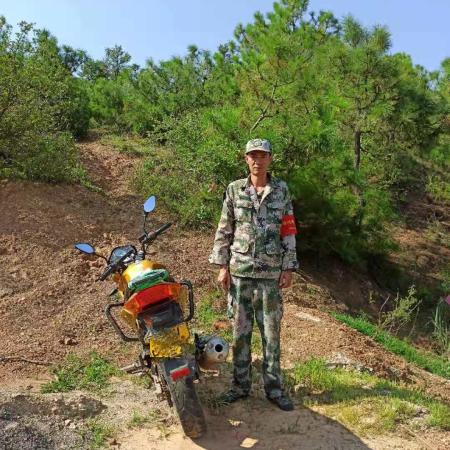
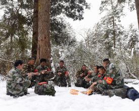
Hace cinco años, Wang Jianbo, de 31 años, se convirtió en guarda forestal ordinario del condado de Huili, en la prefectura de Liangshan. Todos los días se levanta temprano y forma un equipo de patrulla con sus colegas. Se adentra en el denso bosque hasta que regresa a casa. No sólo son un equipo de protección forestal, sino también de extinción de incendios. En los 80 km de patrulla, no sólo observan y registran la limpieza de los recursos naturales a lo largo del camino, sino que también encuentran riesgos de incendio y hacen frente a los incendios, especialmente en primavera cada año, El tiempo en Liangshan es seco y la temperatura es alta. Si no se tiene cuidado, una pequeña chispa puede provocar un incendio de bosques y praderas, ¡y las consecuencias son inimaginables!
En el pasado, todo el trabajo de prevención y extinción de incendios dependía de las personas, y la transmisión de información a menudo no era oportuna ni precisa, por lo que el mando de retaguardia y las operaciones en primera línea dependían de la experiencia y la suerte. En 2021, se desarrolló y puso en marcha el sistema de información inmediata de vigilancia de incendios forestales y de pastizales. Mediante la creación de un sistema digital integrado de "cielo, tierra y gente", se ha convertido en el cerebro inteligente y los ojos de la prevención y extinción de incendios forestales y de pastizales en la provincia de Sichuan.
Al igual que 140000 guardas forestales de la provincia, Wang Jianbo también instaló por primera vez el sistema en su teléfono móvil. En la madrugada del 19 de marzo, recibió una llamada del encargado del centro de control de prevención de incendios. El sistema detectó que había un foco de incendio en la aldea de Hailong, y le pidió que fuera a comprobarlo inmediatamente. Sin decir palabra, cogió la linterna y el teléfono móvil y se apresuró a salir por la puerta. Como el sistema había marcado con precisión la ubicación geográfica del foco de incendio, Wang Jianbo podía llegar a su destino con facilidad y precisión incluso en una noche tan oscura. Efectivamente, había un incendio, pero afortunadamente no era muy grande. Se alegró en secreto y, a continuación, grabó el vídeo in situ y lo subió al sistema. De acuerdo con la información facilitada por Wang Jianbo, la central informó inmediatamente al gobierno local para que organizara un equipo de lucha contra el fuego, y logró apagarlo antes de que fuera de color blanco. Con una sonrisa en su rostro cansado, Wang Jianbo dijo que sin este sistema, las montañas se quemarían por completo durante el día. Como nativo de Liangshan, se siente honrado de poder proteger las verdes montañas y la hierba de su ciudad natal.


