Spatial multi-criteria analysis for prioritizing landscapes for restoration
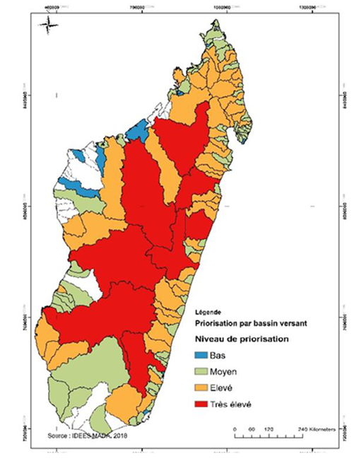
Prioritized watersheds for forest landscape restoration
GIZ Madagascar
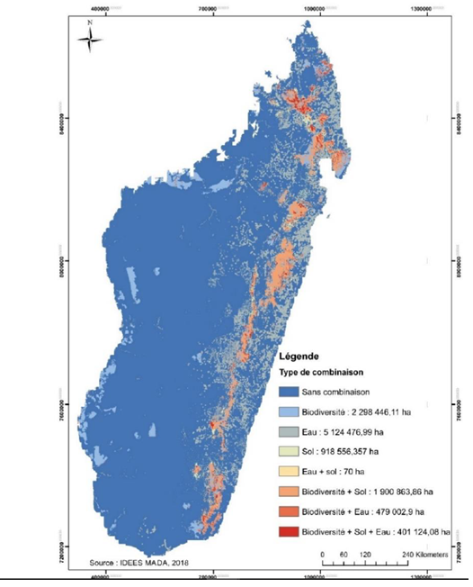
Prioritized areas based on ecosystem functions
GIZ Madagascar
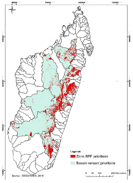
Prioritized areas within watersheds for forest landscape restoration
GIZ Madagascar
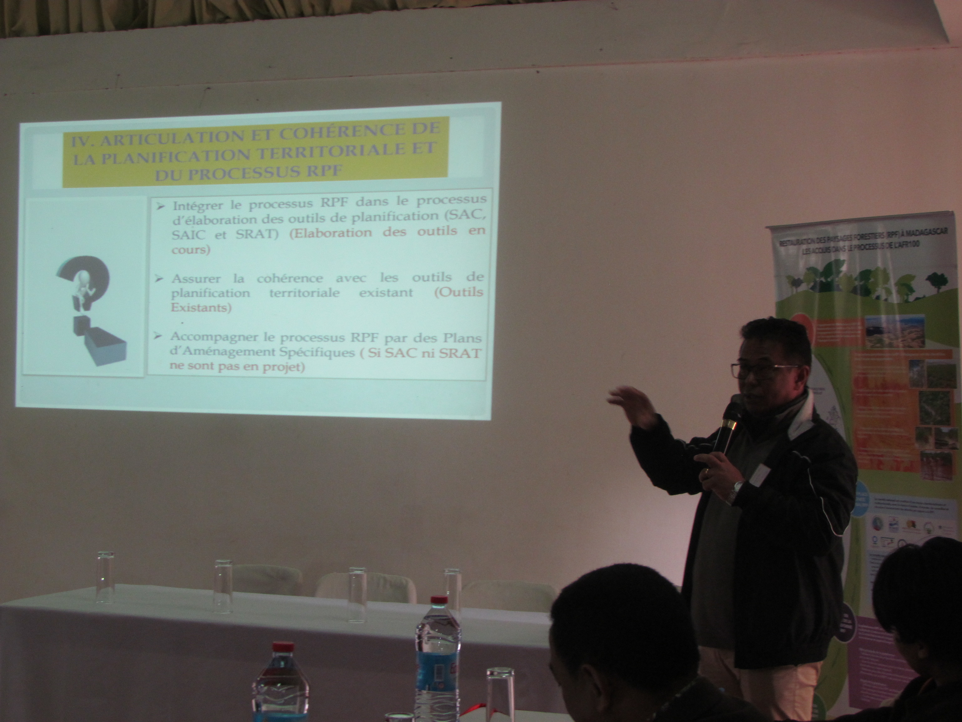
Discussion about spatialisation criteria for national FLR landscapes prioritization
GIZ PAGE
The approach focused on 3 essential ecosystem functions: water, biodiversity and soil. The following steps were used to define criteria for each group:
- Identification of ecosystem service relevant parameters and criteria (> 100 criteria)
- Pre-screening: spatialization of parameters at national, regional and local scale (41 spatially available criteria)
- Consultation: selection of final criteria based on 3 groups (water, biodiversity, soil) during group work, direct consultations; prioritization, indicator weighting and determination of criteria values (28 prioritzed criteria). Criteria examples: rainfall, hydrological resources, population density, land use, soil carbon and productivity
- Multicriteria analysis based on quantitative and qualitative values; preparation of 14 scenario maps, combining different groups (water, biodiversity and soil) with four priority levels; identification of priority area of 11,122,540 ha
- Verification of results based on data from the national restoration opportunities assessment method (ROAM) study and other sources
- Validation of results by the national FLR committee & platform and selection of 8 priority watersheds
- Existing policy and planning documents defining general FLR opportunities
- Analysis of financing options and opportunities for private sector engagement in FLR (completed 05/2017)
- FLR dialogue platform and high interest and mobilization of actors
- Moving from a forest ecosystem focused to an ecosystem approach at landscape level integrating erosion prevention and water provision
- Business as usual land use was not an option anymore as ecosystems were highly degraded
- Identifying 3 distinct ecosystem function groups (water, biodiversity, soil) helped stakeholders from different sectors and institutions to understand their own role and action space in this process
- Thorough consultation & involving 38 different organizations was key to prioritize restoration areas in a transparent and participatory manner and to create consensus on the final decision
- It was crucial to find a political consensus on the most balanced geographical distribution of priority areas of 4 M ha
- The process helped to install an official definition of catchment basins distinguishing 159 watersheds
- The process was very technical, but triggered an intensive political re-flection because a holistic landscape approach was used for planning and decision-making and revealed a huge potential for FLR.
- Decisions were also guided by the current policies in the energy and environmental sector to ensure coherence


