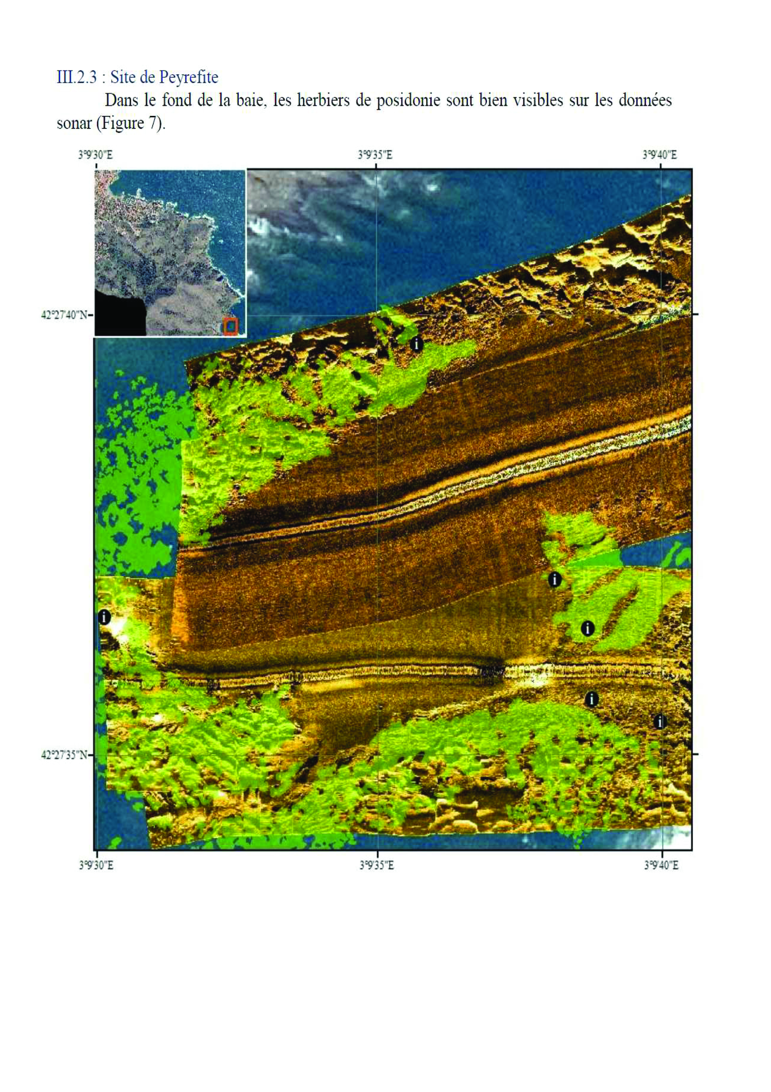

For several years now, numerous studies have been carried out on Posidonia meadows in the Reserve. Each study provided increasingly accurate results, but left a number of gaps. The Reserve decided to fill these gaps by simultaneously using several innovative systems, such as side scan sonar (SBL). This sonar provided an overview of the characteristics of the seabed. The integration of Acoustic Systems for Automatic Bottom Classification (SACLAF) data from previous missions into this project will have been a complementary means to the acoustic scanning imaging system, providing an element of data validity. The reliability of the results was assessed using GoPro® cameras. All data were processed using ArcGIS version 10.3 geographic data processing software.
Acoustic data were acquired using a C-MAX CM2 EDF side scan sonar and processed using Hypack 2012 software. In order to obtain the expected results, i.e. precise mapping of the Reserve's seagrass beds and a comparison of the evolution of the seagrass beds in relation to the last surveys, perfect knowledge of this equipment and of the study area is required.
- Regular exchange and sharing with service providers
- Competence of equipment users
- Ability to process data
- Realization of ground truth