
Radical Restoration: Democratizing Climate Tech for Ecosystem Recovery
Full Solution
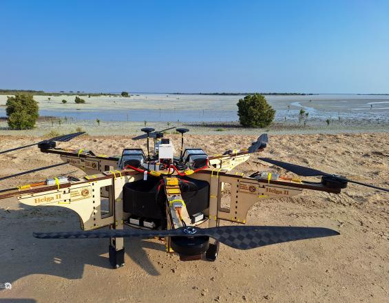
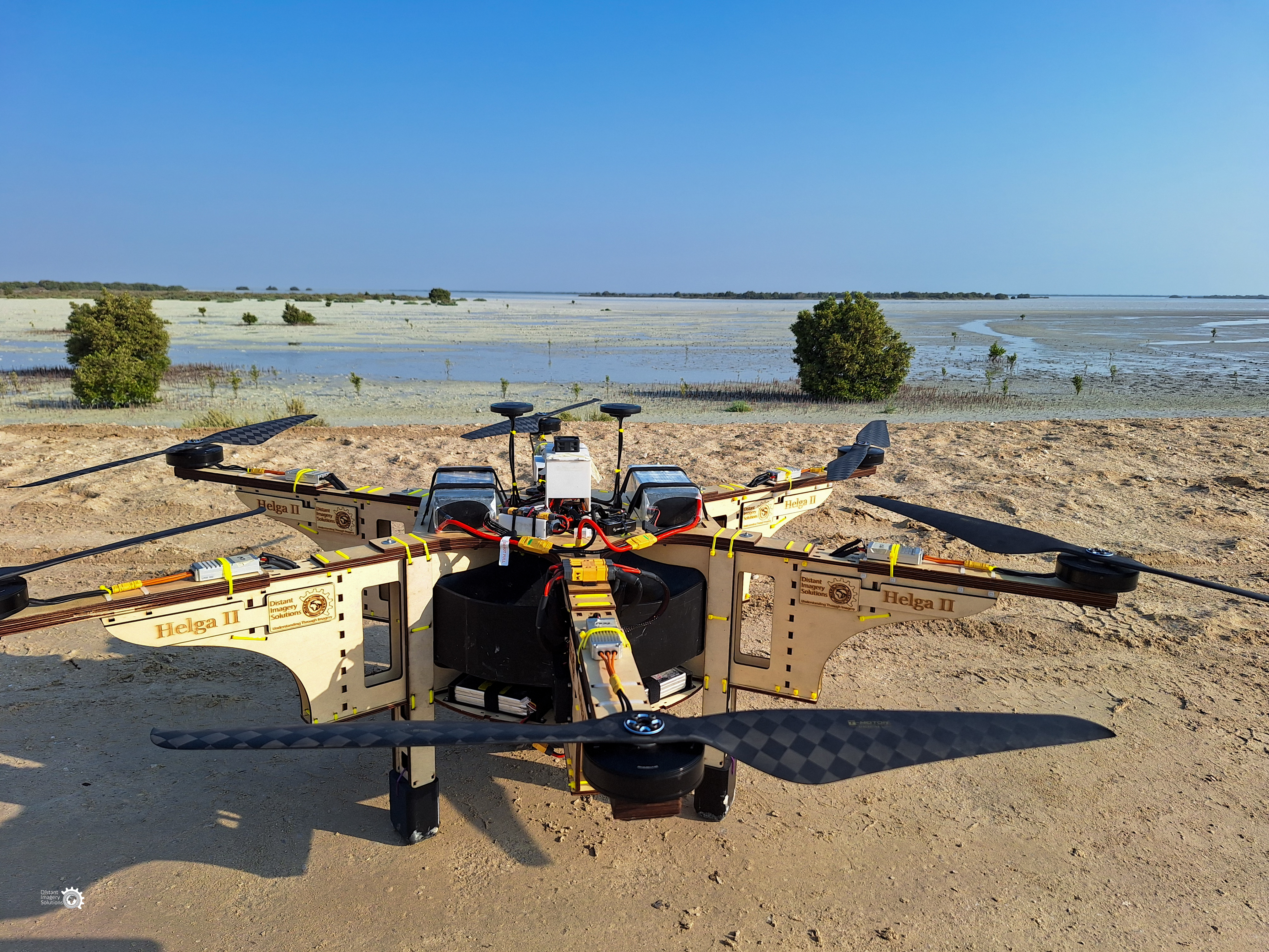
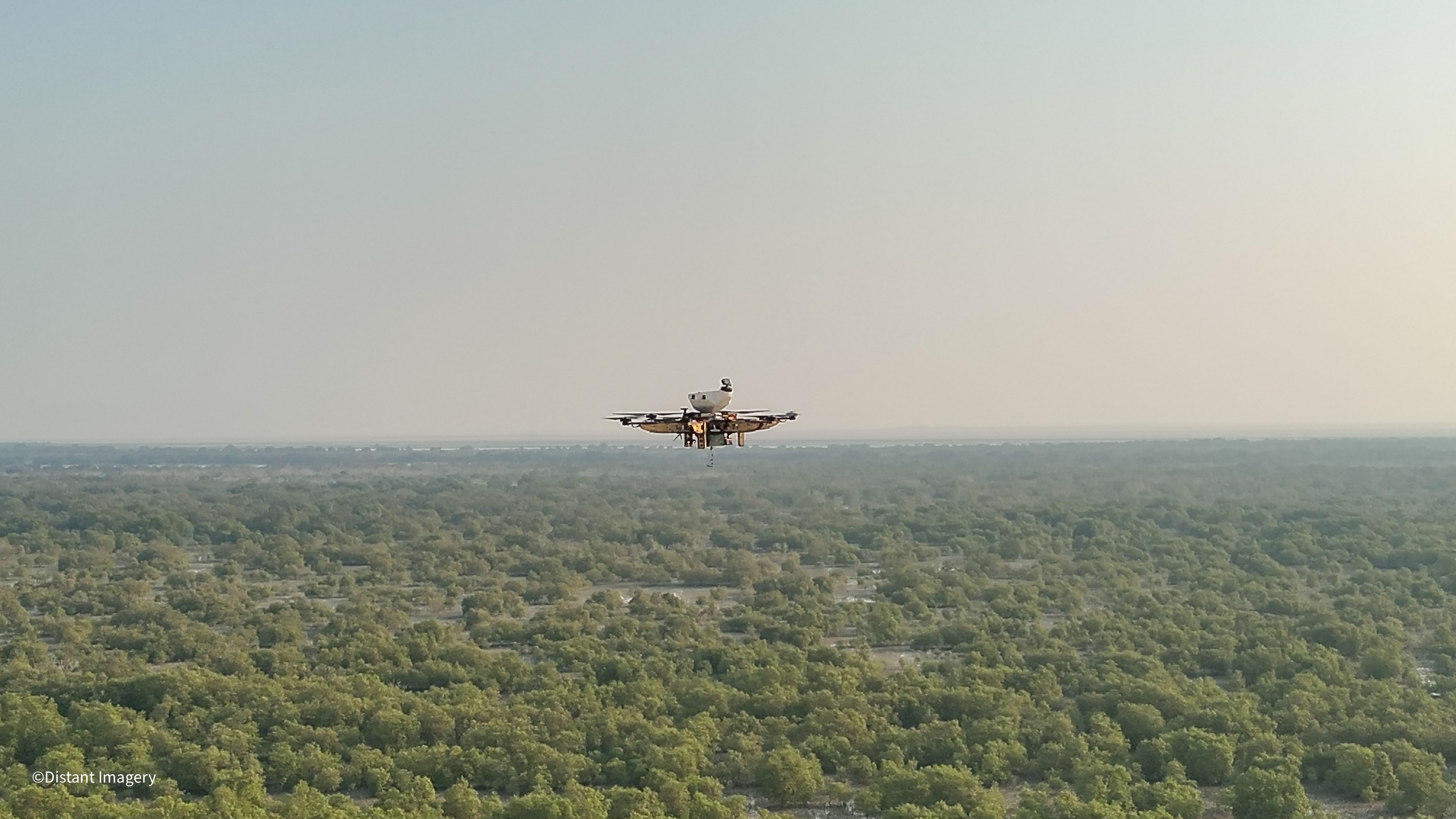
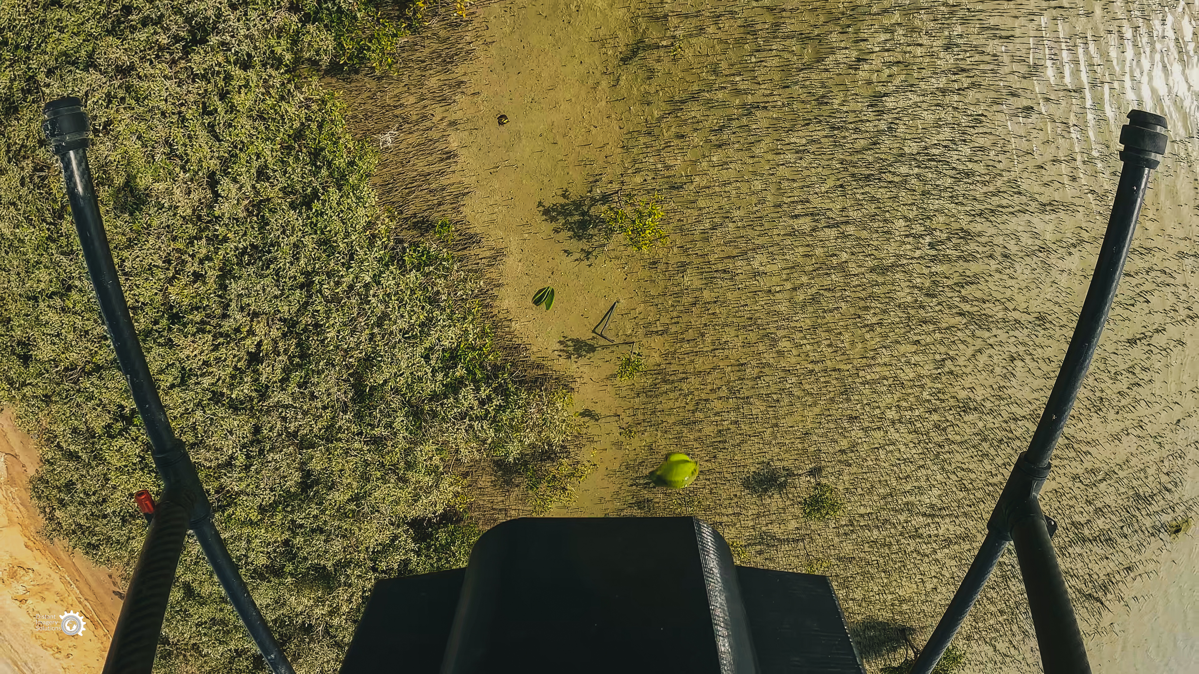
Our self engineered mangrove planting drones
Distant Imagery Solutions
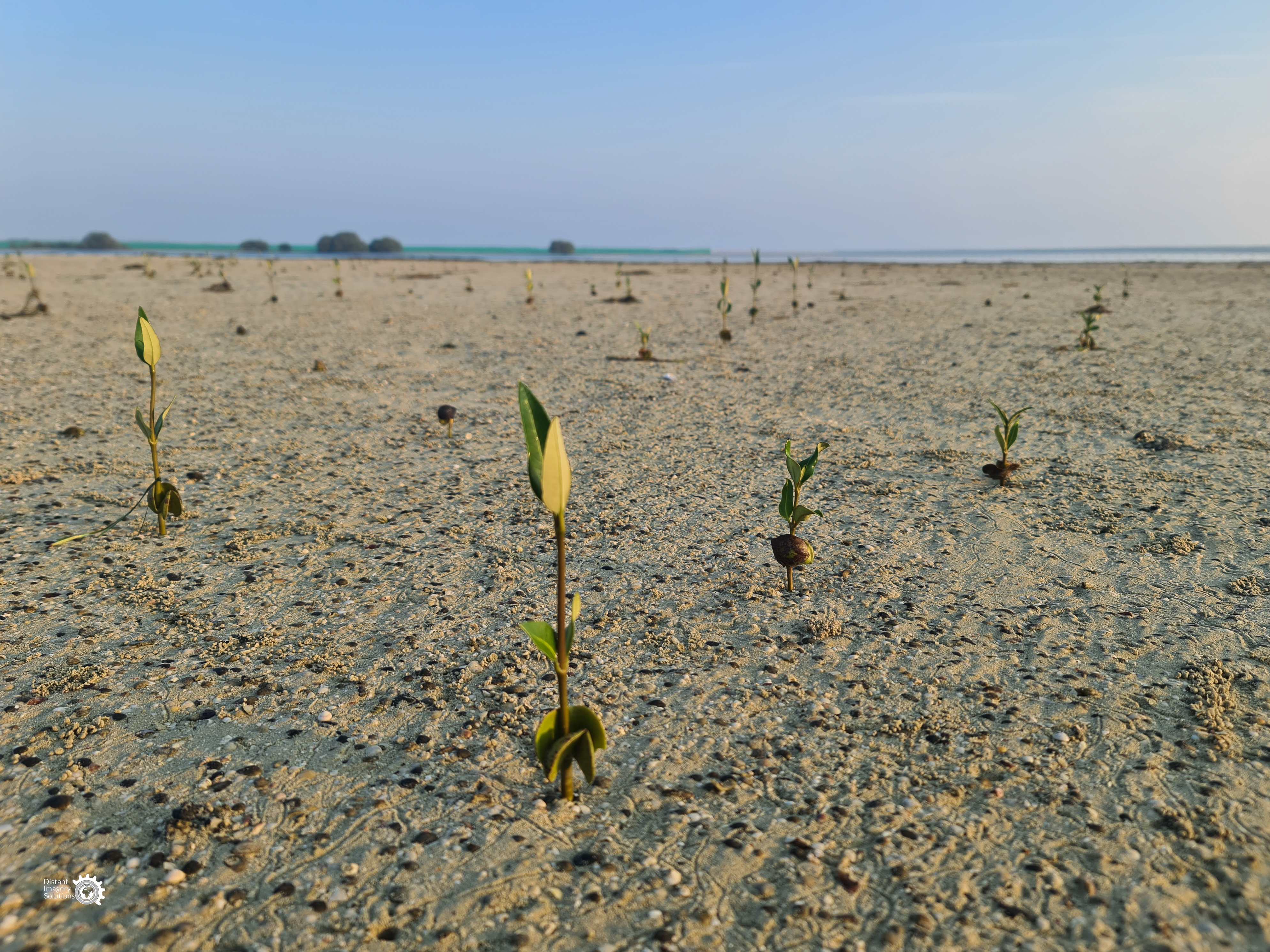
In 2024, Distant Imagery Solutions planted 5.5 million mangroves in the UAE using self-engineered wooden drones designed for simplicity, adaptability, and cost-effectiveness. This milestone redefines the potential of community-driven, ecosystem-based restoration.
With projects ready in Brazil, Tonga, Kenya, and Indonesia, Distant Imagery empowers communities to lead. Our licensing and training platform equips locals to build and operate drones, fostering global knowledge exchange.
More than a technological solution, this is a movement of shared empowerment and stewardship. By connecting communities, Distant Imagery creates a global network innovating together to restore ecosystems and build climate resilience.
Also, our AI-powered Monitoring, Reporting, and Verification (MRV) system tracks restoration progress and combats illegal activities, ensuring ecological recovery and long-term protection.
Last update: 14 Oct 2025
570 Views

Context
Challenges addressed
Degraded ecosystems such as mangroves face biodiversity collapse, reduced carbon storage, and growing vulnerability to climate threats like sea level rise. Our solution enables large scale, precision planting using modular drones, reducing costs and increasing impact. Because aviation laws differ widely, we adapt our deployment strategy country by country. In some locations, drone use requires advance flight permissions, site registration, or locally certified operators. To navigate this, we work directly with civil aviation and environmental authorities from the start of each project, supporting communities to complete applications, co-sign operational plans, and align activities with national environmental priorities. This flexibility ensures communities are never blocked from progressing, even in tightly regulated airspace, and helps embed long term local capacity regardless of national drone policy.
Location
Dubai, Dubai, United Arab Emirates
East and South Africa
Caribbean
Central America
South America
West Asia, Middle East
Southeast Asia
South Asia
East Asia
Oceania
Process
Summary of the process
Distant Imagery Solutions integrates modular drone technology, AI-powered monitoring, and community empowerment into a scalable system for ecological restoration. Our drones are designed for adaptability across varied terrains, while AI tools provide real-time insights for tracking restoration success and ecological health. Revenue is generated through a licensing platform where trained communities build, operate, and maintain their own drones, retaining 100% of the project revenue. This fosters ownership, skill building, and long-term financial sustainability.
Initial deployments are supported through joint project financing secured by Distant Imagery and local partners, blending philanthropic grants, public sector contributions, and early-stage restoration contracts. As capacity grows, each community defines its own continued revenue model, whether through carbon markets, ecological surveillance, biodiversity monitoring, restoration services, or environmental data licensing, depending on local needs and priorities. The project supports them in developing and managing these models independently. Our financing strategy includes partnerships with carbon credit investors, conservation-aligned companies, and public agencies to ensure lasti
Building Blocks
Modular Drone Technology
Our modular drones are designed for accessibility, adaptability, and sustainability. Initially crafted using wooden components with fewer than six screws and zip ties, they are simple to assemble, repair, and replicate using local materials, empowering communities to lead restoration projects independently.
As we’ve advanced, we’ve integrated hydrogen fuel cells and hybrid-electric propulsion systems, enhancing flight endurance, energy efficiency, and environmental sustainability. These innovations enable drones to cover larger areas and operate in remote environments while reducing their carbon footprint.
The modular design ensures flexibility for continuous adaptation, allowing communities to upgrade drones with tools like cameras or sensors for monitoring. This approach combines simplicity and cutting-edge innovation, bridging grassroots empowerment with scalable, impactful environmental restoration.
Licensing and Training Platform
Our licensing and training platform equips communities to independently build, operate, and maintain drones. This approach is hands-on and collaborative, fostering local expertise and enabling communities to adapt the technology to their unique needs. The platform goes beyond technical skills, creating a foundation for communities to innovate and modify drones for additional applications such as surveillance, mapping, and precision agriculture. Importantly, the platform fosters a feedback loop where communities share their innovations, enriching the broader global network of users.
AI-Powered Monitoring, Reporting, and Verification (MRV) System
Restoration is not just about planting—it’s about ensuring long-term impact. Our AI-powered MRV system provides real-time tracking of restoration progress and environmental health. It also addresses critical issues like illegal fishing, poaching, and deforestation, empowering communities to protect their restored ecosystems. This system integrates satellite data, drone imagery, and AI analytics to provide actionable insights, which can be adapted to other restoration or conservation efforts. It also supports transparency and accountability, ensuring stakeholders can measure progress and outcomes effectively.
Cost-Effective Restoration Processes
One of the biggest barriers to large-scale restoration is cost. Our solution eliminates the need for costly nurseries and reduces labor-intensive efforts, enabling efficient large-scale planting. The drones can plant up to 2,000 seeds in under 10 minutes, drastically reducing time and labor costs. This affordability makes restoration feasible for low-income regions and opens up opportunities for scaling in areas previously deemed inaccessible. The process is adaptable to other restoration challenges, such as reforestation or agricultural regeneration, making it versatile across multiple applications.
Impacts
Distant Imagery Solutions contributes to GBF Targets 2, 8, 9, 10, 19, and 21 through scalable drone restoration, AI monitoring, and community empowerment. We have planted over 9 million mangroves to date, including 5.5 million in 2024, with a survival rate of over 98 percent. This supports habitat recovery, carbon storage, and biodiversity protection. Our AI system tracks vegetation health and species data, ensuring adaptive and measurable outcomes.
We address Target 8 by reducing climate risks through coastal restoration, and Target 21 by training communities to build, operate, and maintain drone systems. Our licensing model enables knowledge sharing and local ownership. In Brazil, Tonga, Kenya, and Indonesia, women and Indigenous groups are leading restoration using our tools.
Our drones operate at one-fifth the cost of alternatives, meeting Target 10 by making sustainable land management accessible. We also support Target 19 by enabling access to carbon markets, linking restoration with income. Our work adds value by solving key cost and monitoring gaps in global restoration efforts, combining innovation with community-driven impact.
Beneficiaries
Local communities will gain skills, livelihoods, and revenue through licensing and carbon markets. Ecosystems and biodiversity thrive, while governments achieve climate goals with scalable, cost-effective solutions, delivering environmental, social, and econo
Additionally, explain the scalability potential of your Solution. Can it be replicated or expanded to other regions or ecosystem?
Our modular drones and AI tools are adaptable to diverse terrains and ecosystems. Paired with community training and licensing, this solution can scale globally, empowering local communities to restore ecosystems, foster biodiversity, and combat climate change across regions.
Global Biodiversity Framework (GBF)
GBF Target 2 – Restore 30% of all Degraded Ecosystems
GBF Target 8 – Minimize the Impacts of Climate Change on Biodiversity and Build Resilience
GBF Target 11 – Restore, Maintain and Enhance Nature’s Contributions to People
GBF Target 20 – Strengthen Capacity-Building, Technology Transfer, and Scientific and Technical Cooperation for Biodiversity
GBF Target 22 – Ensure Participation in Decision-Making and Access to Justice and Information Related to Biodiversity for all
Sustainable Development Goals
SDG 8 – Decent work and economic growth
SDG 13 – Climate action
SDG 14 – Life below water
SDG 15 – Life on land
SDG 17 – Partnerships for the goals
Story

Jane and Cory Co Founders Distant Imagery
DIS
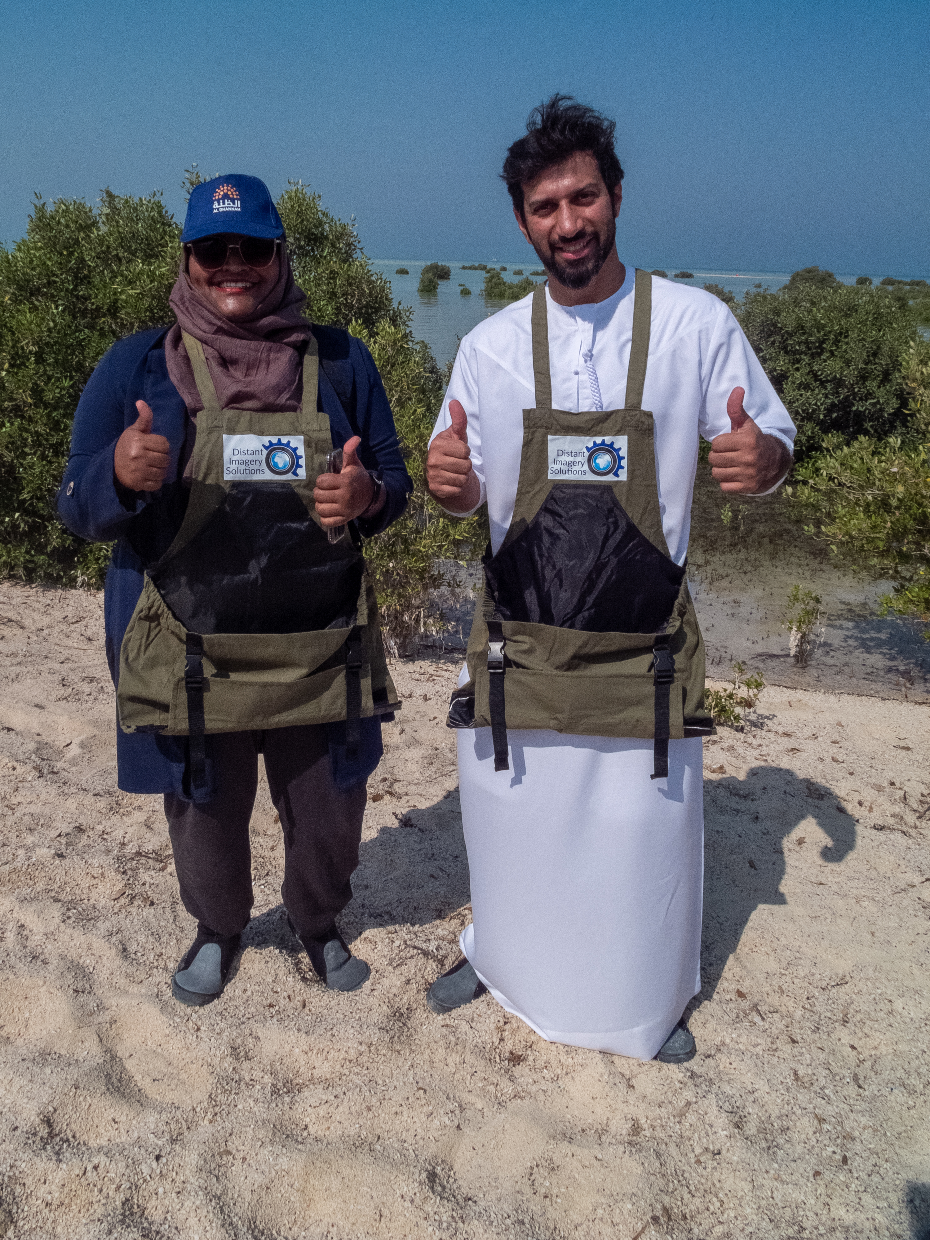
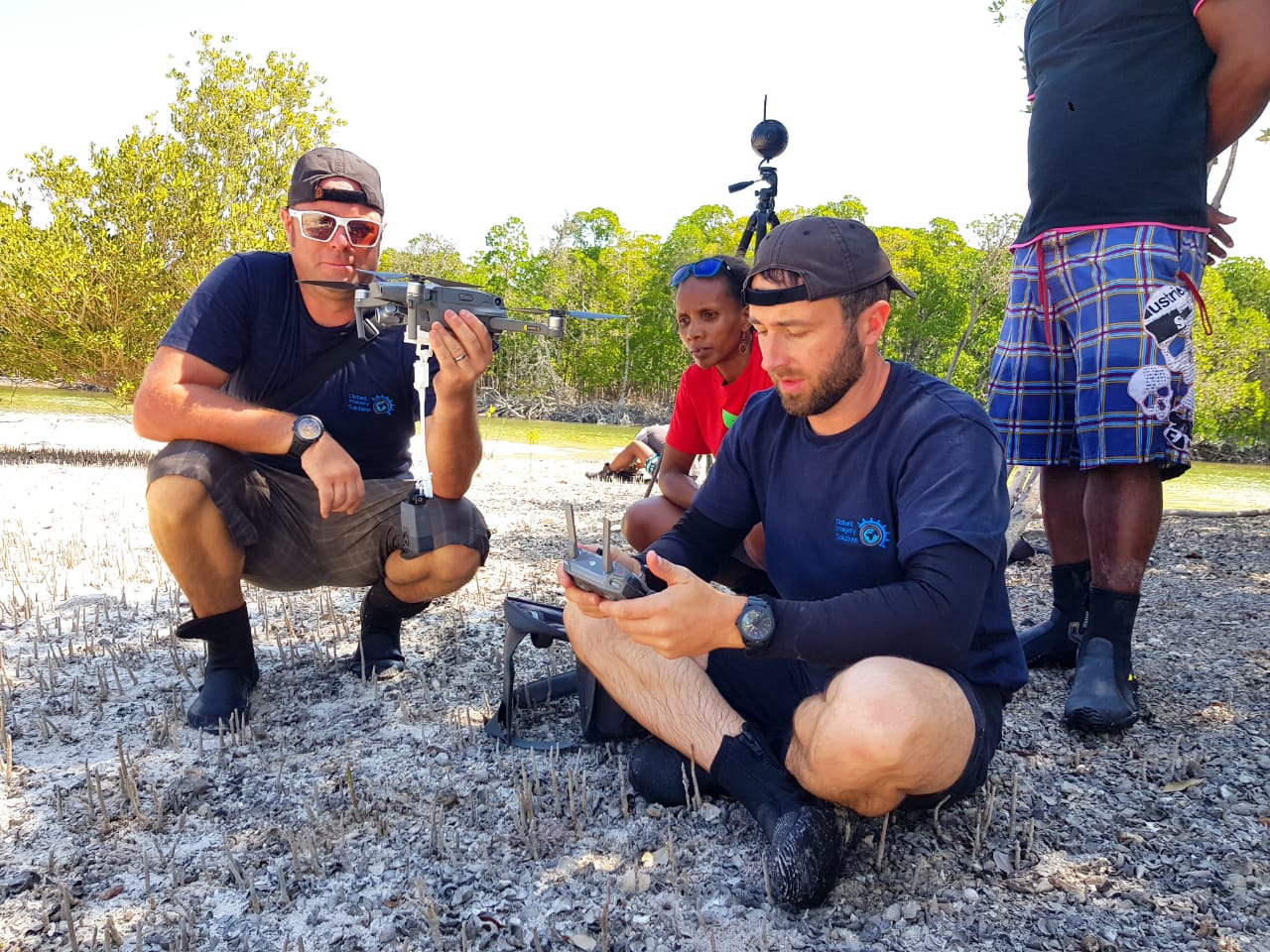
Cory and I founded Distant Imagery Solutions because we couldn’t stand by and watch ecosystems and communities suffer from the lack of accessible restoration solutions. Cory’s practical experience in helicopter engineering and my years working with conservation data showed us how technology could bridge the gap. But the real turning point came when communities started reaching out, asking for tools that could help them restore their ecosystems on their terms.
In Kenya, a coastal village approached us after seeing the success of our drones elsewhere. They wanted to save their mangroves and access carbon markets to secure their future livelihoods. We’re now designing a project tailored to their specific needs, ensuring the tools are easy to maintain and use locally. In Brazil, Indigenous leaders contacted us to restore traditional plant habitats while safeguarding biodiversity. In Tonga, communities wanted to map flood-prone areas to plan agriculture alongside restoration, while in Indonesia, villages sought help to protect mangroves critical to withstanding rising seas.
These communities are shaping the projects with us. They know the challenges, and we’re here to provide the tools, training, and support to make restoration scalable, empowering them to lead the change they envision. Their determination is why we do what we do—and why we believe this model can truly make a difference.