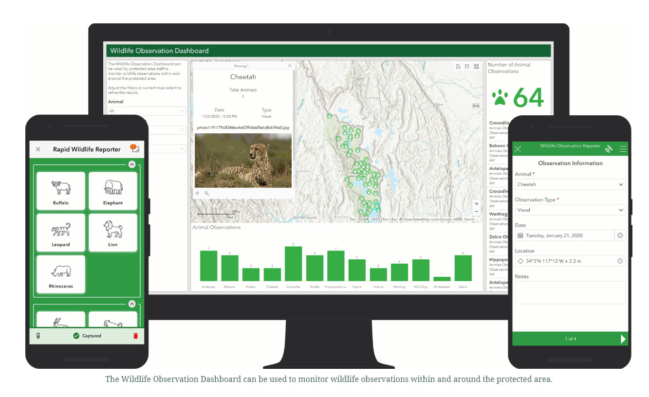

ArcGIS Online proporciona un marco seguro y flexible tanto para desplegar aplicaciones útiles como para integrar otras tecnologías de conservación con el fin de apoyar de forma holística los flujos de trabajo relacionados con cada iniciativa que esté llevando a cabo un área protegida. La base de todos los flujos de trabajo incluye herramientas para la recopilación de datos, como formularios de encuestas móviles (Survey123), visualización de datos (cuadros de mando o aplicaciones web), análisis e informes. Además, el ArcGIS Living Atlas of the World le da acceso a la principal colección de información geográfica de todo el mundo para apoyar sus flujos de trabajo, lo que incluye las últimas imágenes de satélite y productos como la pérdida de bosques.
Hay varios flujos de trabajo preconfigurados para iniciativas que se pueden desempaquetar y aplicar inmediatamente. Estas iniciativas incluyen:
- Seguimiento de la actividad ilegal.
- Supervisar la vida salvaje.
- Mitigar conflictos con la fauna.
- Mantenimiento de la infraestructura del parque.
Los flujos de trabajo son configurables y permiten a los usuarios personalizarlos en función de sus necesidades. Alternativamente, las organizaciones tienen acceso a todos los componentes necesarios para desarrollar flujos de trabajo completamente nuevos para sus propias iniciativas, por ejemplo, iniciativas de divulgación comunitaria o de participación pública.
- Escuche a los profesionales de primera línea y colabore con ellos para comprender el problema y definir los requisitos antes de diseñar e implantar el flujo de trabajo.
- Hay varias aplicaciones configurables disponibles en ArcGIS Online, entender cómo funcionan y cómo pueden vincularse entre sí es crucial para desarrollar flujos de trabajo eficaces.
- Siga la estrategia de diseño, implantación, funcionamiento y revisión para desarrollar un flujo de trabajo y maximizar su impacto.
- Cree prototipos y pruébelos antes de implantarlos.
- Establezca procedimientos y directrices esenciales.
- Siga las mejores prácticas y tendencias.
- La experiencia en ArcGIS es muy beneficiosa; si no, recurra a socios de implantación para que el proceso sea más fácil y eficaz.
- Aproveche la comunidad ArcGIS y los recursos de formación en línea.