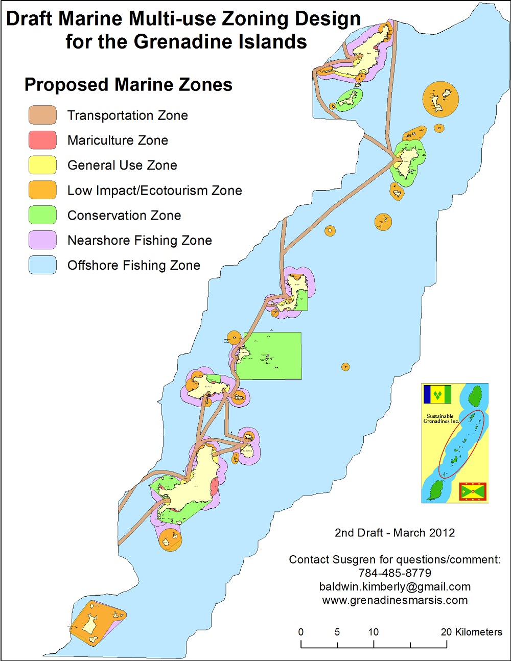

A guided marine spatial planning exercise leads to the development of a multi-use zoning design for the area. This increases the capacity to protect, manage and sustainably use the marine resources. Potential mismatches between the area’s existing jurisdictional (legal-institutional) and geographical (social-ecological) scales requires consideration.
- Pre-existing cross-scale partnerships (i.e. multi-stakeholder working group) and stakeholder engagement mechanisms for communication and information exchange
- Academic-NGO partnership to address the mismatch between the existing jurisdictional (legal-institutional) scale and the geographical (social-ecological) scale
- Collaborative data collection & validation processes supported trust and ownership in MSP information
GIS analyses were useful to determine the spatial allocation of the sea in a way that maximizes societal benefits and mitigates possible conflicts. Although the system was used to support transboundary MSP, inadequate sub-regional governance mechanisms constrain the implementa¬tion of the marine zoning plan by either country. Although framework legislation and national environmental management strategies are in place, formal institutional systems for national and transboundary marine management need to be clearly established. The realisation of effective transboundary cooperation and regional governance is needed to determine the appropriate and feasible institutional arrangements. Likewise, the fostering of environmental political will is essential for the development and implementation of new environmental management policies, plans and institutions.