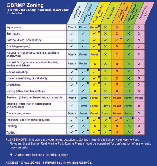


In some parts of the world, zoning is based solely around allowing, or prohibiting, specific activities in specific areas. In the GBR a spectrum of zones exists, each with differing zone objectives; these zones allow a range of activities to occur provided each activity complies with the relevant zone objective. The provisions of the Zoning Plan apply to all users in the GBR. The Zoning Plan sets out in detail two specific lists of ‘use or entry’ provisions for each zone; these help determine the types of activities that are appropriate in that particular zone. 1. The first list indicates activities that are allowed to occur in that zone (‘as of right’) and which do not require a permit; 2. The second list stipulates which activities may occur in that particular zone but only after a permit has been assessed and, if the application meets all the necessary requirements, a permit has been granted. The regulations specify the assessment process and criteria for a permit; these vary depending on the proposed activity. Some zones may also stipulate restrictions on types of fishing gear which also provides differing levels of protection. If an activity is not listed in either (1) or (2) above, it is prohibited in that zone.
The 1975 legislation specified that a plan depicting spatially derived zones (i.e. zoning) was to be a key management tool for the GBR Marine Park, and zoning plans were required by the legislation to define the purposes for which certain areas may be used or entered. The objectives of zoning have ‘evolved’ since the 1975 version of the Act (refer Day 2015) recognizing a need today to protect the full range of the biodiversity of the GBR rather than just keystone species or habitats.
- To assist public understanding, the allowable activities in the Zoning Plan have been summarized into a simple activity/zoning matrix (see Photos below). However, the statutory Zoning Plan (i.e. subordinate legislation under the Act) must be the legal basis for determining which activities are appropriate in a zone.
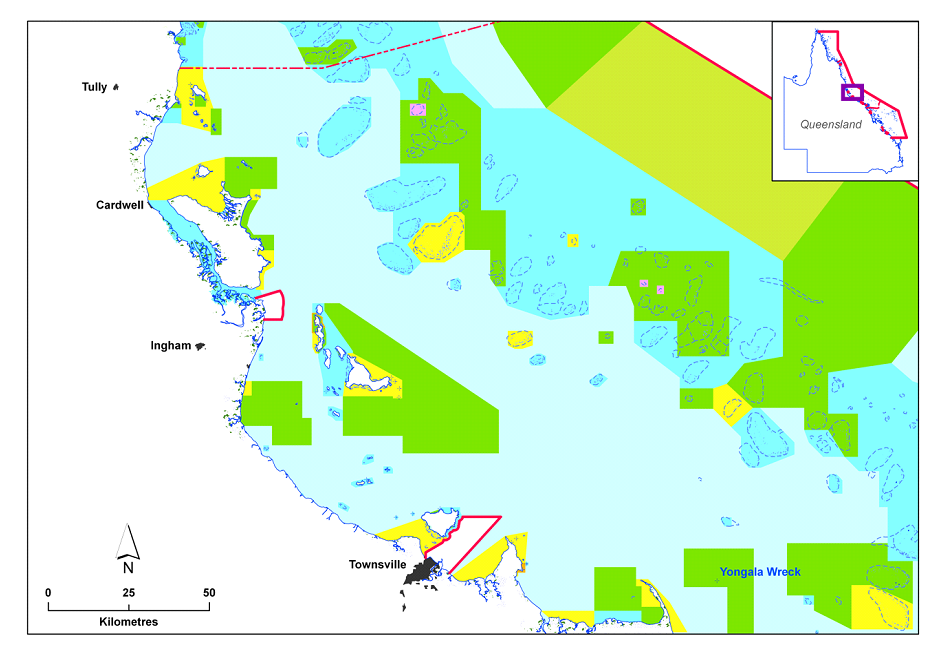
- Zoning maps are a publicly-available form of the statutory Zoning Plan; however, to legally determine exactly where a zone boundary occurs, the actual zone descriptions detailed in the back of the statutory Zoning Plan must be used.
- Just because the Zoning Plan states an activity is able to occur with a permit, it does not automatically mean a permit will always be granted; the application still needs to be assessed and only if it meets all the necessary criteria, is a permit granted.