
Tech-Driven Coexistence: Integrating "Sky & Ground" Monitoring and Early Warning to Mitigate Human-Elephant Conflict in Yunnan, China
Full Solution

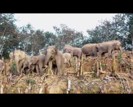
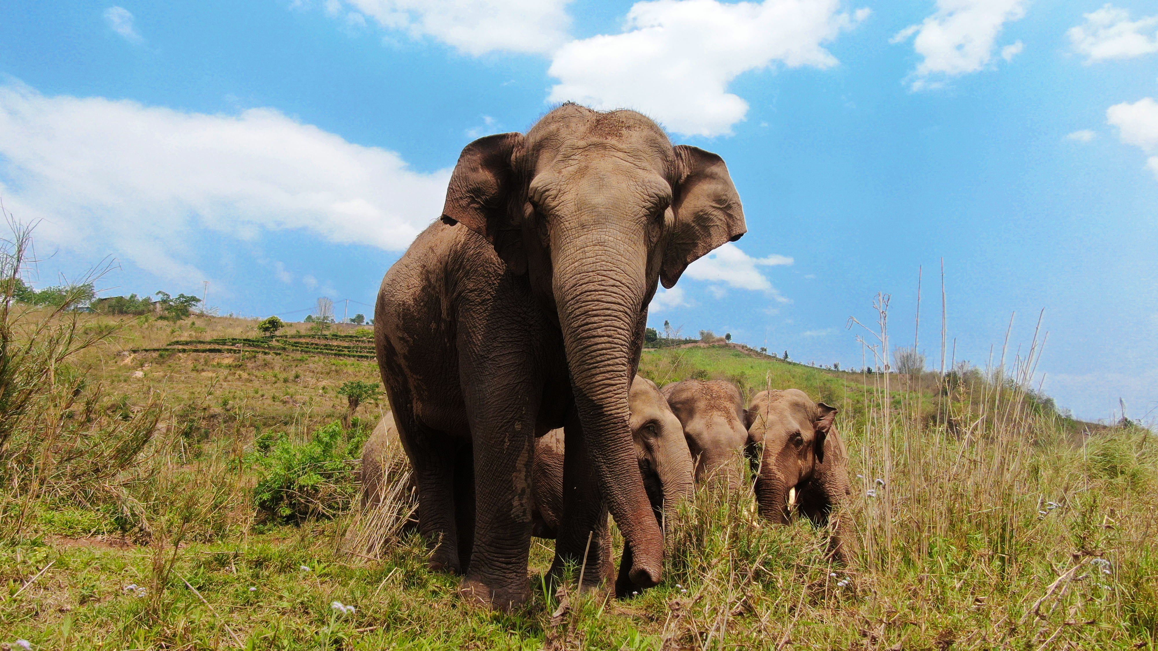
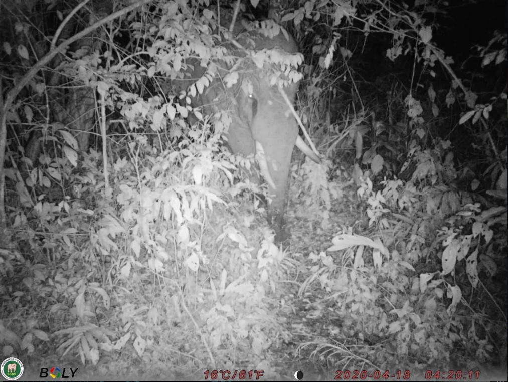
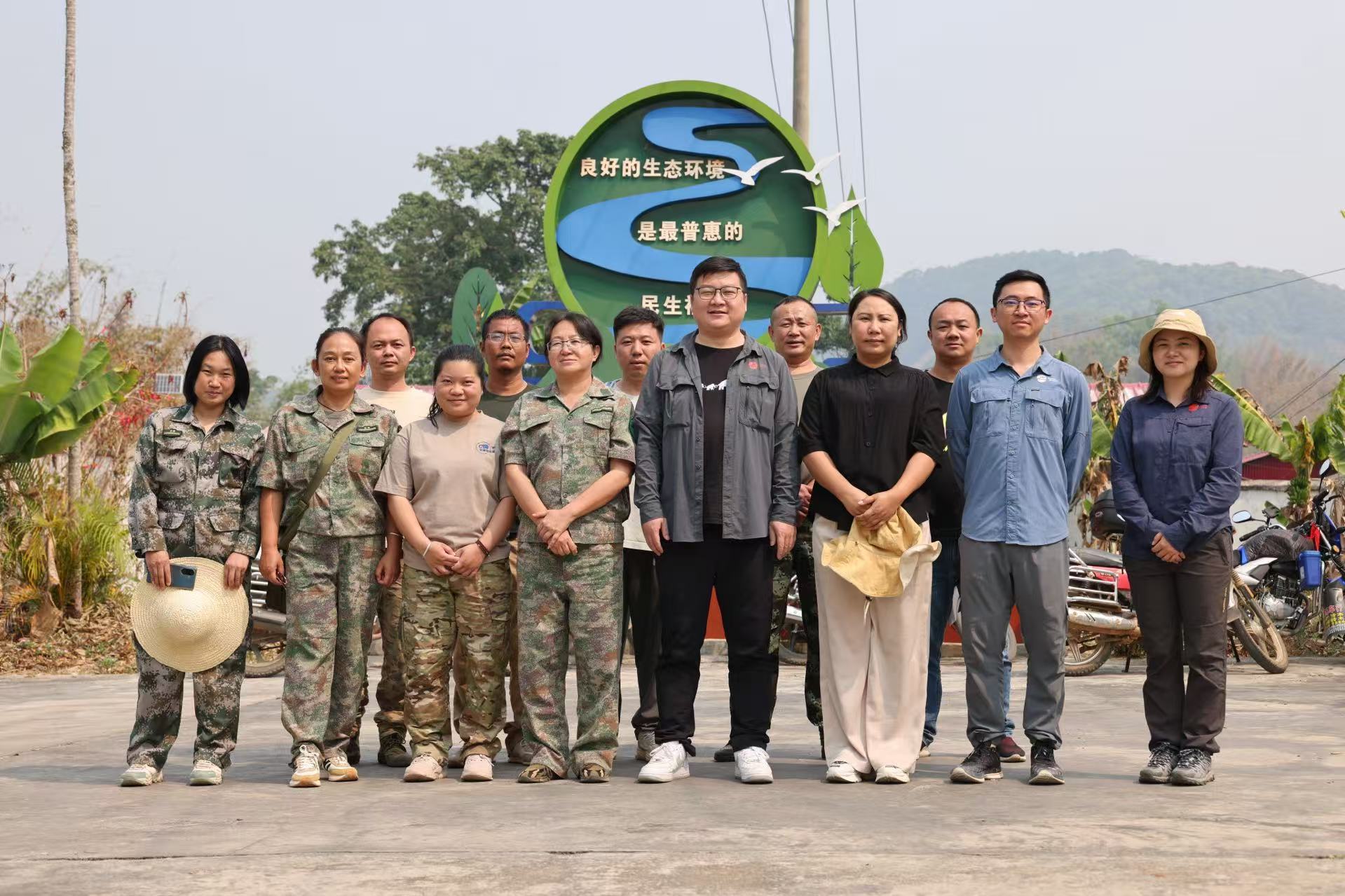
Asian elephants photographed by drone monitoring
SSPI & Zhenghao Monitoring Technology Co.
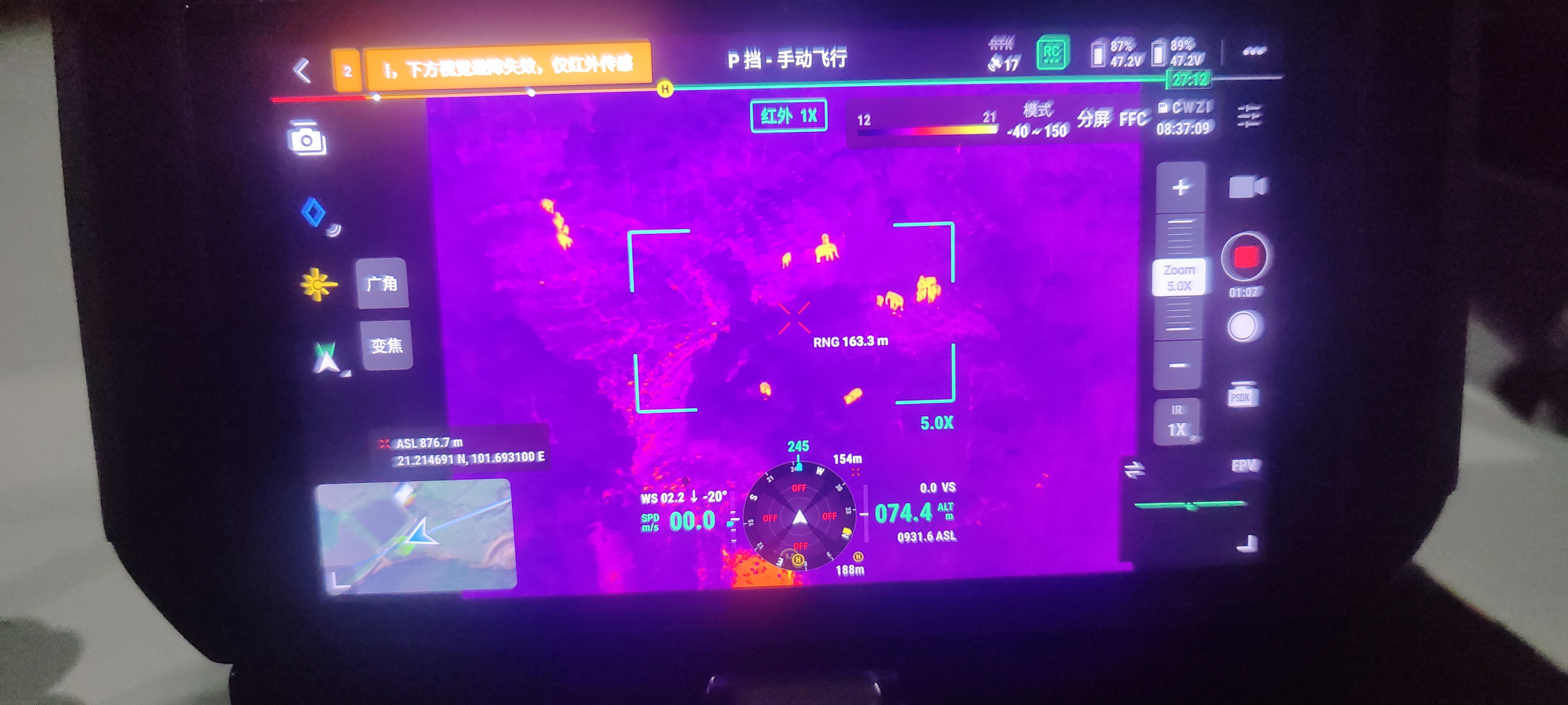
The Asian elephant remains endangered due to poaching, habitat loss, and growing human-elephant conflict—one of the most pressing conservation challenges globally. In response, our team developed an integrated monitoring and early warning system that combines aerial drones with ground-based infrared cameras. This “sky & ground” network ensures real-time, full-time, and large-scale coverage of elephant activity across Yunnan Province. Drones use thermal imaging and zoom to detect elephants even at night, while 600 infrared cameras enable 24/7 data capture with real-time alerts.
Supported by China’s national and provincial forestry departments, the project trains local youth as monitors and forms community teams. Over 130,000 early warnings have been issued, helping reduce human-elephant conflict and improving safety.
It contributes to GBF Targets A, B, and 1, 4, 20, 21. It strengthens biodiversity protection, enhances community engagement, and offers a scalable model for coexistence.
Last update: 31 Oct 2025
353 Views


Context
Challenges addressed
1.Real-Time Monitoring of Asian Elephants: Human-elephant encounters are the main cause of conflicts, including injuries and fatalities. Yunnan’s dense forests create significant monitoring challenges. Accurate, timely monitoring is essential for issuing rapid warnings to reduce direct encounters, but real-time tracking and warnings remain difficult.
2.Challenges in Receiving Warning Information: Delivering early warnings to communities in elephant-affected areas is critical to reducing conflicts. However, groups like farmers, migrant workers, isolated households, the elderly, and disabled face mobility issues or barriers to receiving information, limiting the system’s effectiveness.
3.Economic Challenges: Monitoring aims to encourage avoidance of elephants, protecting lives. However, elephants' presence in agricultural areas disrupts livelihoods. While direct damages are measurable, indirect losses like farming delays are harder to quantify, posing a major challenge to implementation.
Location
Xishuangbanna Dai Autonomous Prefecture, Yunnan, People's Republic of China
East Asia
Process
Summary of the process
The building blocks of this solution are implemented in a logical sequence. Monitoring team development and technology selection are based on years of field experience in tracking Asian elephants. These components lay the groundwork for integrating drone and infrared monitoring, which in turn supports the establishment of the early warning platform and the optimization of the intelligent recognition system. Early warning messages are then synchronized with a mobile app and disseminated at the village level through smart broadcasting and direct outreach. Each component builds upon the previous one, forming a cohesive and adaptive system that maximizes early warning coverage, improves local safety, and helps reduce human-elephant conflict.
Building Blocks
Module 1: Monitoring Coordination and Technology Integration
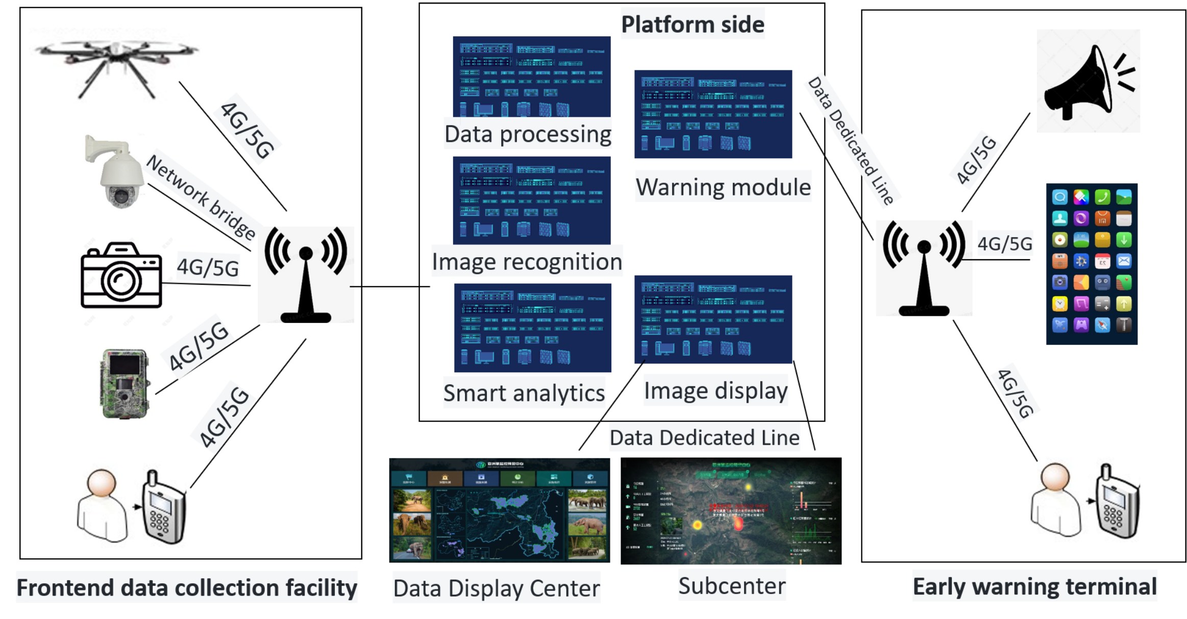
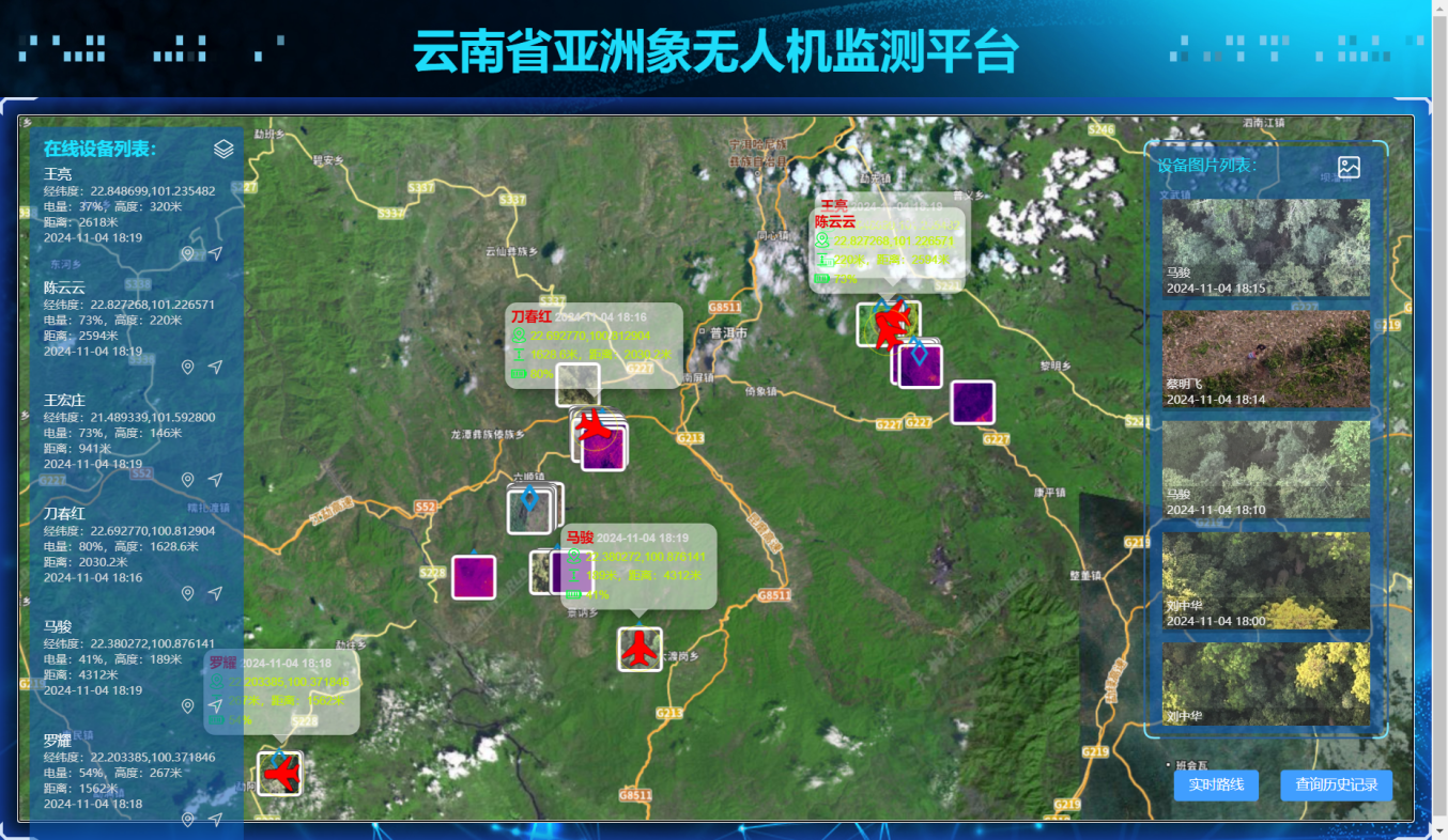
Effective monitoring relies on well-structured teams with clear responsibilities and close coordination. Based on elephant distribution, the project has built specialized drone monitoring teams following a “one herd, one strategy” approach, and established village-based monitoring groups in key areas. Drone teams track elephant activity with precision, while local teams provide on-the-ground support. This dual system—“follow the elephants” and “local presence”—covers over 95% of the wild elephant population (the remaining 5% are within protected areas). In areas where drones cannot operate, infrared cameras are used for 24/7 coverage. By combining aerial and ground technologies, the system has overcome challenges of nighttime and forest-area monitoring.
The system’s success depends on local personnel. Most monitors are young people from local communities who have received training in drone operation, field tracking, and warning communication. This approach not only improves local skills, but also enhances public awareness and engagement. It contributes directly to GBF Targets 20 and 21 by building community monitoring capacity and encouraging participation.
Enabling factors
- The high demand for monitoring and early warning in elephant-affected regions increased the willingness of individuals to join monitoring teams.
- The suitability of drones and infrared cameras for monitoring large terrestrial animals, combined with features like thermal imaging, automatic triggers, and wireless data transmission, made it feasible to track the nocturnal activity patterns of Asian elephants and ensure real-time transmission and automated recognition.
- Local youth showed strong enthusiasm for participating in the project and were highly motivated to contribute to the protection of their home communities.
Lesson learned
- Thermal imaging is highly effective for nighttime monitoring, but regular maintenance of equipment is essential to ensure performance under extreme weather conditions.
- Infrared camera deployment locations must be optimized to ensure stable network coverage and reliable data transmission.
- A stable funding source is needed to support the engagement of full-time personnel.
Module 2: Drone and Infrared Camera Monitoring System
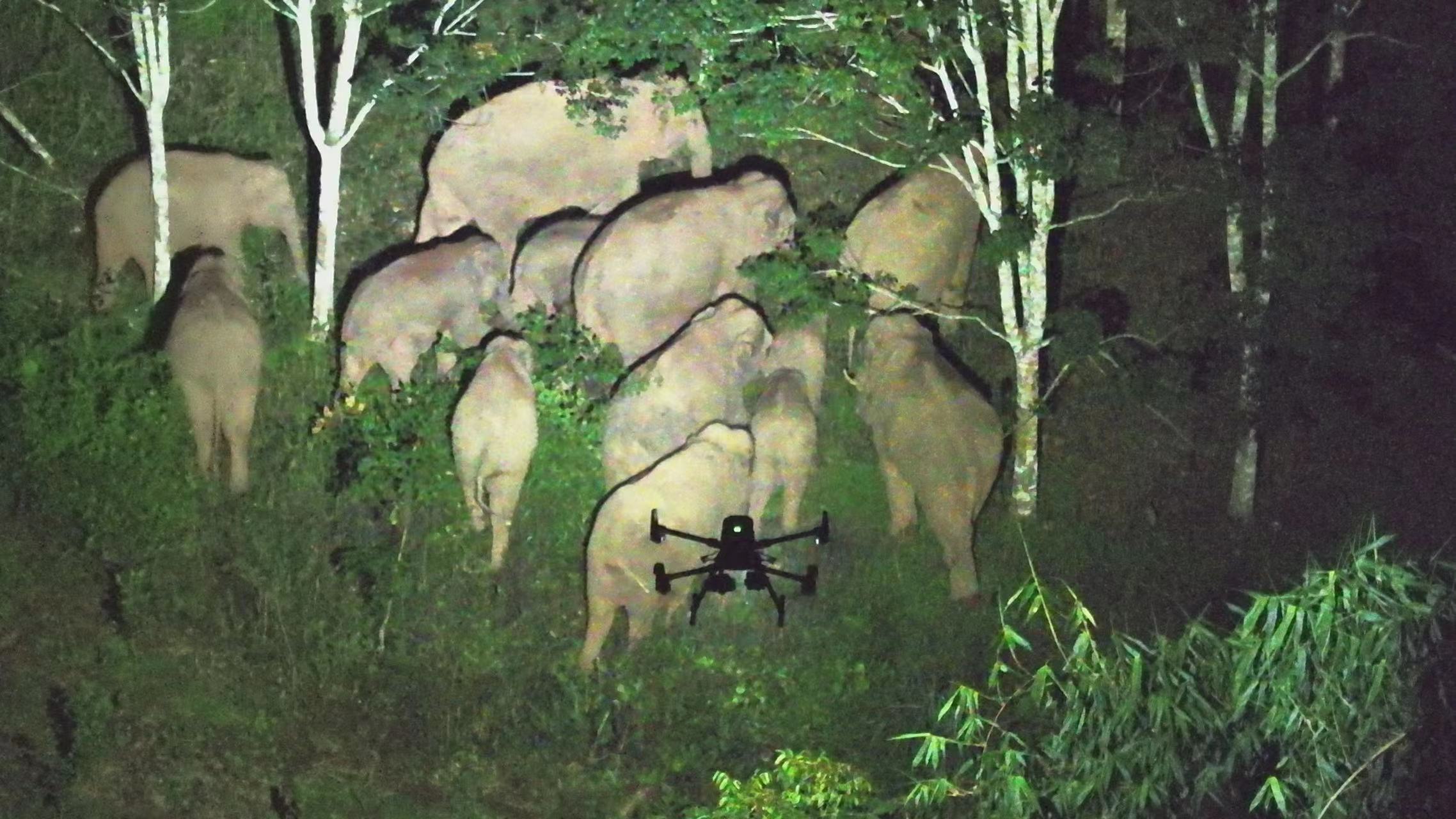
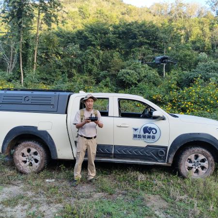
- Drone Monitoring
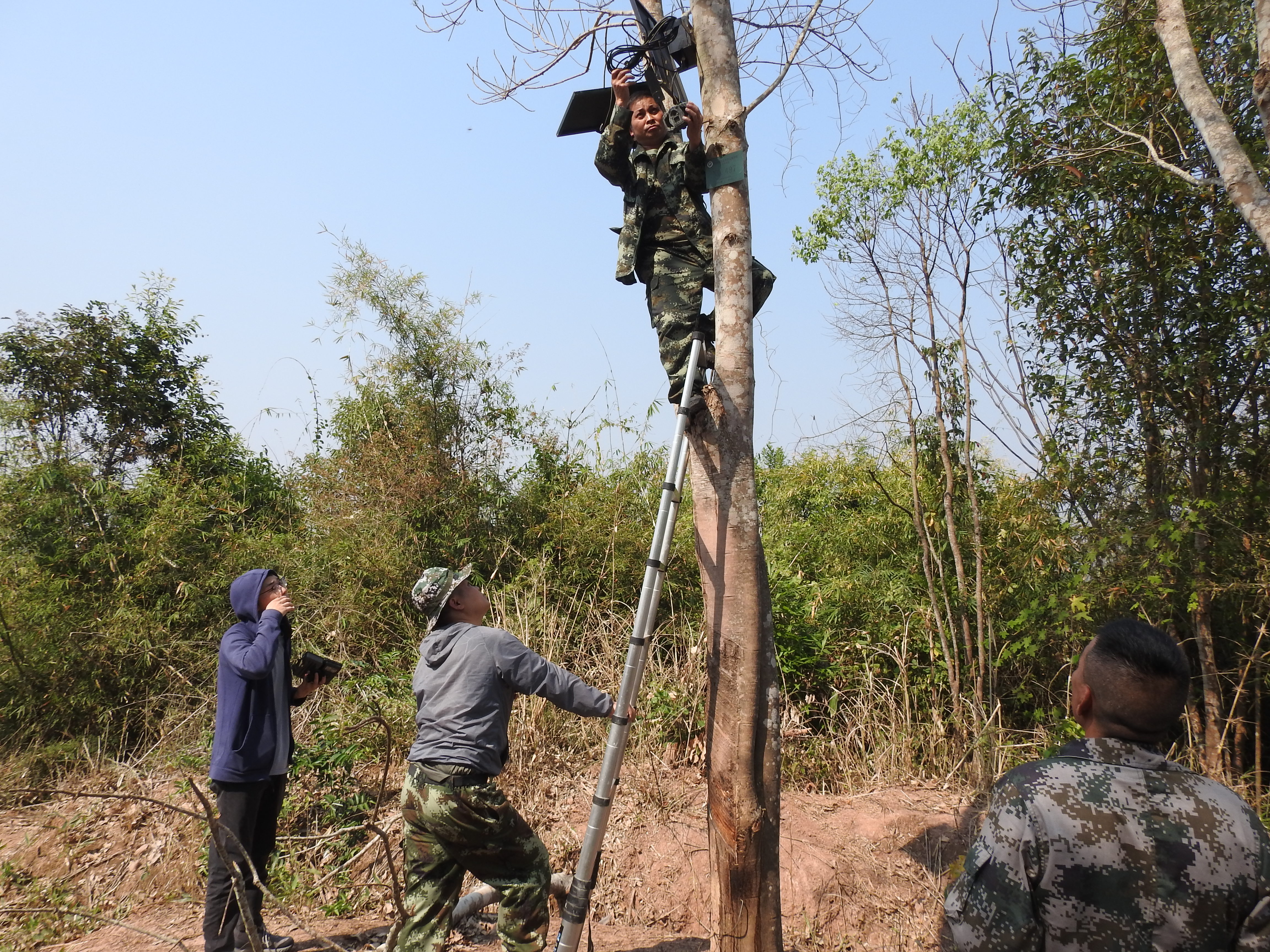
Since 2017, the project has assigned dedicated drone monitoring teams to each elephant herd or individual active outside protected areas. Each team operates around the clock and currently includes over 70 trained personnel, all capable of locating elephants quickly and accurately. - Infrared Camera Monitoring
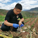
To address the limits of drone coverage—such as shift changes and blind spots at night—the project deployed a custom infrared monitoring system. A total of 600 infrared cameras with real-time data transmission, 21 video cameras, and 177 smart broadcasting devices have been installed in key zones, including roads, elephant corridors, and villages.
Deployment is based on elephant activity hotspots. This supports space-use planning and the safe coexistence of people and elephants, while also informing corridor design and habitat protection. It aligns closely with GBF Targets 1 and 4 by applying technology to biodiversity management and species conservation.In addition, the project is exploring options for recycling and reusing monitoring equipment to ensure long-term ecological and environmental sustainability.
Enabling factors
- Technical Support: Both drones and infrared cameras are equipped with advanced features, including high-resolution imaging, thermal imaging modes, real-time data transmission, and intelligent recognition algorithms.
- Strategic Deployment: Equipment placement is scientifically planned based on elephant movement patterns and high-risk areas, ensuring coverage of critical corridors and activity hotspots.
Lesson learned
- Drone Monitoring Maintenance and Training: Regular maintenance and ongoing training for monitoring personnel are essential to ensure the efficiency of monitoring efforts and the reliability of equipment performance.
- Infrared Camera Deployment: Network coverage and power supply need to be considered comprehensively to ensure the stable operation of the equipments.
Resources
Module 3: Optimization of Big Data and Intelligent Recognition System
The infrared system collects a large number of images daily, including many that are unrelated to elephants. With AI technology, the system has learned to automatically identify and filter out non-elephant images with over 99% accuracy, even detecting partial figures or shadows. Warnings are generated within 13–15 seconds through a fully automated process, reducing the need for manual review and enhancing the efficiency of elephant management.
So far, the system has captured over 3 million images and issued more than 12,000 automated warnings. All data is uploaded in real time to a centralized platform and shared with relevant agencies for research, management, and decision-making. This contributes to GBF Target 20 by promoting knowledge systems, technology, and innovation in biodiversity protection.
Enabling factors
- Advanced Artificial Intelligence Algorithms: The implementation of powerful AI algorithms ensures high-precision image recognition and efficient data processing.
- Unified Data Aggregation: Data from various regions is consolidated, supporting big data analysis and providing a foundation for long-term conservation planning and decision-making.
Lesson learned
- Algorithm Updates: The monitoring and recognition system requires regular algorithm updates to adapt to environmental changes and improve recognition accuracy.
- Efficient Database Management: A robust and efficient database management system is essential to ensure that data can be easily analyzed and utilized for conservation purposes.
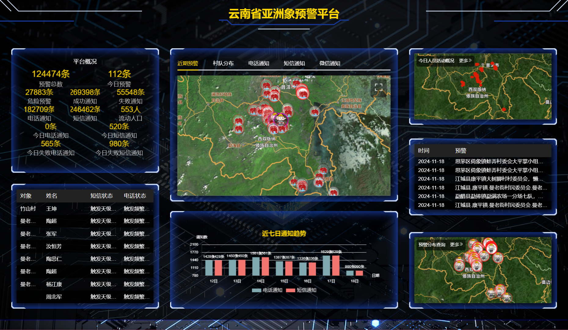
Module 4: Supporting Monitoring and Early Warning Platform
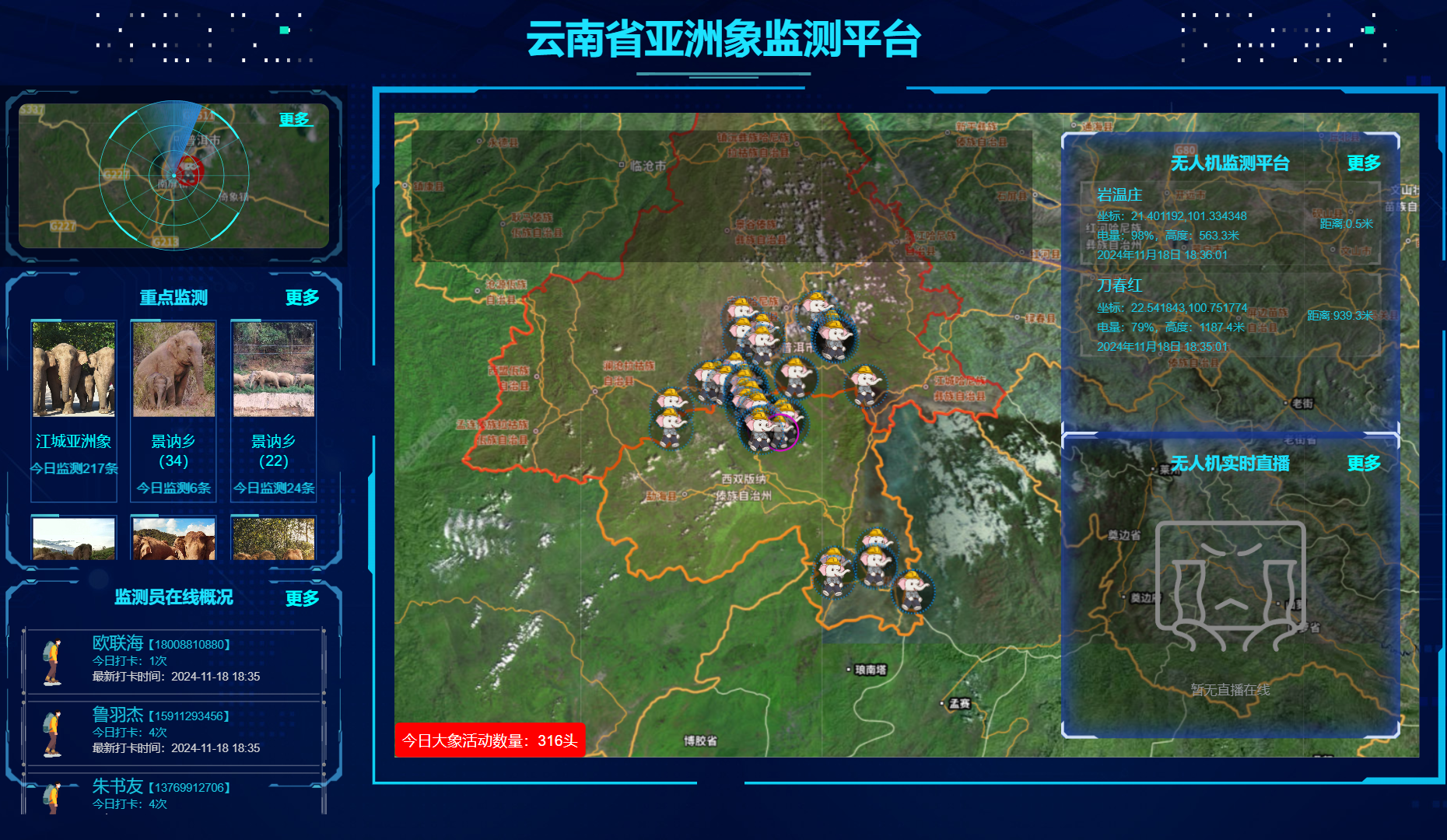
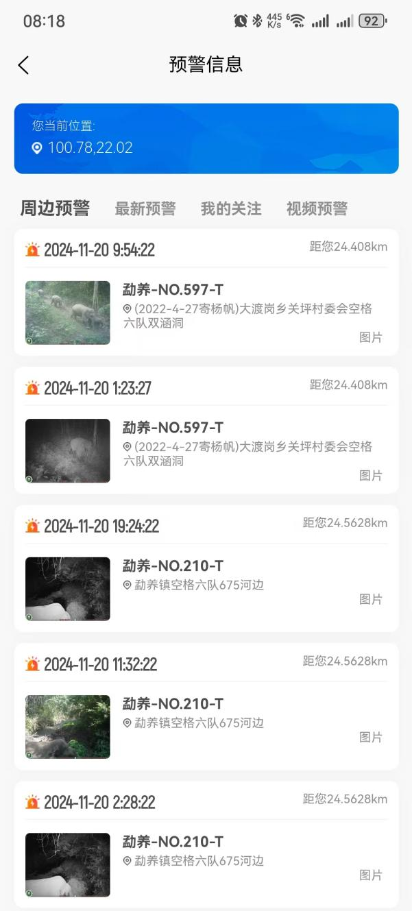
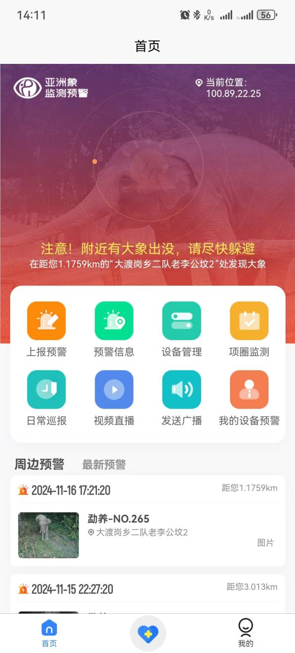
All data from drones and infrared cameras is transmitted to an early warning platform in real time. The system automatically matches location information and generates warning messages, which are sent to end-users through apps, WeChat, text messages, and phone calls. This ensures that residents can respond quickly and stay safe. To date, over 130,000 warnings have been issued.
The platform improves access to information, especially for rural and vulnerable communities. This inclusive communication system fulfills GBF Target 21 by enhancing public access to biodiversity-related information and strengthening the community’s ability to respond to human-wildlife risks.
Enabling factors
- Automated Data Matching: The platform’s database features an automated matching function that ensures efficient and accurate early warnings.
- Comprehensive Distribution Channels: The use of various channels (mobile apps, SMS, phone calls) ensures the coverage of different community needs, catering to diverse user groups.
Lesson learned
- Platform Optimization: The database must be regularly optimized to maintain the speed and accuracy of early warning information matching.
- Multi-Channel Delivery: Expanding distribution methods, such as incorporating intelligent broadcasting, can significantly improve community residents’ reception and responsiveness to warnings.
Module 5: Community Awareness and Early Warning Promotion

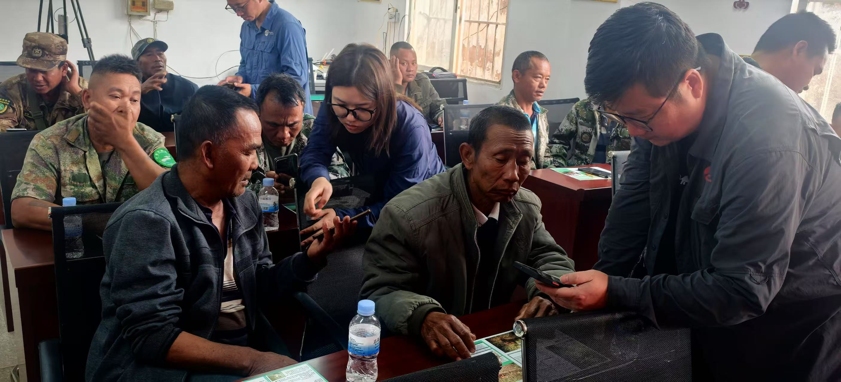
Early warnings are delivered through multiple channels, including a mobile app, smart broadcasting, phone calls, and text messages. The app is the most widely used, and monitors also share alerts via WeChat groups or personal networks for broader reach. To expand user coverage, field teams conduct door-to-door awareness campaigns in elephant-affected villages. As a result, the app has been downloaded by more than 246,660 users.
This module has strengthened public engagement and built community capacity by combining face-to-face outreach with digital tools. It also improves public understanding of wildlife protection and encourages participation. These efforts directly support GBF Targets 20 (capacity-building) and 21 (public awareness and education).
Enabling factors
- Villagers in elephant-affected areas have a strong need for personal safety.
- Monitoring staff conduct door-to-door outreach in local communities.
Lesson learned
- Continuous Training: Regular training sessions are essential, particularly for transient populations and vulnerable groups such as the elderly, children, and individuals with disabilities.
- Impact of Targeted Warnings: Precise delivery of early warning messages via phone calls and SMS has significantly influenced community residents’ ability to take timely protective actions.
Impacts
This solution delivers strong environmental, social, and scientific impacts through the integration of drone and infrared camera technologies. It supports GBF Targets 1, 4, 20, and 21.
A real-time, wide-coverage monitoring system has been built using drones with thermal and high-res cameras and 24/7 infrared camera networks. These tools enhance detection in forests and at night.
Over 130,000 alerts have been issued, helping communities avoid danger and greatly reducing human-elephant conflict. The system covers all known elephant areas, protecting both animals and people.
Local youth are trained as full-time monitors, and alerts reach communities via apps, broadcasts, and SMS. This improves local skills and public awareness.
The system has generated valuable data for planning and management. Maintenance and battery replacement systems are in place, and recycling of damaged devices is being explored to reduce environmental impact.
In 2021, the northward migration of a Yunnan elephant herd gained global attention, with over 11 billion views across 190 countries, showcasing China’s conservation success and the power of technology-enabled outreach.
Beneficiaries
- Local residents receive timely alerts to stay safe.
- Asian elephants benefit from constant monitoring and fewer human encounters.
- Local authorities gain tools for efficient, science-based management.
- Ecosystems are supported through habitat protection.
Additionally, explain the scalability potential of your Solution. Can it be replicated or expanded to other regions or ecosystem?
This solution can be applied to other regions facing high-risk human-wildlife conflict, especially for endangered species such as tigers or bears. The model—combining drones, AI, and real-time alerts—offers a practical and scalable tool for global biodiversity monitoring and conservation.
Global Biodiversity Framework (GBF)
GBF Target 1 – Plan and Manage all Areas To Reduce Biodiversity Loss
GBF Target 4 – Halt Species Extinction, Protect Genetic Diversity, and Manage Human-Wildlife Conflicts
GBF Target 20 – Strengthen Capacity-Building, Technology Transfer, and Scientific and Technical Cooperation for Biodiversity
GBF Target 21 – Ensure That Knowledge Is Available and Accessible To Guide Biodiversity Action
Sustainable Development Goals
SDG 8 – Decent work and economic growth
SDG 9 – Industry, innovation and infrastructure
SDG 11 – Sustainable cities and communities
SDG 15 – Life on land
Story
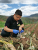
Monitor Yang Jun
SSPI & Zhenghao Monitoring Technology Co.
Yang Jun, a young man from Guanping Village in Dadugang Township, Xishuangbanna, grew up knowing wild elephants lived in the nearby nature reserve. As a child, he never saw them in the wild. To him, elephants were distant legends that didn’t disturb the peaceful village life. But as their population grew, elephants began leaving the reserve, damaging crops and farmland, making life harder for the villagers.
Yang Jun’s family relied on growing rice and corn. Each harvest, his parents feared elephants might destroy their hard work in a single night. Yang Jun saw elephants trample their fields, leaving him angry and helpless. He and the villagers tried scaring them off with noise and flashlights, but these methods failed. Worse, some villagers accidentally encountering elephants were injured or even killed.
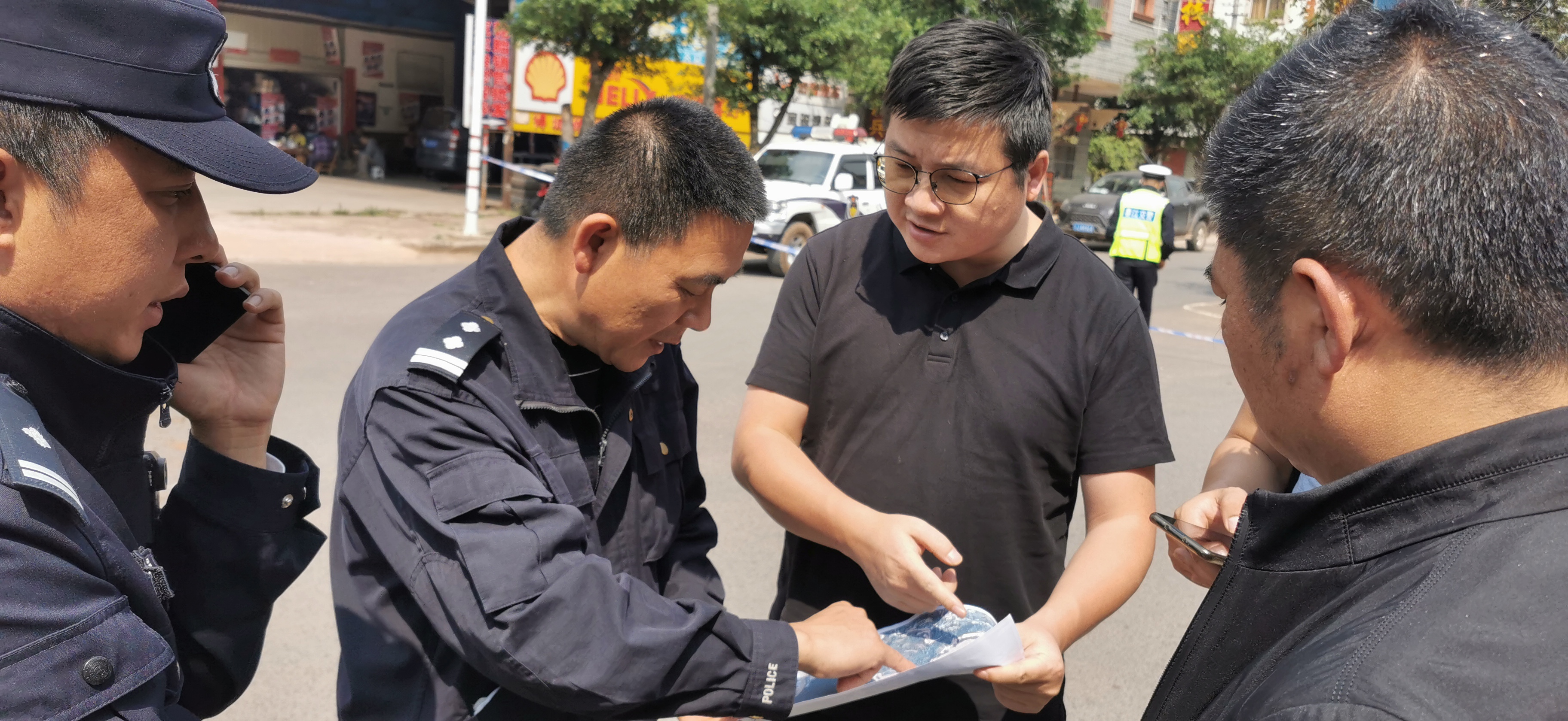
To address this, the local conservation authority launched an Asian elephant monitoring program, introducing drones and infrared cameras. Hearing about it, Yang Jun immediately joined as a monitoring team member.
After training, Yang Jun learned to operate drones and infrared cameras. His job was to track elephants, pinpoint their movements, and send early warnings to villagers via phone. He also installed infrared cameras to monitor elephants, even without human presence. When elephants neared the village, Yang Jun promptly notified residents through the early warning platform, ensuring they could avoid danger.
Initially, some villagers misunderstood his work, thinking he was helping the elephants, not protecting them. But as the system reduced human-elephant encounters, fear subsided, and villagers began appreciating Yang Jun’s efforts.
Today, Yang Jun is more than an ordinary villager—he is a community protector. Using technology, he safeguards his hometown and has helped change villagers’ perceptions of elephants. “Elephants bring trouble, but it’s not their fault,” he says. “We must find ways for humans and elephants to live safely together.”
Connect with contributors

Other contributors
Wang Bin
Xishuangbanna National Nature Reserve
Zhen Xuan
Yunnan Zhenghao Monitoring Technology Co.
Luo Weixiong
Southwest Survey and Planning Institute of National Forestry and Grassland Administration
Zhou Chenhao
Xishuangbanna National Nature Reserve
Yang Zicheng
Southwest Survey and Planning Institute of National Forestry and Grassland Administration
Tang Yongjing
Southwest Survey and Planning Institute of National Forestry and Grassland Administration
Wang Zhihong
Southwest Survey and Planning Institute of National Forestry and Grassland Administration
Xiong Chaoyong
Xishuangbanna National Nature Reserve