Development of national policy frameworks

The existence of robust policy frameworks facilitates the design and implementation of local and national blue carbon initiatives. These policies promote official government support and the foundation for institutional roles, and offer links with other national and international policies, mechanisms and strategies (such as NDCs, REDD+ and NAMAs). The policy building process starts with informal consultations with national authorities to map actors, gauge their interest and obtain their support. As these are national-scale constructs, strategic advice and facilitation of the process is important.

Of utmost importance is to garner the interest and support of national authorities in decision-making positions, as policy development is a government role and must not be imposed onto a country. The existence of other environmental, coastal-marine or climate change policies enables the alignment or incorporation of blue carbon policy notions within pre-existing policies. The availability and communication of sound science for the public is also important during policy development.

Our experience has been that an initial ‘socialization’ (supply, introduction and communication) of basic blue carbon information and principles is needed through formal and informal meetings with country officials at multiple levels of decision-making. Then, a clear understanding of current country needs and priorities, and how they can be met through blue carbon actions, should be considered to ensure the process is compatible with on-going national processes and international climate change and conservation commitments. The role of the people facilitating the policy process is key to deliver sound information, to understand country needs, to ensure that the interests of different actors are met, to negotiate complex matters and to mediate conflicts that may arise. The pace at which governments respond to specific processes is not necessarily compatible with the short-term goals of local project development and implementation or international cooperation.

Carbon inventories in mangrove ecosystems
Carbon inventories provide the basis for quantifying current stocks and mangrove areas needed to estimate historical emissions. They allow for characterization of the environment, description of the flora and horizontal and vertical structure of the stands, plus their condition. Carbon assessments can also kick-start local involvement and capacity building. When repeated over time under a robust monitoring system, they provide growth and carbon accumulation rates that are used to calculate higher quality emission numbers than those currently available.
The involvement of government and local authorities is key. Government officials (local and national) are made aware of the process so they can recognize the value of the inventories in providing detailed data on highly vulnerable ecosystems. Involvement of local actors is key so they are empowered and acquire ownership of the project. Also, their knowledge of the area supports project site selection and ensures safer working conditions.
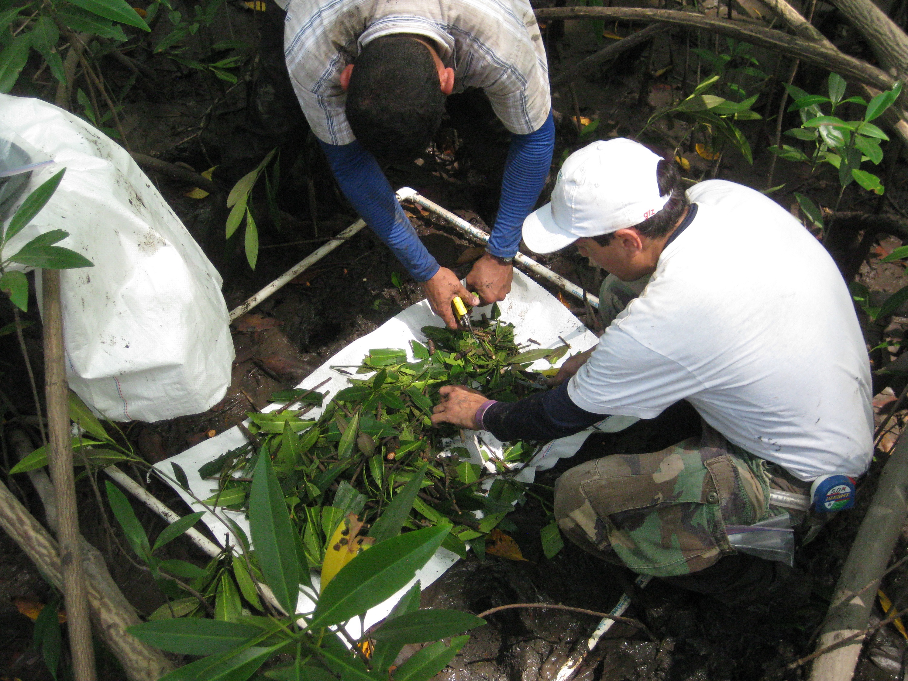
The quality of the inventories depends upon the use of consistent protocols and the level of trained personnel. Work in mangrove forests is more challenging than in terrestrial ecosystems, and safety of the workers needs to be a strong priority. The logistics of using boats to access field sites, short windows of time between tides, plus the difficult terrain preclude swift completion of tasks which, in turn, increases costs and duration of field work. With local involvement, these costs may be controlled, as boat rental fees may be lowered or waived. Also, collecting and processing soil samples in the field is challenging because of their extreme high water content, implying that laboratory facilities need to be arranged in advance. Having local people involved with the inventories is highly recommended because of their first-hand knowledge of the area, tide behavior and land use dynamics. GIS tools facilitate inventory planning.
Green Fees
The Protected Area Network Fund (PANF) supports management and monitoring of the network’s protected areas. The ‘resource-user pays principle’ was applied to define green fees for tourists visiting the country (Palau). In addition, complementary funds in the form of appropriations, loans, and grants from national and foreign governments, international organisations such as the United Nations or other agencies and sources are acquired, accepted and disbursed.
• Technical assistance for establishment and proper management of the fund • High level of awareness and national support • Legal framework
To be provided by solution provider.
Protected Area Network (PAN)
Based on the legal framework which recognizes protected areas established by communities and state governments, these areas become part of the nationwide network according to clear criteria, categories and application procedures. Considerations include bio-geographic, socio-economic and scientific importance, ecological characteristics, the degree of naturalness and uniqueness, as well as management and protection feasibility.
• Legal framework • National policy recognition and support • Support from a trusted agent to sustain dialogue and definition of procedures
Awareness raising from community to national levels, and reaching a consensus on procedures nationwide, may be a lengthy and arduous process. However, experience demonstrates that existing or arising conflicts between traditional and national government laws can be worked out with constant dialogue and patience.
Capacity Building

Regional and national training tailored to needs and priorities builds national and local authorities’ capacity for integrating issues and approaches into their national planning processes. Use and provide training manuals and materials developed by international and national experts for teaching, interaction, group exercises, discussions and field trips. Ensure compliance with regional and national resource documents on coastal spatial planning.

Conditions for adoption elsewhere:

  • National adaptation of capacity building and field application activities of each country

A series of national consultations and gap analyses with each participating countries proofed valuable to identify priorities for capacity building in integrating new management concepts into spatial planning. They also helped to establish a menu of possible capacity building and field application activities including a recommended outline for the workshops and training courses. Compliance of training course curriculum and syllabus with the regional and national resource documents on coastal spatial planning is crucial to provide country-tailored capacity building and field application activities and to meet the country’s priorities.

National Resource Document

National resource documents help local planners, researchers, students, and national authorities with information on coastal spatial planning in the country. In local language it provides material on legal, administrative and institutional aspects, references to case studies, projects having applied coastal spatial planning, and examples of integrating disaster risk reduction, climate change, ecosystem-based management, etc. into national settings.

Conditions for adoption elsewhere:

  • Commitment and support from national authorities and other stakeholders
  • Dialogue, participation and integration of all stakeholders’ needs

The participatory integration of all stakeholders is crucial to developing tailor-made national resource documents that efficiently correspond to capacities, priorities and needs.

Regional Assessment Report
Summarise national assessments in a standardised format to provide the basis and a resource book for ecosystem-based and sustainable integrated coastal zone management framework. Recapitulate valuable information for the effective management of coastal erosion region-wide to improve coastal resilience and consequently reducing impacts from sea level rise on ecosystems, economy, safety, health, quality of life and livelihoods of people.
Conditions for adoption elsewhere: • Information on policies, legal and institutional mechanisms, • Knowledge on past, current and planned interventions and development support, • Gaps and needs in policies, capacities, institutional arrangement and regulatory frameworks, • Identification, prioritisation and budgeting of activities, • Design and planning of specific, needs-based pilot interventions suitable for future replication or scaling up.
- not available -
National Consultation Meeting
Bring together all relevant national authorities and stakeholders in a meeting organized by the national institution responsible for coastal management to exchange any relevant information on coastal erosion, and to enhance awareness of national and local authorities on coastal erosion issues and needs. Present all findings and recommendations, particularly pilot interventions to be developed and implemented by each country for joined agreement.
Conditions for adoption elsewhere: • Awareness of the problem. • Commitment and support of national governments and authorities for defining and applying the solution for effective coastal management.
The commitment and support of national governments and authorities for implementing all necessary steps of the solution for effective and sustainable coastal erosion management is a key factor to success. The establishment of National Project Focal Points (NPFPs) partners in each of the participating countries facilitates networking between the project and all other stakeholders at local, national and regional levels. National consultations with national authorities and stakeholders is paramount to establish a transparent dialogue and cooperation between all partners concerned, to ensure that essential information and know-how on the problems to be solved is shared. National consultation meetings proofed crucial to ensure joint discussions and agreement of all stakeholders. They encourage cross-learning and team building, as they also enhance cooperation, coordination and dialogue between and among stakeholders.
National Assessment of coastal Vulnerability
National assessment - situation analysis - of coastal vulnerability provides a detailed overview of the states of erosion applying a standardised format agreed by all participating countries. It includes relevant policies, legal and institutional mechanisms, gaps and needs and interventions pertinent for addressing coastal erosion at national and sub-national levels. Priorities for action (pilot interventions) to be implemented by governments are defined.
Conditions for adoption elsewhere: • Awareness and recognition of the problem of coastal erosion and sea-level rise and the importance and value of national assessments to address the problem. • Full support and commitment from national governments and authorities including development partners.
Coastal erosion management involves a range of ministries and authorities at various governmental levels. Bringing them all together to discuss and agree on the assessment reports and pilot interventions is quite a challenge which was addressed by the project through national consultations. National reports assessing the national setting and the magnitude of the problem of coastal erosion will serve as a major reference in the development of new or updating of existing national plans, policies, strategies and programs on integrated coastal management at national and local levels. With identified specific capacity building activities and pilot interventions, the national reports could be integrated into a regional report which could later be used in the development of future regional programmes for coastal erosion management for regional implementation.