Identifying priorities for Forest Landscape Restoration based on participatory mapping and forest inventories at subnational level – Togo
Full Solution
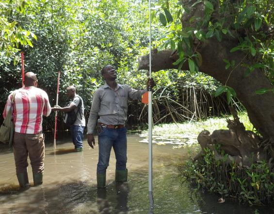
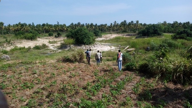
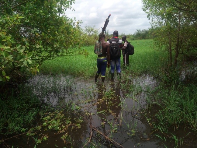
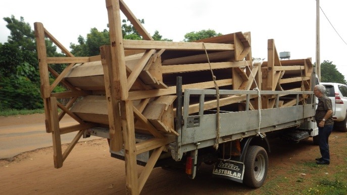
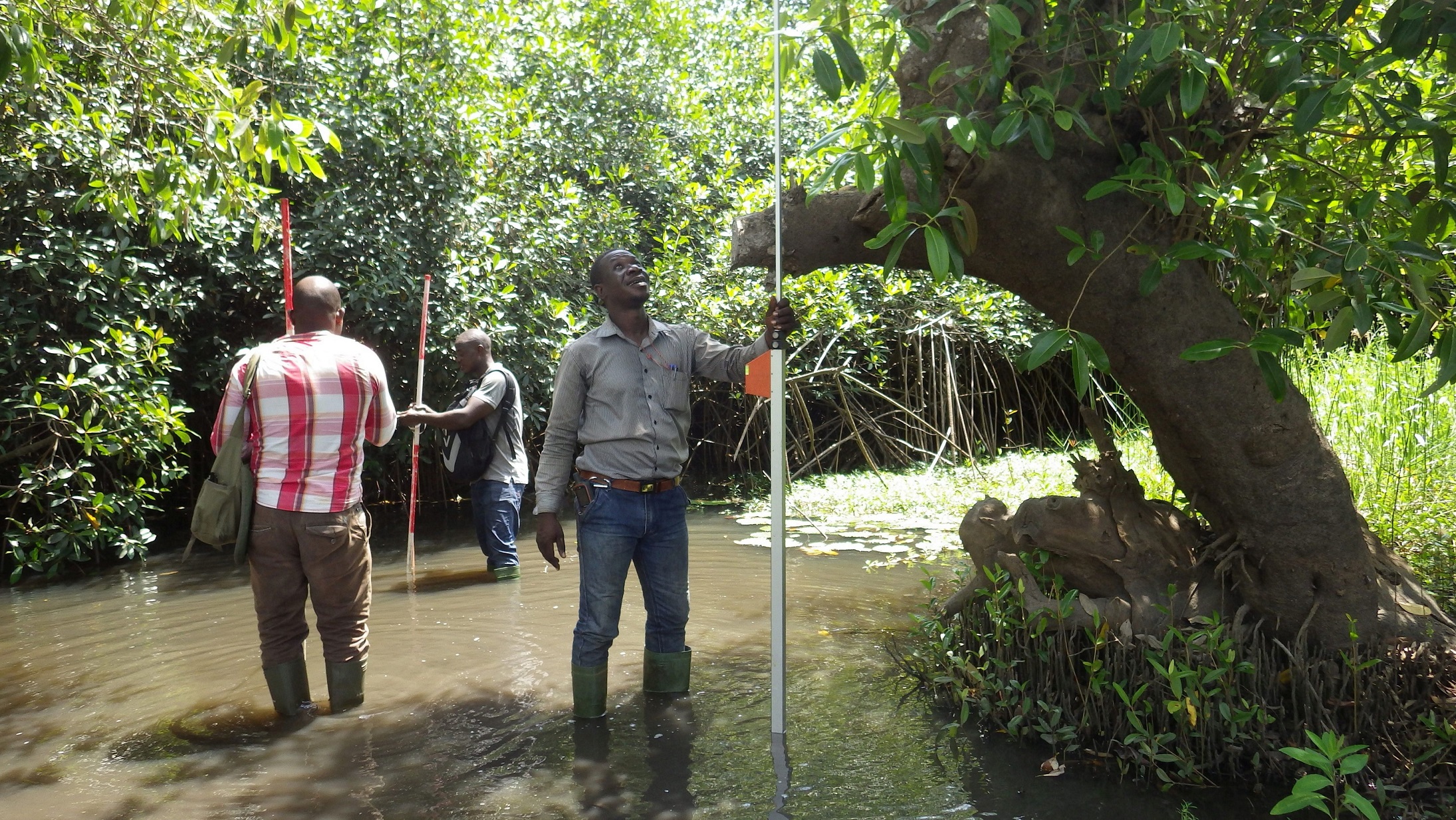
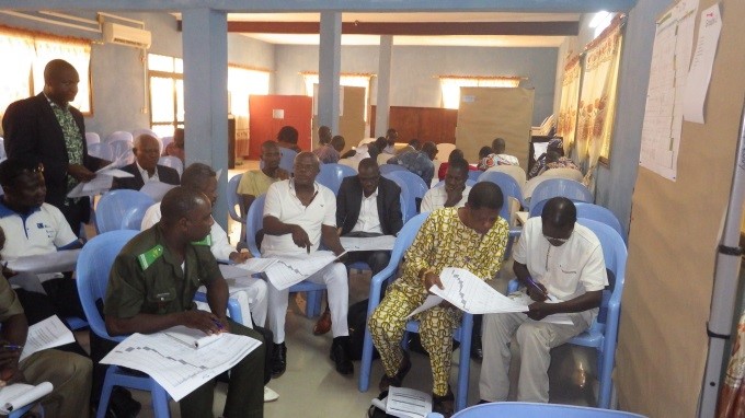
Inventory in mangroves
GIZ/ProREDD
Forest landscapes and the benefits they provide – e.g. timber, fuelwood, water regulation, soil protection and climate regulation - are crucial for the wellbeing of people in Togo. Many landscapes, however, are degraded due to unsustainable use of resources. It is crucial to improve their conditions, via restoration, for improving food security and access to water. This solution defines concrete options for forest landscape restoration (FLR) and land use planning based on participatory mapping and forest resource inventories at subnational level covering 410,000 ha. It provides the basis for the sustainable management of agrarian, forest and mangrove ecosystems with different land tenure systems such as sacred, community and family forests and protected areas, contributing to the wellbeing of the local population, climate change adaptation and biodiversity conservation.
Last update: 30 Sep 2025
7784 Views


Context
Challenges addressed
Environmental:
- Degradation of forest landscapes – including forests and mangroves - affects the fertility of soils, the functioning of the water cycle and carbon storage.
- Land erosion combined with climate change impacts reduces land productivity and leads to a siltation of rivers and lakes. This directly affects livelihoods of people.
- The prefecture has a very low forest cover of 8.91% compared to 29.06% at regional level and 24.24 % at national level.
Socioeconomic:
- People depend on land, ecosystems and their resources such as food, fuel and fodder.
- Forest degradation and loss directly constrains sustainable economic development and affects local people’s livelihoods, jeopardizing poverty reduction efforts, food security and biodiversity conservation. It also reduces their resilience towards climate change impacts.
- Rapid population growth (2.84% per year) boosts pressure on natural resources, such as wood fuel, accelerating resource depletion.
Location
Maritime Region, Togo
West and Central Africa
Process
Summary of the process
Participatory mapping at community level, including the training of cartographers (BB1) provided the basis for the subnational forest inventory (BB2). Based on the inventory, restoration options were identified and prioritized in a highly participatory manner (BB3). Awareness raising campaigns that have been conducted at local level (BB4) at regular intervals provided the relevant enabling environment for subnational activities.

Building Blocks
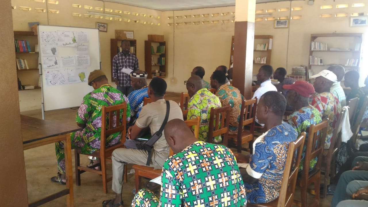
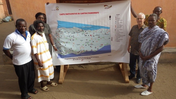
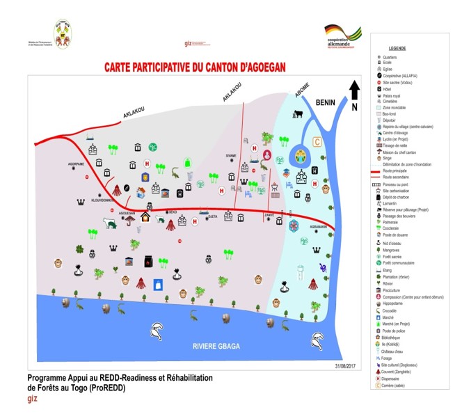
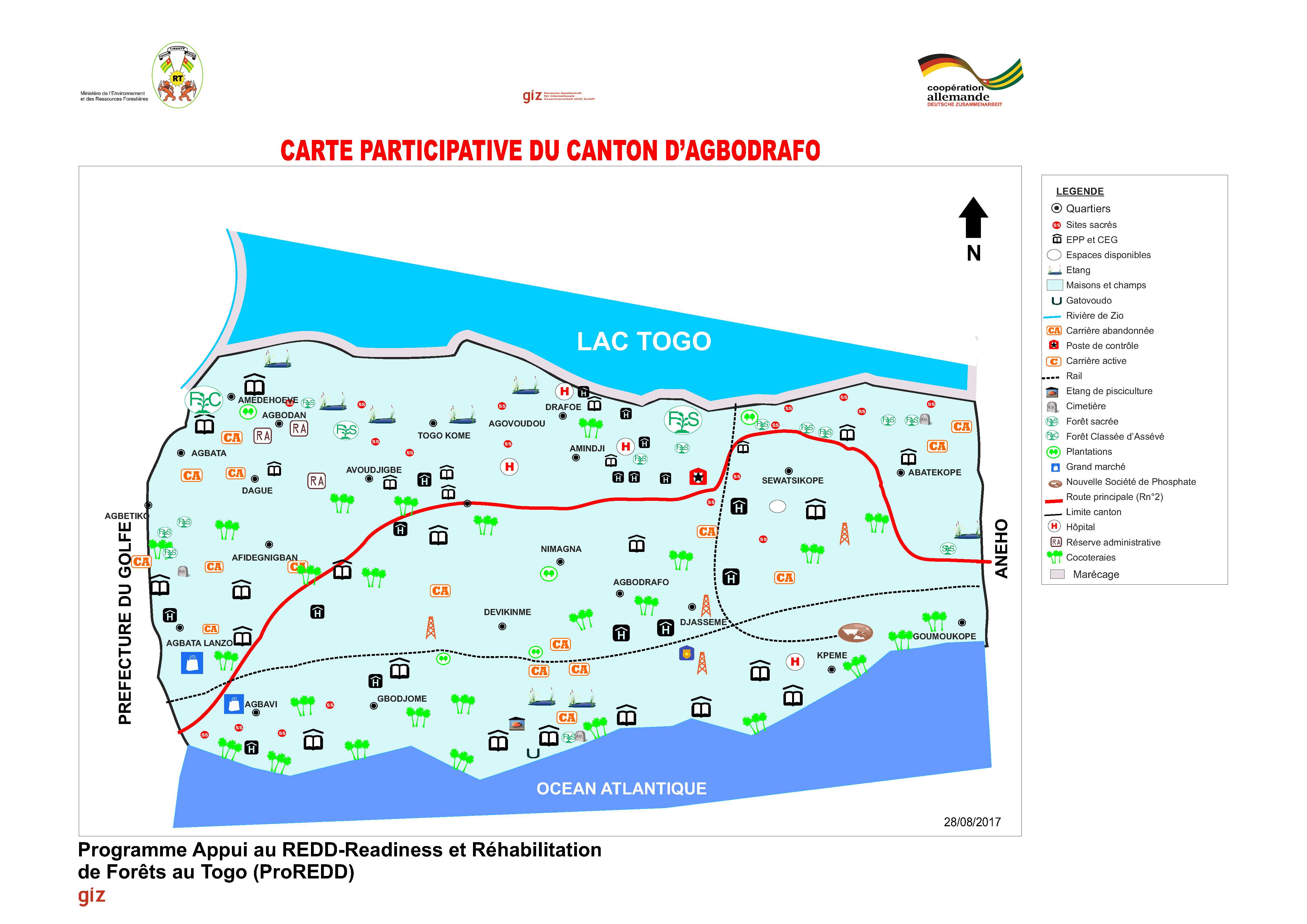
Participatory mapping at community level
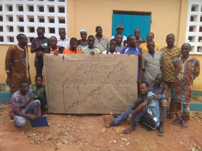
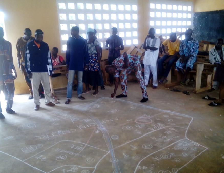
Participatory mapping was done by local communities in collaboration with the forestry administration and support by GIZ. It involved a true ‘cantonal’ approach by facilitating joint meetings between communities. They prepared their land use maps with guidance from advisors. This allowed to develop the relevant knowledge base for land use and restoration opportunities at regional scale and showed the importance of ecosystem connectivity in a landscape. Main steps of mapping:
- Preparation: Analysis & documentation of existing information, local visits to potential restoration sites, meetings with leaders of the prefecture and a launching workshop
- Awareness raising campaign in all 9 cantons and identification of two local cartographers per village (150 in total)
- Training of local cartographers in the development of participatory maps and the use of geoinformation tools including GPS
- Participatory mapping with 77 communities including joint identification of problems, mapping, verification and ground truthing of land use units by local experts and cartographers
- Development of final maps, validation and return of maps to local stakeholders
Enabling factors
- Strong political commitment due to AFR100 pledge of Togo
- Appointment of an FLR Focal Point to the Director of Forest Resources (MERF)
- Availability of local experts, technical & financial support from the Togolese and German government
- Strong collaboration & knowledge exchange between projects at local, national and international level
- High community commitment and participation via existing prefectural, cantonal and village development committees & civil society organizations
Lesson learned
- It was crucial to collaborate with community leaders and development committees from the beginning & use of their local knowledge about land resources and utilization
- Communities elaborated the land use maps on their own, while the project provided the framework conditions. This leveraged ownership, trust and acceptance between communities. It made them aware about the land boundaries & utilization types, condition and location of ecosystems (forests, agro-forests, coconut plantations, forest plantations, mangroves etc.) and land ownership types (public, community, private and sacred forests). It also enabled them to jointly identify environmental problems as the basis for identifying restoration priorities
- A combination of locally appropriate governance & communication processes (i.e. consensual approach, respect of customary rules) with technological approaches (GPS) was very successful
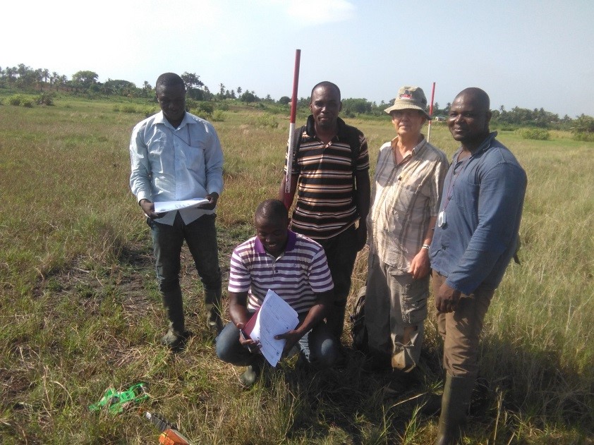
Forest inventory at subnational level
The inventory of natural forests and plantations was based on the participatory mapping. It covered the following steps:
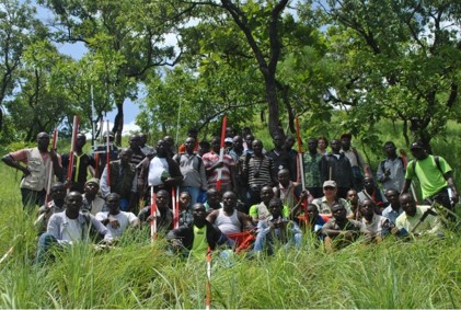
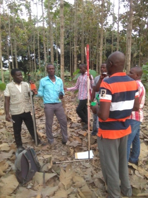
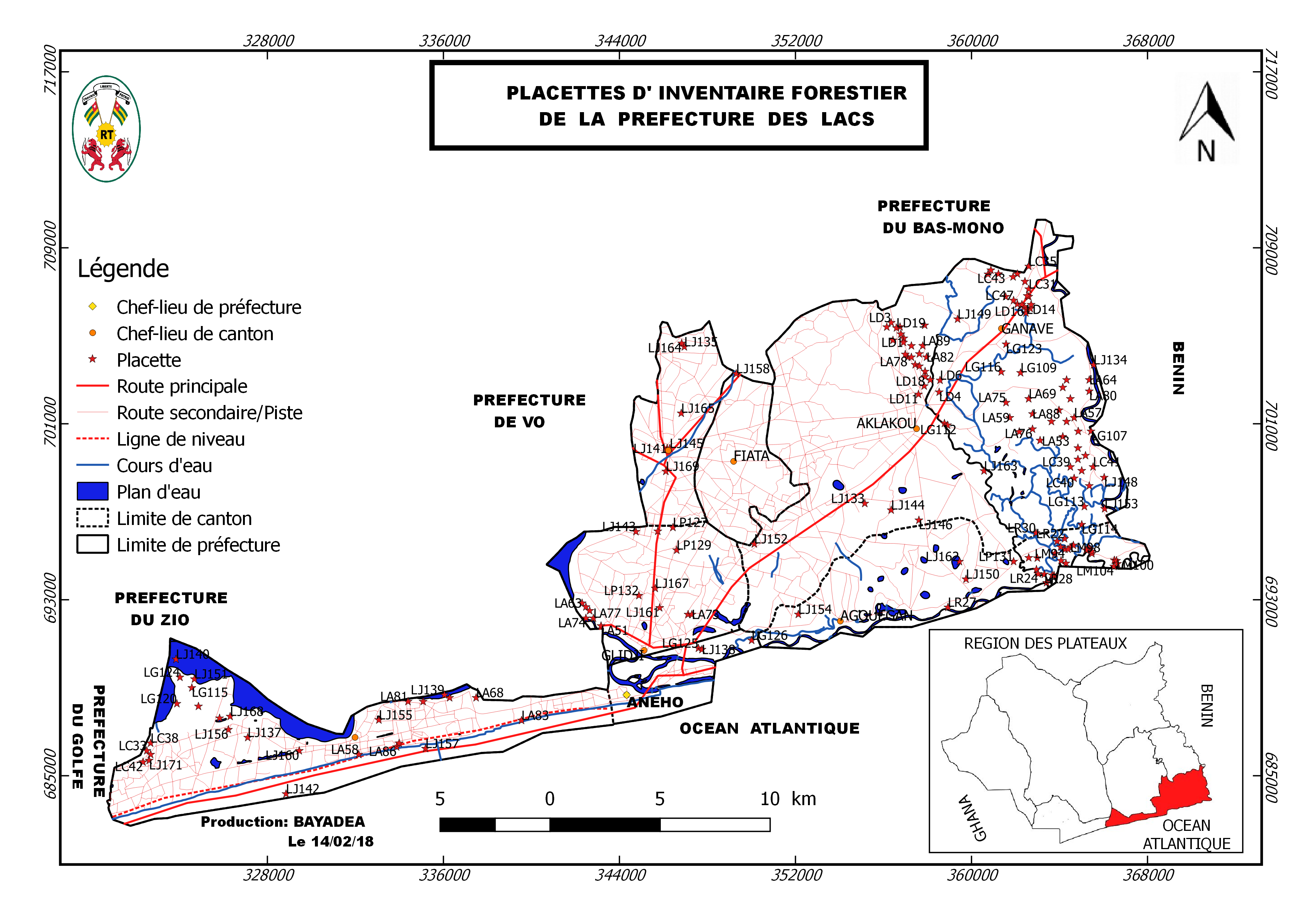
1. Training of forest inventory teams
2. Definition of forest types and layers (stratification): analysis and interpretation of RapidEye 2013-2014 satellite images (resolution of 5 m x 5 m)
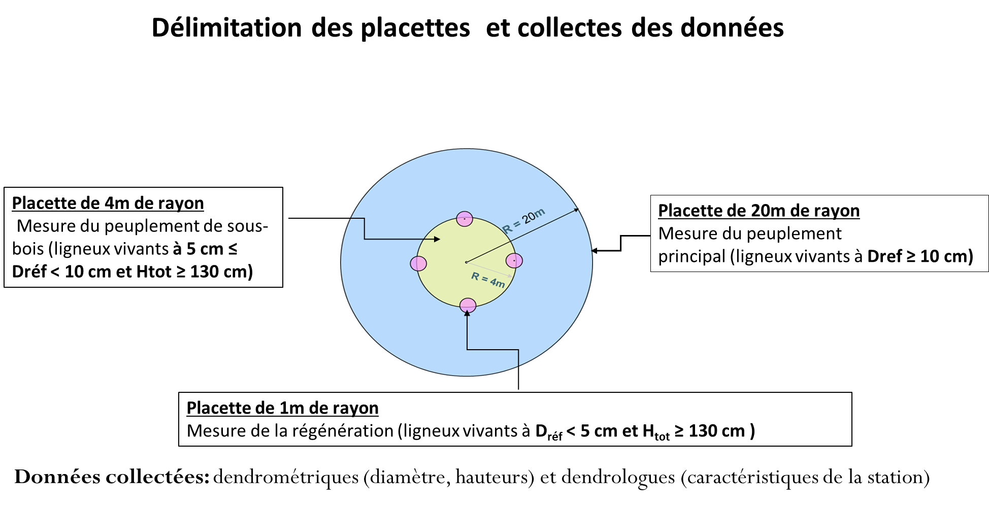
3. Implementation of pre-inventory: Assessment of results from national forest inventory, preparation of field work, determination of variation coefficient and statistical method, measurement of 20 circular plots. Inventory of main forest stand with a 20 m radius for samples ≥ 10 cm in diameter and ≥ 1.30 m height; inventory of forest undergrowth in circular plots with 4 m radius on trees and shrubs samples with a diameter between 5 and 10 cm open and a height ≥ 1.30 m
4. Implementation of inventory: preparation of field work, measurement of 173 circular plots with same sample plot features as during pre-inventory and with the support of local cartographers.
5. Data processing at regional management level with support from the inventory database management unit
6. Zonation and identification of forest landscape restoration options
Enabling factors
- Experience of technical staff of MERF in carrying out the first national forest inventory of Togo
- Existence of forest and cartographic data management units within MERF
- Using results of the first national forest inventory at the regional level
- Availability of RapidEye satellite images (2013-2014)
- Evaluation of restoration potential of forest landscapes study in Togo (2016)
- Guidance and knowledge of local cartographers about the local resources during the forest inventory
Lesson learned
- A thorough identification and mapping of actors in the beginning of the inventory was crucial to form a solid coordination structure
- It was crucial to keep the interest and support of local communities in the inventory process, based on regular communication and awareness raising
- The local forestry administration implemented the inventory at community level in a very remarkable way; the participatory process put foresters in a new role of highly appreciated community advisers and companions for forest management. The administration - once perceived as a repressive force and authoritarian manager of resources – was accepted by the community as a partner
- The inventory, including the identification of 70 tree species in total (incl. 24 families & 65 genera) in the four zones, increased the awareness about existing biodiversity and their potential in the context of forest landscape restoration and climate change adaptation
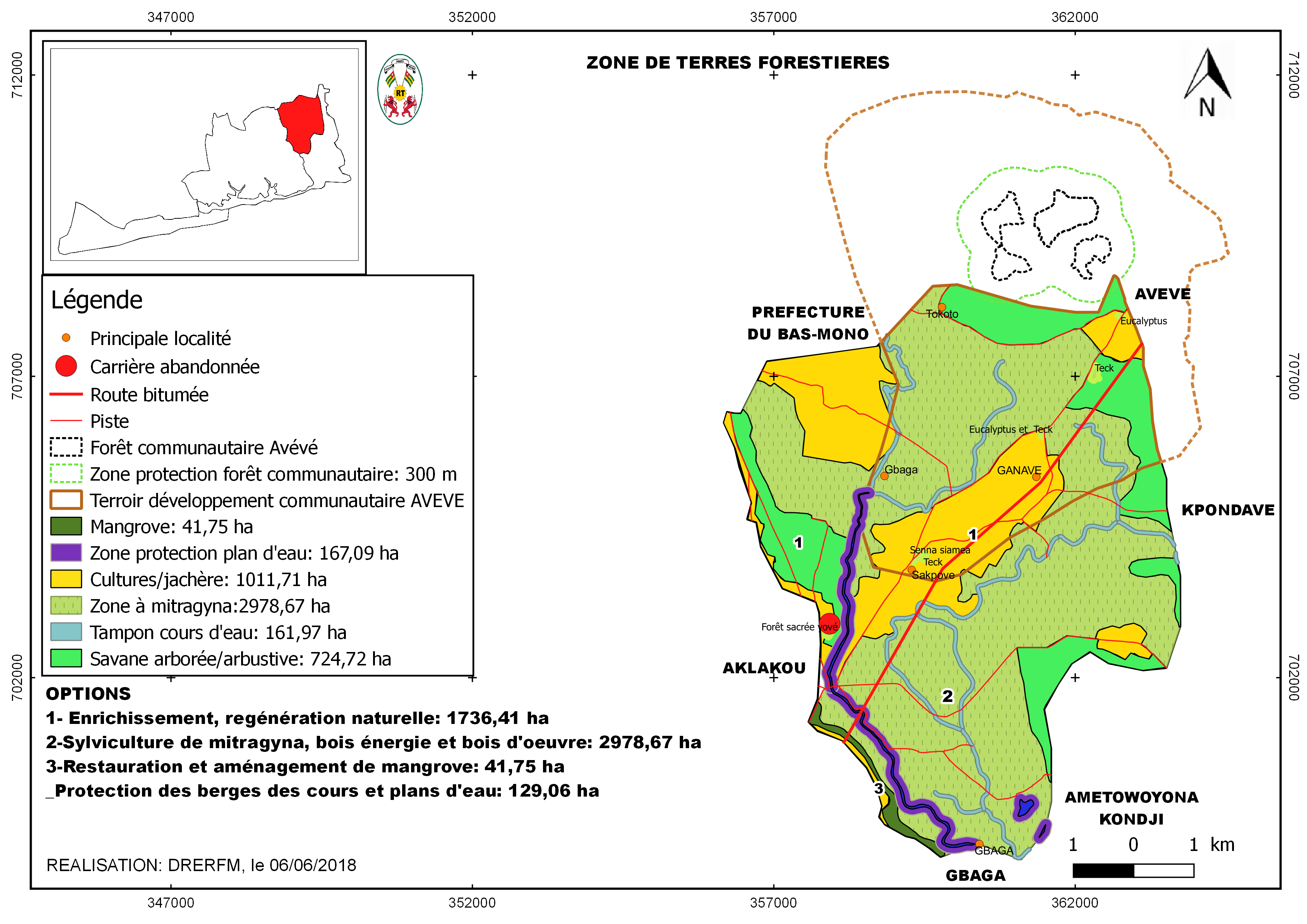
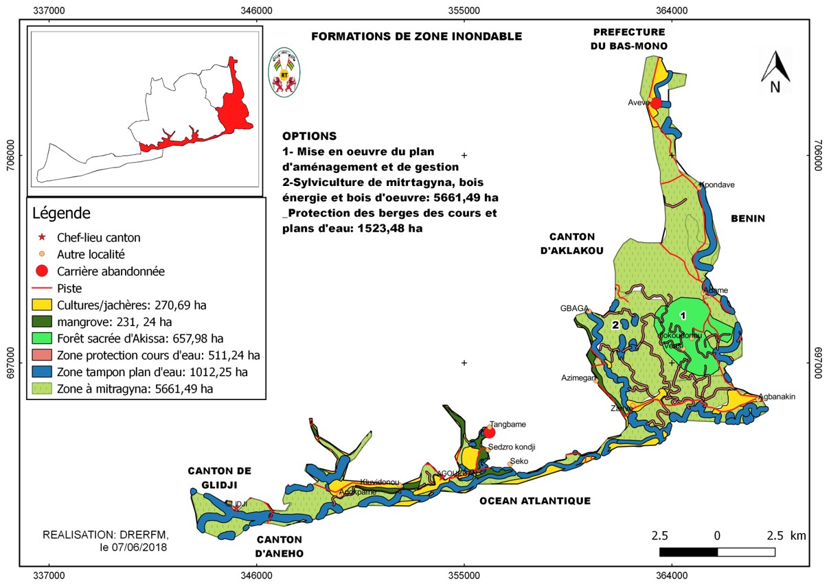
Identification of forest landscape restoration options at subnational level
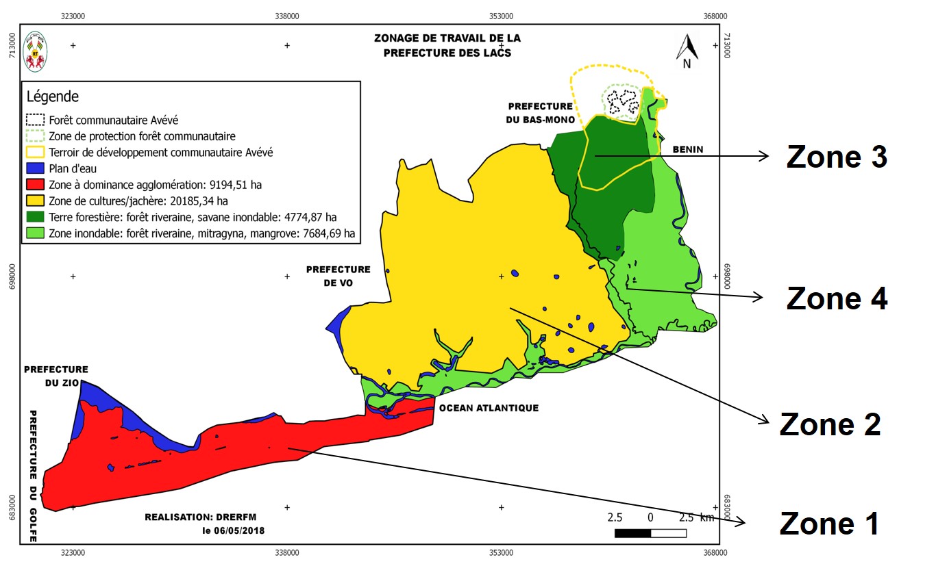
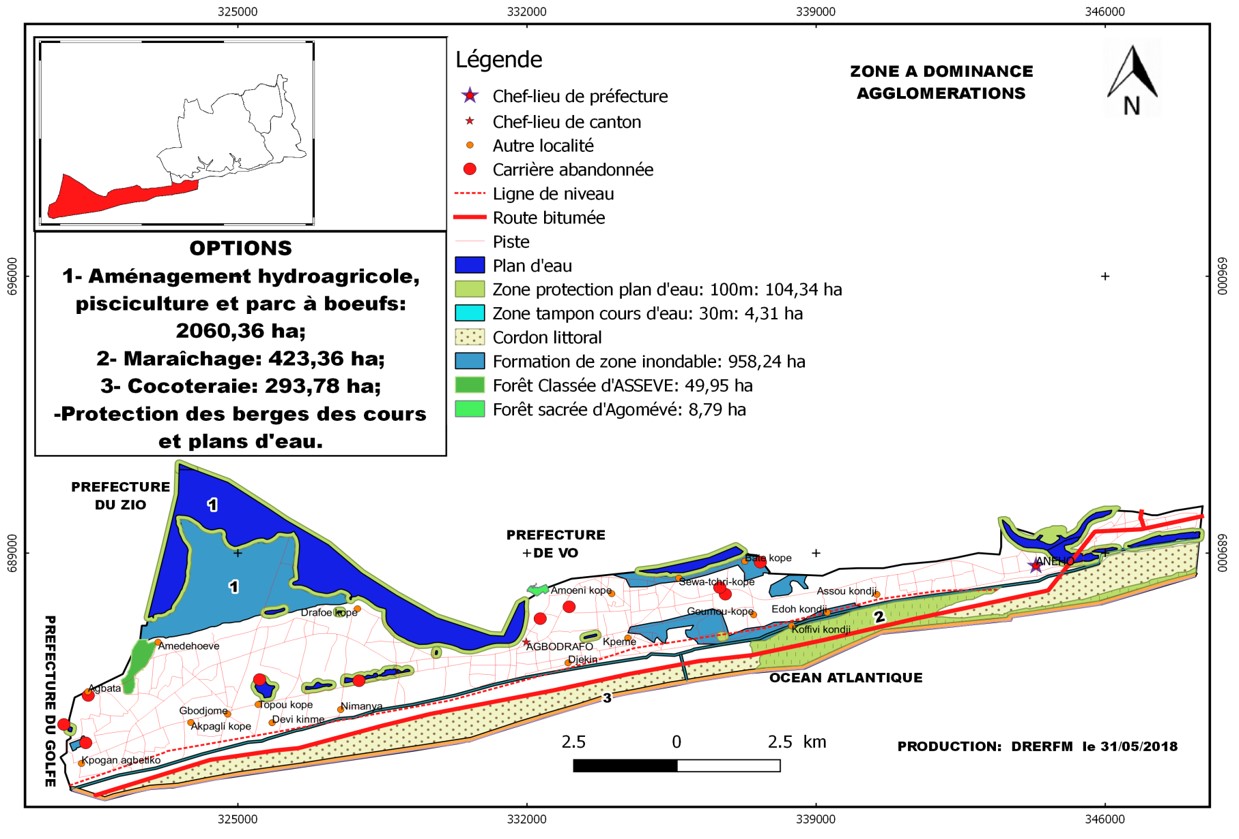
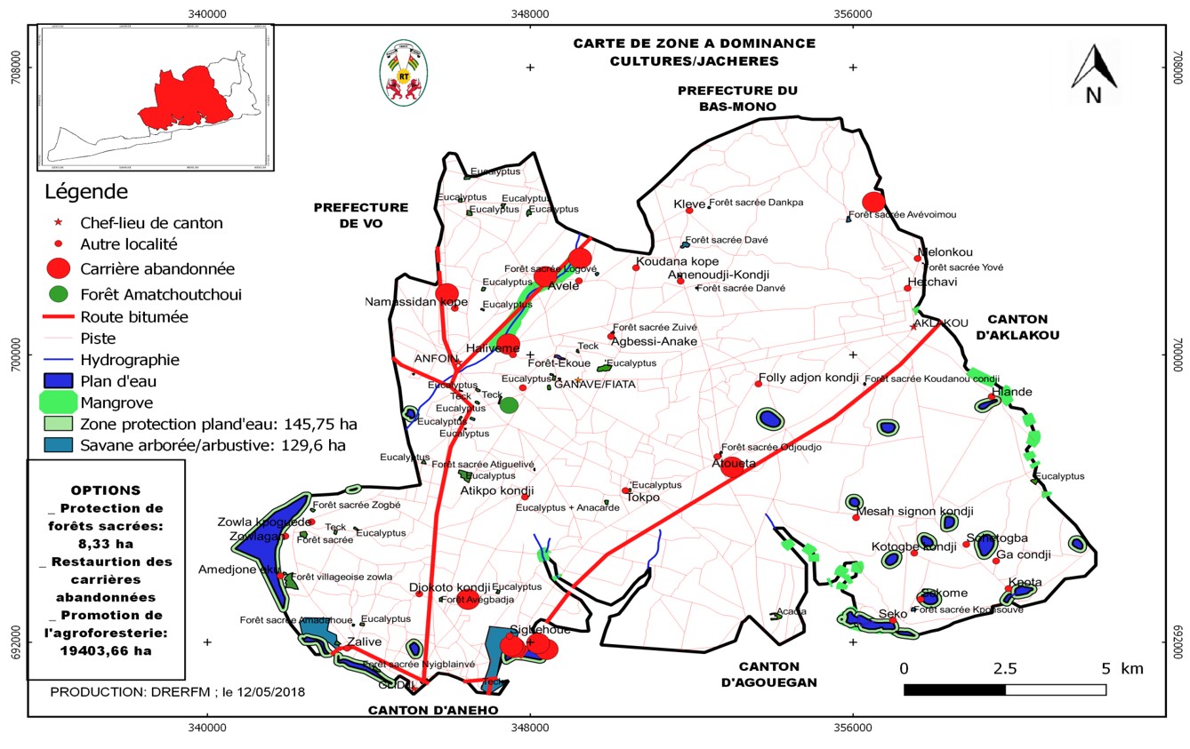
Results of the participatory mapping and forest inventory allowed to assess forest resources and identify concrete priority options for landscape restoration in 4 zones.
Criteria for selecting priority options:
- promote the restoration of natural forests, fragile and specific ecosystems,
- achieve societal goals and objectives related to the conservation of biodiversity and human well-being,
- to be implemented in the framework of existing projects in different land tenure types (protected areas, community or village forests, sacred sites),
- limiting the fragmentation of forest areas and maintaining the connection of natural habitats.
Restoration options include the following:
- Densely populated land (forest land, farmland, settlements): forest enrichment, agroforestry, river bank restoration)
- Agricultural land: improved community forest management, enrichment of agroforestry systems, buffer zones around water bodies, wood energy forests
- Dense forest, shrubland, riparian forests & savannahs: restoration of swampy savanna, riverbanks & community forests, fallow enrichment, improved pasture management
- Wetlands, marshes, mangroves, grasslands: wetland & mangrove restoration
Enabling factors
- National strategy for the conservation, restoration and sustainable management of mangroves
- Forestry Master Plan of the Maritime Region
- National REDD+ strategy is under development
- National restoration option assessment methodology (ROAM)
- Community knowledge of resources
- A good collaboration between national, regional and prefectural government and CSO representatives.
Lesson learned
- Prioritization was highly participatory involving communities of all 9 cantons, civil society organizations, agricultural extension services and local, regional and national forest administrations
- Valuing the knowledge of local communities in the process is extremely important and was not done intensively in the past
- Consideration and respect of the ancestral practices of the communities is key and have to be taking into account; access to sacred forests was only possible by adhering to customary and traditional procedures
- Knowledge of local languages, traditions and procedures was a key element of success
- Understanding and close coordination with local authorities was another factor of success
Awareness raising campaigns at local level
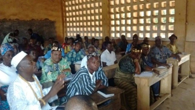
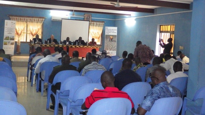
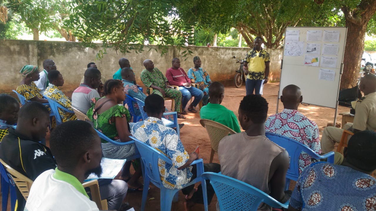
Awareness raising campaigns were conducted in each of the 9 cantons. They covered the following elements:
- field to discuss about FLR and the planning of potential activities
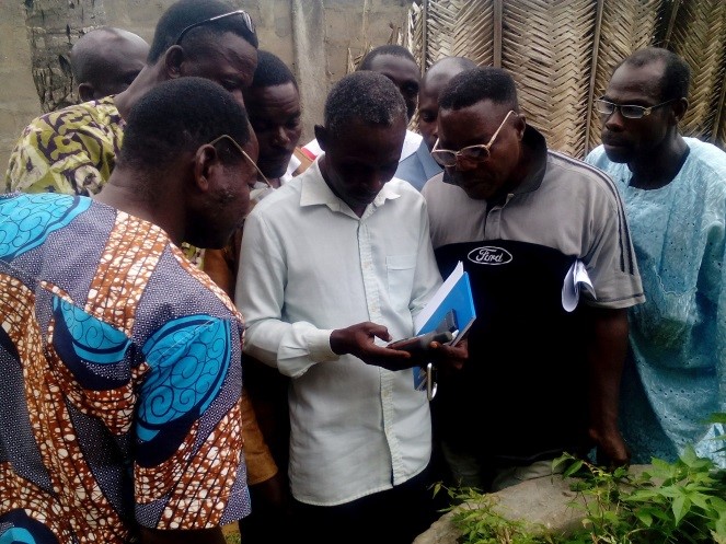
- local meetings with 77 villages, to share findings from field visits
- radio programs in local languages
- exchange sessions with the prefectural director for environment,
- design & development of signboards for each village
After the participative mapping and inventory findings were shared with the communities by the installation of synoptic tables in the villages themselves, visible and accessible for everyone. This triggered community internal discussions and allowed to identify one or two low-cost restoration options per village to be implemented by the communities themselves under the technical supervision by forest service staff. The continuous information provision via various awareness raising formats and participatory meetings to identify FLR priority options in each of the cantons, led to a high momentum and legitimacy in the communities to engage in restoration.
Enabling factors
- Openness by land users to participate since most are facing severe challenges (e.g. lack of fuel wood, soil degradation) and see a direct benefit in restoration
- Preparatory visits to restoration hotspots and workshops including agreements with prefectural authorities & traditional chiefs
- Local NGOs as very trustful partners
- Successful activities of GIZ in the Mono Delta Transboundary Biosphere Reserve provided convincing arguments to support restoration
Lesson learned
- It is essential but also challenging to define the appropriate group size to reach the maximum of the members of the communities (village or cantonal level)
- The content of communication products and messages needs to be adapted to the circumstances of each canton
- The right language for communication is crucial: Early on the decision was made to use the local dialect for a common understanding of all
- The integration of women in all phases of the process was crucial for its success.
Impacts
- 267 village leaders and 150 representatives from 77 local communities in 9 cantons participated in training activities
- ~8,000 people (incl. women's groups, youth, associations) participated in awareness raising activities; their understanding about land use patterns and environmental problems was strengthened
- Mapping helped identifying legal forest owners and to create a land tenure database; this allows to understand, prevent and manage land disputes
- Trust was built and partnerships strengthened between civil society and government
- 12 persons from local forest administrations strengthened capacities on mapping and forest inventories; this is crucial to continue with forest landscape restoration at national and subnational level
- A forest landscape restoration plan has been set up, defining concrete restoration options in four distinct ecological zones; it provides the basis for improved land management, ecosystem-based adaptation and livelihood improvement
- The regional forest administration is able to reproduce the approach in other prefectures based on a process guide for mapping and inventories
- Results directly contribute to the management of land-based carbon stocks in the context of the national REDD+ strategy and international climate change commitments (NDC)
Beneficiaries
- 172,148 people
- chiefs of the 9 cantons and 77 villages
- presidents of village development committees
- regional directorates of agriculture, fisheries, land planning, forestry & environment
- public administration officials (prefecture, communes, cantons)
Sustainable Development Goals
SDG 13 – Climate action
SDG 15 – Life on land
SDG 16 – Peace, justice and strong institutions
Story

Adade Folly, president of village development committee Agouegan & Assafoatse Kuetevi Ekovi, chief of the canton Agbodrafo
GIZ/ProREDD
by Adade Folly, president of the village development committee of the canton of Agouegan:
I followed the process of participatory mapping of the Regional Direction for the Environment and Forest Resources with the support of GIZ through ProREDD. Together we constituted a map of our land areas and identified the problems related to the management of resources. Thanks to this activity, I have an overview of the land areas to be managed in the canton. Based on this map, we could, together with the committee, plan for a better management of our resources, guided by the projects. They could explain us very well, during the awareness raising, how our current actions are degrading mangroves and the consequences related to it. As an example, I remember that in my childhood, I accompanied my father fishing in this area. We brought back enough fish that served us not only for consumption, but also for sale. Today, the mangroves are destroyed, the production is low and even nothing at certain period of the year. I am sure that executing the restoration activities will bring life back to our mangrove.
by Assafoatse Kuetevi Ekovi, chief of the canton of Agbodrafo:
The sacred forests of the canton of Agbodrafo are under anthropogenic pressure. This situation results from coastal erosion. Climate change has been identified as one of the causes of erosion, as well as human activities such as the extraction of marine sands and the collection of seabed stones for construction. About 5 m of villages’ area on the coast are swallowed by the sea each year. The place where these villages were originally located is already taken by the sea. The need for new land and wood energy have led to a strong degradation demonstrated by the existence of the small forest islands of about 2 to 0.5 ha. The edges of the lake Togo are completely bare and we are witnessing an upward transhumance.
The FLR process allowed us to propose activities to deal with these issues. Thus, the options proposed to protect the coast, the reforestation of the edges of the lake Togo and the creation of designated cattle grazing areas have been well appreciated by all of our population because they will allow us to reduce the effects of the coastal erosion, to stabilize the coast and to manage the small islands of forests. The creation of these grazing areas would help us avoid conflicts between farmers and cow herders.
Connect with contributors

Other contributors
Komlan Akpoto (national technical advisor, author)
Deutsche Gesellschaft für Internationale Zusammenarbeit (GIZ)
Wachiou Tchani (national technical advisor, resource person)
Deutsche Gesellschaft für Internationale Zusammenarbeit (GIZ)
Andreas Schleenbaecker (programme coordinator, resource person)
Deutsche Gesellschaft für Internationale Zusammenarbeit (GIZ)
Eberhard Götz (senior technical advisor, resource person)
Deutsche Gesellschaft für Internationale Zusammenarbeit (GIZ)
Dr Atutonu Amah (president of regional steering group, resource person)
Regional Steering Group for the Environment and Maritime Forest Resources, Forest Administration
Lieutenant Adjigo Mawulé (director of department, resource person)
Environmental Department of Prefecture Lacs
Mr Benissan-Tetevi Daté (prefect, resource person)
Prefecture Lacs
Anna Rother (technical advisor, resource person)
Deutsche Gesellschaft für Internationale Zusammenarbeit (GIZ)
Mathias Bertram (advisor, editor)
Deutsche Gesellschaft für Internationale Zusammenarbeit (GIZ)
