Partnerships and public engagement

The project was headed by the State Office of Water Management Munich (Wasserwirtschaftsamt) and includes representatives from the Department of Public Construction (Baureferat), the Department of Urban Planning and Building Regulation (Referat für Stadtplanung und Bauordnung) and the Department of Health and Environment (Referat für Gesundheit und Umwelt). It also partnered with “Isar-Allianz” (an alliance of NGOs). Public participation was ensured through multiple mediums to encourage awareness and participation. Participation was especially encouraged during the landscape design competition for the 1.6 Km urban stretch, which allowed a voice given to the population for the design of the area as well as raising awareness of the issues of renaturalisation and flood protection.

Diverse mediums were used to engage stakeholders, such as an internet platform, info-brochures, excursions, workshops, TV and press, round tables, info-points, and a service telephone.

The level of cooperation achieved between all stakeholders involved within the Isar-Plan was excellent and one key success factor for the project. Indeed, stakeholder dialogue and involvement was challenging at times with controversial discussions, and a public quarrel involving strong campaigns. Conflict came about after two nearly opposing designs were awarded 1st and 2nd prize. The main issues in this case is the fact that there are constraints within a crowded urban sector in terms of what is necessary for flood control. A full EbA Solution, i.e. total renaturalisation, was unlikely to afford enough flood protection in this particular 1.6Km compared to the rest of the 8km. This was taken into account by the 1st design, whereas the 2nd promoted more naturalization. The public was split in two behind the two schemes. A clever compromise between the two designs was reached, showing how good mediation and cooperation is necessary.

Stakeholder engagement and capacity development “on the run”

A shared understanding, engagement and commitment of key stakeholders and the availability of capacities and resources are key. Right from the start, climate change and the ecosystem services proved to be excellent topics to bring together expert opinions and different perspectives from stakeholders, enabling them to work together on common challenges.


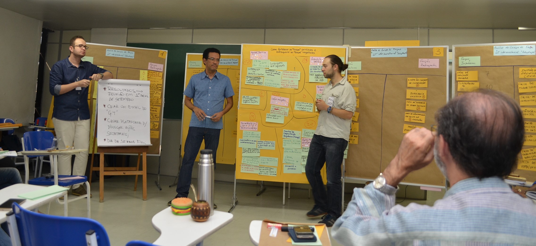
An inter-secretarial workshop brought together representatives from different departments of the municipal government of Duque de Caxias. This (first) opportunity to exchange on these issues helped them to discuss the importance of considering climate change related risks in their municipal planning instruments. The participatory identification of climate change impacts fostered a common understanding of climate change as a crosscutting issue affecting all municipal sectors. The mix of inputs, discussions as well as working on the concrete case strengthened the spirit of cooperation and the search of synergies in preparing for (ecosystem-based) adaptation to climate change in the region of Duque de Caxias.


The final outcome was the creation of an inter-departmental working group on climate change, which seeks for coordination and cooperation in order to enhance adaptation success.

  • Strong ownership of the process on the part of the municipality.
  • Awareness of the need to improve the planning procedure and willingness to implement the necessary steps.
  • Reduction of frontal input during workshops to a minimum, giving to participants as much ownership of the process as possible, and therefore enabling them to discuss and learn “by doing”.
  • Climate change and the ecosystem services approach proved to be excellent topics to bring together experts and stakeholders with different visions, enabling them to collaborate on common challenges.
  • Introducing vulnerability to climate change and ecosystem services as crosscutting issues, rather than separate topics, increased the likelihood for them to be considered a topic of high-value.
  • The combination of workshops with capacity development elements helped to sensitize representatives from different sectors for the need to cooperate and coordinate in order to reduce specific risks.
  • The joint development of starting points and concrete steps to consider vulnerability to climate change and ecosystem services in planning processes lowers the stress of local planning teams.
Mapping of key ecosystem services

The aim of this step was the mapping and evaluation of ecosystem services (ES) provided by the region’s ecosystems, using the IES approach (Integrating Ecosystem Services into Development Planning).


The first step of the workshop was a participative selection of the most relevant ES, so that they can be considered in spatial planning processes. In a second step, using the Matrix Method, the following activities where undertaken for the mapping of the ES:


  1. Creation of a database (current land-use, present and future conditions of ES), design of interview guidelines.
  2. Mapping of relevant interviewees (specialists, decision makers and community representatives), carrying out of the interviews.
  3. Creation of the ES Maps using GIS/QGIS. The maps show the location and intensity of the ES and the main drivers leading to degradation of ecosystems.

The analysis identified conflicts between zones of the current master plan and some of the landscapes that provide important ES. Additionally, several patches of native vegetation inside urban areas have been identified as suppliers of ES, which provided new information for urban planning. The mapping also generated data with explicit information regarding cultural services for the first time.  

  • Municipal technicians’ recognition of both, the importance of ES for the population’s well-being, and the fundamental significance of the protection of ecosystems for the municipality is key for this step.
  • Based on this enabling factor, they facilitated as many resources as possible for a smooth implementation of the work. As a result, the ecosystem services mapping played a key role for a solid diagnosis that allows considering ecosystem services in territorial planning.
  • The ES assessment was an opportunity to: (1) increase public participation in territorial planning; (2) systematize and make use of local knowledge; (3) increase general acceptance of the future zoning proposal; (4) clarify and explicit land use conflicts and uses/dependencies of ecosystems; and (5) add valuable information to the territorial diagnostic in a language that allows for a good understanding of all sectors of the government regarding the importance of each ecosystem.
  • Including key stakeholders in the mapping is vital, both to increase legitimization of the data and its acceptance and to ensure the stakeholders’ advocacy for the results. Validating each step with stakeholders is crucial both to ensure ownership of the results and to enable them to understand and advocate for the results.
  • Necessity of carrying out a detailed stakeholder mapping to identify all key stakeholder as well as of spending more time on this preliminary selection and interview process.
Vulnerability assessment of the protected area

This building block is an essential part of the EbA approach and was carried out prior to the implementation of EbA measures in the Nor Yauyos-Cochas Landscape Reserve. It was considered important to understand the vulnerability to climate change of ecosystems and of populations living in the reserve and whose livelihoods depend directly on the reserve´s ecosystem services.

The objective was to determine the level of sensitivity and the ability to cope with the adverse effects of climate change and extreme events using present observations and future scenarios. Based on the results of these vulnerability and impact studies, the districts with higher vulnerability of ecosystems and ecosystem services -if current management practices would be continued – were identified.

This information served not only to select pilot areas but also to confirm that previously identified EbA measures were adequate to increase resilience of ecosystems to climate change.

  • Availability and access to necessary information, both scientific (climatic, hydrological, etc.) and field information.
  • Time: the study required time for data collection and analysis.
  • Coordinated work of the actors: SERNANP and Communities
  • Knowing and understanding how vulnerable ecosystems and populations are to climate change is absolutely necessary in order to identify the most appropriate measures to reduce this vulnerability in the future.
  • There is no single way to measure vulnerability. The main lesson is that not only a scientific study is required, but a complete and agile and participatory process that generates the quantitative and qualitative information that is needed.
  • If the study is very expensive or very complex, it is not replicable. It is necessary to evaluate in advance to what extent the study should be carried out.
Participatory land use planning

In order to properly monitor the participatory implementation of the programme a “Community Management Group” (CMG) has been established. Members of the group were selected via an open voting involving all municipality members. The CMG members represent all economic and social groups that depend on natural resources (e.g. cattle breeders, beekeepers, gardeners…) including women and youth. During the planning and implementation phase of the erosion control measures, the CMG meets regularly, informs on the current situation, discusses challenges and decides on further steps. The CMG presents its proposal and comments on the management of public land (communal land) to relevant stakeholders of the District Administration, the Property Committee, the Rayon Agriculture Department and the regional department of the Ministry of Ecology. After incorporating the feedback from different stakeholders the CMG approves the implementation of the programme activities. Moreover the CMG is a mechanism to negotiate diverging interests and solve occurring conflicts.  

  • Mapping of ecosystem services and understanding of its contribution to human well-being.
  • Existence of traditional knowledge and skills regarding the collective use of natural resources.
  • Existence of a relevant legal bases (environment) and willingness of corresponding authorities to participate in the planning process.

Plan and organize regular meetings

  • The benefit of the applied measures for land users should be clearly explained to the decision makers.
  • The involvement of all relevant stakeholders is mandatory to prevent exclusion and conflicts that would otherwise negatively impact the programme.
  • Moderators can facilitate the decision making process (e.g. conflict mitigation).
  • External experts will contribute to planning and implementation (technical, institutional advice).
  • Inviting relevant ministry representatives to community meetings may create conflicts if the community is not aware of corresponding laws and regulations. It is recommended to explain current laws and regulations to the community members beforehand.
  • Women, as main users of natural resources, are not always involved in decision making. Involving women will highly affect the sustainable use of natural resources.
  • Participatory land use planning should use traditional knowledge and skills of the target group to maintain long-term gains.
Commission for the management and protection of sea turtles.

1.By consensus of the interested parties, INCOPESCA, ADIO, UCR, and SINAC created a commission of co-management and created a legal framework established with executive decree DAJ-020-2005, in order to work together and this group of Co-management launches a management plan for the conservation and sustainable use of turtles (Lepidochelys olivacea) nesting on Ostional beach.

The SINAC and INCOPESCA authorization and supervision of the Ostional Development Association (ADIO) to use eggs as a means of subsistence (consumption and sale). The community benefits from consumption of the egg as food and also to receive the economic resources that are distributed between people and social welfare, while contributing to the conservation of the turtle, through the cleaning of the beach and the care Of turtle hatchlings.


Leaning from the results of the first phase (2006-2011) progress was made in fulfilling population recovery objectives. The analysis of research advances made in the last five years and the sessions valuation that each of the actors did on experiences informed the 2013 – 2016 5-year plan; so did negotiations and agreements between the parties.

Representatives of the ADIO, UCR, INCOPESCA and SINAC developed jointly and by consensus four products that were the basis for the development of the new five-year management proposal:

  • A basic characterization of the roles of the actors and the main elements of their experience, which identified the keys to a successful plan for future use.
  • An interpretation framework as reference to outline the guidelines of the use plan for the next five years;
  • the principles governing the plan
  • general and specific rules and objectives.
Strengthening local capacities and knowledge

The main goal of the capacity building and local knowledge component was to provide technical knowledge for managing and conserving water, natural pastures, and livestock. Our focus was on informing community members and park rangers through evaluation workshops and training sessions on topics such as pasture fencing, water management and water distribution. A 3-D model of the Miraflores community was developed in a participatory way to facilitate planning for managing pastures and water in the communal territory. Information was gathered during participatory rural appraisals. These appraisals include specific studies focused on water, pastures, archeology, social organization, agricultural and livestock productivity.

  • Use of communication tools to increase local awareness and understanding of the project
  • Local, traditional knowledge and dialogue with outside experts: local participation and positive interactions between locals and external experts have led to effective communications between them
  • Participatory approach and participatory action-research methodology
  • Local researchers served as a bridge between the project and the whole community
  • It is essential that the field team be trained in applying the participatory approach, using participatory tools and facilitating collective learning.
  • Diversifying work with local partners - combining workshops with other methods, practical tools and field work ("learning by doing").
  • Develop activities that involve women, youth and other groups within the community.
  • Maintain a high level of presence in the field and share the day-to-day work with the community.
  • Provide more practical training during fieldwork.
  • Communication strategies helped disseminate the project’s ongoing achievements and progress. These updates were well received and had good impact. Examples are the participatory videos and the "Night of Art” theater.
Steps towards effectively communicating EbA solutions and trade-offs to stakeholders

It is important to communicate the results of a complex analysis such as a cost-benefit analysis (CBA) in a non-technical way. Outcomes were reported to communities in the form of key messages encompassing the effects of EbA on community welfare, traditions and customary rules. For instance, restoring historical wells for provision of water during climate emergencies also comes with social benefits, such as maintaining historical and customary sites. Similarly, the EbA solution for watershed protection also helps to protect areas used to provide plants for traditional medicinal uses. We found that an effective way to communicate solutions, synergies and trade-offs is to tap into traditional uses of services and resources from the ecosystems.

Support from local NGOs, Communities interest in challenges and opportunities

a) It is crucial to break down CBA results into non-technical language, through key messages that spell out benefits and costs, in order for individuals, households and community to weigh challenges and opportunities of EbA solutions;

b) it was important to report benefits as opportunities in terms of capacity building, alternative source of income or livelihoods and describing welfare improvement for households and community;

c) where possible, presenting costs in terms of time that communities should commit for implementing and enforcing a solution (e.g. maintaining wells, vegetation strips, etc.) improve understanding of the results.

Identifying EbA solutions through participatory assessments

The identification of socially, economically and environmentally viable EbA solutions for each community were identified through:

(1) local participatory assessments to identify threats and potential solutions;

(2) household surveys to collect information on income sources and dependence on natural resources and

(3) social cost-benefit analysis (CBA) to explicitly compare the costs and benefits of adaptation options including impacts on ecosystem services.

Historically, Micronesian communities have relied on ecosystem services and the connection with ecosystems and nature is still strong at present. This strong connection, coupled with ownership and local knowledge, was the main driver of EbA acceptance and application. The grass-roots approach allowed the identification of traditional resource uses, which were generally associated with sustainable practices.

a) Participatory meetings were the essential settings for different stakeholders to come together and commit their time, as a community, for maintaining and managing their island ecosystems;

b) Using a participatory approach helped to reinforce the traditional governance system and enhance accountability and ownership of island communities;

c) active participation strengthened EbA solutions by acknowledging the relevance of adaptation to climate change for individuals, households and the entire community.

Integrated vulnerability analysis at national and local level

The vulnerability assessment was carried out for three periods: the status quo in 2014, the period 2030-2060 and the period 2070-2100. The assessment follows the eight-step approach described in GIZ’s Vulnerability Sourcebook, and was supplemented by a scientific modeling of the impacts of climate change for Burundi.

The study was carried out by three institutions (Adelphi, EURAC, PIK) in collaboration with GIZ / ACCES and its partners. Four national workshops were held with all relevant stakeholders. A group of experts was created to advise and direct the process. Activities at the local level at the selected project sites were carried out in close collaboration with local governmental and non-governmental actors and the local population.

The results of the assessment were presented in the form of vulnerability maps for the three factors of erosion, drought and malaria prevalence. Highly vulnerable areas have been identified to guide the identification of three pilot watersheds. In these watersheds, local vulnerability assessments were conducted to identify local challenges and appropriate adaptation measures.
  • National Workshops: enabled participants (government and civil society) to better understand the process and to share their perspectives and expertise on the topic.
  • Establishment of an expert group composed of experts from various Burundian ministries and institutions: important for the ownership of the process itself and its results.
  • Integration of vulnerability assessment into the National Adaptation Plan (NAP) process in Burundi.
  • Data availability was a major challenge. Most government records are not classified and documents and information are incomplete. Aggregate data are often only available at the national and provincial levels, making it difficult to communicate at the local level.
  • The results of the vulnerability assessment form the basis for integrating climate change adaptation into national and local investment policies, strategies and plans. Other actors can use this experience and information for adaptation planning.
  • The methodology used to assess vulnerability in Burundi is based on a standardized methodology, which allows for replication.