Climate change impact visualisation
Participatory 3D Modelling helps visualise vulnerabilities
The Nature Conservancy
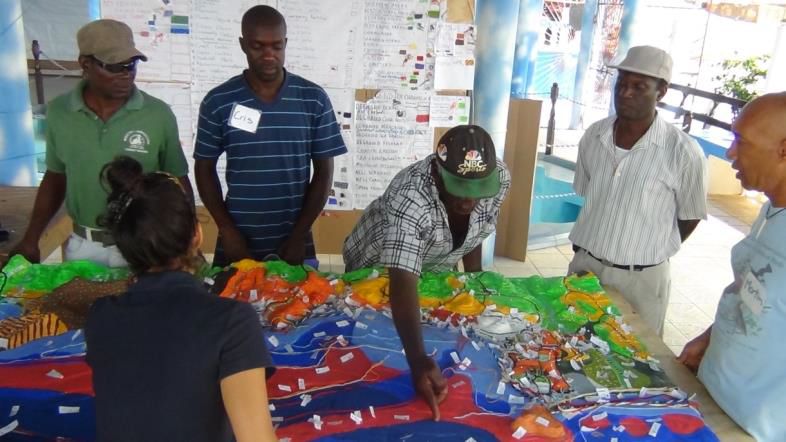
Visualizing potential impacts is a powerful tool to help communities understand their vulnerabilities and consider future scenarios and tradeoffs. This is important to motivate changes that need to be made to reduce a community’s risks and support decision making around climate and disaster risk management. Computer based maps are not always the most effective means of communication. At the national scale we developed a suite of visualization tools for technical persons that included web-based maps and electronic and hard copy maps. At the local scale we worked with local partners Grenada Fund for Conservation and Grenada Red Cross to engage communities through household surveys and Participatory 3D Mapping (P3DM). These tools allowed us to integrate the knowledge and perspectives of nearly 400 community members, generate site level vulnerability assessments and visualization tools. To help facilitate community input and visioning, we also partnered with a land-use planning firm. Using the design firm’s strong graphic facilitation skills, a visual representation of a number of climate change impacts and associated potential actions that would contribute to Grenville Bay’s climate resilient Grenville bay was generated.
• Community understanding the importance and the benefits of a successful implementation.
• Community acceptance, participation and ownership.
• Government involvement and participation.
• Partnerships with the Grenada Red Cross and NGO Grenada Fund for Conservation (mobilizing communities, empowering stakeholders, ensuring the development of an action plan for climate adaptation).
• Access to data on climate change impact (via local knowledge and/or quantitative model predictions).
• The site level process described above was critical for the development of several targeted locally relevant proposals.
• Applying a participatory process empowered community participation critical for the selection of locally relevant options that best align with a community’s vision of desired current and future outcomes.
• Partnering with a variety of groups (engineers, land use planners, and local NGO’s like the RC and GFC) greatly facilitated the integration of diverse knowledge and consideration of a suite of options that will help communities and decision makers chose an informed path forward. Building capacity and working at pilot sites with communities takes a significant commitment of time and resources.
• Participatory 3D mapping is a powerful tool for gathering community knowledge and stimulating discussion, and it also requires trained facilitators and community mobilization to implement.
